Counties with the shortest life expectancy in North Dakota
Life expectancy can be affected by a variety of factors. About 25% of your lifespan is determined by genetics, according to the National Library of Medicine. Health and wellness habits—like following a balanced, nutrient-rich diet; not smoking; drinking minimal alcohol; maintaining a healthy weight; and staying physically active—can add more than a decade to your life, research from the National Institutes of Health shows. While these factors are significant, another important element that you might not have considered is your environment and community.
While life expectancy generally increases annually in the United States—jumping from about 70.8 years old to 77.5 between 1970 and 2022, according to the Centers for Disease Control and Prevention—this particular metric can vary from state to state or even county to county. In some parts of the country, the average lifespan is getting shorter based on a variety of risk factors on top of health, including socioeconomic factors like poverty, unemployment, income, and education.
According to a 2020 study from researchers at Penn State, West Virginia, and Michigan State Universities, communities with a higher population density, more fast food restaurants, and a high number of extraction industry-based jobs tend to have shorter life expectancies.
To find out how life expectancy varies within North Dakota, Stacker used 2024 County Health Rankings & Roadmaps from the University of Wisconsin Population Health Institute to identify the counties with the shortest life expectancy. Life expectancy measures the average number of years from birth a person can expect to live and is calculated based on the number of deaths in a given time period and the average number of people at risk of dying during that period. Counties with unreliable or insufficient data were excluded from the analysis. Mortality data came from the National Vital Statistics System.
Read on to see if your county is on the list.
You may also like: Where refugees in North Dakota are arriving from
#20. Williams County (tie)
– Life expectancy: 78.0 years
— 0.1 years lower than the state average
About
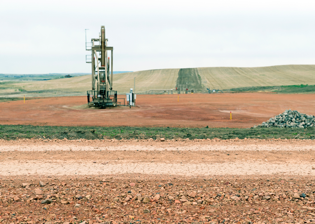
Williams County is a key region in North Dakota known for its significant role in energy production and agriculture. The area has experienced rapid economic growth in recent years due to the development of the Bakken shale oil formation. This growth has led to increased investment in housing, infrastructure, and local businesses.
The county government supports a variety of public services, including emergency management, health services, and community development programs. With a mix of rural landscapes and growing urban centers, Williams County maintains a balance between traditional values and modern expansion. Community life here includes educational opportunities, parks, and active civic engagement.
Where is Williams County?
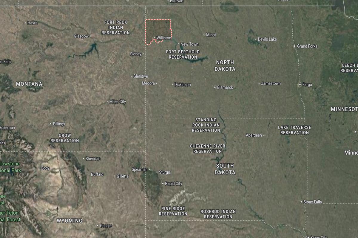
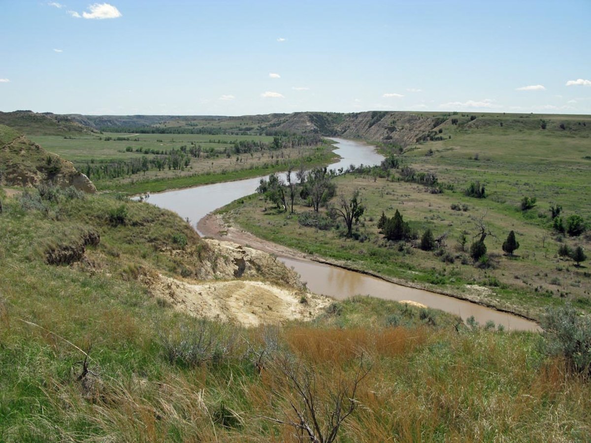
Williams County is located in northwestern North Dakota, about 15 miles east of the Montana border and 50 miles south of the Canadian border. The county seat, Williston, lies roughly 60 miles north of Watford City and 140 miles northwest of Minot. It is part of the Bakken oil region and sits along U.S. Route 2 and U.S. Route 85.
The area is approximately 95 miles west of Crosby and 100 miles northeast of Sidney, Montana. It is also about 120 miles northwest of Dickinson and 210 miles northwest of Bismarck. Williston serves as the main economic and transportation hub in the region.
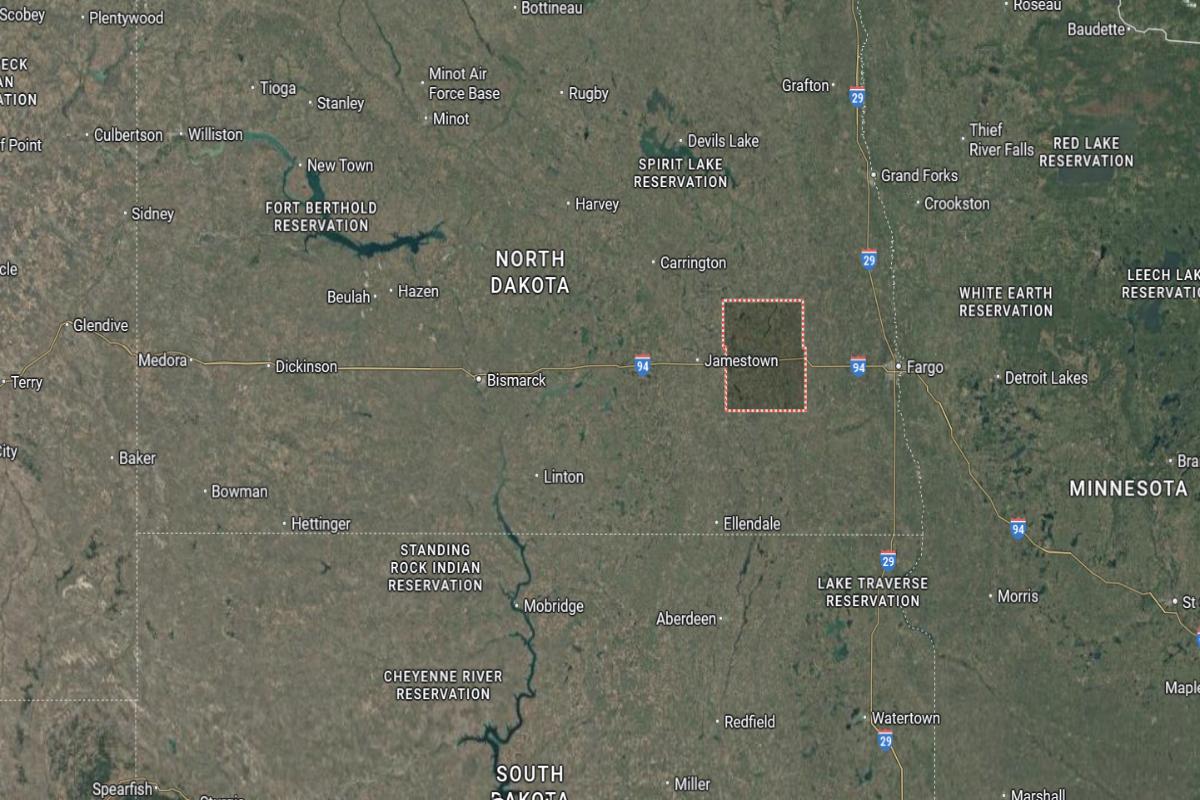
#20. Stutsman County (tie)
– Life expectancy: 78.0 years
— 0.1 years lower than the state average
About
Stutsman County features a diverse economic base supported by agriculture, manufacturing, and service industries. The area is recognized for its strong community values, with educational institutions, healthcare facilities, and cultural venues contributing to local life. It also serves as a regional hub for transportation and commerce.
The county government oversees a range of public services, including law enforcement, environmental health, and rural development programs. Recreational amenities such as parks, lakes, and historic landmarks offer residents and visitors opportunities for leisure and learning. Stutsman County continues to balance heritage with economic and community growth.
Where is Stutsman County?
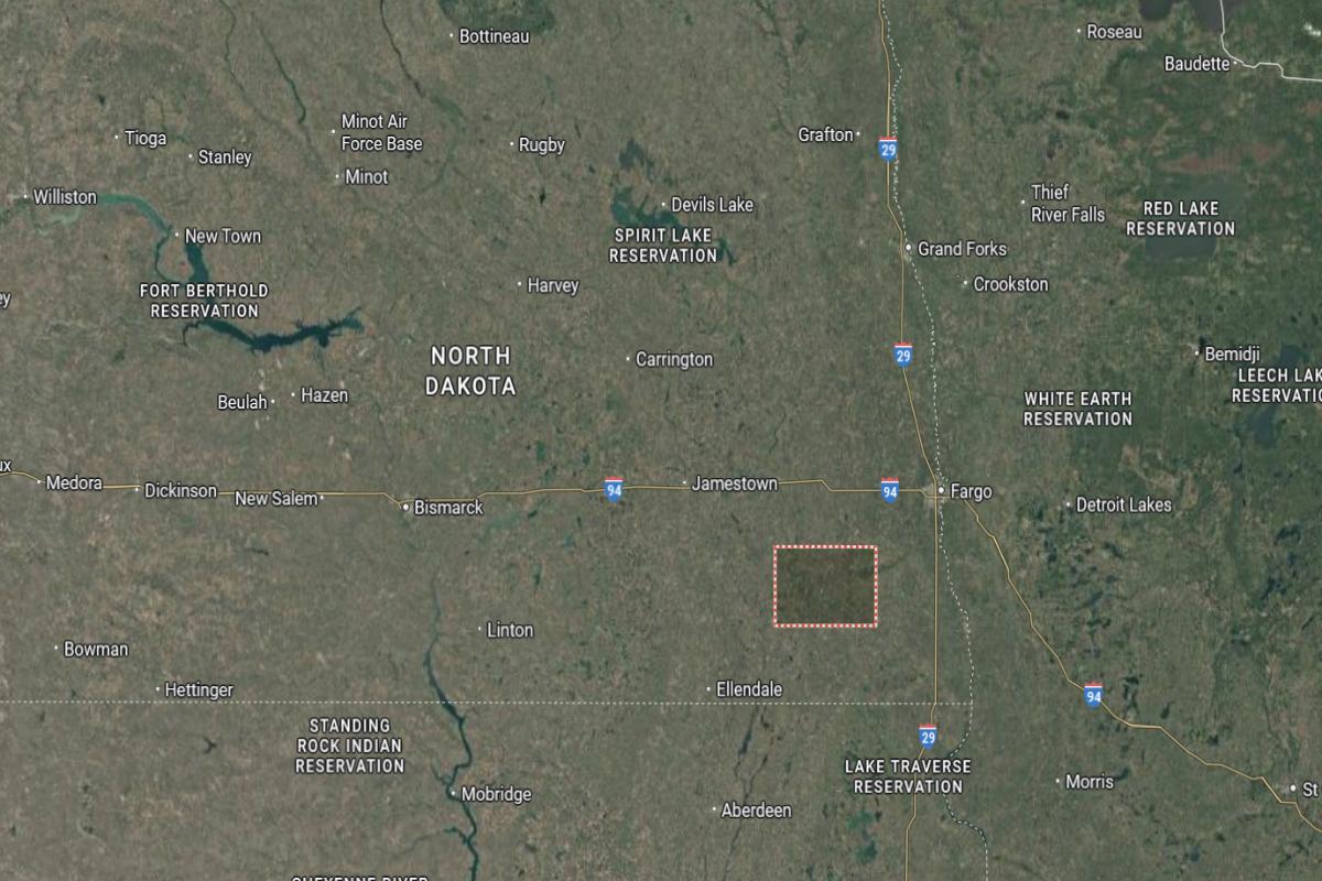
Stutsman County is located in southeastern North Dakota, about 100 miles east of Bismarck and 95 miles west of Fargo. The county seat, Jamestown, lies roughly 40 miles west of Valley City and 70 miles north of Ellendale. It is situated along Interstate 94 in a region of prairies and farmland.
The area is approximately 85 miles south of Devils Lake and 60 miles east of Carrington. U.S. Route 281 and State Route 20 provide access through the county. Stutsman County is also about 90 miles northwest of Wahpeton near the Minnesota border.
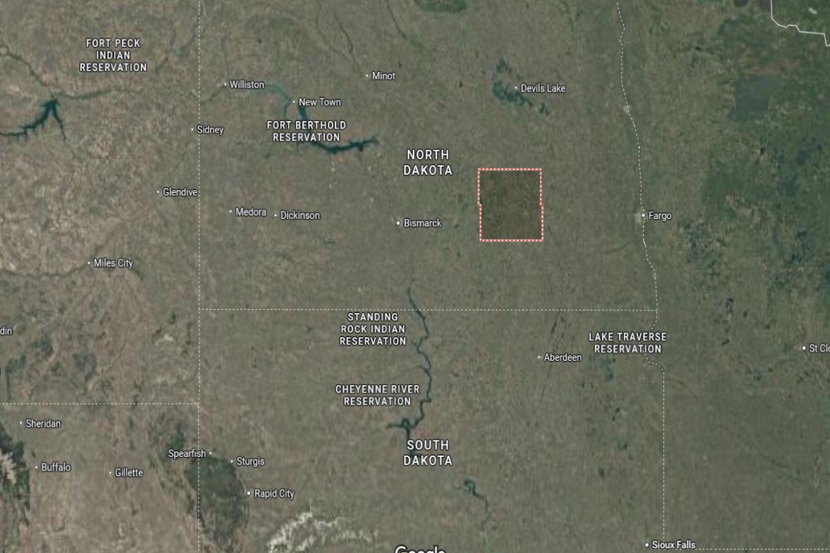
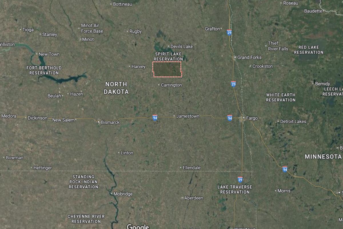
#19. Foster County
– Life expectancy: 77.9 years
— 0.2 years lower than the state average
About
Foster County is a predominantly agricultural region with a focus on crop production and agribusiness. The local economy is supported by a close-knit community and small businesses that serve the needs of residents and surrounding rural areas. Public institutions like schools, libraries, and health services contribute to the county’s quality of life.
County leadership manages services including road maintenance, emergency response, and public safety. Cultural events, community gatherings, and recreational spaces foster a strong sense of identity and local pride. Foster County emphasizes tradition while supporting sustainable growth and civic participation.
Where is Foster County?
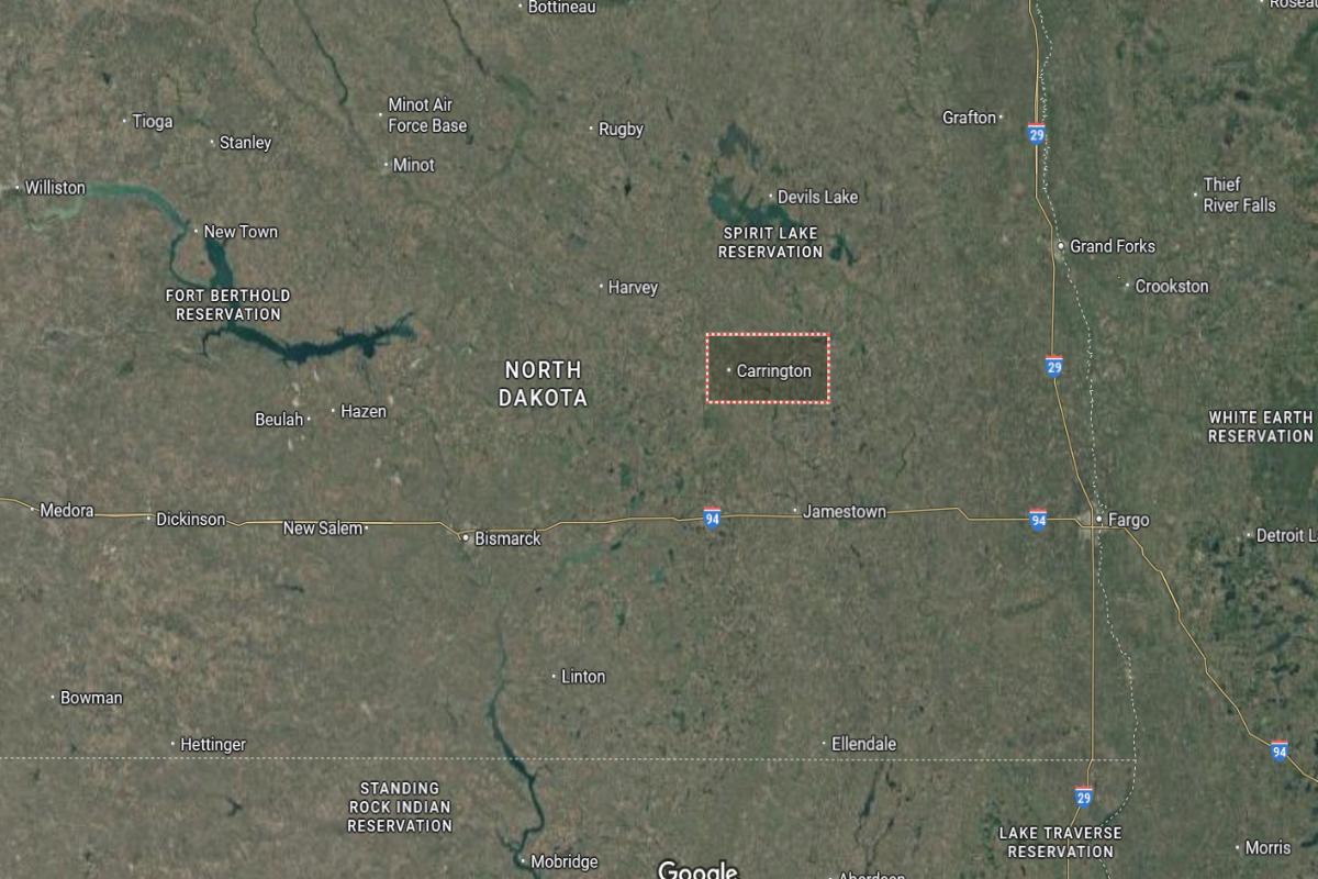
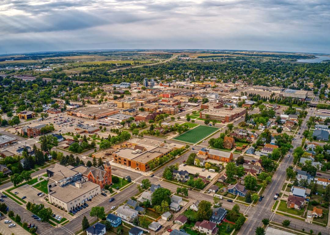
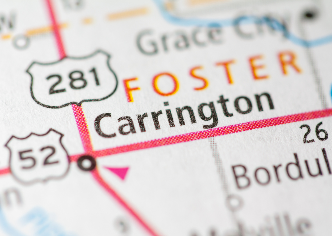
Foster County is located in east-central North Dakota, about 60 miles northeast of Jamestown and 90 miles northwest of Fargo. The county seat, Carrington, lies roughly 45 miles north of Valley City and 35 miles southeast of Devils Lake. It is situated in a rural area known for agriculture and open plains.
The area is approximately 70 miles west of Grand Forks and 50 miles east of Harvey. U.S. Route 281 and State Route 200 intersect in Carrington, providing regional connectivity. Foster County is also about 80 miles south of the Canadian border.
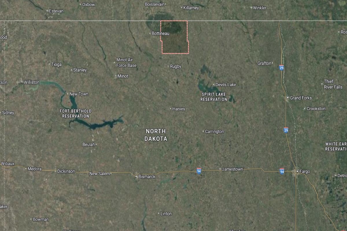
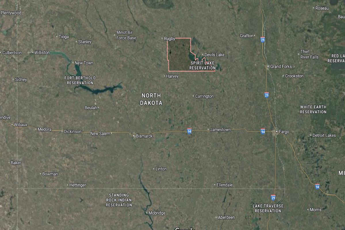
#18. Towner County
– Life expectancy: 77.8 years
— 0.3 years lower than the state average
About
Towner County is rooted in agriculture, with farming and ranching playing central roles in its economy and way of life. The community is small but resilient, with local institutions supporting education, health, and social services. Businesses and residents contribute to a stable and cooperative local economy.
The county government provides essential services such as public safety, infrastructure maintenance, and emergency management. Recreational opportunities include hunting, fishing, and access to scenic outdoor areas. Towner County values its rural heritage while fostering a supportive environment for its residents.
Where is Towner County?
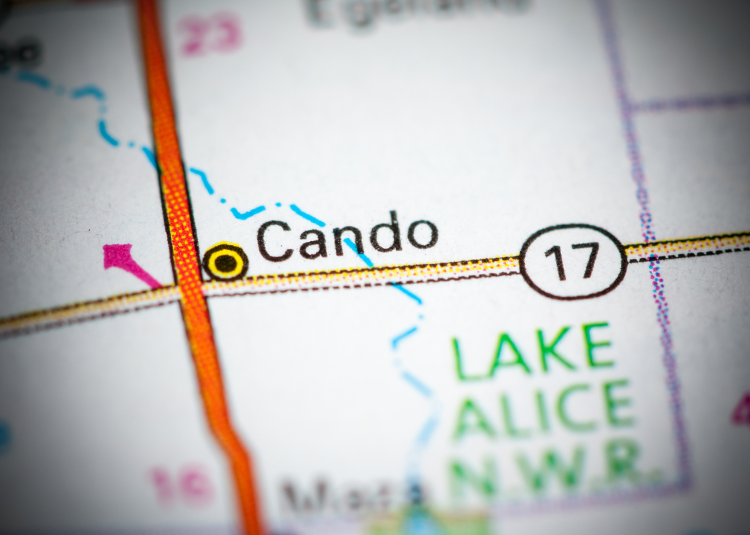
Towner County is located in north-central North Dakota, directly along the Canadian border and about 140 miles north of Bismarck. The county seat, Cando, lies roughly 40 miles west of Devils Lake and 60 miles northeast of Rugby. It is situated in a rural region of farmland and prairie.
The area is approximately 80 miles northwest of Grand Forks and 50 miles south of the Manitoba border. U.S. Route 281 runs through the county, offering access to surrounding towns. Towner County is also about 70 miles north of Carrington in Foster County.
#15. Ward County (tie)
– Life expectancy: 77.6 years
— 0.5 years lower than the state average
About
Ward County is one of the most populous regions in the state, offering a diverse economy driven by agriculture, energy, retail, and services. It is home to a variety of institutions including healthcare centers, schools, and cultural venues that support a high quality of life. The area has experienced steady development, supported by infrastructure and economic initiatives.
County government provides a wide range of public services, including law enforcement, emergency management, and land use planning. Residents enjoy recreational facilities, parks, and community events that foster engagement and connectivity. Ward County blends rural charm with urban amenities and regional significance.
Where is Ward County?
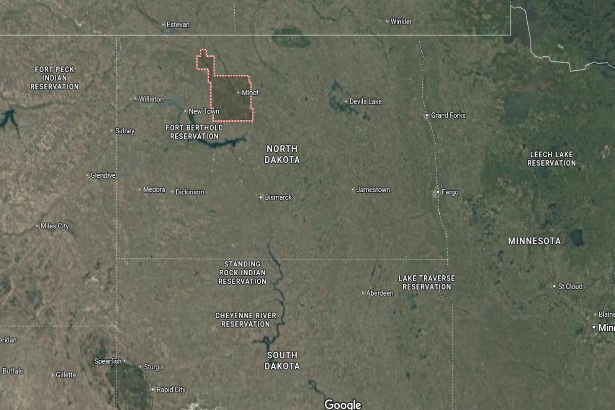
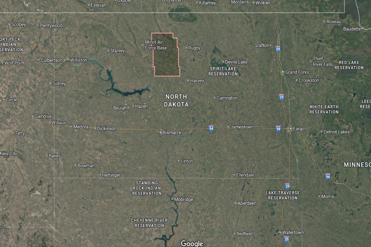
Ward County is located in north-central North Dakota, about 110 miles north of Bismarck and 60 miles south of the Canadian border. The county seat, Minot, lies roughly 55 miles west of Rugby and 70 miles east of Stanley. It is a major regional hub and sits along U.S. Route 2 and U.S. Route 83.
The area is approximately 90 miles northeast of Williston and 80 miles northwest of Devils Lake. Minot Air Force Base is about 15 miles north of Minot. Ward County is also around 65 miles north of Garrison and Lake Sakakawea.
You may also like: How opioid prescriptions to Medicaid patients in North Dakota stack up
#15. McLean County (tie)
– Life expectancy: 77.6 years
— 0.5 years lower than the state average
About
McLean County has a strong foundation in agriculture, energy production, and outdoor recreation, supporting both economic stability and lifestyle quality. Local communities are known for their cooperation and resilience, with schools, clinics, and businesses contributing to daily life. The county benefits from natural resources that support both industry and tourism.
The local government oversees services such as road maintenance, public health, and emergency response. Residents take pride in cultural traditions, community events, and recreational access to lakes and parks. McLean County continues to grow while maintaining its rural character and community spirit.
Where is McLean County?
McLean County is located in central North Dakota, about 40 miles north of Bismarck and 100 miles southeast of Minot. The county seat, Washburn, lies roughly 25 miles south of Garrison and 30 miles north of Wilton. It is situated along the Missouri River and near the eastern edge of Lake Sakakawea.
The area is approximately 85 miles west of Devils Lake and 70 miles south of Minot Air Force Base. U.S. Route 83 and State Route 200 provide main transportation routes through the county. McLean County is also about 90 miles northeast of Dickinson.
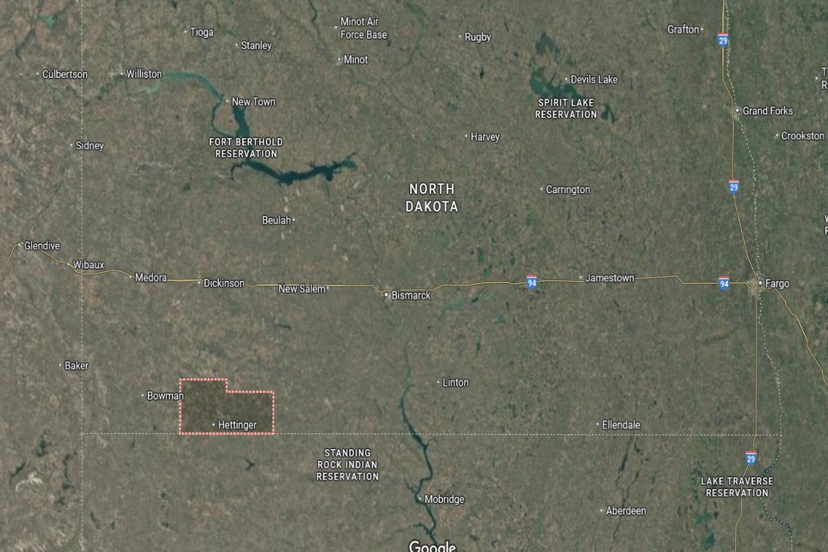
#15. Hettinger County (tie)
– Life expectancy: 77.6 years
— 0.5 years lower than the state average
About
Hettinger County is characterized by a strong agricultural presence, with farming and ranching serving as the backbone of the local economy. Small-town values, community engagement, and support for local institutions shape daily life. The region is known for its open landscapes and quiet, steady pace.
County services include infrastructure maintenance, public safety, and administrative support for residents. Recreational options like hunting, local fairs, and outdoor activities offer cultural and leisure experiences. Hettinger County blends tradition with practicality, fostering a stable and close-knit environment.
Where is Hettinger County?
Hettinger County is located in southwestern North Dakota, about 115 miles southwest of Bismarck and 25 miles east of the Montana border. The county seat, Mott, lies roughly 45 miles south of Dickinson and 35 miles north of Bowman. It is a rural area characterized by rolling plains and agricultural land.
The area is approximately 70 miles west of Mott and 90 miles northeast of Belle Fourche, South Dakota. State Route 8 and U.S. Route 12 provide access through the region. Hettinger County is also about 60 miles southeast of Amidon in Slope County.
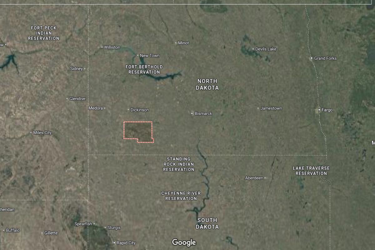
#14. Morton County
– Life expectancy: 77.2 years
— 0.9 years lower than the state average
About
Morton County has a diverse economy supported by agriculture, manufacturing, and commerce, creating a balance between rural life and regional development. The community benefits from educational institutions, healthcare services, and civic organizations that strengthen local infrastructure. Growth and modernization efforts are evident in public projects and business expansion.
The county government manages essential services including emergency management, law enforcement, and planning and zoning. Outdoor recreation, cultural events, and historical landmarks contribute to community identity and resident engagement. Morton County values its heritage while promoting forward-looking development and quality of life.
Where is Morton County?
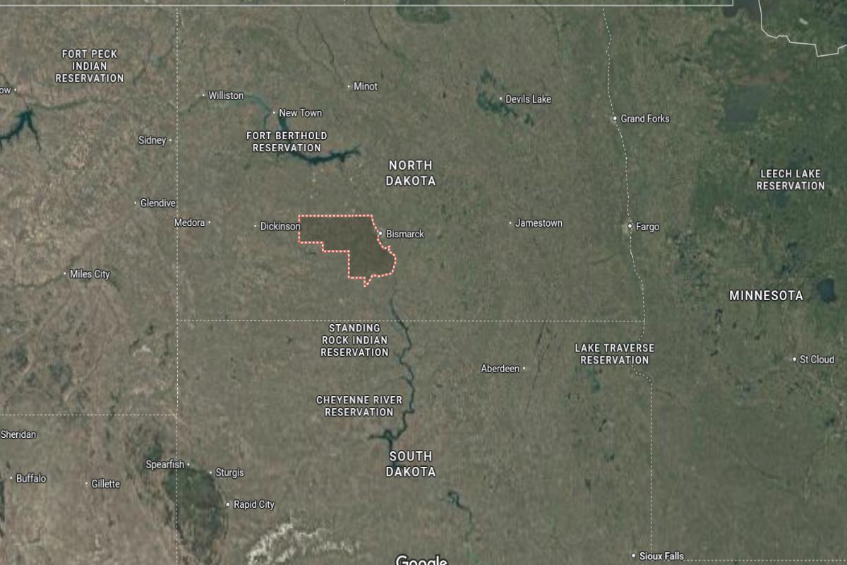
Morton County is located in south-central North Dakota, directly across the Missouri River from Bismarck and about 130 miles east of Dickinson. The county seat, Mandan, lies roughly 5 miles west of Bismarck and 70 miles south of Garrison. It is part of the Bismarck-Mandan metropolitan area and follows Interstate 94.
The area is approximately 90 miles northwest of Aberdeen, South Dakota and 85 miles southeast of Beulah. U.S. Route 83 and State Route 6 run through the county, connecting it with other central and western regions. Morton County is also about 60 miles north of the South Dakota border.
#13. Ransom County
– Life expectancy: 76.9 years
— 1.2 years lower than the state average
About
Ransom County is rooted in agriculture, with farming and related industries playing a central role in the local economy. The community is supported by educational institutions, healthcare services, and small businesses that sustain daily life. Residents value a quiet, cooperative lifestyle with strong local ties.
The county government provides key services such as road maintenance, emergency services, and public safety. Recreational opportunities include parks, trails, and community events that encourage outdoor activity and social connection. Ransom County maintains a balance between rural tradition and steady, community-focused development.
Where is Ransom County?
Ransom County is located in southeastern North Dakota, about 65 miles southwest of Fargo and 75 miles southeast of Jamestown. The county seat, Lisbon, lies roughly 25 miles south of Valley City and 40 miles west of Wahpeton. It is situated in the Sheyenne River Valley with a mix of farmland and rolling hills.
The area is approximately 90 miles northeast of Aberdeen, South Dakota and 55 miles east of Ellendale. State Routes 27 and 32 run through the county, providing access to regional communities. Ransom County is also about 45 miles north of the South Dakota border.
#12. McHenry County
– Life expectancy: 76.8 years
— 1.3 years lower than the state average
About
McHenry County is an agriculturally driven area with deep community roots and a strong emphasis on rural values. Farming, ranching, and small businesses form the backbone of the local economy, providing stability and employment. The county is known for its peaceful environment and strong sense of community.
County services include public safety, infrastructure maintenance, and emergency management to support residents’ needs. Outdoor activities such as hunting, fishing, and nature exploration are popular among locals and visitors. McHenry County upholds its rural character while fostering civic pride and sustainable living.
Where is McHenry County?
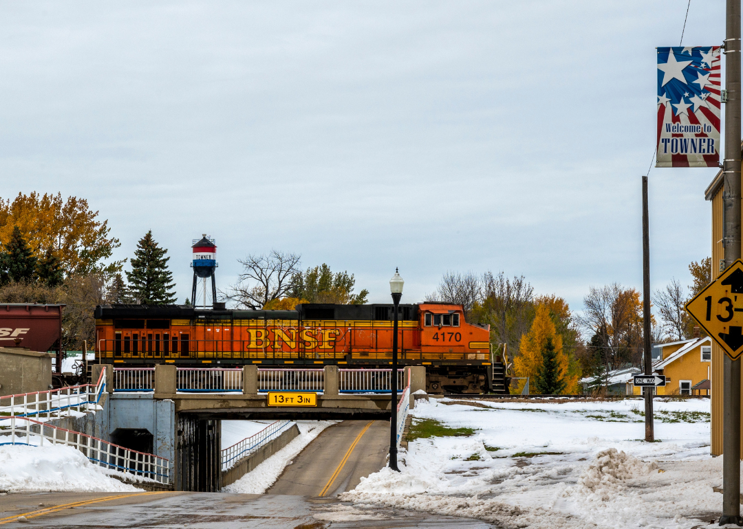
McHenry County is located in north-central North Dakota, about 45 miles southeast of Minot and 115 miles northeast of Bismarck. The county seat, Towner, lies roughly 40 miles southwest of Rugby and 90 miles northwest of Devils Lake. It sits in a rural area of farmland and rolling prairie within the Drift Prairie region.
The area is approximately 65 miles west of the Turtle Mountains and 80 miles south of the Canadian border. U.S. Route 2 and State Route 14 run through the county, providing regional transportation access. McHenry County is also about 70 miles north of Jamestown.
You may also like: Best public colleges in North Dakota
#11. Dickey County
– Life expectancy: 76.6 years
— 1.5 years lower than the state average
About
Dickey County has a strong agricultural foundation, with farming and livestock operations shaping the local economy and lifestyle. The community is close-knit, with schools, health services, and local businesses supporting residents’ daily needs. Emphasis is placed on preserving traditions while encouraging local engagement and development.
County services include road and bridge maintenance, emergency response, and public health programs. Residents enjoy outdoor recreation, seasonal events, and access to natural spaces that enhance quality of life. Dickey County blends a rural atmosphere with a commitment to community growth and well-being.
Where is Dickey County?
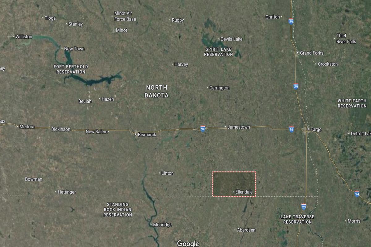
Dickey County is located in southeastern North Dakota, about 85 miles southwest of Fargo and 45 miles south of Jamestown. The county seat, Ellendale, lies roughly 40 miles west of Wahpeton and 10 miles north of the South Dakota border. It is a rural county with wide stretches of farmland and prairie.
The area is approximately 60 miles northeast of Aberdeen, South Dakota and 70 miles southeast of Carrington. U.S. Route 281 and State Route 11 provide main access through the county. Dickey County is also about 90 miles east of Bismarck.
#10. Barnes County
– Life expectancy: 76.5 years
— 1.6 years lower than the state average
About
Barnes County is centered around agriculture, education, and local commerce, creating a balanced and resilient economy. The community supports a range of services including schools, medical facilities, and civic organizations that contribute to everyday life. Local pride and cooperation are reflected in events, traditions, and volunteer efforts.
The county government manages essential services such as infrastructure, emergency management, and land use planning. Outdoor recreation, cultural programs, and historical landmarks offer both leisure and learning opportunities. Barnes County continues to promote community well-being while preserving its rural heritage.
Where is Barnes County?
Barnes County is located in southeastern North Dakota, about 60 miles west of Fargo and 100 miles east of Bismarck. The county seat, Valley City, lies roughly 35 miles east of Jamestown and 45 miles west of Lisbon. It sits along the Sheyenne River and is part of a region known for rolling hills and farmland.
The area is approximately 70 miles south of Devils Lake and 55 miles southeast of Carrington. Interstate 94 and U.S. Route 52 run through the county, offering regional access. Barnes County is also about 80 miles north of Ellendale.
#9. Adams County
– Life expectancy: 76.3 years
— 1.8 years lower than the state average
About
Adams County is grounded in agriculture, with farming and ranching serving as key pillars of its local economy and lifestyle. The community values simplicity, cooperation, and strong local institutions that provide education, healthcare, and essential services. Residents enjoy a quiet, stable environment shaped by generational ties and rural traditions.
County operations support public safety, infrastructure, and emergency services, ensuring the well-being of residents. Recreational opportunities like hunting, community fairs, and local gatherings foster engagement and pride. Adams County maintains its rural identity while supporting steady, community-focused development.
Where is Adams County?
Adams County is located in southwestern North Dakota, about 160 miles southwest of Bismarck and 30 miles east of the Montana border. The county seat, Hettinger, lies roughly 45 miles south of Bowman and 70 miles west of Mott. It is a rural area characterized by rolling prairie and farmland.
The area is approximately 95 miles southeast of Dickinson and 80 miles north of Belle Fourche, South Dakota. U.S. Route 12 and State Route 8 provide access through the county. Adams County is also about 25 miles north of the South Dakota border.
#8. Ramsey County
– Life expectancy: 76.2 years
— 1.9 years lower than the state average
About
Ramsey County features a well-rounded economy supported by agriculture, small business, and tourism-related services. The community benefits from educational institutions, healthcare facilities, and civic organizations that contribute to daily life and local identity. Economic growth is supported by a blend of tradition and modern initiatives.
County government oversees services such as emergency management, infrastructure, and public health. Recreational opportunities, cultural events, and scenic landscapes provide residents with a strong sense of place and belonging. Ramsey County continues to foster community resilience while embracing sustainable development.
Where is Ramsey County?
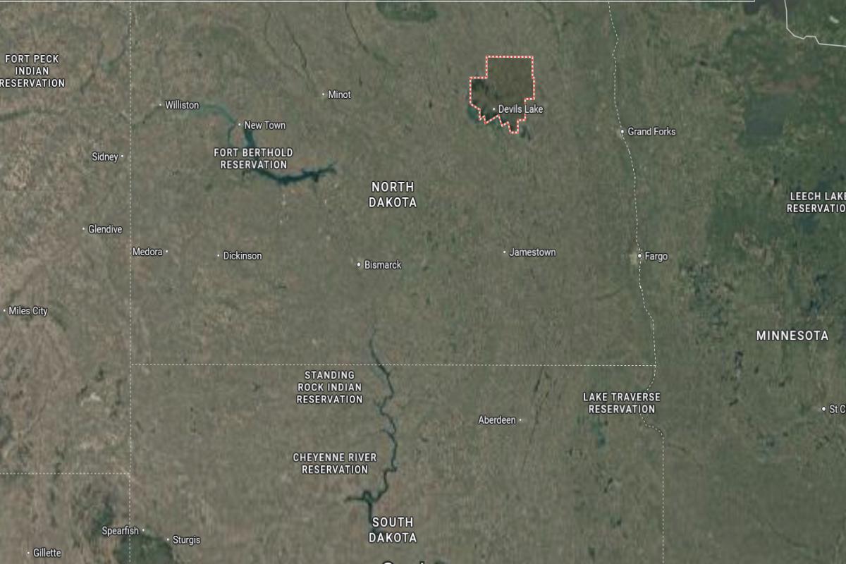
Ramsey County is located in northeastern North Dakota, about 90 miles west of Grand Forks and 60 miles east of Rugby. The county seat, Devils Lake, lies along the southern shore of Devils Lake and roughly 95 miles north of Jamestown. It serves as a regional hub in an area known for its lakes and open prairie.
The area is approximately 75 miles south of the Canadian border and 50 miles northeast of Minnewaukan. U.S. Route 2 and State Route 20 provide main transportation routes through the county. Ramsey County is also about 45 miles northwest of Lakota in Nelson County.

#7. McKenzie County
– Life expectancy: 76.0 years
— 2.1 years lower than the state average
About
McKenzie County has experienced significant growth due to its strong presence in the energy and agriculture sectors. The local economy is supported by a blend of traditional rural industries and modern development, creating new opportunities for residents. Community infrastructure has expanded to meet the needs of a growing population.
The county provides essential services including law enforcement, emergency management, and road maintenance. Residents enjoy outdoor recreation, community events, and access to cultural and natural resources. McKenzie County balances rapid development with its commitment to preserving community values and rural character.
Where is McKenzie County?

McKenzie County is located in western North Dakota, about 185 miles northwest of Bismarck and 50 miles east of the Montana border. The county seat, Watford City, lies roughly 50 miles southeast of Williston and 70 miles north of Dickinson. It is situated in the heart of the Bakken oil region with rugged terrain and badlands.
The area is approximately 60 miles west of Lake Sakakawea and 45 miles east of the Theodore Roosevelt National Park’s north unit. U.S. Route 85 runs through the county, connecting it to nearby economic and transportation hubs. McKenzie County is also about 90 miles south of the Canadian border.
You may also like: Healthy hotspots: The most physically active counties in North Dakota
#6. Grant County
– Life expectancy: 75.8 years
— 2.3 years lower than the state average
About
Grant County is a rural community rooted in agriculture, with farming and ranching playing central roles in its economy and way of life. Residents value simplicity, strong work ethic, and close-knit relationships that define daily living. The area reflects a steady pace, supported by local institutions and small businesses.
County government services include road maintenance, public safety, and emergency response to meet community needs. Outdoor activities, seasonal events, and scenic landscapes offer recreational and cultural experiences. Grant County remains dedicated to preserving its rural traditions while supporting its residents with essential services.
Where is Grant County?
Grant County is located in south-central North Dakota, about 60 miles southwest of Bismarck and 90 miles southeast of Dickinson. The county seat, Carson, lies roughly 30 miles south of Interstate 94 and 50 miles west of Fort Yates. It is a rural area with rolling hills and farmland.
The area is approximately 70 miles north of the South Dakota border and 45 miles east of Hettinger. State Routes 21 and 49 run through the county, offering access to nearby communities. Grant County is also about 40 miles west of Linton in Emmons County.
#5. Eddy County
– Life expectancy: 72.5 years
— 5.6 years lower than the state average
About
Eddy County is shaped by its agricultural roots, with farming and livestock operations forming the backbone of the local economy. The community is small but active, with schools, healthcare, and local businesses supporting everyday life. A strong sense of pride and tradition is reflected in local events and family-run enterprises.
County services include emergency response, infrastructure maintenance, and public health programs aimed at meeting resident needs. Outdoor recreation such as fishing, hunting, and seasonal festivals offer leisure and community engagement. Eddy County upholds its rural heritage while fostering a safe and connected environment for its residents.
Where is Eddy County?
Eddy County is located in east-central North Dakota, about 40 miles north of Jamestown and 60 miles west of Grand Forks. The county seat, New Rockford, lies roughly 35 miles southeast of Devils Lake and 50 miles northeast of Carrington. It is situated in a rural region of farmland and prairie.
The area is approximately 75 miles south of the Canadian border and 45 miles west of Lakota. U.S. Route 281 and State Route 15 provide access through the county. Eddy County is also about 70 miles east of Harvey.
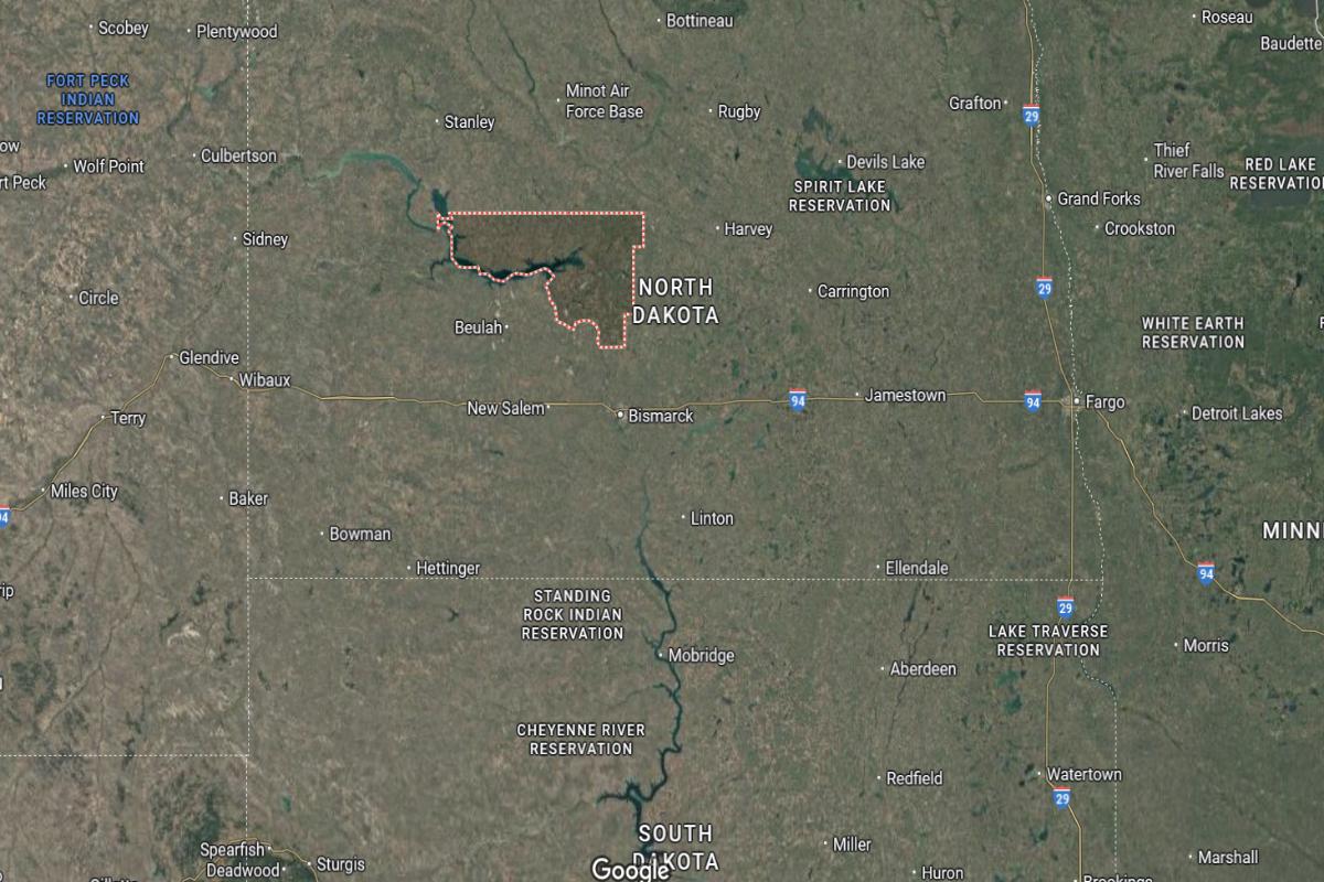
#4. Mountrail County
– Life expectancy: 69.8 years
— 8.3 years lower than the state average
About
Mountrail County has a diverse economy supported by both agriculture and energy development, particularly in oil production. The community reflects a mix of traditional rural life and modern growth, with expanding services and infrastructure. Residents benefit from access to schools, healthcare, and local businesses that meet everyday needs.
County government provides essential services such as law enforcement, emergency management, and road maintenance. Recreational opportunities include outdoor sports, community events, and access to natural landscapes. Mountrail County balances economic progress with a strong commitment to its cultural roots and community values.
Where is Mountrail County?
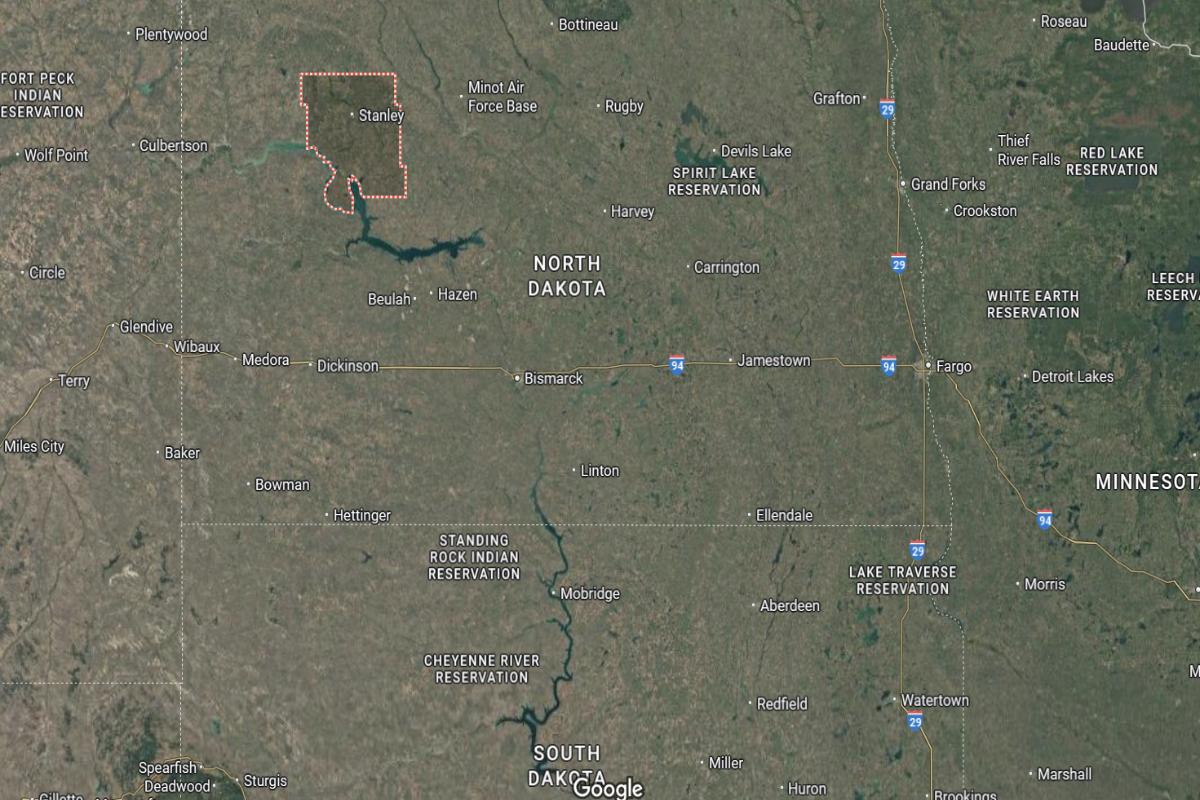
Mountrail County is located in northwestern North Dakota, about 130 miles northwest of Bismarck and 35 miles south of the Canadian border. The county seat, Stanley, lies roughly 55 miles east of Williston and 60 miles west of Minot. It is part of the Bakken oil region and is situated along U.S. Route 2.
The area is approximately 45 miles north of Lake Sakakawea and 80 miles northeast of Watford City. State Routes 8 and 23 also pass through the county, providing access to surrounding communities. Mountrail County is about 70 miles west of Rugby in central North Dakota.
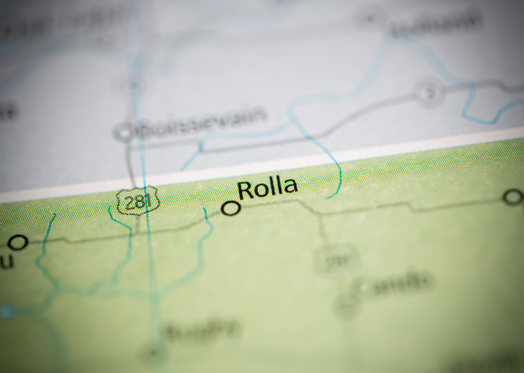
#3. Rolette County
– Life expectancy: 68.2 years
— 9.9 years lower than the state average
About
Rolette County is known for its rich cultural heritage, with a strong presence of tribal communities and local traditions. Agriculture and public services form the foundation of the local economy, supported by education and healthcare institutions. The community values family, history, and a shared connection to the land.
County services include emergency management, infrastructure support, and public health programs aimed at improving quality of life. Cultural events, artisan traditions, and outdoor recreation contribute to community identity and engagement. Rolette County maintains a deep sense of heritage while fostering resilience and development.
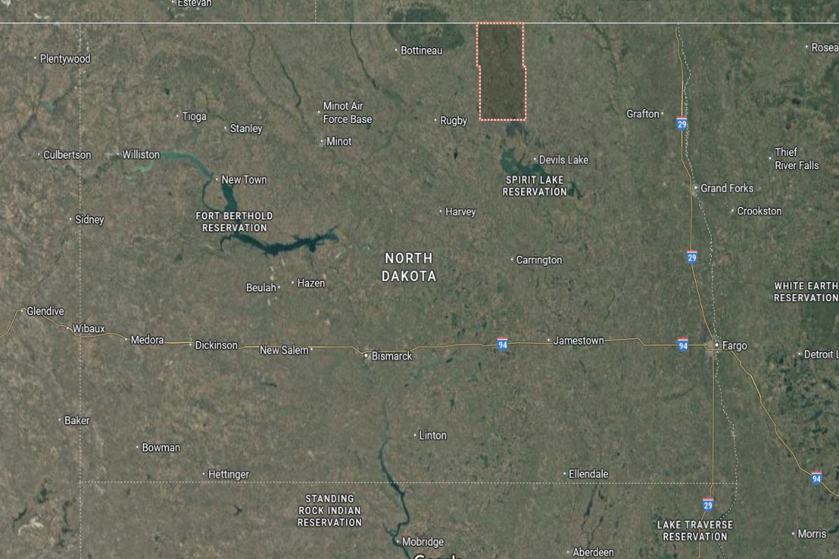
Where is Rolette County?
Rolette County is located in north-central North Dakota, directly along the Canadian border and about 125 miles north of Bismarck. The county seat, Rolla, lies roughly 25 miles west of Rugby and 10 miles south of the Manitoba border. It is part of the Turtle Mountain region, known for its forested hills and elevated terrain.
The area is approximately 30 miles northeast of the International Peace Garden and 35 miles east of Bottineau. U.S. Route 281 and State Route 5 provide access across the county. Rolette County is also about 85 miles northwest of Grand Forks.
#2. Benson County
– Life expectancy: 62.2 years
— 15.9 years lower than the state average
About
Benson County is a rural area with strong agricultural ties and a deep cultural history, including tribal communities and family-run farms. The local economy is supported by farming, education, and public services that sustain the community’s daily life. Residents place value on tradition, cooperation, and community well-being.
The county government oversees essential functions such as emergency services, infrastructure, and public health initiatives. Recreational opportunities include fishing, hunting, and cultural gatherings that bring people together. Benson County continues to honor its heritage while investing in community support and long-term stability.
Where is Benson County?
Benson County is located in northeastern North Dakota, about 85 miles west of Grand Forks and 60 miles east of Rugby. The county seat, Minnewaukan, lies on the southern shore of Devils Lake and roughly 95 miles north of Jamestown. It is a largely rural area made up of wetlands, prairie, and farmland.
The area is approximately 70 miles south of the Canadian border and 50 miles northeast of Carrington. U.S. Route 2 and State Route 19 provide access across the county. Benson County is also about 45 miles northwest of New Rockford.
You may also like: Counties with the highest unemployment in North Dakota
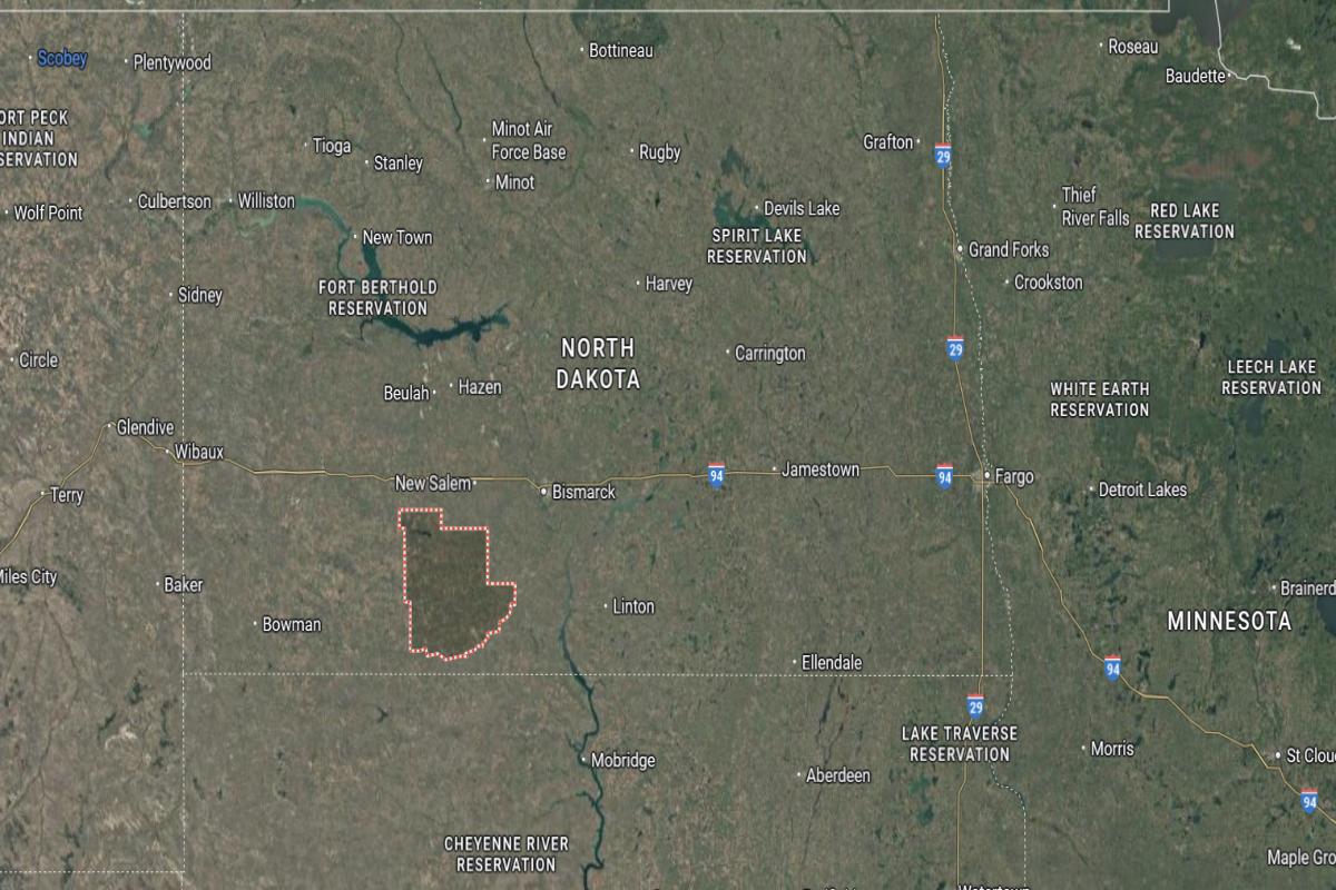
#1. Sioux County
– Life expectancy: 62.0 years
— 16.1 years lower than the state average
About
Sioux County is deeply connected to Native American heritage, with strong cultural traditions shaping daily life and community identity. The local economy relies on tribal government, agriculture, and public services to support residents. Education, family, and spiritual practices play a central role in community strength.
County operations include emergency management, infrastructure support, and health services tailored to local needs. Cultural events, gatherings, and natural landscapes provide opportunities for connection and celebration. Sioux County remains rooted in its traditions while focusing on community care and resilience.
Where is Sioux County?
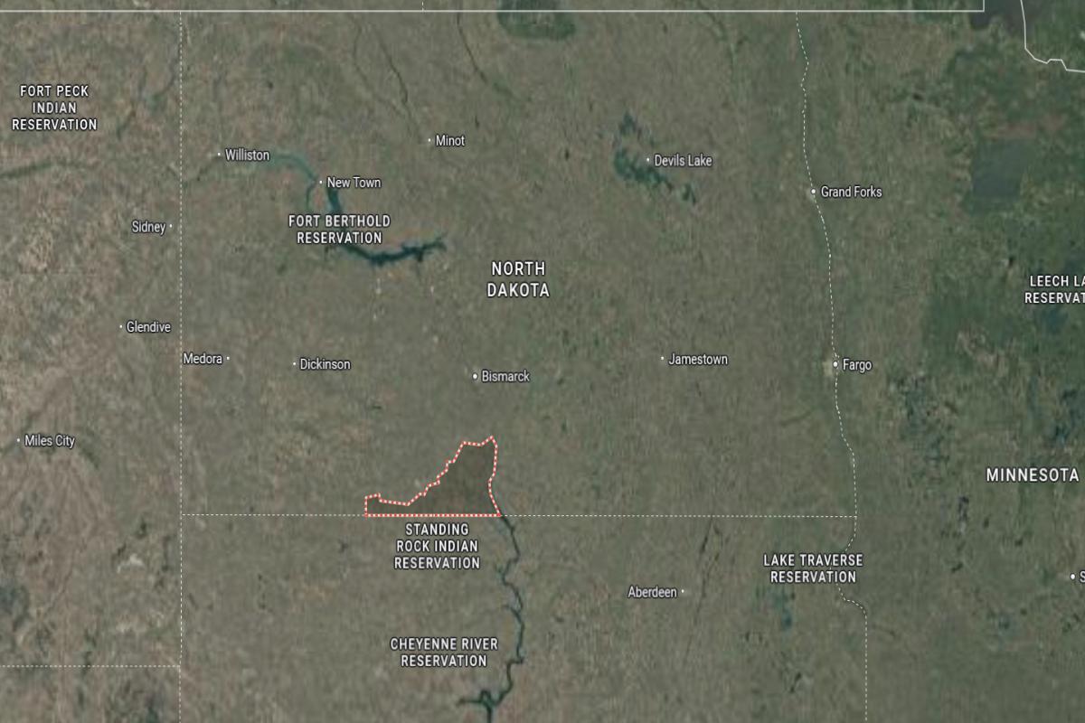
Sioux County is located in south-central North Dakota, directly along the South Dakota border and about 45 miles south of Bismarck. The county seat, Fort Yates, lies roughly 25 miles south of Mandan and 40 miles north of Mobridge, South Dakota. It is entirely within the Standing Rock Indian Reservation and borders the Missouri River to the east.
The area is approximately 85 miles west of Ellendale and 90 miles southeast of Dickinson. State Routes 6 and 24 provide access through the county. Sioux County is also about 50 miles southwest of Linton in Emmons County.
This story features data reporting by Karim Noorani, writing by Kiersten Hickman, and is part of a series utilizing data automation across 49 states.
By Stacker