
🔥 Would you like to save this?
Counties with the shortest life expectancy in New Mexico
Life expectancy can be affected by a variety of factors. About 25% of your lifespan is determined by genetics, according to the National Library of Medicine. Health and wellness habits—like following a balanced, nutrient-rich diet; not smoking; drinking minimal alcohol; maintaining a healthy weight; and staying physically active—can add more than a decade to your life, research from the National Institutes of Health shows. While these factors are significant, another important element that you might not have considered is your environment and community.
While life expectancy generally increases annually in the United States—jumping from about 70.8 years old to 77.5 between 1970 and 2022, according to the Centers for Disease Control and Prevention—this particular metric can vary from state to state or even county to county. In some parts of the country, the average lifespan is getting shorter based on a variety of risk factors on top of health, including socioeconomic factors like poverty, unemployment, income, and education.
In order to come up with the very specific design ideas, we create most designs with the assistance of state-of-the-art AI interior design software.
According to a 2020 study from researchers at Penn State, West Virginia, and Michigan State Universities, communities with a higher population density, more fast food restaurants, and a high number of extraction industry-based jobs tend to have shorter life expectancies.
To find out how life expectancy varies within New Mexico, Stacker used 2024 County Health Rankings & Roadmaps from the University of Wisconsin Population Health Institute to identify the counties with the shortest life expectancy. Life expectancy measures the average number of years from birth a person can expect to live and is calculated based on the number of deaths in a given time period and the average number of people at risk of dying during that period. Counties with unreliable or insufficient data were excluded from the analysis. Mortality data came from the National Vital Statistics System.
Read on to see if your county is on the list.
You may also like: Best places to live in New Mexico
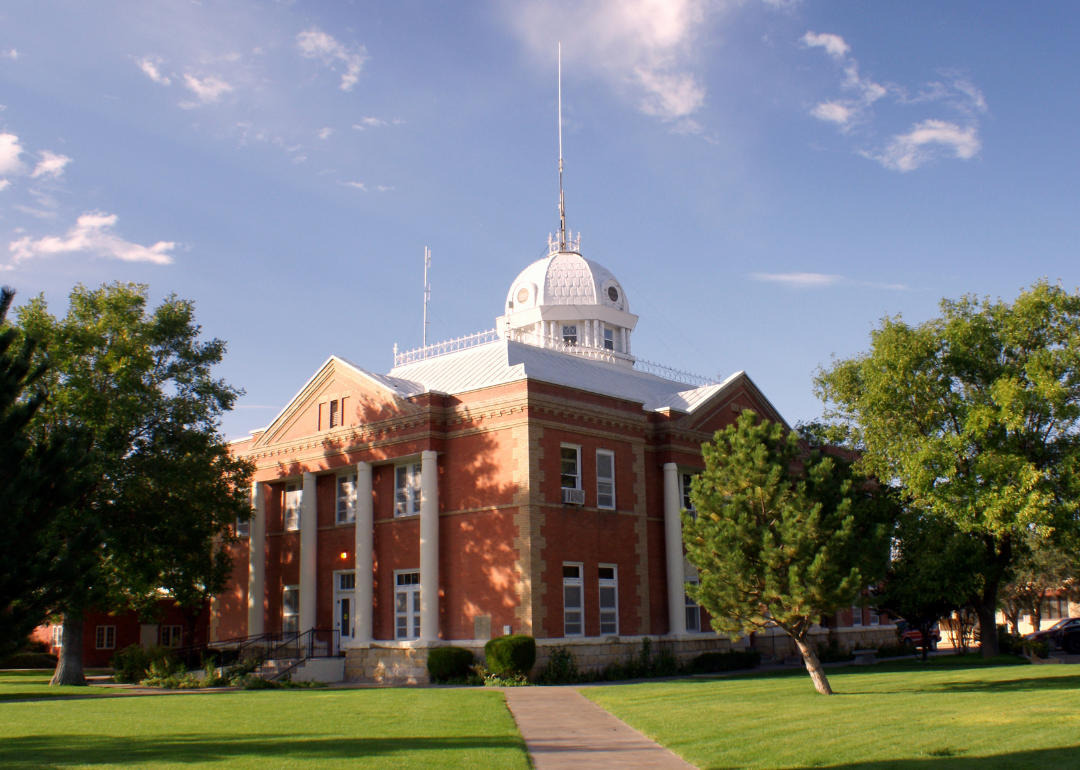
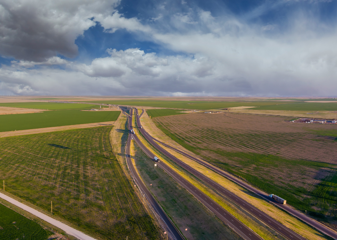
#16. Union County
– Life expectancy: 74.6 years
— 0.7 years lower than the state average
About
Union County is defined by wide-open plains, dramatic skies, and a quiet strength rooted in ranching, farming, and frontier heritage. Its small towns reflect resilience, self-reliance, and a deep connection to land and history. The landscape invites solitude, reflection, and appreciation for the natural world.
Residents enjoy a lifestyle shaped by tradition, outdoor living, and tight-knit community values. Local events and seasonal rhythms provide a sense of continuity and pride. Union County embodies the spirit of rural New Mexico—enduring, grounded, and shaped by the land.
Where is Union County?
Union County is located in the northeastern corner of New Mexico, bordering Colorado to the north and Texas and Oklahoma to the east. It is approximately 230 miles northeast of Albuquerque and 150 miles northwest of Amarillo, Texas. The county spans about 60 miles from north to south and 60 miles from east to west.
Clayton, the county seat, is around 85 miles west of Dalhart, Texas and 140 miles southeast of Raton, New Mexico. It is also about 100 miles south of Trinidad, Colorado. Union County features open plains, volcanic formations, and historic trails, with a rural landscape shaped by ranching and wide horizons.
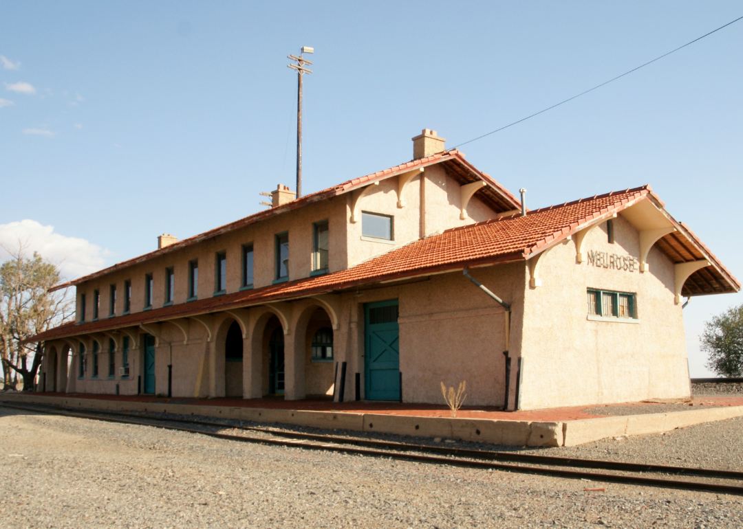
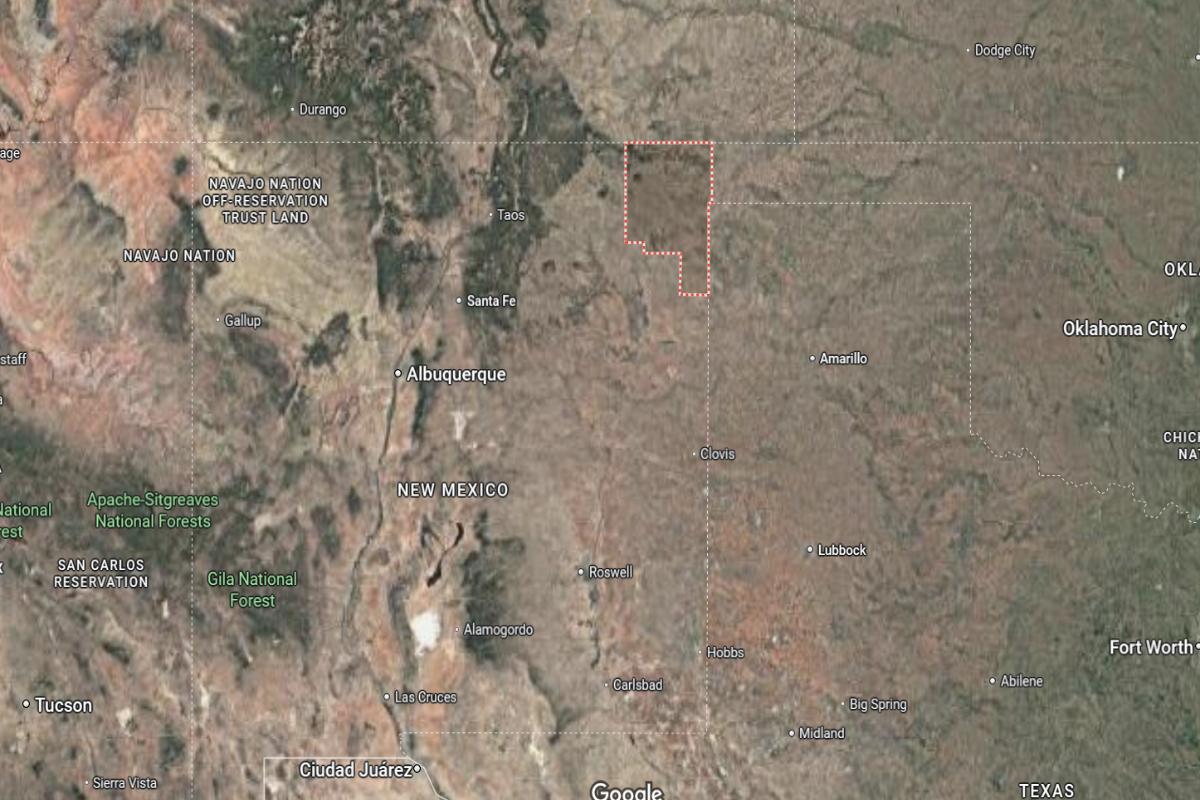
#15. Curry County
– Life expectancy: 74.2 years
— 1.1 years lower than the state average
About
Curry County blends open landscapes, agricultural strength, and a strong sense of local identity rooted in tradition and community pride. The region is known for its connection to farming, ranching, and military heritage, creating a culture of service, resilience, and hard work. Small towns and family-owned businesses support a welcoming and grounded atmosphere.
Residents enjoy community events, local fairs, and wide skies that reflect the area’s steady pace of life. A sense of belonging and shared values runs deep through neighborhoods and generations. Curry County represents a dependable, close-knit way of life shaped by history, service, and the land.
Where is Curry County?
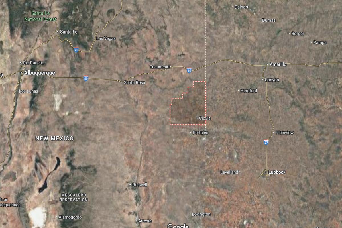
Curry County is located in the eastern part of New Mexico, directly along the Texas state line. It is approximately 220 miles east of Albuquerque and 100 miles southwest of Amarillo, Texas. The county stretches about 40 miles from north to south and 35 miles from east to west.
Clovis, the county seat and largest city, lies around 10 miles west of the Texas border and 90 miles northwest of Lubbock, Texas. It is also about 110 miles southeast of Santa Rosa, New Mexico. Curry County is known for its agricultural economy, military presence, and location along major highways connecting eastern New Mexico to west Texas.

#14. Torrance County
– Life expectancy: 73.6 years
— 1.7 years lower than the state average
About
Torrance County is characterized by its expansive desert plains, rural communities, and a lifestyle rooted in independence and tradition. The region reflects a strong connection to agriculture, ranching, and a deep respect for the land. Its small towns offer quiet resilience, local pride, and a steady pace of life.
Residents enjoy open skies, seasonal gatherings, and a sense of space that fosters self-reliance and reflection. Community values, historic ties, and simplicity shape daily experiences. Torrance County represents the spirit of rural New Mexico—enduring, honest, and deeply connected to the landscape.
Where is Torrance County?
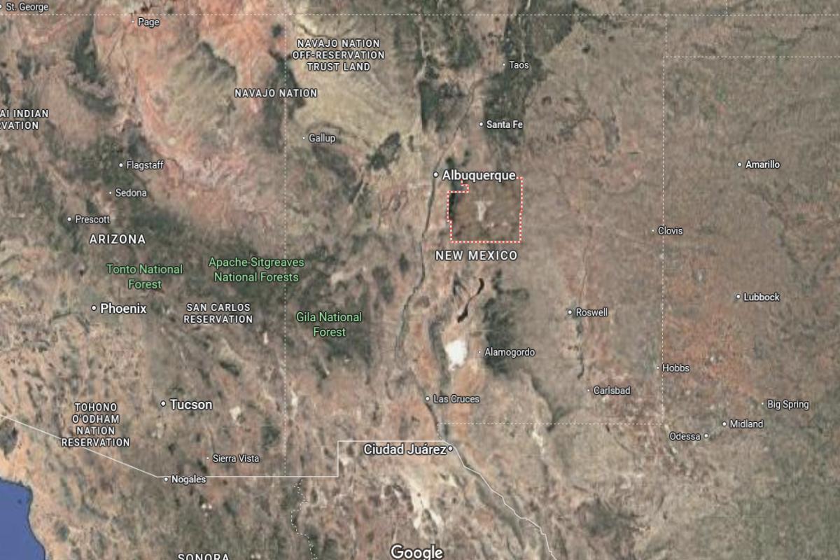
Torrance County is located in central New Mexico, southeast of Albuquerque and situated within the Estancia Basin. It lies approximately 40 miles southeast of Albuquerque and is bordered by the Manzano Mountains to the west. The county spans about 50 miles north to south and 45 miles east to west.
Estancia, the county seat, is around 25 miles south of Moriarty and 60 miles north of Carrizozo. Mountainair, another key town, is located about 35 miles southwest of Estancia. Torrance County is largely rural and agricultural, with open plains and mountain views connecting central New Mexico’s high desert communities.
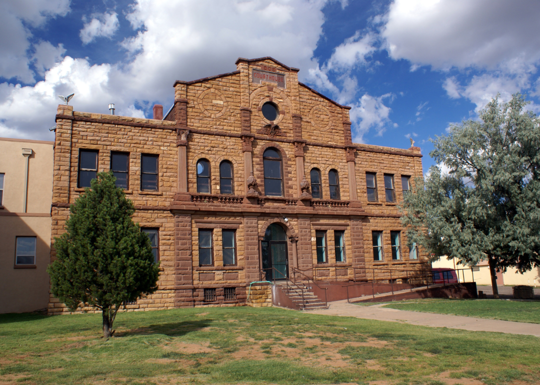
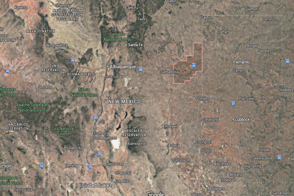
#13. Guadalupe County
– Life expectancy: 73.3 years
— 2.0 years lower than the state average
About
Guadalupe County is steeped in history and tradition, with a landscape marked by open plains, rugged beauty, and deep cultural roots. The area reflects a strong blend of Hispanic heritage, ranching life, and small-town pride. Its communities value simplicity, resilience, and a strong connection to both family and land.
Residents enjoy a peaceful, grounded lifestyle shaped by seasonal rhythms and long-standing customs. Festivals, faith, and storytelling help preserve a shared sense of identity. Guadalupe County represents a quiet, enduring way of life filled with authenticity, heritage, and natural beauty.
Where is Guadalupe County?
Guadalupe County is located in east-central New Mexico, approximately 115 miles southeast of Santa Fe and 95 miles east of Albuquerque. It lies along the Pecos River and is intersected by Interstate 40, making it a key route between northern and southern parts of the state. The county stretches about 50 miles from north to south and 60 miles from east to west.
Santa Rosa, the county seat, is around 60 miles west of Tucumcari and 100 miles northeast of Socorro. Vaughn, another town in the county, is located about 40 miles southwest of Santa Rosa. Guadalupe County features desert plains, mesas, and historic routes, including a portion of old Route 66.
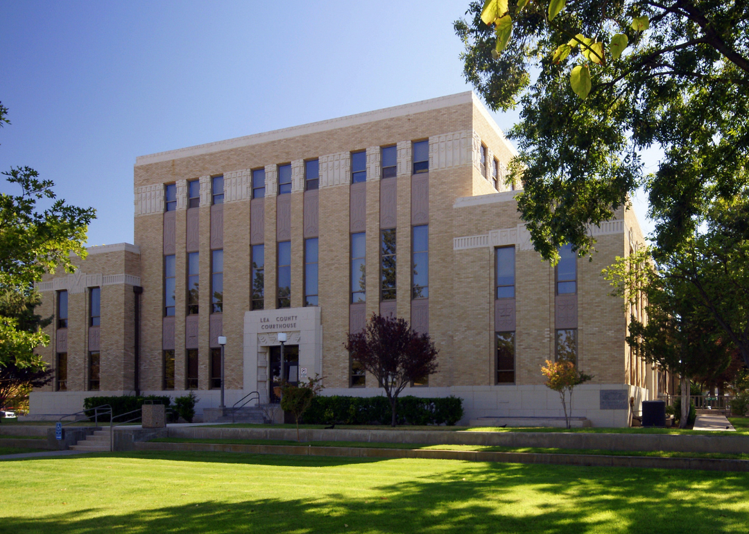
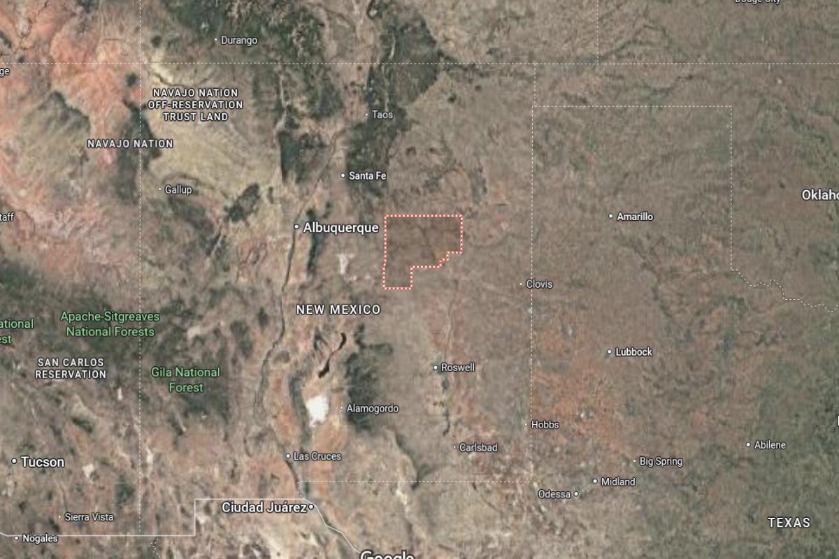
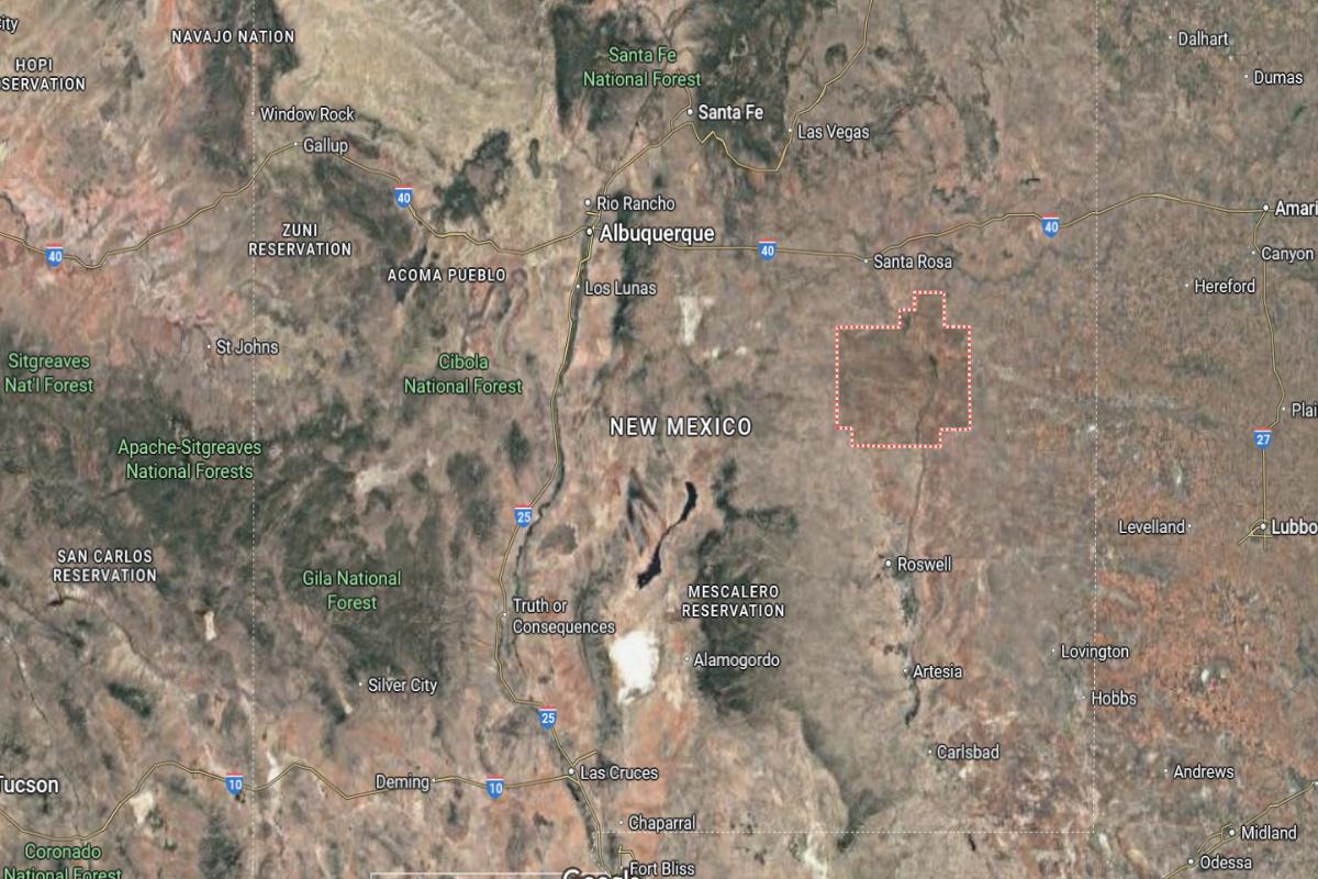
#12. Lea County
– Life expectancy: 73.1 years
— 2.2 years lower than the state average
About
Lea County is shaped by its oil, gas, and agricultural industries, fostering a hardworking culture rooted in resilience and economic drive. The landscape is wide and open, reflecting both opportunity and self-reliance. Towns here carry a strong sense of community, pride, and frontier spirit.
Residents enjoy local rodeos, fairs, and a lifestyle defined by determination and connection to the land. Growth and tradition exist side by side, with families and businesses building on deep local ties. Lea County reflects the rugged determination and cooperative values of southeastern New Mexico.
Where is Lea County?
Lea County is located in southeastern New Mexico, directly along the Texas border. It is approximately 320 miles southeast of Albuquerque and 100 miles west of Lubbock, Texas. The county spans about 70 miles north to south and 75 miles east to west.
Hobbs, the county seat and largest city, is around 20 miles west of the Texas state line and 70 miles southeast of Roswell. Lovington, another major city, is located about 20 miles north of Hobbs. Lea County is a major center for oil and gas production, with wide open plains and a strong connection to both agriculture and energy industries.
You may also like: Counties with the highest rates of high blood pressure in New Mexico
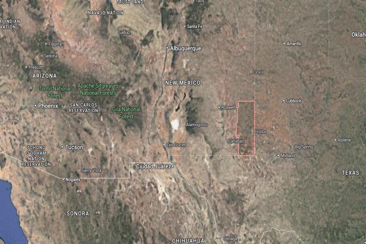
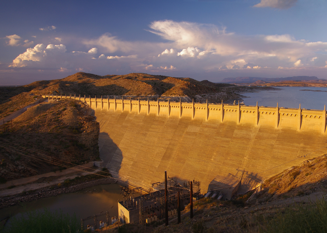
#11. Eddy County
– Life expectancy: 73.0 years
— 2.3 years lower than the state average
About
Eddy County blends desert landscapes, natural wonders, and a strong industrial base rooted in oil, gas, and tourism. Its communities reflect a hardworking spirit, with deep ties to both the land and the economic engines that shape daily life. The region balances growth and tradition, offering both opportunity and a strong sense of place.
Residents enjoy access to outdoor recreation, community events, and a pace of life grounded in resilience and local pride. Cultural heritage and natural beauty come together in a way that defines the area’s character. Eddy County represents a bold, enduring lifestyle built on resourcefulness, community, and connection to the land.
Where is Eddy County?
Eddy County is located in southeastern New Mexico, bordering Texas to the south. It is approximately 260 miles southeast of Albuquerque and 160 miles northeast of El Paso, Texas. The county spans about 65 miles from north to south and 85 miles from east to west.
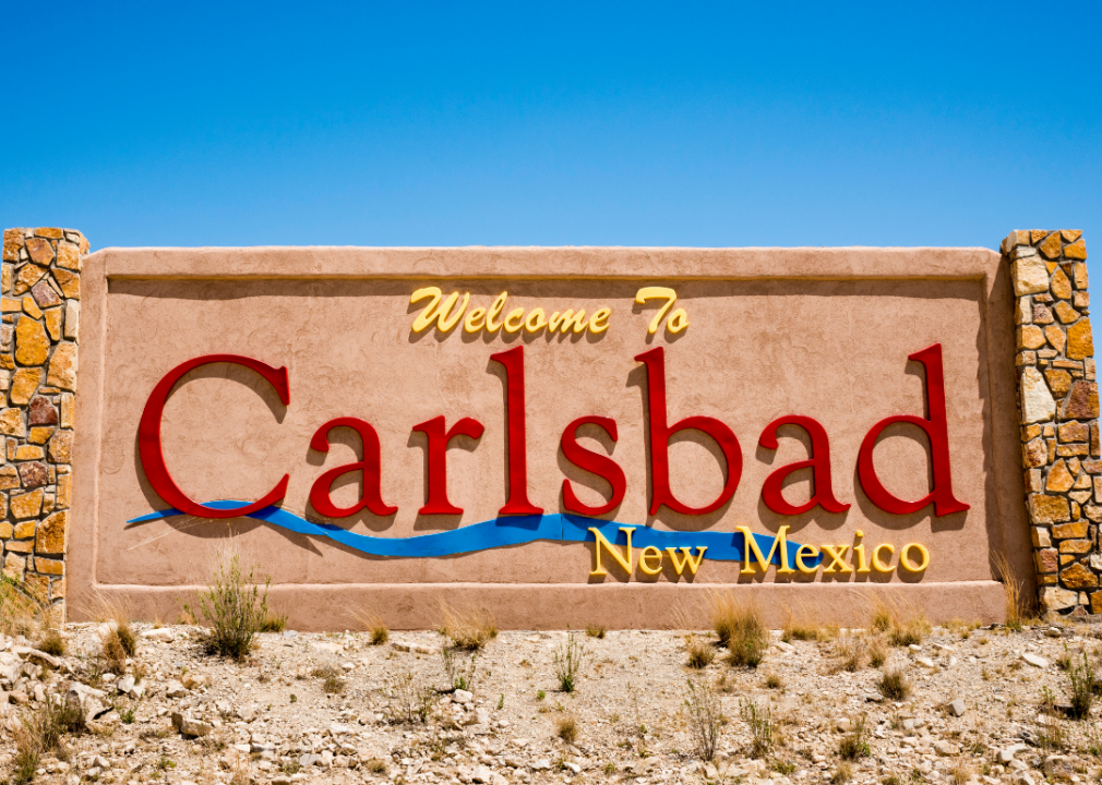
Carlsbad, the county seat, is around 75 miles south of Roswell and 30 miles north of the Texas border. Artesia, another major city, is about 40 miles north of Carlsbad and 40 miles south of Roswell. Eddy County is known for Carlsbad Caverns, oil and gas industries, and a blend of desert landscapes and underground wonders.
🔥 Would you like to save this?
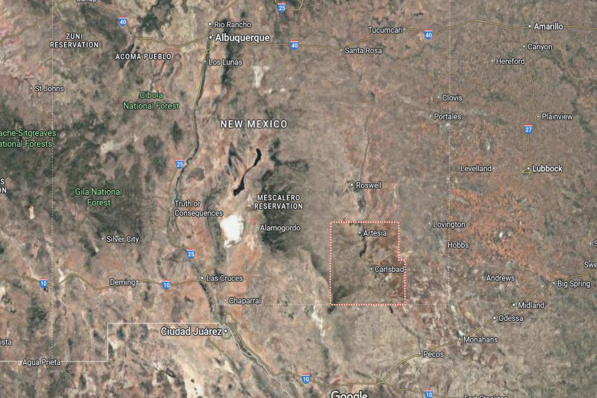
#10. Chaves County
– Life expectancy: 72.9 years
— 2.4 years lower than the state average
About
Chaves County is known for its agricultural roots, wide desert vistas, and a strong blend of history and local legend. The area supports a hardworking way of life centered on farming, ranching, and small-town values. Its communities reflect pride, resilience, and a commitment to preserving heritage while embracing quiet progress.
Residents enjoy open skies, local events, and a lifestyle shaped by both tradition and imagination. From family-run businesses to unique cultural ties, daily life here feels grounded and connected. Chaves County represents a steady, authentic rhythm shaped by land, history, and enduring community bonds.
Where is Chaves County?
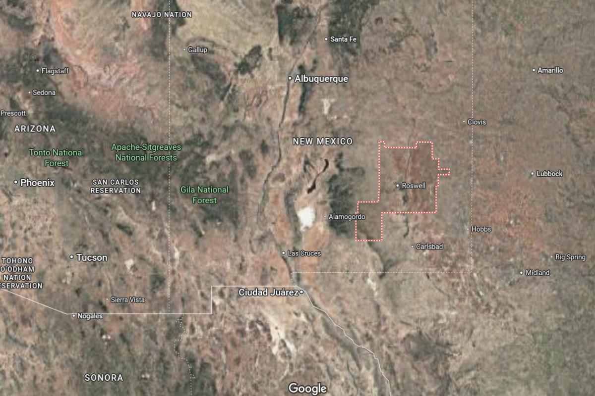
Chaves County is located in southeastern New Mexico, situated in the high desert between the Sacramento Mountains and the Llano Estacado. It is approximately 200 miles southeast of Albuquerque and 90 miles east of Ruidoso. The county spans about 100 miles north to south and 70 miles east to west.
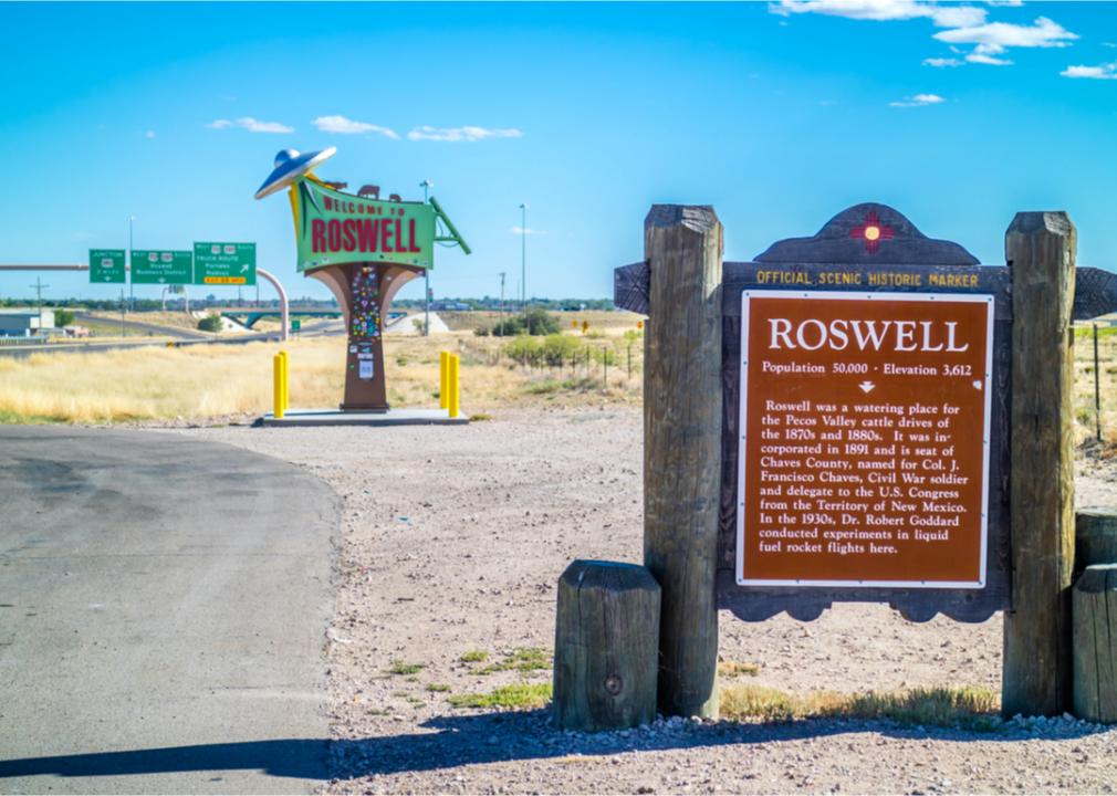
Roswell, the county seat and largest city, is around 75 miles south of Fort Sumner and 40 miles north of Artesia. It also lies about 100 miles west of the Texas border. Chaves County is known for its agriculture, aviation history, and as a popular destination for UFO and space-related tourism.
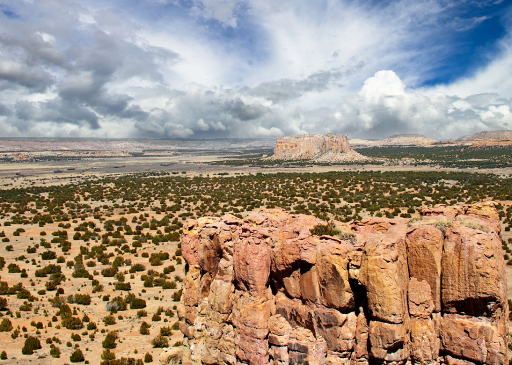
#9. Socorro County
– Life expectancy: 72.8 years
— 2.5 years lower than the state average
About
Socorro County offers a dramatic mix of desert landscapes, scientific innovation, and a rich cultural past deeply rooted in the Southwest. The area is known for its blend of academic presence, historical significance, and strong ties to ranching and rural life. Its communities are shaped by curiosity, endurance, and a close relationship with nature.
Residents enjoy stargazing, cultural festivals, and outdoor exploration that reflect the county’s unique character. Life here balances intellectual pursuit with a rugged, independent spirit. Socorro County embodies a distinct fusion of tradition, science, and Southwestern resilience.
Where is Socorro County?
Socorro County is located in central New Mexico, stretching from the Rio Grande Valley to the western mountains and desert basins. It is approximately 75 miles south of Albuquerque and 140 miles north of Las Cruces. The county spans about 100 miles from north to south and 80 miles from east to west.
Socorro, the county seat, is around 25 miles south of Belen and 60 miles northwest of Carrizozo. Magdalena, another town in the county, is located about 25 miles west of Socorro. Socorro County is known for its scientific institutions, open landscapes, and the Very Large Array radio telescope west of the city.

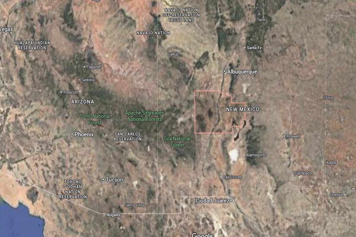
#8. Luna County
– Life expectancy: 72.6 years
— 2.7 years lower than the state average
About
Luna County is defined by its expansive desert beauty, agricultural tradition, and deep cultural roots. The region reflects a quiet resilience, with communities built on farming, family values, and a strong connection to heritage. Its landscape and lifestyle evoke simplicity, openness, and a steady pace.
Residents enjoy local festivals, wide-open skies, and a spirit of self-reliance that shapes everyday life. Community pride, natural surroundings, and cross-cultural influence create a unique and grounded environment. Luna County represents the essence of rural New Mexico—peaceful, enduring, and rich in character.
Where is Luna County?
Luna County is located in southwestern New Mexico, directly along the border with Mexico. It is approximately 60 miles west of Las Cruces and 115 miles northwest of El Paso, Texas. The county spans about 30 miles from north to south and 55 miles from east to west.
Deming, the county seat, is around 35 miles north of the U.S.–Mexico border and 60 miles east of Lordsburg. It is also about 150 miles southwest of Albuquerque. Luna County is known for its desert terrain, proximity to border crossings, and its role as a transportation and agricultural hub in the region.
#7. Quay County
– Life expectancy: 71.6 years
— 3.7 years lower than the state average
About
Quay County is marked by open plains, Route 66 nostalgia, and a deep connection to ranching and rural life. Its small towns reflect a slower, grounded pace shaped by history, agriculture, and community pride. The landscape carries a quiet beauty, inviting reflection and resilience.
Residents enjoy local fairs, historic landmarks, and a lifestyle that values self-reliance and neighborly ties. Generational traditions and strong work ethics are woven into daily life. Quay County embodies classic southwestern charm rooted in heritage, simplicity, and wide-open space.
Where is Quay County?
Quay County is located in eastern New Mexico, along the Texas border and part of the high plains region. It is approximately 165 miles east of Santa Fe and 110 miles west of Amarillo, Texas. The county spans about 60 miles from north to south and 50 miles from east to west.
Tucumcari, the county seat, is around 40 miles southwest of Logan and 65 miles northeast of Santa Rosa. It is also about 85 miles northwest of Clovis. Quay County is known for its historic Route 66 connections, wide-open landscapes, and agricultural economy.
You may also like: These 10 car insurers have the highest market share in New Mexico
#5. Cibola County (tie)
– Life expectancy: 71.5 years
— 3.8 years lower than the state average
About
Cibola County is shaped by its striking mesas, cultural diversity, and a deep spiritual and historical heritage. The area reflects a blend of Indigenous traditions, Hispanic influences, and frontier resilience, creating a rich and layered identity. Its communities value storytelling, craftsmanship, and a strong connection to the land.
Residents enjoy scenic beauty, local festivals, and a lifestyle rooted in heritage and quiet strength. Natural landmarks and cultural landmarks coexist, offering both inspiration and reflection. Cibola County represents a meaningful blend of tradition, endurance, and the enduring spirit of the Southwest.
Where is Cibola County?
Cibola County is located in western New Mexico, just west of Albuquerque and bordering Arizona. It is approximately 75 miles west of Albuquerque and 145 miles southeast of Gallup. The county spans about 85 miles from north to south and 70 miles from east to west.
Grants, the county seat, is around 50 miles north of the El Malpais National Monument and 60 miles east of the Arizona state line. It is also about 130 miles northeast of Silver City. Cibola County features a mix of mesas, lava fields, and forests, and includes parts of the Acoma and Laguna Pueblos.

#5. De Baca County (tie)
– Life expectancy: 71.5 years
— 3.8 years lower than the state average
About
De Baca County is defined by its vast open spaces, ranching heritage, and a quiet, enduring way of life. The landscape offers wide skies, rolling plains, and a sense of solitude that shapes the community’s identity. History and tradition are deeply rooted, giving the area a strong sense of place and continuity.
Residents value independence, neighborly bonds, and the timeless rhythms of rural living. Local events and family ties foster connection in a place where simplicity and self-reliance are essential. De Baca County reflects the spirit of the American West—steadfast, humble, and deeply grounded in the land.
Where is De Baca County?
De Baca County is located in east-central New Mexico, within the high plains region of the state. It is approximately 170 miles southeast of Santa Fe and 60 miles north of Roswell. The county spans about 45 miles from north to south and 35 miles from east to west.
Fort Sumner, the county seat, is around 40 miles west of Clovis and 60 miles southeast of Santa Rosa. It also lies about 90 miles northeast of Carrizozo. De Baca County is known for its rural setting, ranching history, and as the burial place of Billy the Kid.

🔥 Would you like to save this?
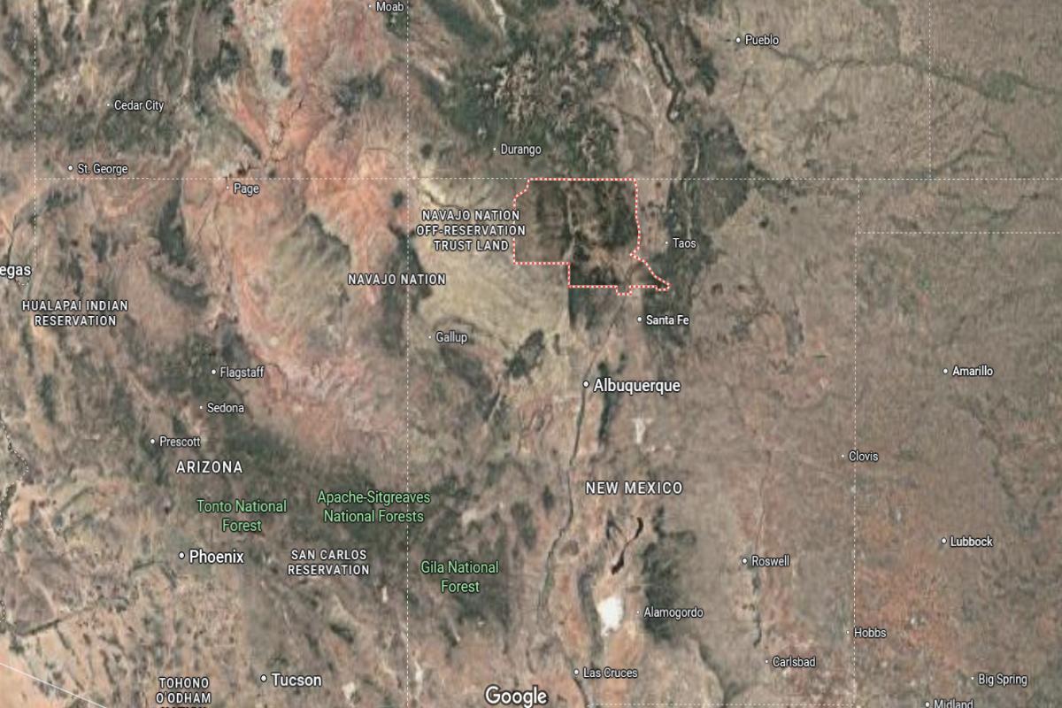
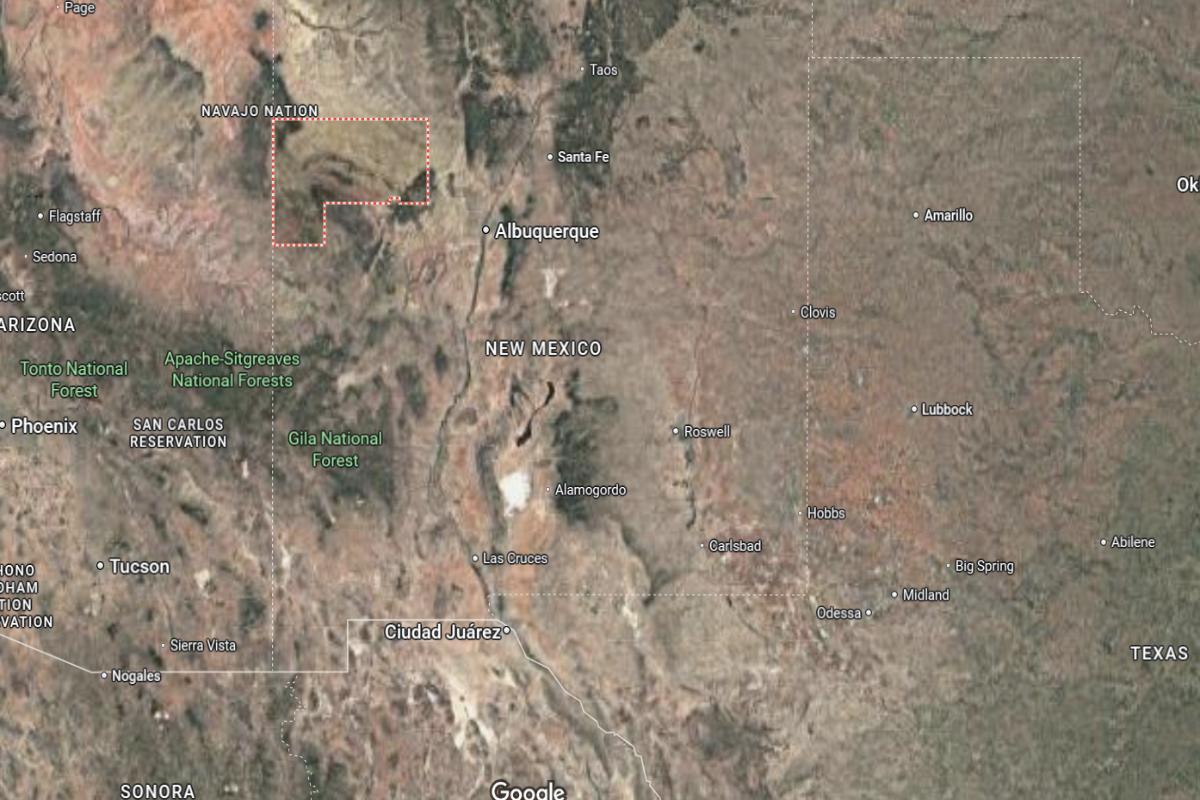
#4. San Juan County
– Life expectancy: 71.3 years
— 4.0 years lower than the state average
About
San Juan County is a region of striking landscapes, cultural depth, and strong community ties rooted in tradition and resourcefulness. The area blends Native American heritage, energy development, and agriculture into a diverse and resilient identity. Its towns and open spaces reflect a balance between history, industry, and natural beauty.
Residents enjoy a rich mix of outdoor recreation, cultural events, and close-knit communities that honor the past while embracing change. Daily life is shaped by connection to the land, artistic expression, and a shared sense of pride. San Juan County embodies a vibrant, grounded spirit with deep cultural roots and a forward-looking outlook.
Where is San Juan County?
San Juan County is located in the northwestern corner of New Mexico, bordering Colorado to the north, Arizona to the west, and the Navajo Nation to the south. It is approximately 185 miles northwest of Santa Fe and 200 miles northeast of Flagstaff, Arizona. The county spans about 90 miles from north to south and 70 miles from east to west.
Farmington, the county seat and largest city, is around 55 miles southeast of Shiprock and 55 miles west of Aztec. It also lies about 60 miles south of Durango, Colorado. San Juan County is known for its energy industry, Native American culture, and access to scenic landmarks like the Four Corners and Bisti Badlands.
#2. Rio Arriba County (tie)
– Life expectancy: 70.9 years
— 4.4 years lower than the state average
About
Rio Arriba County is rich in cultural heritage, natural beauty, and deep ancestral roots that span generations. The area reflects a blend of Native American, Hispanic, and frontier traditions, creating a landscape of vibrant history and spiritual depth. Its mountains, rivers, and adobe villages speak to a lifestyle grounded in land and legacy.
Residents embrace a slower, reflective pace of life supported by art, agriculture, and community traditions. Festivals, faith, and family define daily rhythms, fostering strong local identity and pride. Rio Arriba County represents a soulful, enduring connection between people, place, and history.
Where is Rio Arriba County?
Rio Arriba County is located in northern New Mexico, bordering Colorado to the north and stretching into the heart of the Rocky Mountains. It is approximately 95 miles north of Santa Fe and 60 miles west of Taos. The county spans about 100 miles from north to south and 70 miles from east to west.
Espanola, one of the main cities, is around 25 miles north of Santa Fe and 45 miles south of Chama, near the Colorado line. Tierra Amarilla, the county seat, is about 65 miles north of Espanola. Rio Arriba County is known for its mountainous landscapes, Native American pueblos, and historic Spanish settlements.
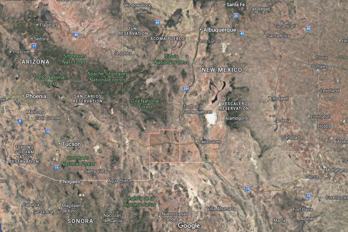
#2. Sierra County (tie)
– Life expectancy: 70.9 years
— 4.4 years lower than the state average
About
Sierra County is known for its rugged landscapes, tranquil atmosphere, and a lifestyle rooted in wellness, creativity, and exploration. The region combines desert beauty with a strong sense of independence and community, where art, nature, and history intersect. Its towns offer a mix of charm, eccentricity, and laid-back spirit.
Residents enjoy hot springs, festivals, outdoor adventures, and a peaceful rhythm that encourages reflection and connection. The area values authenticity, sustainability, and personal expression. Sierra County reflects a unique blend of solitude, creativity, and southwestern character.
Where is Sierra County?
Sierra County is located in southern New Mexico, in the Rio Grande Valley between the Black Range and San Andres Mountains. It is approximately 145 miles south of Albuquerque and 60 miles north of Las Cruces. The county spans about 50 miles from north to south and 55 miles from east to west.
Truth or Consequences, the county seat, is around 40 miles west of Alamogordo and 30 miles south of Socorro. Williamsburg, a nearby town, is just 1 mile west of Truth or Consequences. Sierra County is known for its hot springs, access to Elephant Butte Lake, and proximity to Spaceport America.
You may also like: Counties where the most opioids are dispensed in New Mexico
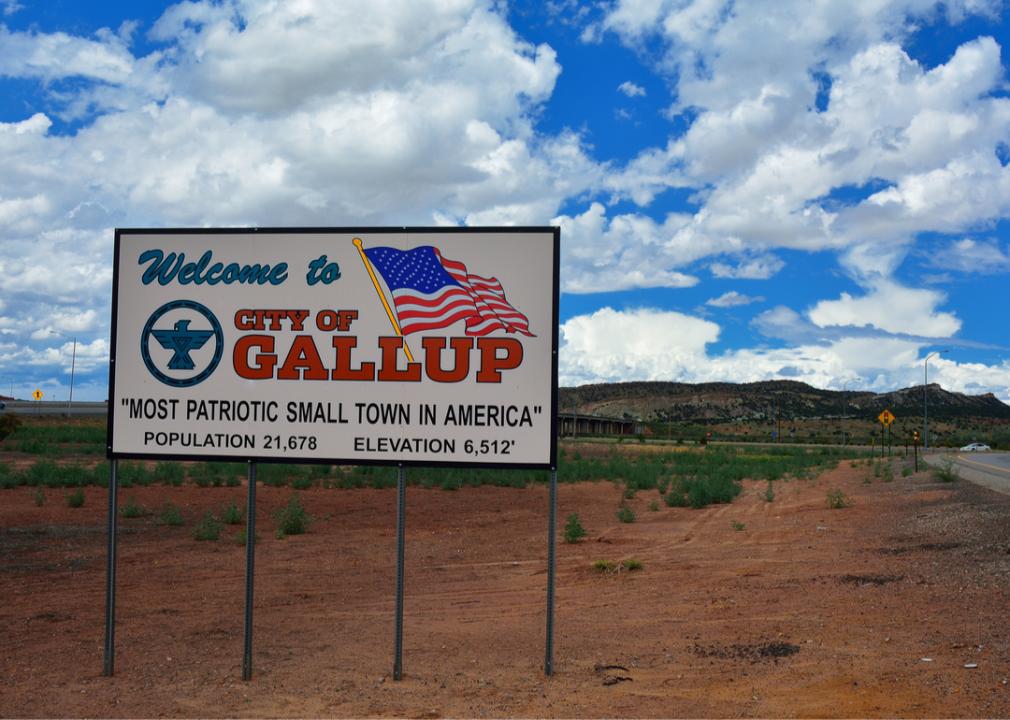
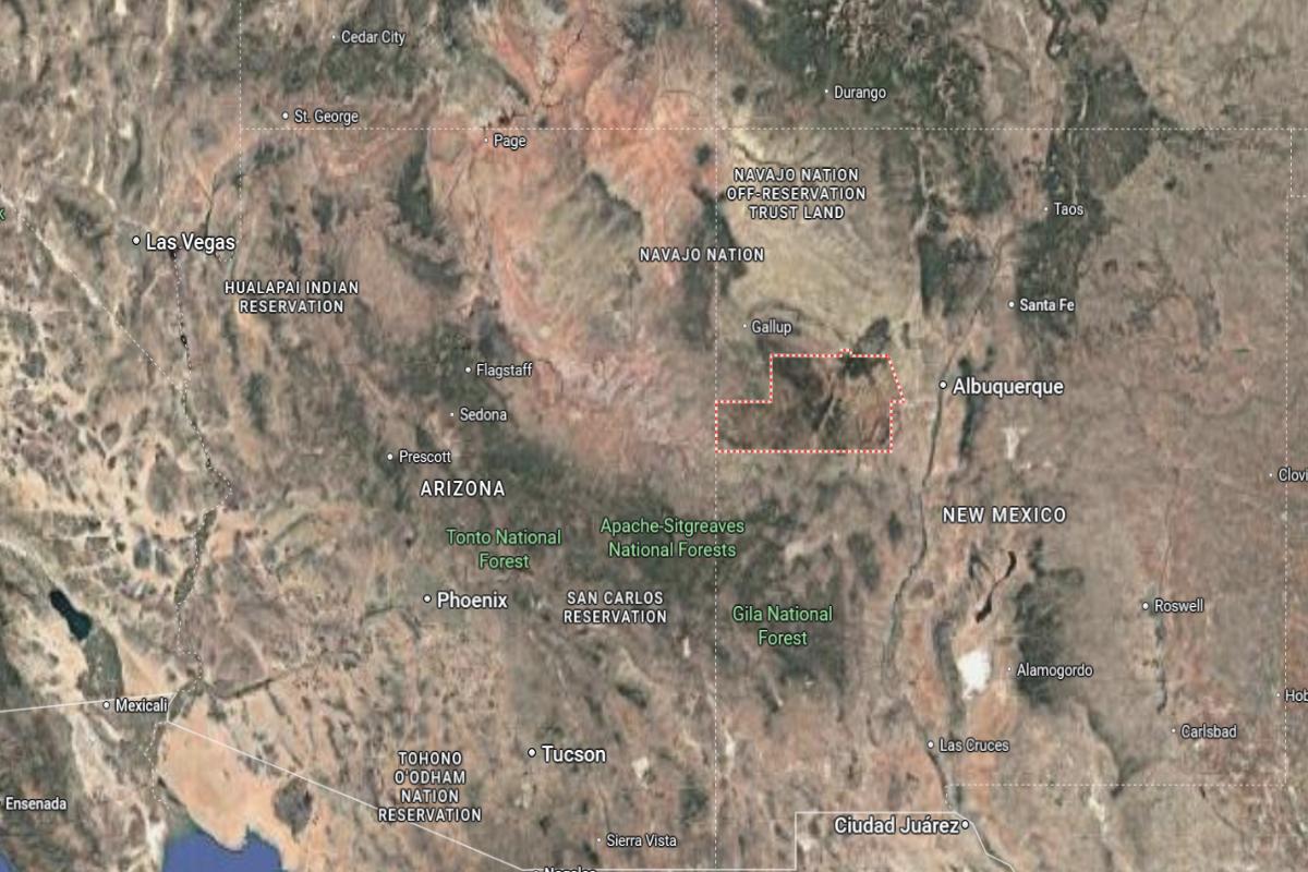
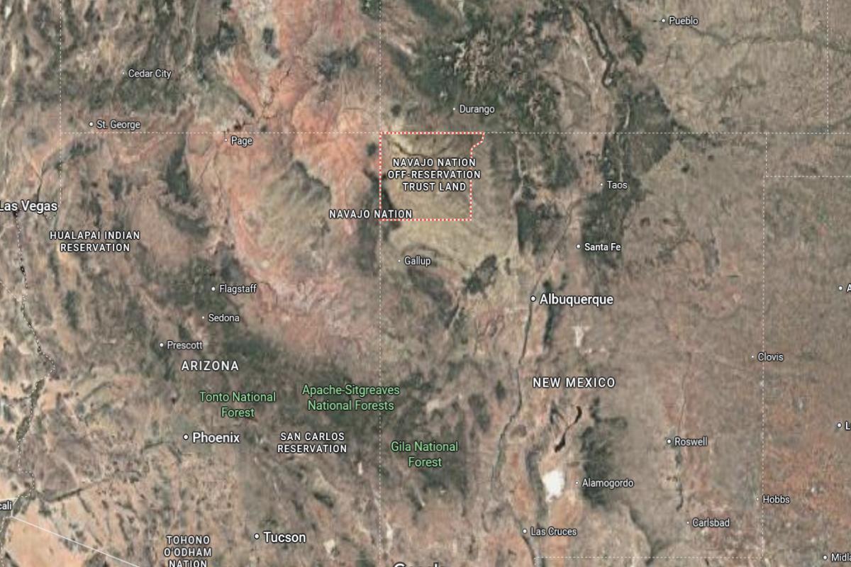
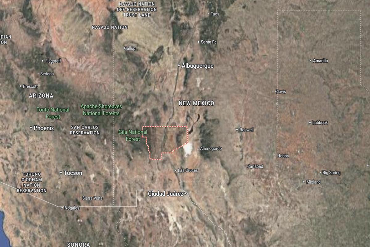
#1. McKinley County
– Life expectancy: 65.2 years
— 10.1 years lower than the state average
About
McKinley County is steeped in Indigenous culture, artistic tradition, and a rugged, high-desert landscape that shapes a strong community identity. The region reflects a blend of historical depth, spiritual heritage, and resilience across generations. Its towns and rural areas carry a deep connection to land, craftsmanship, and storytelling.
Residents value cultural expression, family ties, and the preservation of ancestral ways of life. Art markets, ceremonies, and local gatherings are central to the rhythm of daily living. McKinley County represents a profound blend of heritage, endurance, and cultural pride in the heart of the Southwest.
Where is McKinley County?
McKinley County is located in northwestern New Mexico, bordering Arizona to the west and encompassing a large portion of the Navajo Nation. It is approximately 140 miles west of Albuquerque and 25 miles east of the Arizona state line. The county spans about 75 miles from north to south and 65 miles from east to west.
Gallup, the county seat and largest city, is around 65 miles southwest of Farmington and 40 miles west of Grants. It also lies about 135 miles northeast of Window Rock, Arizona. McKinley County is known for its Native American culture, desert mesas, and historic role in trade and rail transport.
This story features data reporting by Karim Noorani, writing by Kiersten Hickman, and is part of a series utilizing data automation across 49 states.
By Stacker


