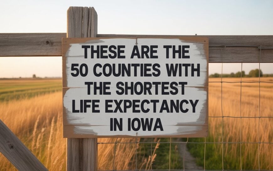
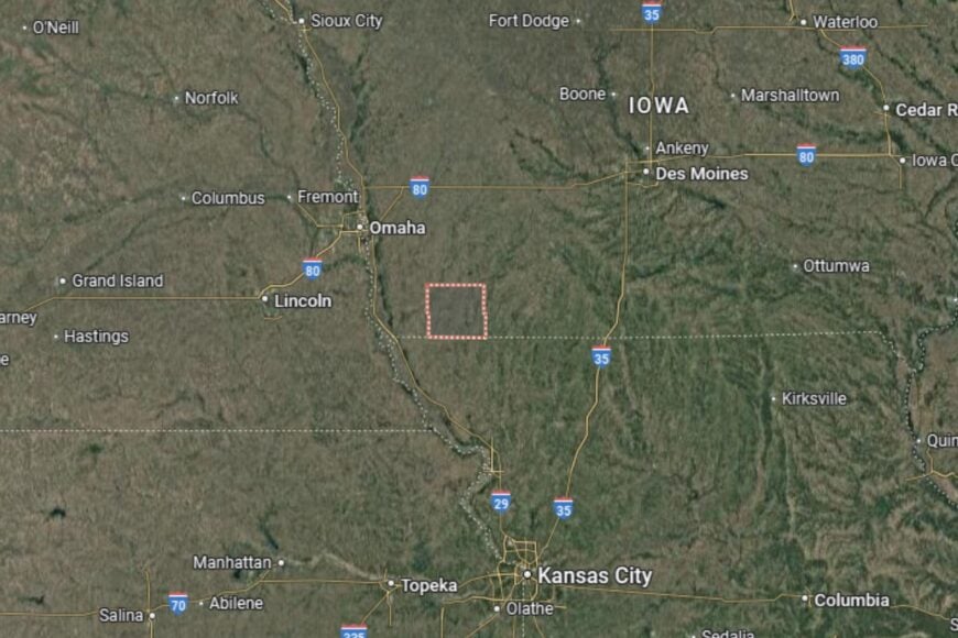
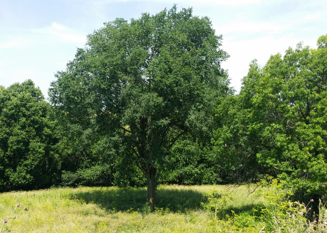
Counties with the shortest life expectancy in Iowa
Life expectancy can be affected by a variety of factors. About 25% of your lifespan is determined by genetics, according to the National Library of Medicine. Health and wellness habits—like following a balanced, nutrient-rich diet; not smoking; drinking minimal alcohol; maintaining a healthy weight; and staying physically active—can add more than a decade to your life, research from the National Institutes of Health shows. While these factors are significant, another important element that you might not have considered is your environment and community.
In order to come up with the very specific design ideas, we create most designs with the assistance of state-of-the-art AI interior design software. Also, assume links that take you off the site are affiliate links such as links to Amazon. this means we may earn a commission if you buy something.
While life expectancy generally increases annually in the United States—jumping from about 70.8 years old to 77.5 between 1970 and 2022, according to the Centers for Disease Control and Prevention—this particular metric can vary from state to state or even county to county. In some parts of the country, the average lifespan is getting shorter based on a variety of risk factors on top of health, including socioeconomic factors like poverty, unemployment, income, and education.
According to a 2020 study from researchers at Penn State, West Virginia, and Michigan State Universities, communities with a higher population density, more fast food restaurants, and a high number of extraction industry-based jobs tend to have shorter life expectancies.
To find out how life expectancy varies within Iowa, Stacker used 2024 County Health Rankings & Roadmaps from the University of Wisconsin Population Health Institute to identify the counties with the shortest life expectancy. Life expectancy measures the average number of years from birth a person can expect to live and is calculated based on the number of deaths in a given time period and the average number of people at risk of dying during that period. Counties with unreliable or insufficient data were excluded from the analysis. Mortality data came from the National Vital Statistics System.
Read on to see if your county is on the list.
You may also like: Highest-rated wineries in Iowa, according to Yelp
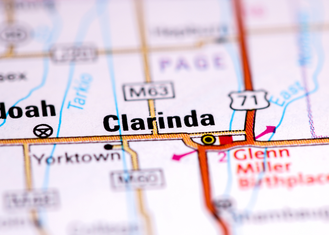
#50. Page County (tie)
– Life expectancy: 78.0 years
— 0.1 years lower than the state average
About
Page County is a largely rural community with a history rooted in agriculture, small-town living, and Midwestern values. Farming remains an essential part of the local economy, complemented by small businesses and community services that reflect the county’s character. Residents enjoy a relaxed lifestyle, where cultural events, school activities, and local traditions foster a sense of togetherness.
The county emphasizes quality of life through accessible healthcare, education, and civic programs designed to support families and seniors. Outdoor recreation such as hiking, camping, and fishing is popular, with community parks and open spaces providing opportunities to connect with nature. Page County balances its agricultural heritage with a steady pace of modern development.
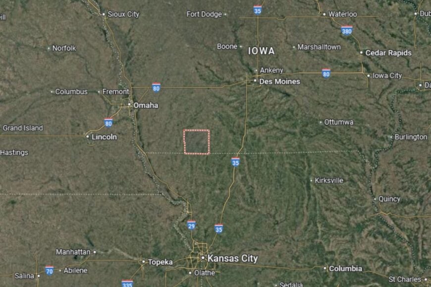
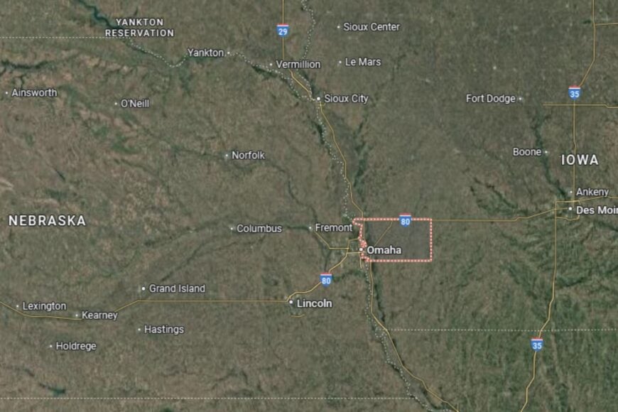
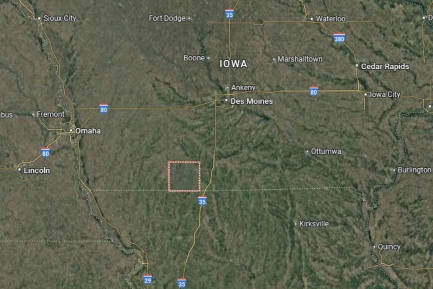
Where is Page County?
Page County is located in the southwestern corner of Iowa, directly along the Missouri border. The county seat, Clarinda, is about 100 miles southeast of Omaha, Nebraska, and roughly 120 miles southwest of Des Moines, Iowa. It sits near major transportation routes, including U.S. Highway 71 and U.S. Highway 2, which connect residents to regional hubs.
Neighboring counties include Montgomery to the north and Taylor to the east, with easy access to Missouri towns just across the border. The landscape is characterized by rolling farmland and scenic rural vistas. This location makes Page County a bridge between Iowa’s agricultural heartland and the cultural influence of nearby Missouri and Nebraska.
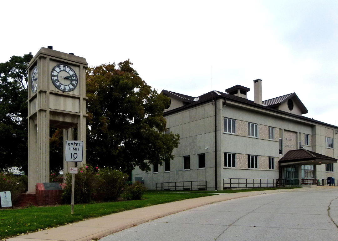
#49. Mills County (tie)
– Life expectancy: 77.9 years
— 0.2 years lower than the state average
About
Mills County is known for its strong agricultural economy, tight-knit communities, and proximity to larger metropolitan areas. Farming and agribusiness dominate the local landscape, though small industries and retail also play a role in sustaining the county. Residents value a slower pace of life, balanced with easy access to nearby job markets and city amenities.
Community events, county fairs, and school programs help preserve traditions and encourage civic engagement. Mills County also places importance on maintaining infrastructure and local services, ensuring residents enjoy both convenience and a close connection to their surroundings. Parks, trails, and recreation areas add to the county’s appeal for families and outdoor enthusiasts.
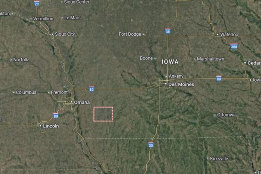
Where is Mills County?
Mills County is located in the southwestern part of Iowa, bordering Nebraska along the Missouri River. Its county seat, Glenwood, is about 20 miles south of Omaha, Nebraska, making it one of the closest Iowa counties to the Omaha-Council Bluffs metropolitan area. U.S. Highway 34 and Interstate 29 provide direct connections to neighboring states and cities.
The county’s location along the Missouri River gives it both economic and recreational advantages. Neighboring Fremont and Pottawattamie Counties offer additional access to regional resources and opportunities. Mills County’s position provides residents with the benefits of rural life while being just minutes away from major urban centers.
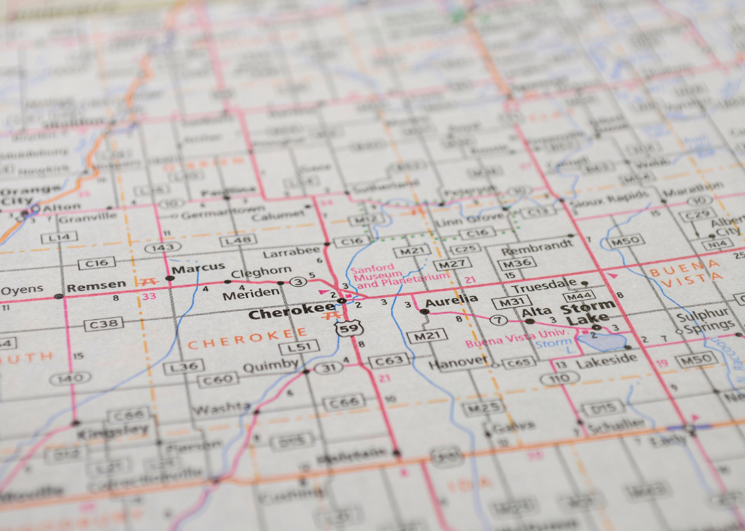
#48. Cherokee County (tie)
– Life expectancy: 77.9 years
— 0.2 years lower than the state average
About
Cherokee County is a community that blends a proud agricultural foundation with cultural and historical significance. Farming remains central to the economy, but healthcare, education, and local commerce also provide stability for residents. The county’s strong sense of identity is reflected in its institutions, festivals, and heritage-focused organizations.
Residents benefit from services designed to support families, including schools, healthcare providers, and recreational facilities. Cherokee County also highlights cultural life through museums and community events, while its rural setting ensures a peaceful lifestyle. The balance between history, agriculture, and modern development shapes daily life in the county.
Where is Cherokee County?
Cherokee County is situated in northwestern Iowa, about 60 miles east of Sioux City and 100 miles northwest of Des Moines. The county seat, Cherokee, serves as a regional hub for healthcare, education, and commerce. U.S. Highway 59 and Iowa Highway 3 run through the county, providing efficient connections to neighboring areas.
The surrounding landscape is made up of fertile farmland and rolling prairies, characteristic of Iowa’s northwest. Nearby counties include Buena Vista to the east and Plymouth to the west. Cherokee County’s location makes it a vital part of the broader agricultural network of northwestern Iowa.
#47. Greene County (tie)
– Life expectancy: 77.8 years
— 0.3 years lower than the state average
About
Greene County is a small Iowa community known for its agricultural heritage and close-knit neighborhoods. Farming and agribusiness remain the backbone of the local economy, with corn, soybeans, and livestock production playing key roles. Residents appreciate the county’s combination of rural charm and accessible modern services, with schools and healthcare supporting a stable way of life.
The county promotes community engagement through fairs, local markets, and cultural events. Outdoor recreation is an important part of life, with parks, trails, and rivers offering plenty of options for fishing, boating, and hiking. Greene County maintains its balance of traditional rural living with small-scale development that enhances residents’ quality of life.
Where is Greene County?
Greene County is located in central Iowa, about 65 miles northwest of Des Moines. The county seat, Jefferson, sits along U.S. Highway 30, a major east–west corridor across the state, with Iowa Highway 4 providing a north–south connection. This makes Jefferson and the county accessible from multiple directions.
The county is bordered by Boone to the east, Carroll to the west, Calhoun to the north, and Guthrie to the south. Its position places it in the heart of Iowa farmland, with open fields, rivers, and prairies shaping the landscape. Greene County’s location makes it a vital link in central Iowa’s agricultural and community network.
#46. Keokuk County (tie)
– Life expectancy: 77.8 years
— 0.3 years lower than the state average
About
Keokuk County is steeped in Iowa’s agricultural traditions, with farming serving as the primary driver of the local economy. Corn, soybeans, and livestock are essential to both employment and community identity. Residents value a rural lifestyle centered on family, church, and civic engagement.
The county supports its communities with schools, healthcare providers, and recreational programs that strengthen local connections. Festivals, farmers markets, and seasonal activities add to the charm of small-town life. Keokuk County’s commitment to preserving its heritage while supporting local services ensures a steady quality of life for residents.
Where is Keokuk County?
Keokuk County is located in southeastern Iowa, about 60 miles southwest of Iowa City and roughly 85 miles southeast of Des Moines. The county seat, Sigourney, lies near Iowa Highways 92 and 149, which provide links to regional hubs.
Bordering counties include Washington to the east and Mahaska to the west. The area is made up of rolling farmland and scenic countryside, offering both economic productivity and natural beauty. Its location makes Keokuk County a quiet but accessible part of southeastern Iowa.
You may also like: Best counties to live in Iowa
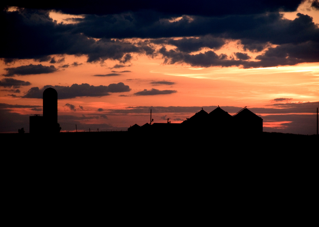
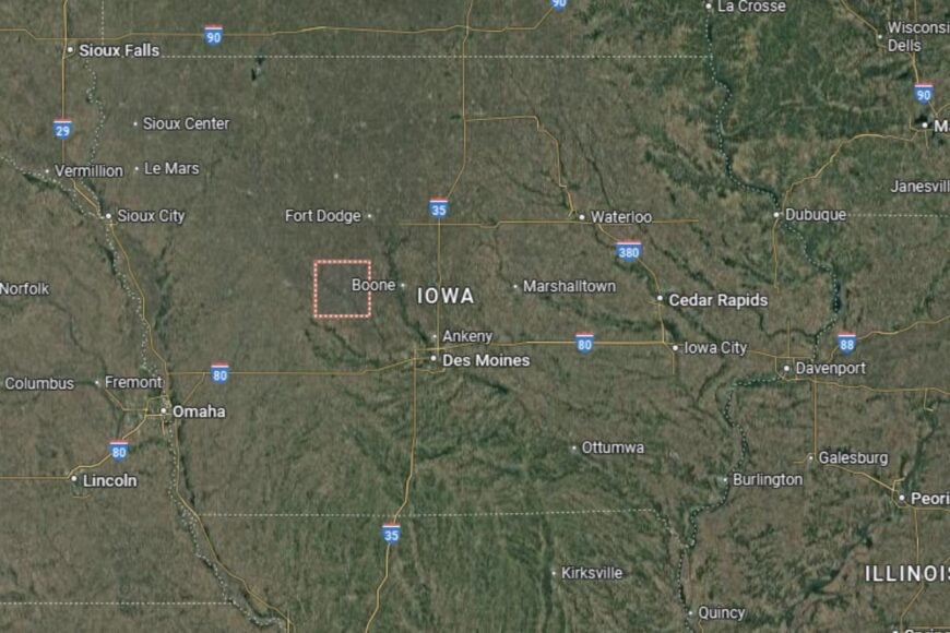
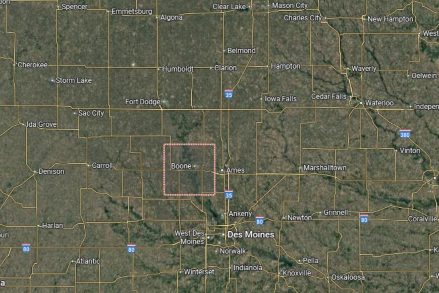
#45. Boone County (tie)
– Life expectancy: 77.8 years
— 0.3 years lower than the state average
About
Boone County is a community that blends a strong agricultural economy with recreational and cultural opportunities. Farming remains important, but the county also benefits from its proximity to Ames and Des Moines, giving residents access to broader employment and education options. Local events, fairs, and historical attractions strengthen Boone County’s cultural identity.
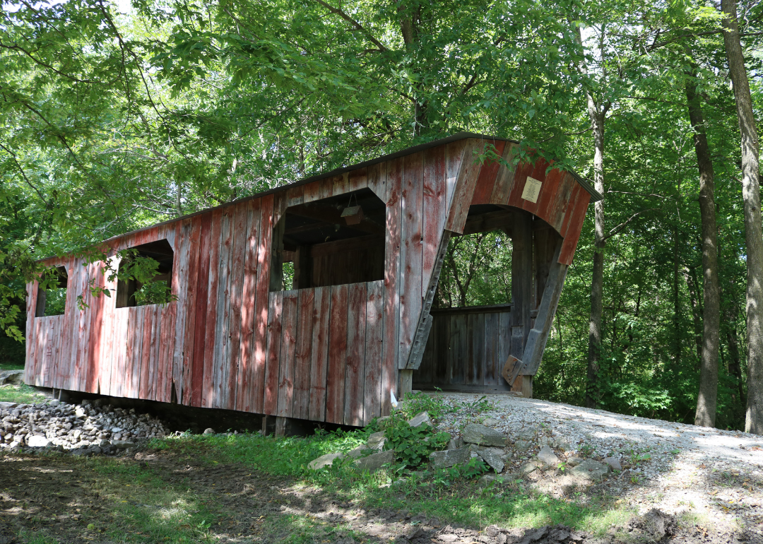
Residents enjoy a balance of small-town living and regional connectivity. Outdoor recreation is abundant, particularly in Ledges State Park, which offers hiking, camping, and scenic views. Boone County also maintains strong schools and community programs that make it a desirable place for families.
Where is Boone County?
🔥 Would you like to save this?
Boone County is located in central Iowa, just west of Ames and about 40 miles north of Des Moines. The county seat, Boone, lies along U.S. Highway 30 and is well connected to Interstate 35. This provides easy access to the Des Moines metropolitan area.
Neighboring counties include Story to the east and Greene to the west. The county’s landscape is a mix of farmland, woodlands, and river valleys. Its central location makes Boone County an attractive area for both rural living and quick access to urban centers.
#44. Van Buren County (tie)
– Life expectancy: 77.8 years
— 0.3 years lower than the state average

About
Van Buren County is one of Iowa’s most rural counties, known for its natural beauty, historic towns, and strong agricultural roots. Farming and tourism both contribute to the economy, with visitors drawn to the county’s small-town charm and historic landmarks. Residents enjoy a peaceful lifestyle rooted in tradition and close community connections.
The county is also known for its recreational opportunities, with parks, trails, and rivers offering fishing, camping, and hiking. Local festivals and cultural events highlight the county’s pride in preserving its heritage. Van Buren County’s small population size fosters a sense of neighborliness and community spirit.
Where is Van Buren County?
Van Buren County is located in southeastern Iowa, along the border with Missouri. The county seat, Keosauqua, sits on the Des Moines River and lies about 90 miles southeast of Des Moines and 50 miles southwest of Iowa City. U.S. Highway 63 and Iowa Highway 2 connect the county to surrounding areas.
The county is bordered by Jefferson County to the north and Lee County to the east. Its location along the Des Moines River provides both recreational opportunities and scenic views. Van Buren County’s position near the Missouri border makes it an important part of Iowa’s southeastern region.
#43. Henry County (tie)
– Life expectancy: 77.7 years
— 0.4 years lower than the state average
About
Henry County is a thriving community with a blend of agriculture, education, and manufacturing. While farming remains an important part of the economy, the county also supports a diverse base of small industries and services. Residents take pride in their schools, cultural events, and strong sense of civic involvement.
The county is home to a range of recreational opportunities, including local parks, trails, and annual fairs. Historical sites and cultural programs provide additional outlets for community engagement. Henry County’s balanced economy and supportive services make it a welcoming place for families and retirees.
Where is Henry County?
Henry County is located in southeastern Iowa, about 35 miles south of Iowa City and 70 miles southeast of Des Moines. The county seat, Mount Pleasant, is situated along U.S. Highway 34 and near U.S. Highway 218, providing excellent connectivity to regional centers.
The county borders Jefferson County to the west and Des Moines County to the east. Its location places it within easy reach of both small rural towns and larger metropolitan areas. Henry County’s accessibility and community-focused atmosphere make it an important part of southeastern Iowa.
#42. Louisa County (tie)
– Life expectancy: 77.7 years
— 0.4 years lower than the state average
About
Louisa County is a rural community in Iowa known for its strong agricultural base and welcoming small towns. Farming, particularly corn and soybeans, drives much of the economy, but local businesses and community services also provide support for residents. The county values a lifestyle rooted in tradition, neighborly ties, and steady growth.
Outdoor recreation plays an important role in community life, with the Iowa and Cedar Rivers offering fishing, boating, and camping opportunities. Residents also benefit from well-regarded schools, health services, and civic programs that enhance quality of life. Louisa County blends rural simplicity with natural beauty.
Where is Louisa County?
Louisa County is located in southeastern Iowa, along the Mississippi River. The county seat, Wapello, lies about 40 miles south of Iowa City and 60 miles southeast of Cedar Rapids. U.S. Highway 61 and Iowa Highway 92 provide strong transportation connections.
The county shares borders with Muscatine and Washington Counties, as well as Illinois across the Mississippi River. Its riverfront location gives it unique geographic and recreational advantages. Louisa County’s position makes it both a rural retreat and an important part of Iowa’s southeastern corridor.
#41. Jackson County (tie)
– Life expectancy: 77.7 years
— 0.4 years lower than the state average
About
Jackson County is a scenic county in eastern Iowa with a mix of agriculture, tourism, and community-based industries. Farming continues to be central to the economy, but the county is also known for its parks, caves, and historic sites that attract visitors year-round. Residents value the balance between rural traditions and natural attractions.
The county provides residents with services such as healthcare, education, and community programs to support families. Events and festivals highlight the area’s cultural pride and heritage. Jackson County combines small-town living with a strong sense of natural identity.
Where is Jackson County?
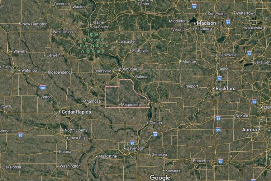
Jackson County is located in eastern Iowa along the Mississippi River, about 30 miles south of Dubuque and 60 miles north of Davenport. The county seat, Maquoketa, sits along U.S. Highway 61, offering direct access to major transportation routes.
The Mississippi River defines its eastern border, providing both scenic views and recreational opportunities. Neighboring counties include Clinton to the south and Jones to the west. Jackson County’s location makes it an attractive blend of riverfront living and rural Midwestern charm.
You may also like: Counties with the worst commutes in Iowa
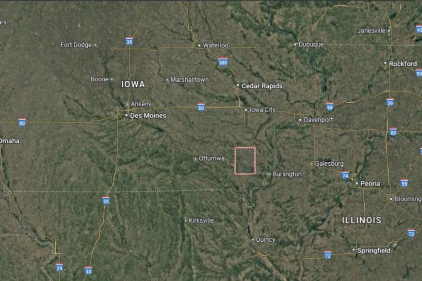
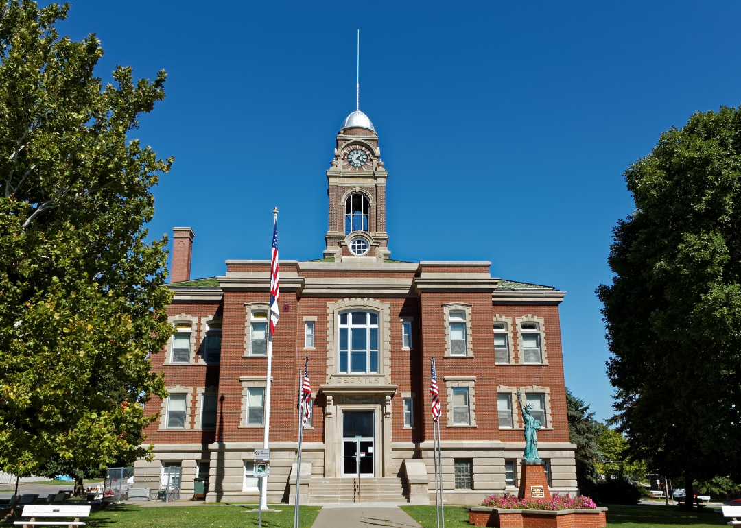
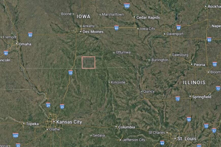
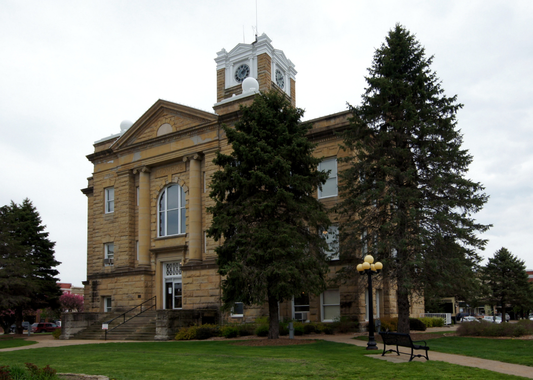
#40. Decatur County (tie)
– Life expectancy: 77.7 years
— 0.4 years lower than the state average
About
Decatur County is a rural county that thrives on agriculture and community-driven initiatives. Farming is the backbone of the economy, with corn, soybeans, and livestock production supporting local families. Residents value the small-town atmosphere, where traditions and local events bring people together.
Civic life is supported by schools, healthcare providers, and volunteer organizations. The county emphasizes maintaining infrastructure and recreational spaces, ensuring residents have access to essential services and outdoor activities. Decatur County maintains a rural identity while encouraging community well-being.
Where is Decatur County?
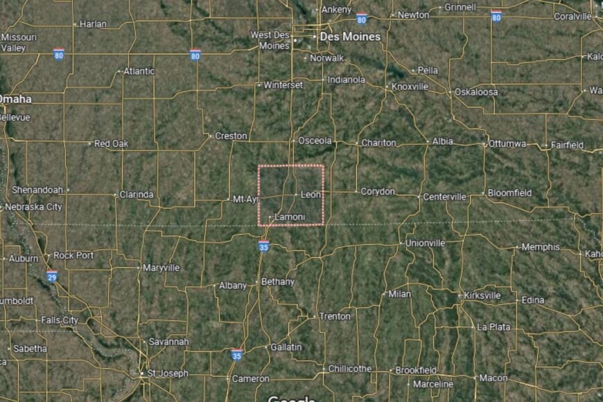
Decatur County is located in south-central Iowa along the Missouri border. The county seat, Leon, is about 75 miles south of Des Moines and lies near Interstate 35, which provides a direct connection to the state capital and Missouri.
Neighboring counties include Clarke to the north and Wayne to the east. The landscape is defined by open farmland and rolling prairies. Decatur County’s location offers residents a quiet lifestyle with convenient access to regional transportation routes.
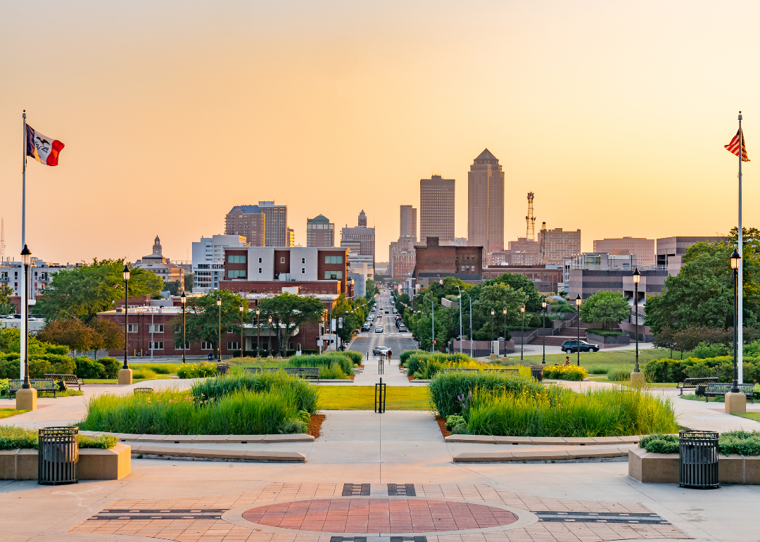
#39. Polk County (tie)
– Life expectancy: 77.5 years
— 0.6 years lower than the state average
About
Polk County is the most populous county in Iowa, home to Des Moines, the state capital. The county is a hub of government, business, and culture, with a diverse economy supported by finance, insurance, healthcare, and education. While agriculture plays a smaller role here than in rural areas, Polk County remains vital to Iowa’s economy.
Residents enjoy a wide range of services, from top-tier hospitals to higher education institutions. Cultural attractions, festivals, and recreational facilities make Polk County a vibrant place to live. The county balances urban growth with parks and green spaces, offering both big-city amenities and natural escapes.
Where is Polk County?
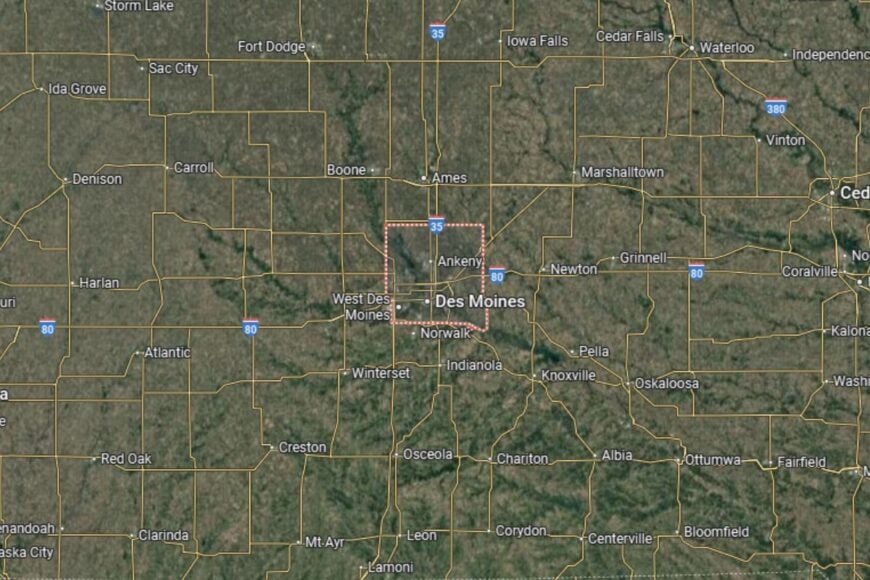
🔥 Would you like to save this?
Polk County is located in central Iowa, with Des Moines at its heart. It sits at the intersection of Interstates 35 and 80, making it one of the state’s most connected regions. Other major roads such as I-235 provide access throughout the metropolitan area.
Neighboring counties include Dallas to the west and Jasper to the east. The Des Moines and Raccoon Rivers flow through the area, contributing to both recreation and local identity. Polk County’s location in the center of the state makes it Iowa’s economic and cultural anchor.
#38. Hamilton County (tie)
– Life expectancy: 77.5 years
— 0.6 years lower than the state average
About
Hamilton County is a rural Iowa county known for its agricultural strength and community-centered lifestyle. Farming continues to be the cornerstone of the economy, supported by small businesses and local industries. Residents value the county’s combination of rural charm and reliable access to services.
Community life is highlighted by festivals, school events, and civic organizations that strengthen ties among residents. Outdoor activities, such as hunting, fishing, and hiking, are popular across the county’s parks and natural areas. Hamilton County maintains a strong balance between tradition and progress.
Where is Hamilton County?
Hamilton County is located in central Iowa, about 25 miles north of Ames and 75 miles north of Des Moines. The county seat, Webster City, sits near U.S. Highway 20, which provides convenient east–west travel across northern Iowa.
The county is bordered by Wright County to the north and Story County to the south. Its location places it within easy reach of larger metropolitan areas while maintaining a rural identity. Hamilton County’s position makes it an important part of central Iowa’s agricultural network.
#37. Pocahontas County (tie)
– Life expectancy: 77.3 years
— 0.8 years lower than the state average
About
Pocahontas County is a small, rural county that represents the heart of Iowa’s farming traditions. Agriculture dominates the economy, with corn, soybeans, and livestock as the primary sources of income. The county’s communities are known for their hospitality and commitment to preserving small-town traditions.
Local services such as schools, healthcare, and civic organizations provide support to residents. Community events, fairs, and volunteer programs strengthen bonds and celebrate shared heritage. Pocahontas County offers a peaceful lifestyle centered on family, farming, and community values.
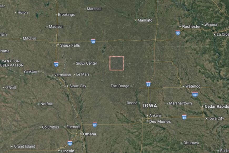
Where is Pocahontas County?
Pocahontas County is located in northwestern Iowa, about 100 miles northwest of Des Moines. The county seat, Pocahontas, lies along Iowa Highway 3, which connects residents to surrounding communities.
Neighboring counties include Buena Vista to the west and Humboldt to the east. The county is characterized by fertile farmland and open prairies, making it an important part of Iowa’s agricultural landscape. Its central location in the region provides both rural charm and access to nearby towns.
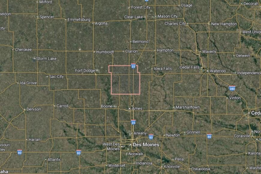
#36. Hardin County (tie)
– Life expectancy: 77.3 years
— 0.8 years lower than the state average
About
Hardin County combines a strong agricultural economy with historic towns and scenic landscapes. Farming remains the backbone of the county, but manufacturing, education, and healthcare also contribute to the local economy. Residents value the balance of rural living and modern amenities.
The county promotes community engagement through fairs, parades, and recreational activities. Residents enjoy access to natural areas such as the Iowa River Greenbelt, which offers opportunities for hiking and wildlife viewing. Hardin County is a place where agriculture, history, and outdoor beauty intersect.
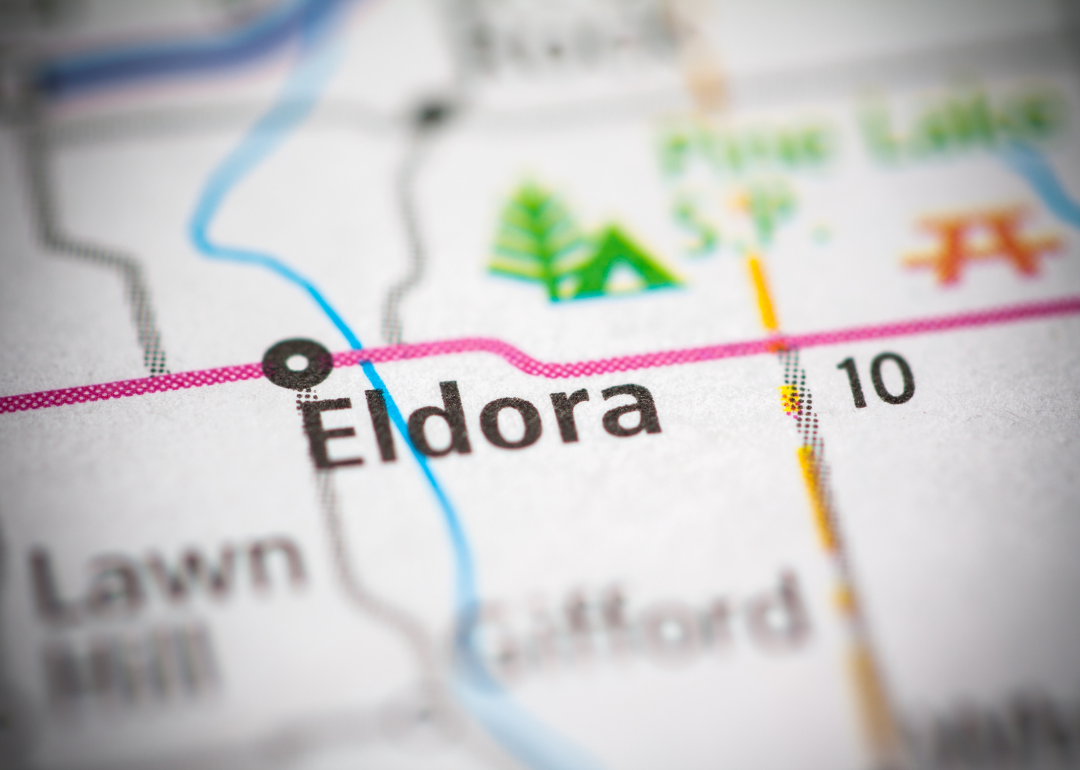
Where is Hardin County?
Hardin County is located in central Iowa, about 60 miles north of Des Moines. The county seat, Eldora, lies near U.S. Highway 65 and Iowa Highway 175, providing regional connectivity.
The county borders Franklin to the north and Marshall to the south. The Iowa River runs through the county, shaping both its geography and recreational opportunities. Hardin County’s location offers easy access to central Iowa’s larger cities while preserving its small-town charm.
You may also like: Counties with the highest rates of strokes in Iowa
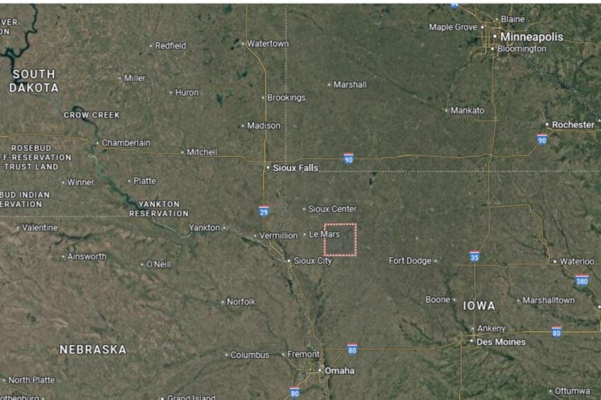
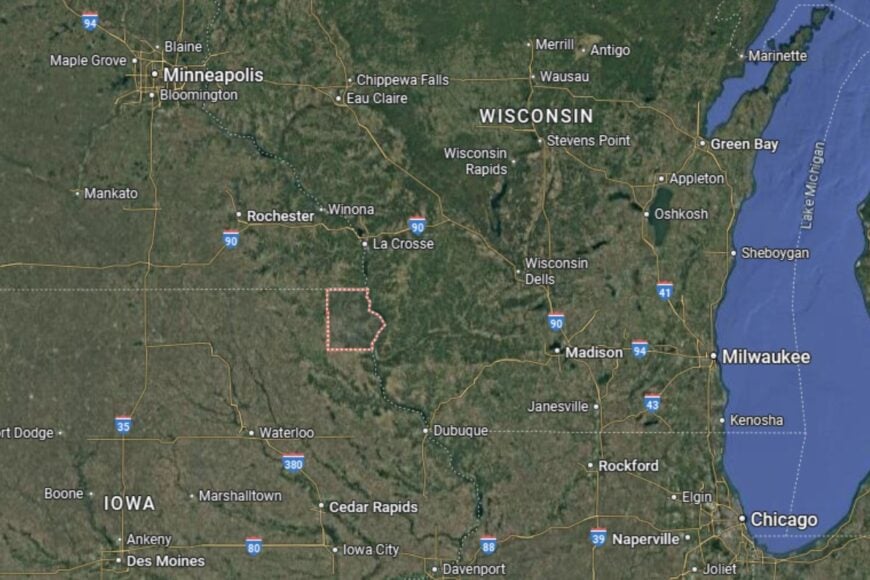
#35. Fayette County (tie)
– Life expectancy: 77.3 years
— 0.8 years lower than the state average
About
Fayette County is a rural county with a proud agricultural base and strong community values. Corn and soybean farming remain the foundation of the economy, though local businesses and services also play an important role. Residents enjoy a slower pace of life where traditions and civic pride run deep.
The county supports cultural and recreational activities through fairs, local festivals, and historical sites. Residents also take advantage of parks, trails, and outdoor areas for recreation. Fayette County combines agricultural productivity with a community spirit that values history and togetherness.
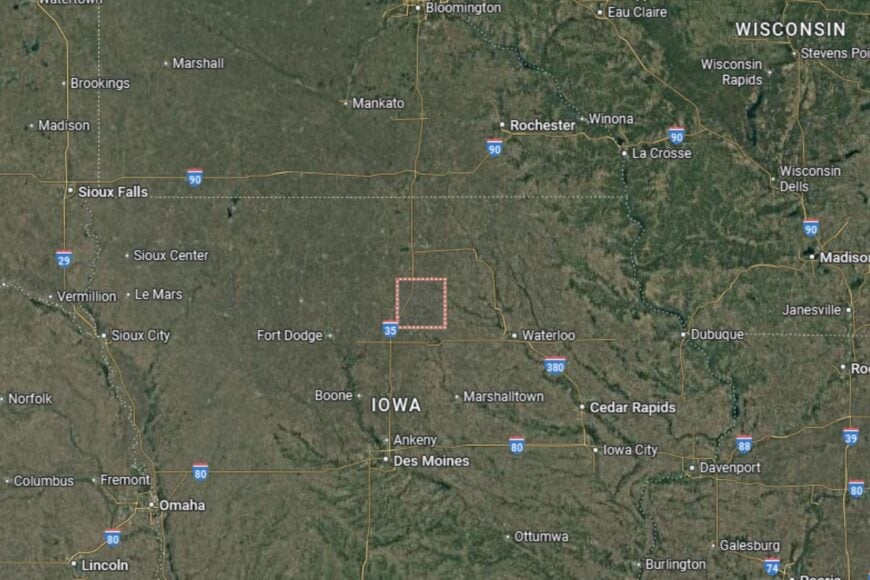
Where is Fayette County?
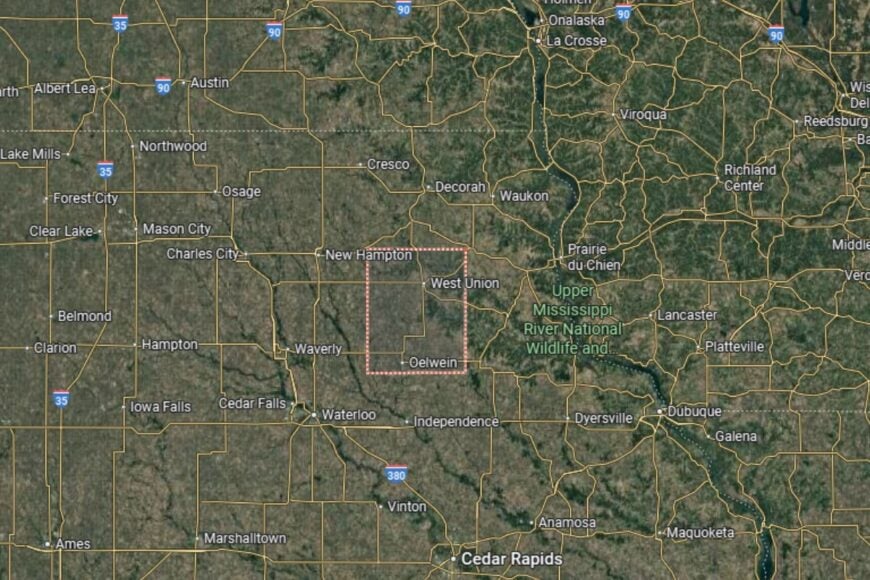
Fayette County is located in northeastern Iowa, about 60 miles northeast of Waterloo. The county seat, West Union, lies near U.S. Highway 18, providing direct east–west access across northern Iowa.
The county is bordered by Clayton to the east and Bremer to the west. Its location places it in the scenic Driftless Area, known for rolling hills and valleys. Fayette County’s geography makes it distinct from much of the flatter farmland of the state.
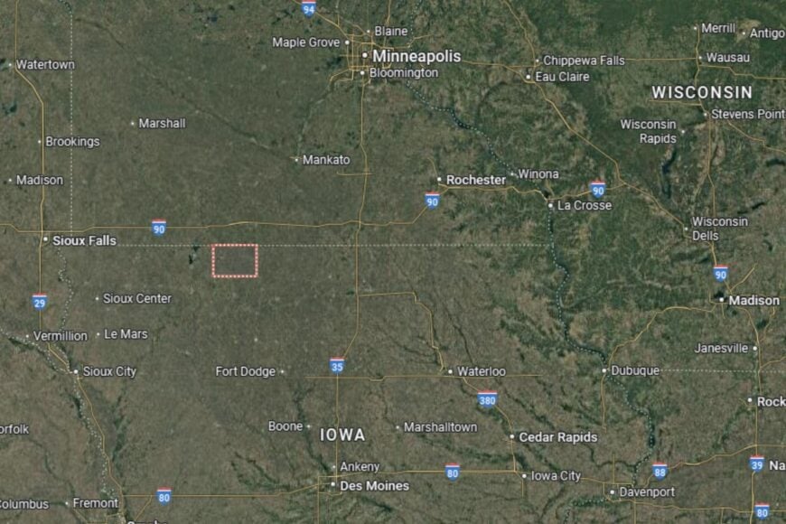
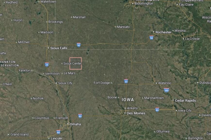
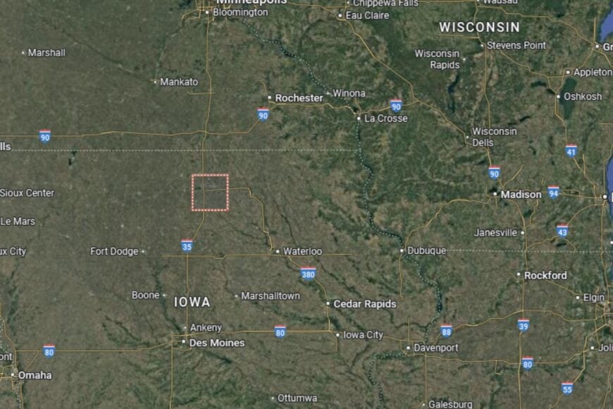
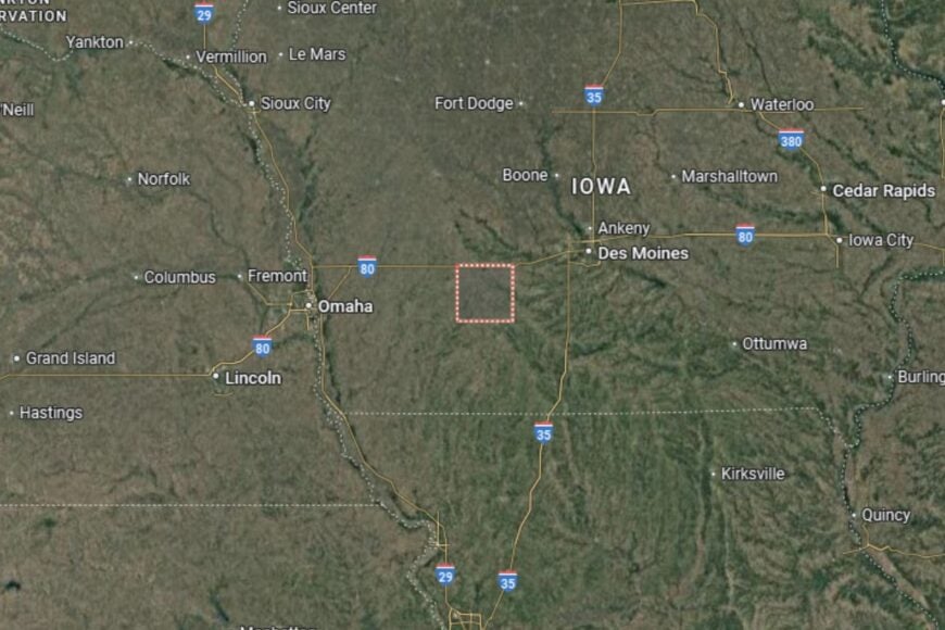
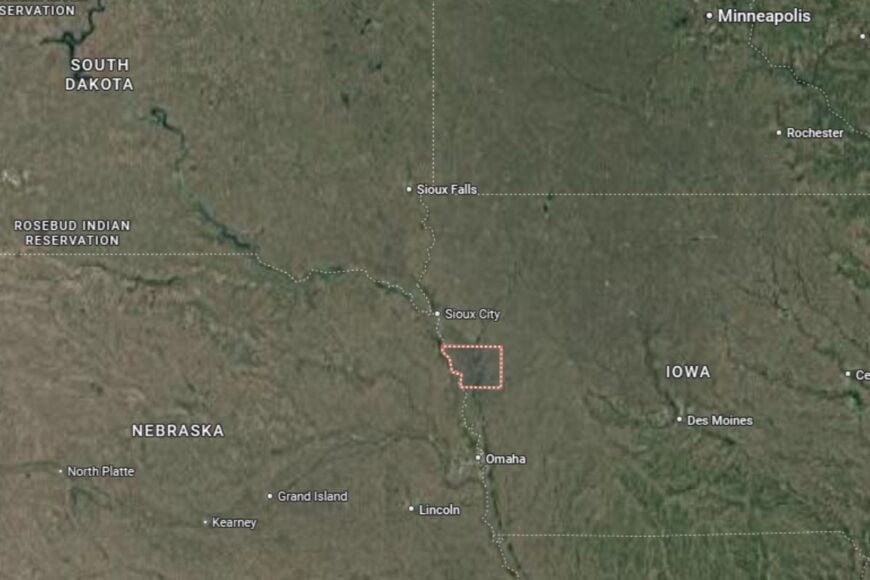
#34. Osceola County
– Life expectancy: 77.2 years
— 0.9 years lower than the state average
🔥 Would you like to save this?
About
Osceola County is one of Iowa’s smallest counties by population, with a strong reliance on agriculture and close-knit communities. Corn, soybeans, and livestock farming form the backbone of the economy, while small businesses and local services support daily life. Residents appreciate the quiet pace and strong traditions of rural living.
Community activities, fairs, and school programs bring residents together. Recreational opportunities, such as hunting, fishing, and camping, are abundant in the surrounding countryside. Osceola County embodies the values of family, tradition, and agricultural heritage.
Where is Osceola County?
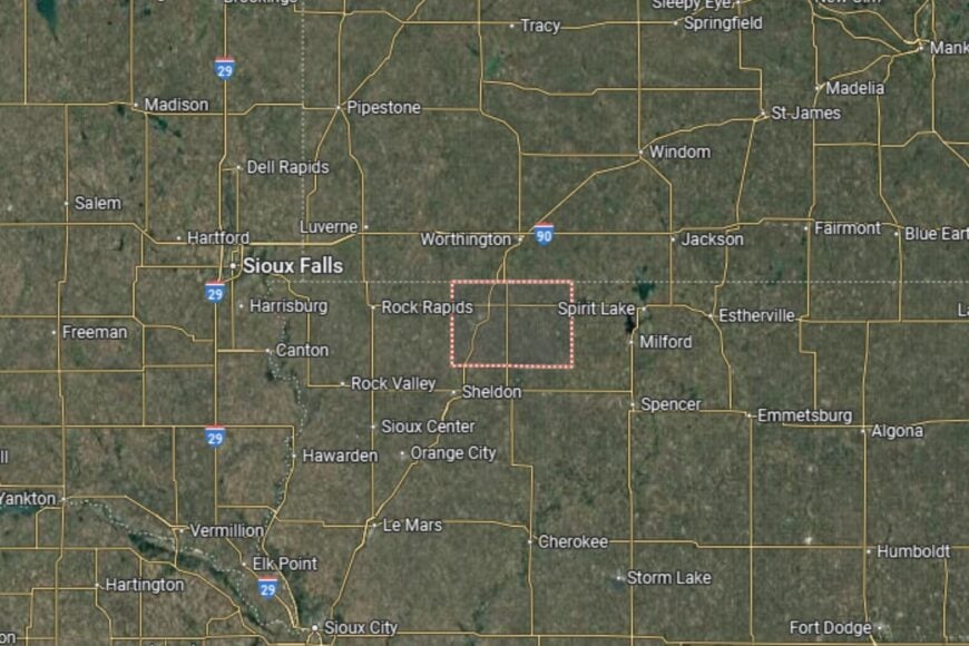
Osceola County is located in the far northwestern corner of Iowa, bordering Minnesota to the north and South Dakota to the west. The county seat, Sibley, lies near Iowa Highway 60, providing a direct route to Sioux City and Minnesota.
The county’s rural landscape is characterized by fertile farmland and open prairies. Neighboring counties include Lyon to the west and O’Brien to the east. Osceola County’s location gives it a unique position at the intersection of three states.
#33. Clinton County (tie)
– Life expectancy: 77.1 years
— 1.0 years lower than the state average
About
Clinton County combines agriculture, industry, and river-based commerce in eastern Iowa. The Mississippi River plays a key role in the county’s economy, offering opportunities in trade, transportation, and recreation. Farming remains important, but healthcare, manufacturing, and education also contribute to economic stability.
The county emphasizes community engagement through cultural events, historical sites, and recreational opportunities. Residents benefit from access to strong schools, healthcare, and riverfront amenities. Clinton County blends its agricultural traditions with its role as a regional hub.
Where is Clinton County?
Clinton County is located in eastern Iowa, along the Mississippi River. The county seat, Clinton, sits about 40 miles northeast of Davenport and directly across the river from Illinois. U.S. Highway 30 and U.S. Highway 67 provide important connections.
The Mississippi River defines much of the county’s geography, offering scenic beauty and recreational opportunities. Neighboring counties include Jackson to the north and Scott to the south. Clinton County’s location makes it a significant part of the Quad Cities region.
#32. Black Hawk County (tie)
– Life expectancy: 77.1 years
— 1.0 years lower than the state average
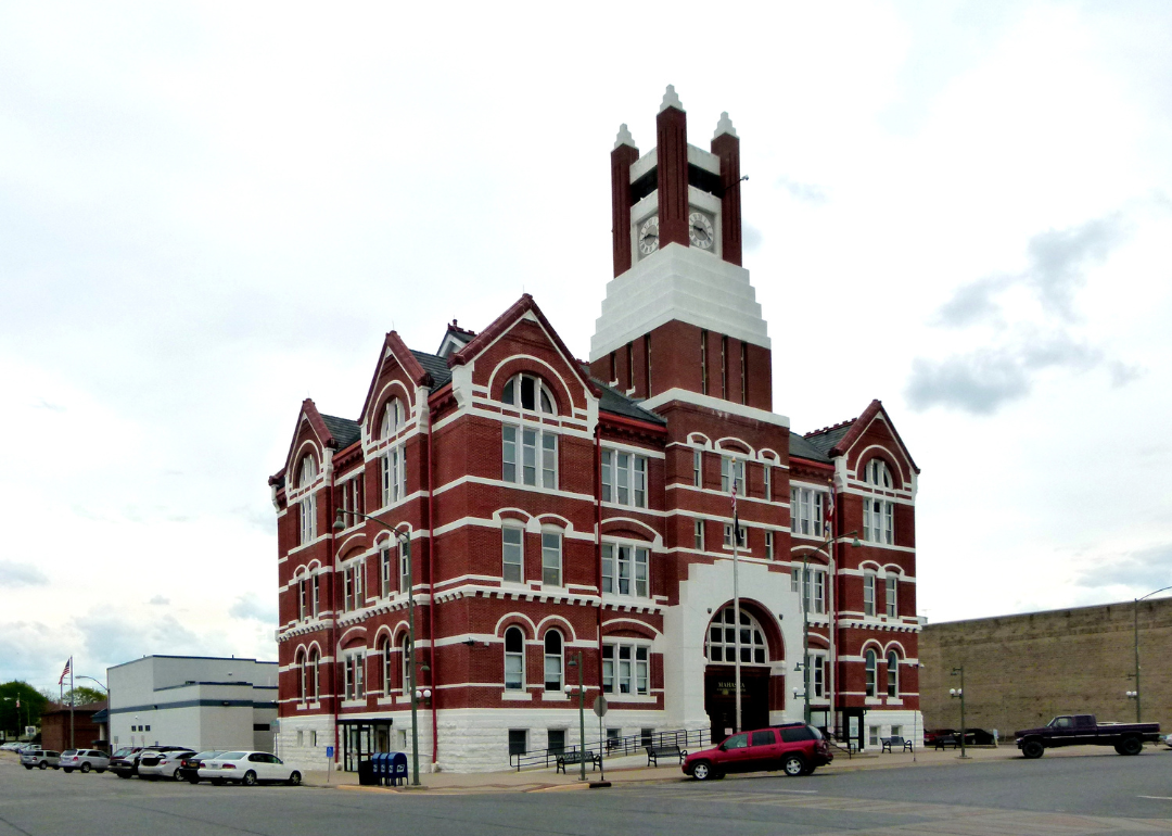
About
Black Hawk County is one of Iowa’s larger population centers and home to Waterloo, a hub for education, healthcare, and industry. The county’s economy blends agriculture with manufacturing, retail, and service industries. The presence of universities and cultural institutions strengthens its regional importance.
Residents enjoy access to healthcare, schools, and community programs that enhance quality of life. Festivals, cultural events, and sporting activities create a lively atmosphere. Black Hawk County balances urban growth with access to nearby rural landscapes, offering both city conveniences and small-town charm.
Where is Black Hawk County?
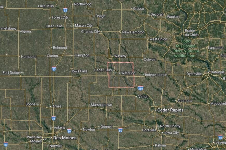
Black Hawk County is located in northeastern Iowa, about 55 miles north of Cedar Rapids. The county seat, Waterloo, lies along U.S. Highways 20 and 218, which connect the area to the rest of the state.
Neighboring counties include Bremer to the north and Benton to the south. The Cedar River runs through the county, shaping its geography and providing recreation. Black Hawk County’s location makes it an important center for northeastern Iowa.
#31. Ida County (tie)
– Life expectancy: 77.1 years
— 1.0 years lower than the state average
About
Ida County is a small agricultural county with a focus on farming, small-town living, and community pride. Corn, soybeans, and livestock production dominate the local economy, supported by small businesses and county services. Residents value a lifestyle rooted in rural traditions and close connections with neighbors.
The county supports recreational activities such as hunting, fishing, and community festivals. Local schools, healthcare providers, and civic groups contribute to residents’ quality of life. Ida County offers a peaceful rural lifestyle in the heart of Iowa’s farmland.
Where is Ida County?
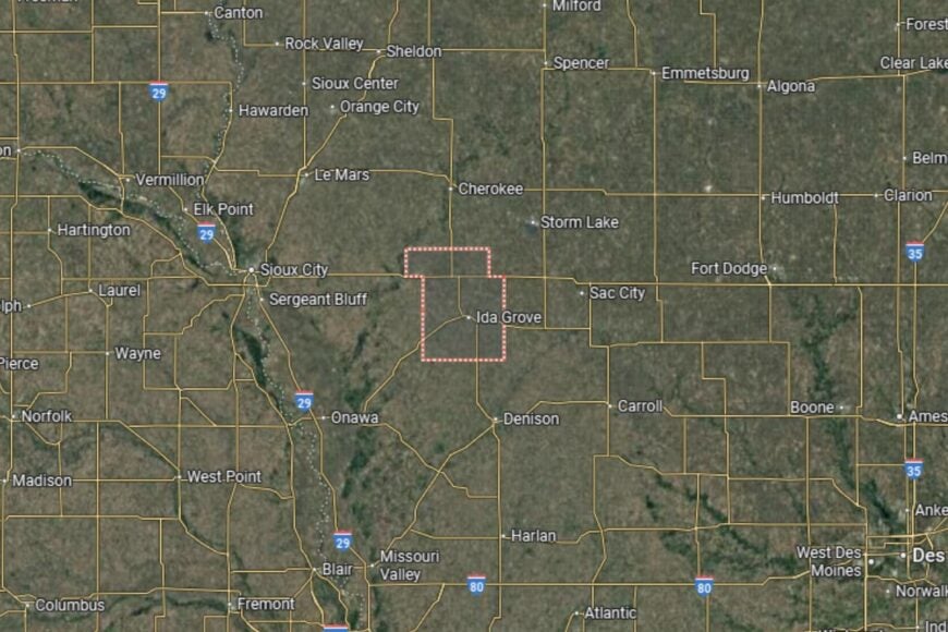
Ida County is located in western Iowa, about 60 miles east of Sioux City. The county seat, Ida Grove, is situated along U.S. Highway 59 and Iowa Highway 175, providing regional connections.
The county is bordered by Cherokee to the north and Crawford to the south. Its landscape is largely farmland with rolling prairies. Ida County’s location offers residents quiet rural living within reach of western Iowa’s larger towns.
You may also like: Highest-rated breweries in Iowa
#30. Mahaska County (tie)
– Life expectancy: 77.0 years
— 1.1 years lower than the state average
About
Mahaska County combines agriculture, industry, and education in southeastern Iowa. Farming remains central to the economy, but manufacturing and local businesses also contribute to growth. The county’s communities focus on preserving traditions while welcoming steady development.
Residents enjoy community programs, schools, and healthcare facilities that provide stability. Outdoor recreation is popular, with parks and rivers offering opportunities for fishing, hiking, and family gatherings. Mahaska County maintains its rural identity while supporting economic diversity.
Where is Mahaska County?
Mahaska County is located in southeastern Iowa, about 65 miles southeast of Des Moines. The county seat, Oskaloosa, lies at the intersection of U.S. Highways 63 and 92, providing direct routes across the state.
Neighboring counties include Keokuk to the east and Marion to the west. The South Skunk River flows through the county, shaping both its geography and recreational options. Mahaska County’s location makes it a vital part of Iowa’s southeastern corridor.
#29. Emmet County (tie)
– Life expectancy: 77.0 years
— 1.1 years lower than the state average
About
Emmet County is a rural county in northern Iowa with a strong agricultural base. Farming, particularly corn, soybeans, and livestock, dominates the local economy, while small businesses and services support the community. Residents enjoy a quiet lifestyle where traditions and neighborly ties are central.
The county provides opportunities for outdoor recreation, including hunting, fishing, and camping. Local schools, healthcare, and civic organizations strengthen community life. Emmet County preserves its agricultural roots while supporting residents with essential services.
Where is Emmet County?
Emmet County is located in northern Iowa, directly along the Minnesota border. The county seat, Estherville, lies along U.S. Highway 9 and Iowa Highway 4, offering regional connections.
The county borders Kossuth to the east and Dickinson to the west. Its northern border connects directly to southern Minnesota communities. Emmet County’s position makes it an important agricultural hub in Iowa’s northern region.
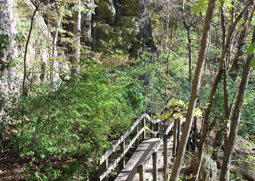
#28. Allamakee County (tie)
– Life expectancy: 76.9 years
— 1.2 years lower than the state average
About
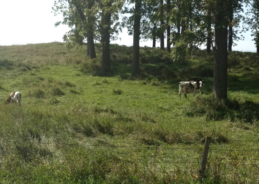
Allamakee County is known for its scenic beauty, cultural heritage, and strong farming roots. Agriculture, especially dairy and crop farming, forms the backbone of the economy, though tourism has also become increasingly important. Residents enjoy a lifestyle centered on tradition, outdoor recreation, and community pride.
The county promotes a variety of recreational activities, from hiking and fishing to cultural events that celebrate local history. Schools, healthcare facilities, and civic groups support daily life. Allamakee County offers a peaceful balance of natural beauty and strong community ties.
Where is Allamakee County?
Allamakee County is located in the far northeastern corner of Iowa, along the Mississippi River and bordering both Minnesota and Wisconsin. The county seat, Waukon, is about 70 miles northeast of Waterloo and is accessible via U.S. Highway 52.
The county is part of the scenic Driftless Area, known for its bluffs, valleys, and unique landscapes. Neighboring counties include Winneshiek to the west and Clayton to the south. Allamakee County’s position makes it one of the most picturesque regions of Iowa.
#27. O’Brien County (tie)
– Life expectancy: 76.9 years
— 1.2 years lower than the state average
About
O’Brien County is an agricultural community that thrives on farming and small-town living. Corn, soybeans, and livestock dominate the local economy, while small industries and local services provide additional support. Residents value their traditions and maintain a close-knit, family-oriented lifestyle.
The county also highlights community through festivals, fairs, and cultural gatherings. Schools, healthcare, and local organizations contribute to residents’ quality of life. O’Brien County reflects the values of rural Iowa with an emphasis on farming and community spirit.
Where is O’Brien County?
O’Brien County is located in northwestern Iowa, about 60 miles northeast of Sioux City. The county seat, Primghar, lies near U.S. Highway 59 and Iowa Highway 10, which connect the area to surrounding regions.
Neighboring counties include Sioux to the west and Clay to the east. The county’s geography is largely made up of rolling farmland and prairie landscapes. O’Brien County’s location makes it a central part of northwest Iowa’s agricultural belt.
#26. Lucas County (tie)
– Life expectancy: 76.8 years
— 1.3 years lower than the state average
About
Lucas County is a rural Iowa county with a long history tied to farming and coal mining. Agriculture remains central to the economy, though small industries and services also contribute to local stability. Residents value the quiet pace of rural life and the close community bonds that define the area.
Community activities, schools, and civic organizations provide residents with strong social connections. Outdoor recreation such as fishing, camping, and hiking is popular in the county’s parks and lakes. Lucas County maintains its rural identity while adapting to modern needs.
Where is Lucas County?
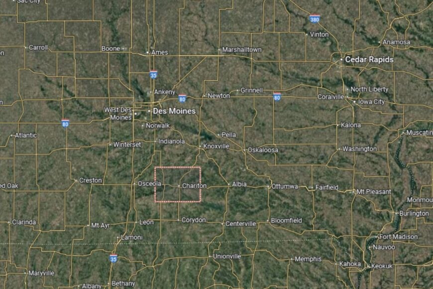
Lucas County is located in south-central Iowa, about 55 miles south of Des Moines. The county seat, Chariton, lies near the junction of U.S. Highway 34 and U.S. Highway 65, providing convenient access both east–west and north–south across the state.
The county borders Warren to the north, Monroe to the east, Wayne to the west, and Clarke to the southwest. Its gently rolling hills and farmland are characteristic of southern Iowa, giving Lucas County both a quiet rural setting and easy routes to larger urban centers.
You may also like: Counties with the most homes selling under list price in Iowa
#25. Muscatine County (tie)
– Life expectancy: 76.8 years
— 1.3 years lower than the state average
About
Muscatine County blends agriculture, manufacturing, and river-based commerce in southeastern Iowa. While farming continues to be important, the Mississippi River and local industries provide significant economic support. The county is also known for its diverse communities and cultural heritage.
Residents benefit from schools, healthcare, and recreational facilities that strengthen community life. Parks and riverfront areas offer fishing, boating, and festivals that draw visitors and locals alike. Muscatine County thrives on its mix of industry, culture, and natural resources.
Where is Muscatine County?
Muscatine County is located in southeastern Iowa along the Mississippi River. The county seat, Muscatine, is about 30 miles southwest of Davenport and accessible via U.S. Highway 61.
The Mississippi River forms the eastern border, giving the county both recreational and economic significance. Neighboring counties include Cedar to the north and Louisa to the south. Muscatine County’s location makes it a vibrant part of Iowa’s river corridor.
#24. Wayne County (tie)
– Life expectancy: 76.8 years
— 1.3 years lower than the state average
About
Wayne County is a small, rural county where agriculture is the lifeblood of the economy. Farming families have long shaped the community’s traditions, and corn, soybeans, and livestock production remain central to daily life. Residents enjoy a lifestyle focused on family, community, and rural values.
Community activities, fairs, and school events strengthen connections among residents. Recreational opportunities are available through parks, lakes, and trails that showcase Iowa’s natural beauty. Wayne County maintains a strong agricultural foundation while emphasizing close community ties.
Where is Wayne County?
Wayne County is located in south-central Iowa along the Missouri border. The county seat, Corydon, lies about 70 miles south of Des Moines, near U.S. Highway 65.
The county is bordered by Lucas to the west and Appanoose to the east. Its location along the state line provides connections to Missouri communities as well. Wayne County offers a quiet, rural lifestyle in the heart of southern Iowa.
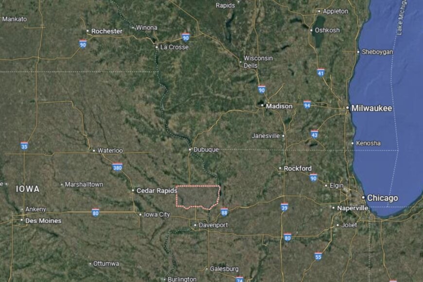
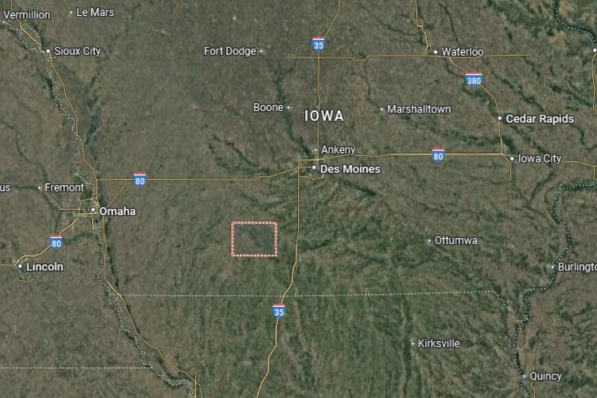
#23. Taylor County
– Life expectancy: 76.7 years
— 1.4 years lower than the state average
About
Taylor County is a quiet corner of southern Iowa where agriculture is still king. Corn and soybean fields stretch for miles, and livestock operations provide steady work for farming families. The county has a reputation for resilience, with residents preserving traditions while adapting to new opportunities in agribusiness and small enterprise.
Community gatherings, from county fairs to church suppers, form the social heartbeat of the area. Local schools and civic organizations nurture a spirit of cooperation and pride. Taylor County remains a place where neighbors know one another by name and lend a hand when needed.
Where is Taylor County?
Taylor County is located in southwestern Iowa, right on the Missouri border. The county seat, Bedford, is about 100 miles south of Des Moines and sits along U.S. Highway 71.
The county is surrounded by rolling farmland and scenic countryside, with Adams County to the north and Page County to the west. Its southern boundary connects directly with Missouri, making Taylor a gateway between the two states.
#22. Palo Alto County
– Life expectancy: 76.5 years
— 1.6 years lower than the state average
About
Palo Alto County is known for its fertile farmland, peaceful lakes, and strong agricultural roots. Farming is the backbone of the economy, but the county also draws attention for its outdoor recreation, especially around Lost Island Lake. Residents value the county’s blend of rural charm and natural amenities.
Cultural life thrives through local festivals, fairs, and historical societies that celebrate the area’s Irish heritage and pioneer history. With supportive schools, healthcare, and community groups, Palo Alto County remains a welcoming place for families and retirees alike.
Where is Palo Alto County?
Palo Alto County is located in north-central Iowa, about 40 miles south of the Minnesota border. The county seat, Emmetsburg, lies near U.S. Highway 18 and Iowa Highway 4, making it a central hub for the region.
The county is bordered by Clay to the west and Kossuth to the east. Its landscape includes farmland, rivers, and lakes that add scenic diversity to the rolling plains. Palo Alto’s central position in the region makes it both productive and picturesque.
#21. Cerro Gordo County (tie)
– Life expectancy: 76.4 years
— 1.7 years lower than the state average
About
Cerro Gordo County blends agriculture with a thriving local economy centered in Mason City, its largest community. While farming is still important, manufacturing, healthcare, and cultural life also drive the county forward. Residents take pride in Mason City’s Frank Lloyd Wright architecture, music heritage, and strong sense of community.
Recreation is part of everyday life, with Clear Lake serving as a hub for boating, fishing, and summer festivals. Schools, healthcare services, and cultural institutions support families and create a vibrant, well-rounded community. Cerro Gordo County balances rural traditions with small-city conveniences.
Where is Cerro Gordo County?
Cerro Gordo County is located in north-central Iowa, about 120 miles north of Des Moines. Mason City, the county seat, lies along Interstate 35 and U.S. Highway 18, offering excellent regional connections.
Clear Lake, one of Iowa’s most popular recreation spots, lies within the county and draws visitors year-round. Neighboring counties include Worth to the north and Franklin to the south. Its location makes Cerro Gordo a cultural and economic anchor for the surrounding region.
You may also like: What Medicaid acceptance looks like at Iowa substance use treatment centers
#20. Adair County (tie)
– Life expectancy: 76.4 years
— 1.7 years lower than the state average
About
Adair County is a rural community where agriculture shapes nearly every aspect of life. The county’s fields of corn and soybeans dominate the landscape, while livestock operations remain a reliable source of local income. Residents cherish the county’s quiet towns and slower pace of life.
Community traditions are alive and well through fairs, markets, and school activities. With supportive schools, healthcare facilities, and civic organizations, Adair County maintains a family-friendly environment. The county combines rural simplicity with a strong sense of place.
Where is Adair County?
Adair County is located in southwestern Iowa, about 60 miles west of Des Moines. The county seat, Greenfield, lies along U.S. Highway 92, with Interstate 80 crossing the county’s northern tier to provide quick access east toward Des Moines and west toward Omaha.
The county is bordered by Guthrie to the north, Madison to the east, Union to the south, and Adams to the southwest. Its farmland and small towns sit at the heart of western Iowa’s rolling countryside, giving Adair a balance of rural quiet and strong transportation links.
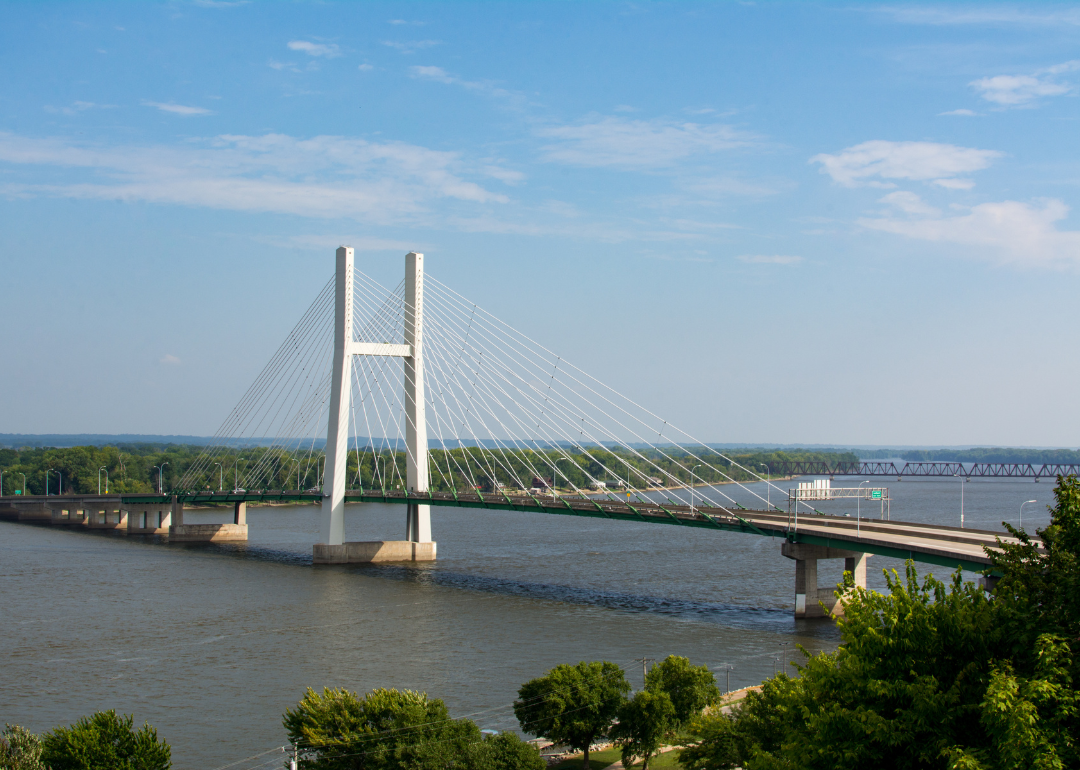
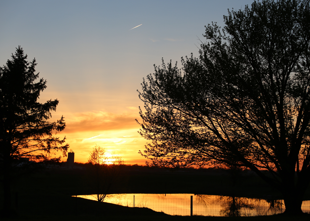
#19. Des Moines County (tie)
– Life expectancy: 76.4 years
— 1.7 years lower than the state average
About
Des Moines County is a vibrant riverfront community where agriculture, industry, and commerce meet. The Mississippi River plays a central role in the county’s economy, supporting trade, transportation, and recreation. Burlington, the county seat, anchors the region with cultural events, historic districts, and a lively riverfront.
Residents enjoy access to schools, healthcare, and a wide range of recreational options. Parks, river trails, and festivals bring people together and highlight the county’s strong sense of community. Des Moines County strikes a balance between river-based commerce and small-town life.
Where is Des Moines County?
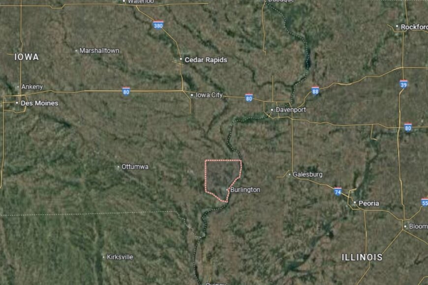
Des Moines County is located in southeastern Iowa, directly along the Mississippi River. The county seat, Burlington, is about 80 miles south of Iowa City and sits along U.S. Highway 61.
Its location along the Mississippi provides both scenic beauty and economic importance. The county is bordered by Louisa to the north and Lee to the south, with Illinois just across the river. Des Moines County serves as both a transportation hub and a cultural anchor in southeastern Iowa.
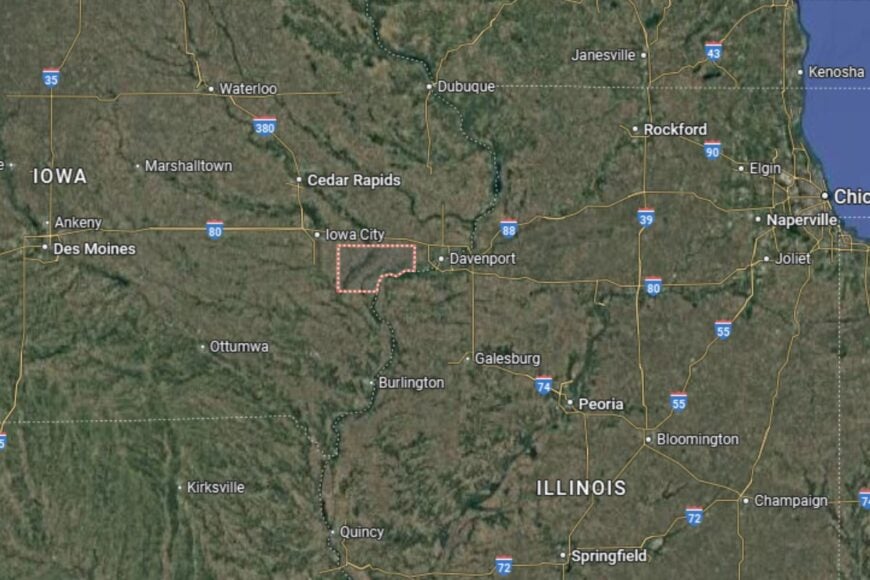
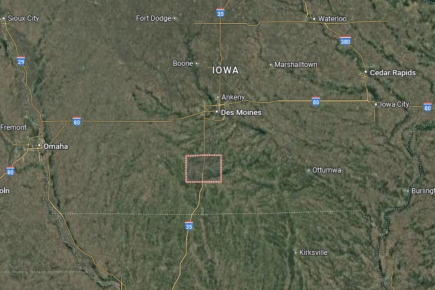
#18. Tama County
– Life expectancy: 76.3 years
— 1.8 years lower than the state average
About
Tama County is a blend of agricultural strength and cultural diversity, home to both farming communities and the Meskwaki Settlement, Iowa’s only federally recognized Native American tribe. This unique heritage gives the county a rich cultural identity that extends beyond its fertile fields of corn and soybeans.
Local life is enhanced by schools, healthcare services, and cultural programs that celebrate both agricultural traditions and tribal heritage. Festivals, powwows, and fairs bring residents together in a shared spirit of pride and community. Tama County thrives on its mix of history, culture, and natural resources.
Where is Tama County?
Tama County is located in central Iowa, about 55 miles northeast of Des Moines. The county seat, Toledo, lies near U.S. Highway 30, a major route connecting eastern and western Iowa.
The county is bordered by Marshall to the west and Benton to the east. With the Iowa River running through it, the county offers scenic beauty and recreational opportunities. Tama County’s position makes it both a crossroads of cultures and a hub for agriculture.
#17. Union County
– Life expectancy: 76.2 years
— 1.9 years lower than the state average
About
Union County is a rural county that balances a proud farming tradition with a strong sense of resilience and community spirit. Corn and soybean fields dominate the landscape, while small industries and retail contribute to the local economy. The county is known for its friendly towns where neighbors support one another.
Civic life is enhanced by annual events, school activities, and cultural programs that celebrate local history. Residents enjoy parks, lakes, and outdoor recreation that connect them to Iowa’s natural beauty. Union County maintains a family-centered lifestyle that values tradition and progress equally.
Where is Union County?
Union County is located in southern Iowa, about 75 miles southwest of Des Moines. The county seat, Creston, is situated along U.S. Highway 34 and U.S. Highway 25, offering strong transportation links.
Neighboring counties include Clarke to the east and Adams to the west. The county’s rolling hills and farmland create a picturesque setting typical of southern Iowa. Union County’s location makes it a welcoming part of the state’s agricultural landscape.
#16. Appanoose County (tie)
– Life expectancy: 76.1 years
— 2.0 years lower than the state average
About
Appanoose County is a southern Iowa county where agriculture and outdoor recreation come together. While farming remains the economic backbone, the county is also home to Rathbun Lake, one of Iowa’s largest recreational lakes. This makes the area a popular destination for boating, fishing, and camping.
Residents embrace a slower pace of life, with schools, healthcare, and community organizations supporting family-centered living. Festivals and local gatherings highlight both agricultural pride and the recreational appeal of the county. Appanoose blends its farming heritage with its role as a leisure destination.
Where is Appanoose County?
Appanoose County is located in south-central Iowa, directly on the Missouri border. The county seat, Centerville, lies near Iowa Highway 5 and about 85 miles southeast of Des Moines, anchoring the region with strong road access.
The county borders Monroe to the north, Wayne to the west, and Davis to the east, with Missouri forming its southern boundary. Rathbun Lake dominates the landscape, making Appanoose both an agricultural producer and a recreation destination in Iowa’s southern tier.
You may also like: Counties with the most tornadoes in Iowa
#15. Monroe County (tie)
– Life expectancy: 76.1 years
— 2.0 years lower than the state average
About
Monroe County is a small, historically rich county with roots in both agriculture and coal mining. Farming remains central to its economy today, with corn and soybeans dominating the fields. Residents take pride in their traditions, small towns, and strong community networks.
Cultural life is shaped by festivals, historical societies, and local landmarks that honor the county’s past. Outdoor recreation, from fishing to hiking, also plays a role in everyday life. Monroe County offers residents a strong sense of place and belonging.
Where is Monroe County?
Monroe County is located in south-central Iowa, about 70 miles southeast of Des Moines. The county seat, Albia, is near U.S. Highway 34, which provides an important east–west connection.
Neighboring counties include Lucas to the west and Wapello to the east. The county’s rolling hills and fertile farmland are characteristic of southern Iowa. Monroe County’s location offers both rural tranquility and accessibility to regional centers.
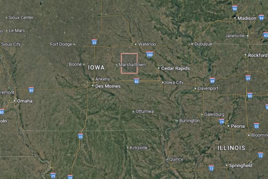
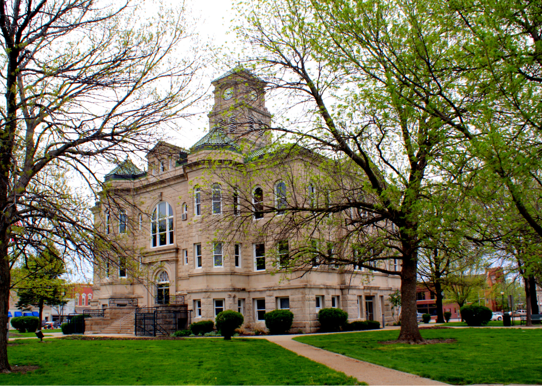
#14. Marshall County (tie)
– Life expectancy: 76.0 years
— 2.1 years lower than the state average
About
Marshall County is a diverse county that blends agricultural productivity with industrial and cultural life. The county seat, Marshalltown, is known for its vibrant immigrant communities, manufacturing base, and rich cultural offerings. Agriculture remains important, but industry and services broaden the local economy.
Residents benefit from strong schools, healthcare services, and recreational opportunities that enhance quality of life. Parks, cultural festivals, and community events highlight the county’s diversity and heritage. Marshall County thrives as a mix of rural and urban influences.
Where is Marshall County?
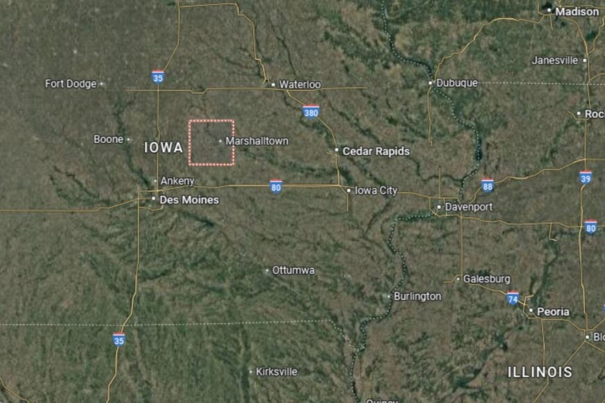
Marshall County is located in central Iowa, about 50 miles northeast of Des Moines. Marshalltown, the county seat, sits along U.S. Highway 30 and Iowa Highway 14, making it a regional transportation hub.
Neighboring counties include Hardin to the north and Jasper to the south. The Iowa River runs through the county, offering scenic beauty and outdoor recreation. Marshall County’s central position makes it an important cultural and economic hub in Iowa.
#13. Pottawattamie County (tie)
– Life expectancy: 76.0 years
— 2.1 years lower than the state average
About
Pottawattamie County is one of Iowa’s most dynamic regions, blending the vibrancy of urban life in Council Bluffs with a strong agricultural backdrop. Farming continues to play a role, but the county’s economy has diversified into retail, healthcare, and industry. Residents benefit from a balance of rural tradition and metropolitan convenience.
The county is also known for its cultural and recreational opportunities. From casinos and museums to parks along the Missouri River, Pottawattamie offers something for everyone. Its combination of economic strength and community pride makes it a regional anchor in western Iowa.
Where is Pottawattamie County?
Pottawattamie County is located in western Iowa, directly across the river from Omaha, Nebraska. Council Bluffs, the county seat, sits at the junction of Interstates 80 and 29, giving it exceptional regional connectivity.
The county borders Mills to the south and Harrison to the north. Its western edge is defined by the Missouri River, which provides both commerce and recreation. Pottawattamie’s location positions it as Iowa’s gateway to Nebraska and the greater Omaha metro area.
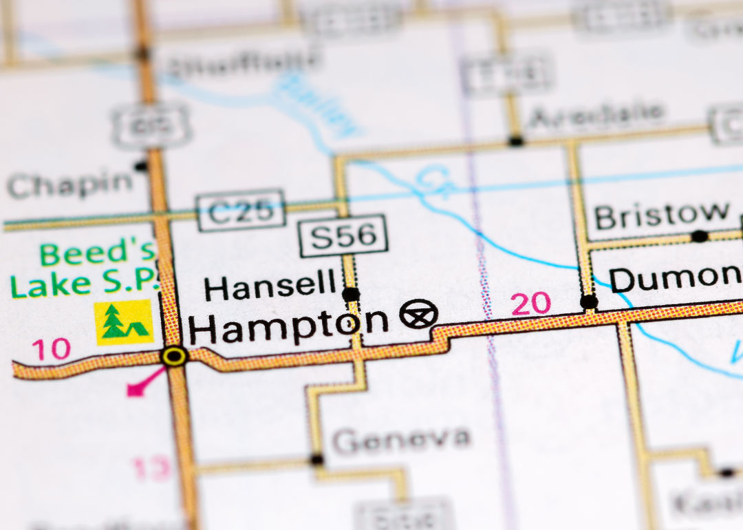
#12. Franklin County (tie)
– Life expectancy: 75.8 years
— 2.3 years lower than the state average
About
Franklin County is a rural county that prides itself on its agricultural heritage and small-town way of life. Corn and soybean farming dominate the economy, while livestock operations add to its agricultural diversity. Residents embrace a close-knit culture where community events and traditions carry deep importance.
Life in Franklin County is enriched by festivals, school activities, and local fairs that celebrate farming and community ties. Residents also enjoy outdoor recreation in parks, lakes, and countryside landscapes. The county embodies the essence of Iowa’s rural identity.
Where is Franklin County?
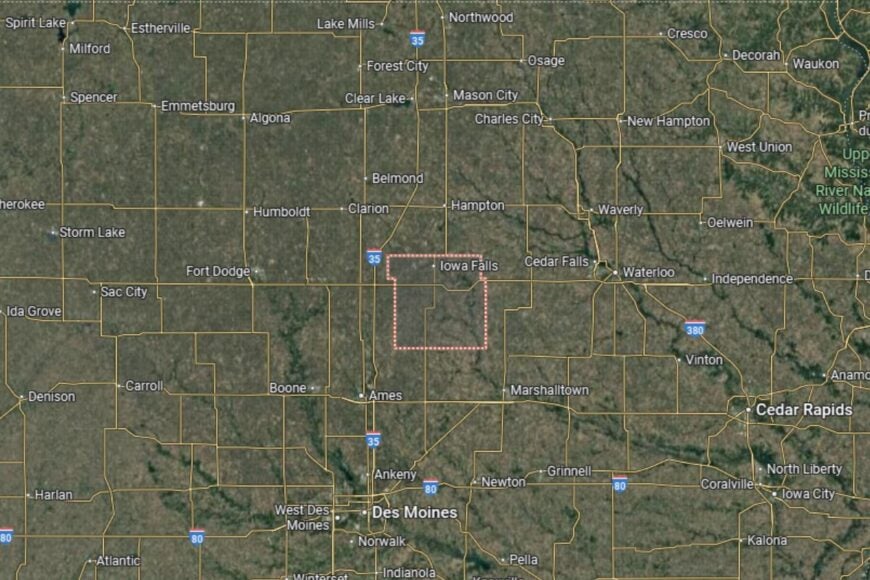
Franklin County is located in north-central Iowa, about 30 miles south of Mason City. The county seat, Hampton, lies near Interstate 35 and U.S. Highway 65, providing direct access to regional centers.
The county is bordered by Cerro Gordo to the north and Hardin to the south. Its fertile fields and open skies make it a classic example of Iowa farmland. Franklin County’s location offers both agricultural strength and easy connections to larger cities.
#11. Cass County (tie)
– Life expectancy: 75.8 years
— 2.3 years lower than the state average
About
Cass County blends a rich agricultural base with a reputation for strong community life. Corn, soybeans, and livestock production remain the foundation of the local economy, while small businesses and industries provide additional support. Residents enjoy a rural lifestyle defined by tradition, stability, and pride in their communities.
Events like county fairs, parades, and cultural festivals highlight the spirit of togetherness. With schools, healthcare facilities, and recreational areas, Cass County supports a family-centered way of living. Its residents balance the simplicity of farming life with modern community amenities.
Where is Cass County?
Cass County is located in southwestern Iowa, positioned almost midway between Omaha and Des Moines. The county seat, Atlantic, sits just south of Interstate 80, offering a major east–west route across the state.
The county is bordered by Audubon to the north, Adair to the east, Adams to the south, and Pottawattamie to the west. With its central spot on the interstate corridor, Cass serves as a key agricultural and community hub in western Iowa.
You may also like: Cities with the fastest-growing home prices in Iowa
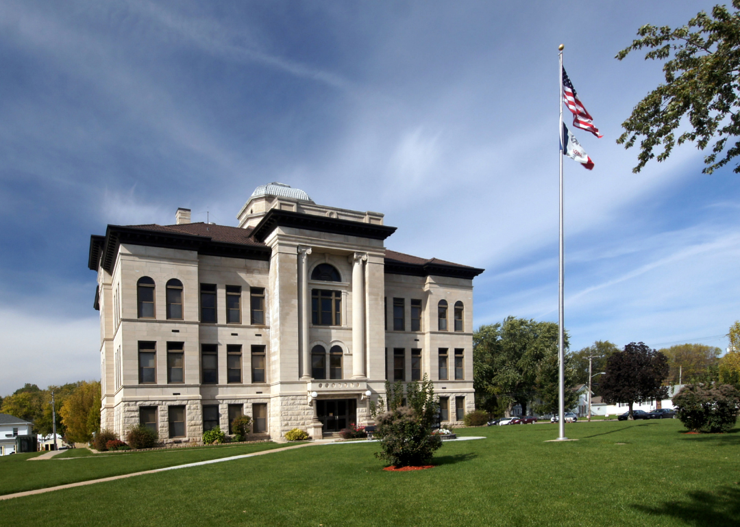
#10. Woodbury County (tie)
– Life expectancy: 75.8 years
— 2.3 years lower than the state average
About
Woodbury County is one of Iowa’s most diverse counties, combining the cultural and economic hub of Sioux City with a backdrop of farmland and prairies. Agriculture remains important, but healthcare, retail, and industry make the local economy one of the most robust in the region.
Residents enjoy access to cultural institutions, sports, and entertainment in Sioux City while still maintaining strong rural traditions outside the urban core. Parks, trails, and riverfront activities add to the county’s recreational appeal. Woodbury County thrives on its blend of urban energy and rural roots.
Where is Woodbury County?
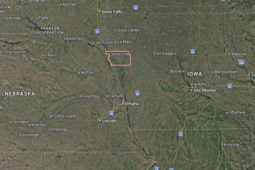
Woodbury County is located in northwestern Iowa along the Missouri River, directly across from Nebraska and South Dakota. The county seat, Sioux City, lies at the intersection of Interstate 29 and U.S. Highway 20, giving it strong regional connectivity.
The county borders Plymouth to the north and Monona to the south. Its location at the tri-state junction makes Woodbury County a cultural and economic crossroads of the Great Plains.
#9. Harrison County (tie)
– Life expectancy: 75.7 years
— 2.4 years lower than the state average
About
Harrison County is a blend of rural Iowa tradition and natural beauty, with farming at its heart. Corn and soybeans dominate the landscape, but the Loess Hills — a rare geological formation — make this county especially distinctive. Residents value both the productivity of their land and the unique scenery that defines their region.
Community life is enriched by local festivals, county fairs, and outdoor recreation. Residents enjoy exploring trails, parks, and historic sites that reflect both the natural and cultural richness of the area. Harrison County is a place where farming and natural wonders coexist.
Where is Harrison County?
Harrison County is located in western Iowa, about 30 miles north of Council Bluffs. The county seat, Logan, sits near U.S. Highway 30 and Interstate 29, providing excellent north–south and east–west connections.
Neighboring counties include Pottawattamie to the south and Monona to the north. Its proximity to the Missouri River adds to both its history and recreational opportunities. Harrison County’s location in the Loess Hills region makes it one of Iowa’s most scenic counties.
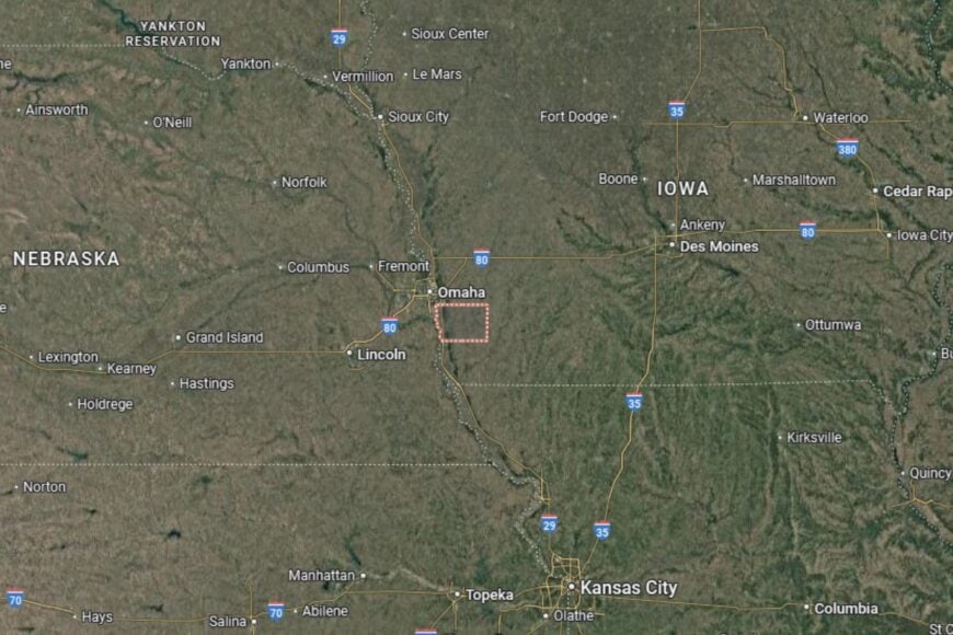
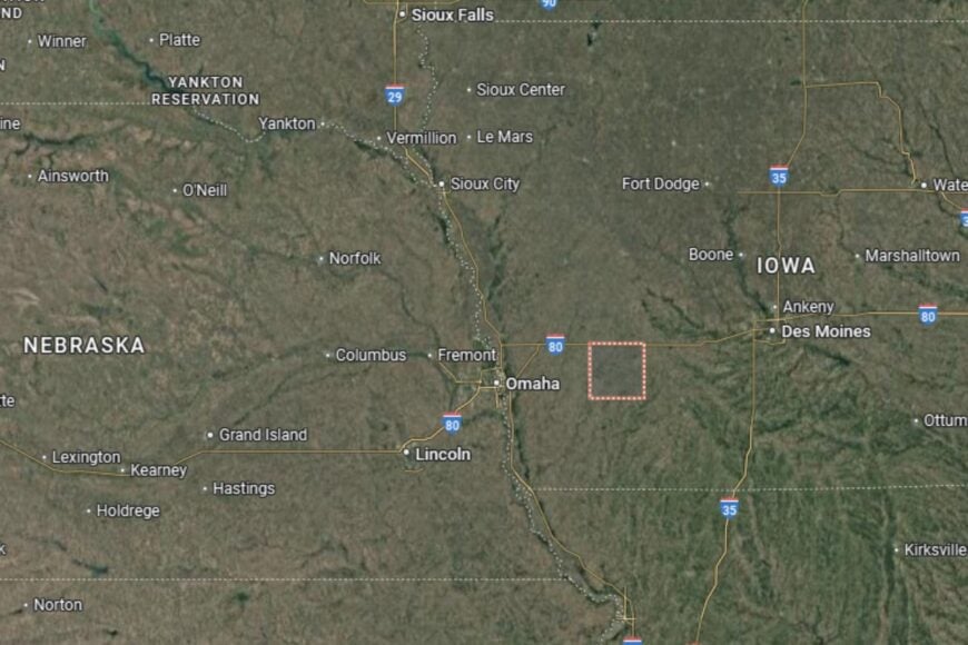
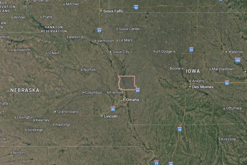
#8. Fremont County (tie)
– Life expectancy: 75.7 years
— 2.4 years lower than the state average
About
Fremont County is a small, tightly knit county that values farming, history, and outdoor life. Agriculture, particularly corn, soybeans, and livestock, drives the economy. The county is also known for its historical significance, including ties to early settlement and Native American heritage.
Community events, schools, and fairs bring residents together in celebration of local traditions. Outdoor recreation, from river activities to hiking, also adds to the appeal. Fremont County embodies the simplicity and strength of rural Iowa life.
Where is Fremont County?
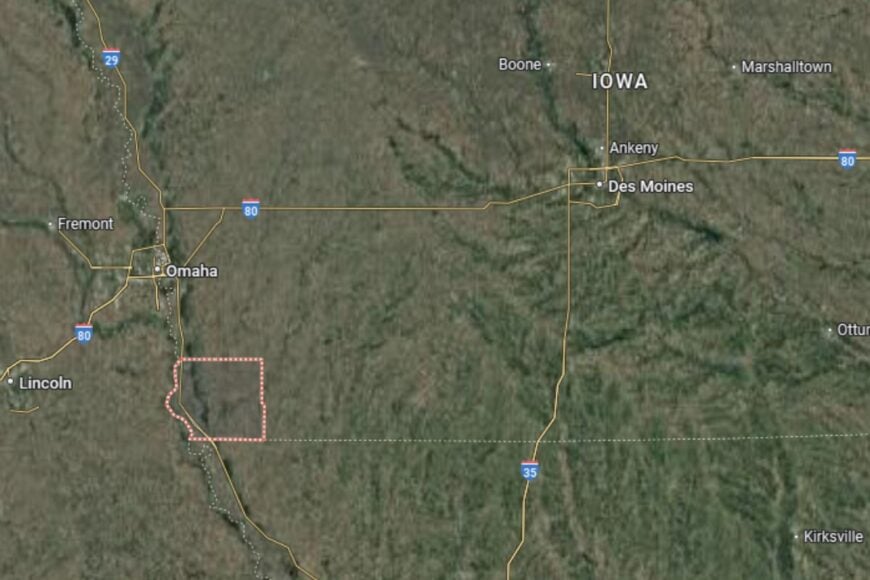
Fremont County is located in the far southwestern corner of Iowa, directly bordering both Nebraska and Missouri. The county seat, Sidney, lies near Interstate 29 and U.S. Highway 275, providing strong north–south connections.
The county’s western edge touches the Missouri River, giving it both scenic and economic advantages. Neighboring counties include Page to the east and Mills to the north. Fremont County’s position makes it a gateway at the tri-state border.
#7. Ringgold County
– Life expectancy: 75.6 years
— 2.5 years lower than the state average
About
Ringgold County is a rural county where tradition and agriculture shape everyday life. Corn and soybean fields stretch across the countryside, while livestock farming adds to the economic foundation. Residents enjoy a quiet pace and take pride in their strong community ties.
Festivals, parades, and school events provide a sense of unity and cultural pride. Outdoor recreation, including hunting, fishing, and camping, is also popular in the area. Ringgold County thrives on its combination of rural stability and natural charm.
Where is Ringgold County?
Ringgold County is located in southern Iowa along the Missouri border. The county seat, Mount Ayr, lies about 90 miles southwest of Des Moines and is accessible via U.S. Highway 169.
The county is bordered by Decatur to the east and Taylor to the west. Its rolling farmland and scenic prairies provide both productivity and beauty. Ringgold County’s location makes it a quiet yet central part of southern Iowa.
#6. Montgomery County
– Life expectancy: 75.2 years
— 2.9 years lower than the state average

About
Montgomery County is a southwestern Iowa county with a strong farming base and a reputation for community resilience. Corn, soybeans, and livestock farming remain central, but small industries and retail businesses also contribute to the local economy. Residents value the sense of belonging that comes with rural life.
Civic organizations, schools, and healthcare facilities support families and foster local pride. Community gatherings, including fairs and cultural events, highlight both tradition and togetherness. Montgomery County offers a steady balance of agricultural productivity and neighborly connection.
Where is Montgomery County?
Montgomery County is located in southwestern Iowa, about 60 miles southeast of Omaha, Nebraska. The county seat, Red Oak, lies near U.S. Highways 34 and 48, providing key transportation routes.
Neighboring counties include Page to the south and Cass to the north. The county’s rolling farmland is typical of the region, offering both beauty and productivity. Montgomery County’s location makes it a vital part of Iowa’s agricultural landscape.
You may also like: Counties with the lowest cost of living in Iowa
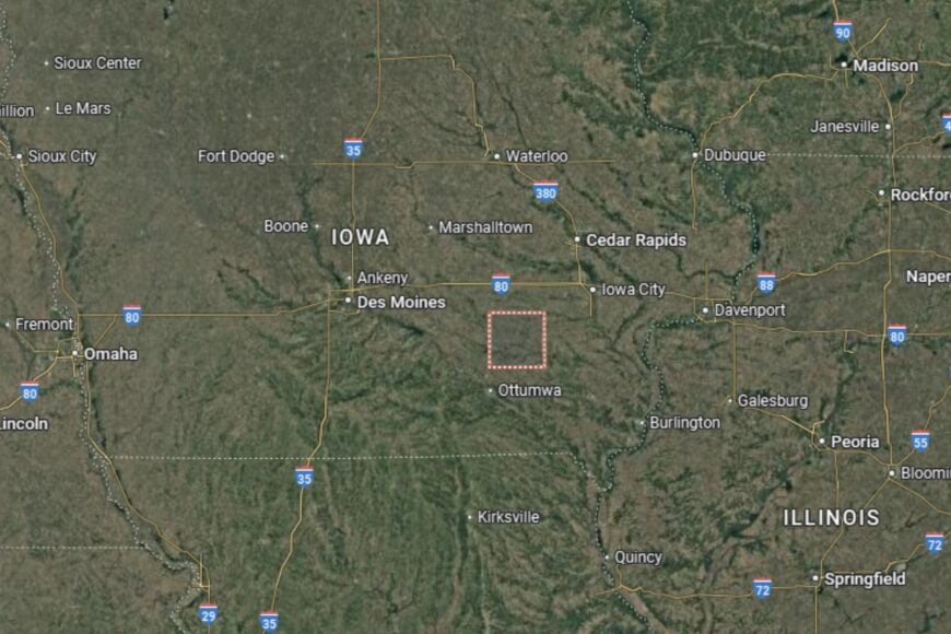
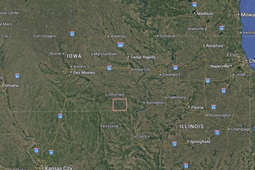
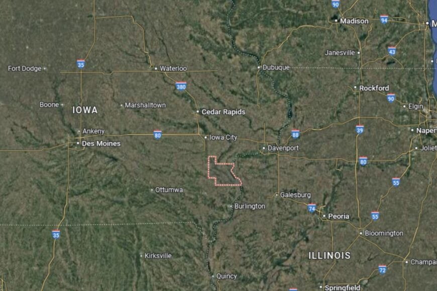
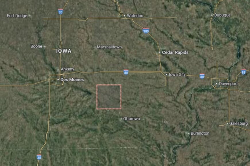
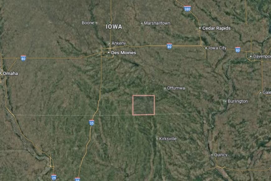
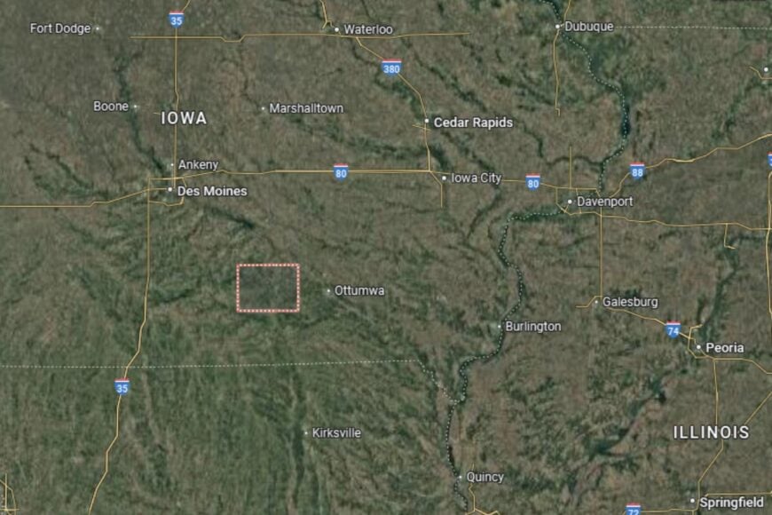
#5. Wapello County
– Life expectancy: 75.0 years
— 3.1 years lower than the state average
About
Wapello County blends industrial and agricultural strengths, anchored by Ottumwa, its largest city. Farming remains important, but the county also benefits from a diverse economy that includes manufacturing and retail. Residents value both the opportunities of urban life and the traditions of surrounding rural communities.
Cultural attractions, festivals, and historic landmarks enrich community life. Schools, healthcare systems, and civic organizations provide support for families. Wapello County offers a mix of small-town warmth and city amenities.
Where is Wapello County?
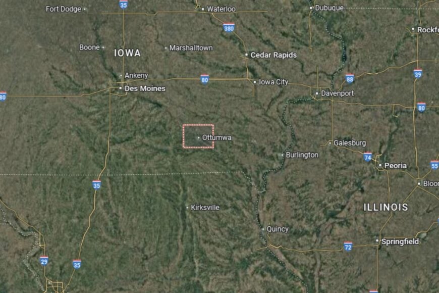
Wapello County is located in southeastern Iowa, about 85 miles southeast of Des Moines. The county seat, Ottumwa, lies along U.S. Highway 63 and U.S. Highway 34, which provide strong regional connections.
Neighboring counties include Monroe to the west and Jefferson to the east. The Des Moines River flows through the county, shaping both its economy and recreational opportunities. Wapello County’s location makes it a central hub in southeastern Iowa.
#4. Monona County
– Life expectancy: 74.9 years
— 3.2 years lower than the state average
About
Monona County is a rural county defined by agriculture, river valleys, and small-town living. Farming is central, but the county is also known for its scenic beauty, particularly the Loess Hills that run through its eastern edge. Residents enjoy the blend of fertile farmland and striking natural landscapes.
Community life thrives on local traditions, festivals, and strong civic engagement. Outdoor recreation, such as hiking, fishing, and camping, is an important part of daily life. Monona County combines agricultural productivity with natural wonder.
Where is Monona County?
Monona County is located in western Iowa along the Missouri River, about 50 miles south of Sioux City. The county seat, Onawa, sits near Interstate 29, offering strong north–south connections.
The county borders Harrison to the south and Woodbury to the north. Its landscape includes both rich farmland and unique Loess Hills terrain. Monona County’s location gives it a mix of agricultural importance and scenic appeal.
#3. Clarke County (tie)
– Life expectancy: 74.8 years
— 3.3 years lower than the state average
About
Clarke County is a small county where agriculture and small-town values remain at the center of life. Corn and soybean farming dominate the economy, while residents enjoy a lifestyle shaped by close community ties. Schools, healthcare, and civic organizations provide essential support.
Community pride is expressed through local events, fairs, and recreational programs. Parks, lakes, and trails add to the area’s charm. Clarke County offers a quiet lifestyle with a focus on family and tradition.
Where is Clarke County?
Clarke County is located in south-central Iowa, about 40 miles south of Des Moines. The county seat, Osceola, sits along Interstate 35, providing quick access to the state capital and Missouri.
Neighboring counties include Decatur to the south and Warren to the north. Its rolling farmland and open skies reflect classic Iowa landscapes. Clarke County’s location makes it a gateway between central and southern Iowa.
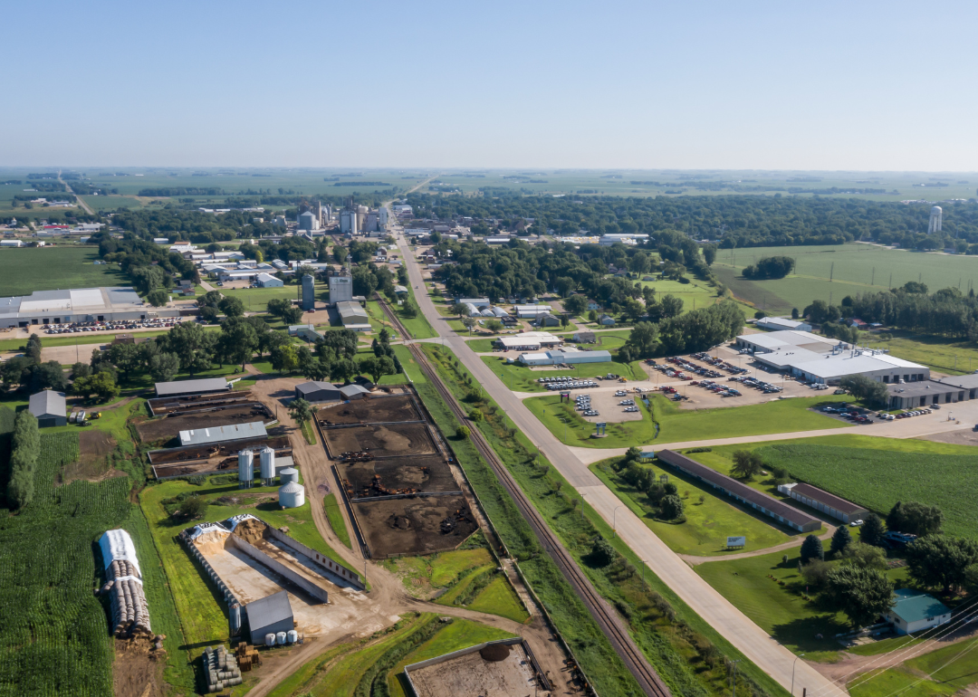
#2. Webster County (tie)
– Life expectancy: 74.8 years
— 3.3 years lower than the state average
About
Webster County is an economic hub in north-central Iowa, anchored by Fort Dodge. Agriculture remains important, but the county has developed a diverse economy that includes industry, healthcare, and education. Residents benefit from both small-town warmth and urban convenience.
Community events, cultural attractions, and recreational facilities contribute to quality of life. Schools, hospitals, and civic programs ensure residents are supported at every stage of life. Webster County balances modern industry with a strong agricultural heritage.
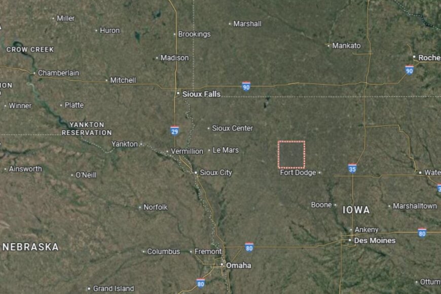
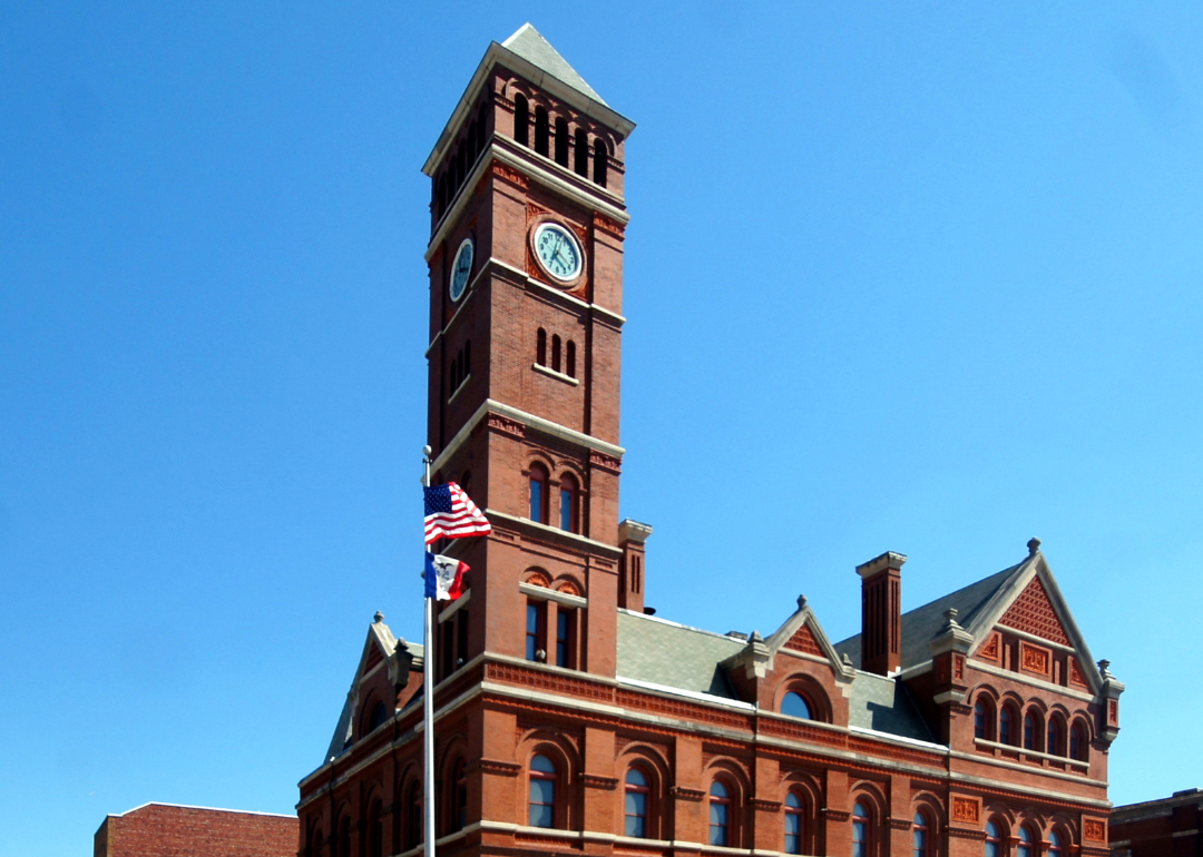
Where is Webster County?
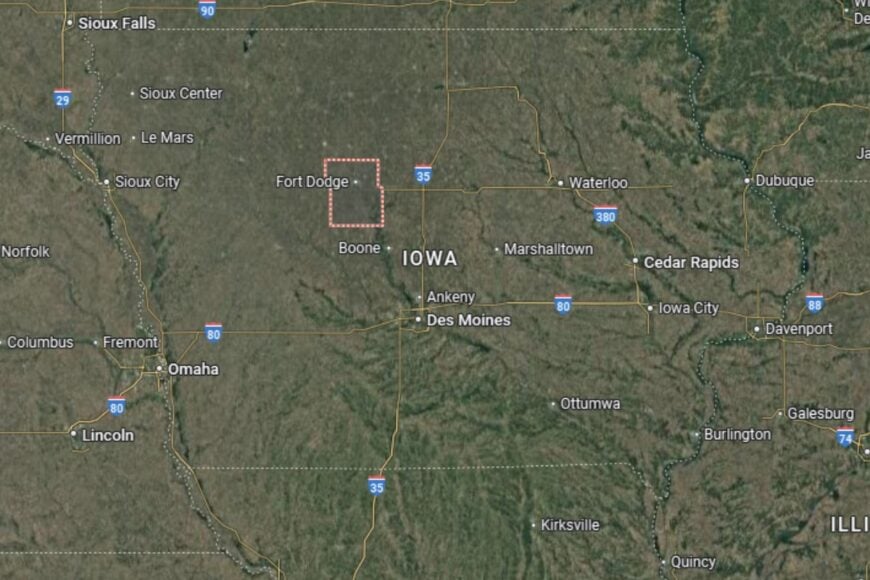
Webster County is located in central Iowa, about 90 miles northwest of Des Moines. The county seat, Fort Dodge, is situated near U.S. Highways 20 and 169, giving the area strong regional connections for commerce and travel.
The county borders Hamilton to the east, Humboldt to the north, and Calhoun to the west. Its landscape blends farmland with river valleys and prairie, placing Webster at the center of Iowa’s agricultural and industrial life.
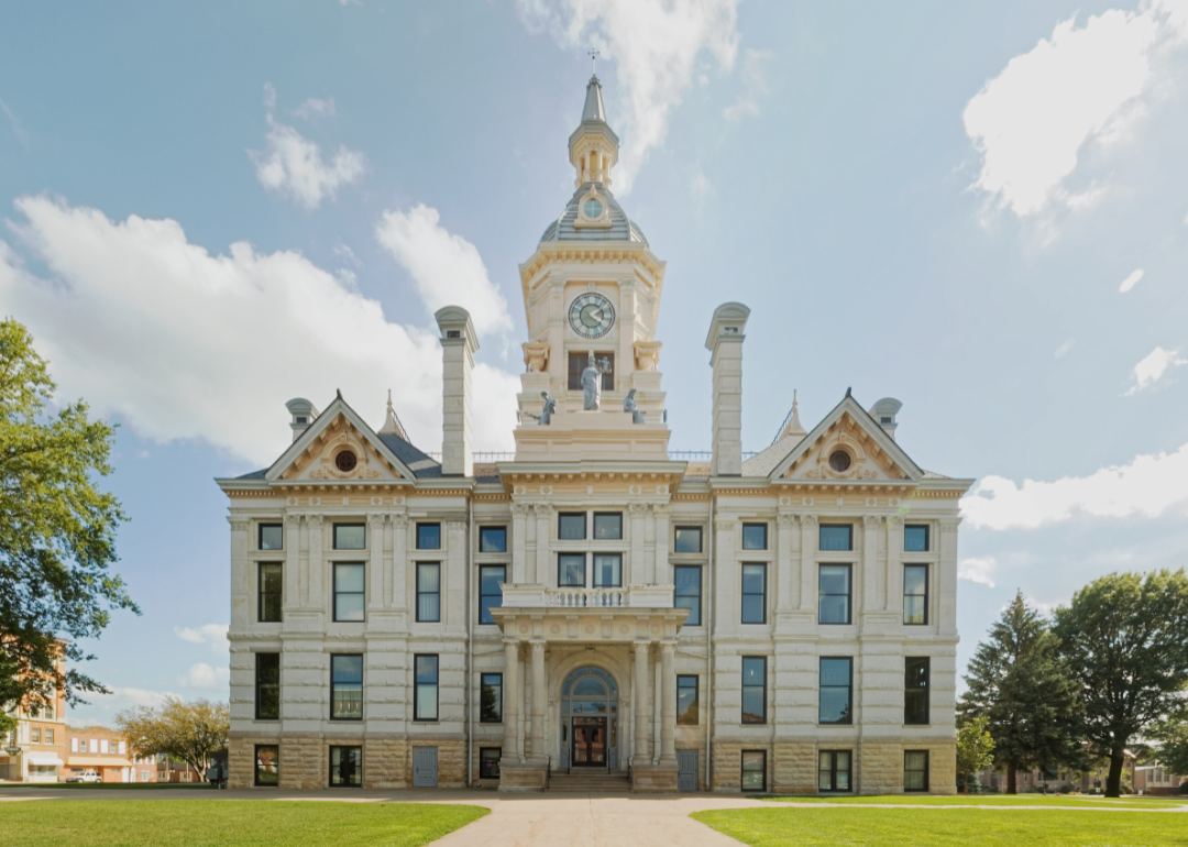
#1. Lee County
– Life expectancy: 74.5 years
— 3.6 years lower than the state average
About
Lee County sits at the very southeastern tip of Iowa, where the Mississippi and Des Moines Rivers meet. Agriculture has long been a foundation of the local economy, but industry, trade, and tourism also play key roles. Residents take pride in the county’s history, natural beauty, and welcoming communities.
The county promotes cultural life through festivals, museums, and historic landmarks. Outdoor recreation is abundant along the riverfront, with opportunities for boating, fishing, and camping. Lee County embodies both economic diversity and natural charm.
Where is Lee County?
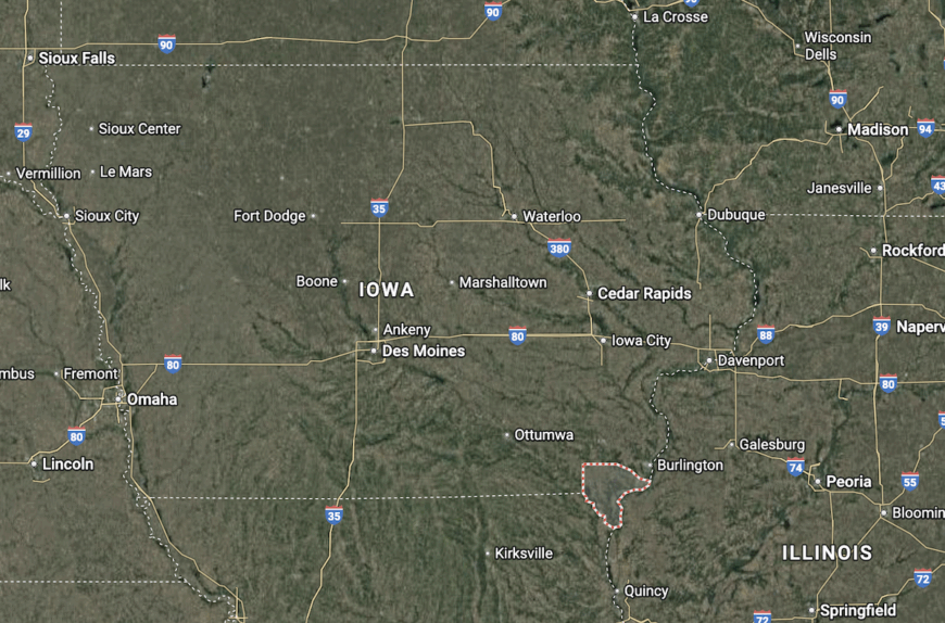
Lee County is located in southeastern Iowa, directly on the Mississippi River and bordering Illinois and Missouri. The county has two county seats: Fort Madison and Keokuk, both situated along major river crossings. U.S. Highways 61 and 218 provide direct regional connections.
The county’s geography is shaped by two major rivers, offering both commerce and recreation. Its tri-state border location makes it unique among Iowa’s counties. Lee County serves as both a historic gateway and a modern economic hub for the region.
This story features data reporting by Karim Noorani, writing by Kiersten Hickman, and is part of a series utilizing data automation across 49 states.
You may also like: Where refugees in Iowa are arriving from
By Stacker