Would you like to save this?
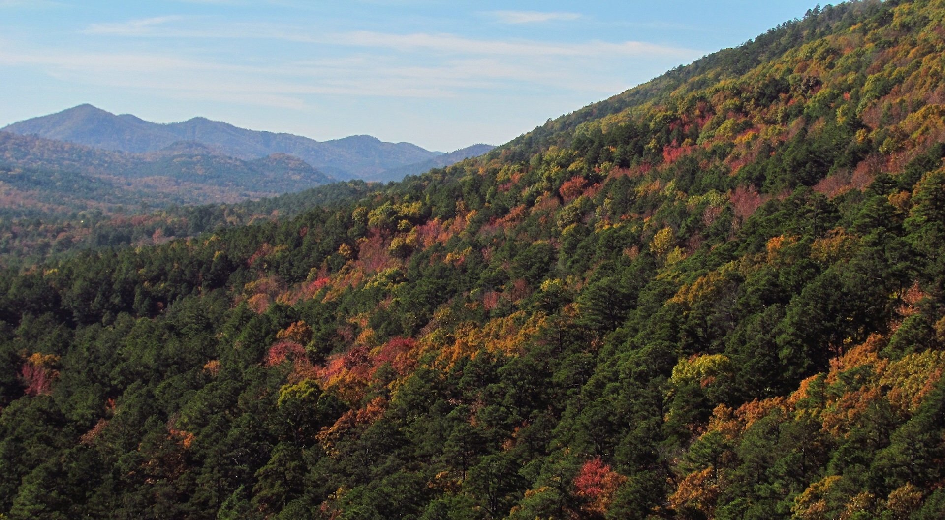
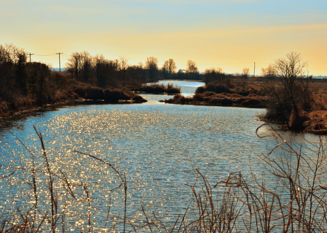
Counties with the shortest life expectancy in Arkansas
Life expectancy can be affected by a variety of factors. About 25% of your lifespan is determined by genetics, according to the National Library of Medicine. Health and wellness habits—like following a balanced, nutrient-rich diet; not smoking; drinking minimal alcohol; maintaining a healthy weight; and staying physically active—can add more than a decade to your life, research from the National Institutes of Health shows.
While these factors are significant, another important element that you might not have considered is your environment and community. While life expectancy generally increases annually in the United States—jumping from about 70.8 years old to 77.5 between 1970 and 2022, according to the Centers for Disease Control and Prevention—this particular metric can vary from state to state or even county to county.
In some parts of the country, the average lifespan is getting shorter based on a variety of risk factors on top of health, including socioeconomic factors like poverty, unemployment, income, and education.
According to a 2020 study from researchers at Penn State, West Virginia, and Michigan State Universities, communities with a higher population density, more fast food restaurants, and a high number of extraction industry-based jobs tend to have shorter life expectancies.
To find out how life expectancy varies within Arkansas, Stacker used 2024 County Health Rankings & Roadmaps from the University of Wisconsin Population Health Institute to identify the counties with the shortest life expectancy.
Life expectancy measures the average number of years from birth a person can expect to live and is calculated based on the number of deaths in a given time period and the average number of people at risk of dying during that period. Counties with unreliable or insufficient data were excluded from the analysis. Mortality data came from the National Vital Statistics System.
Read on to see if your county is on the list.
You may also like: Best private colleges in Arkansas

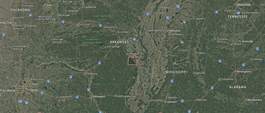
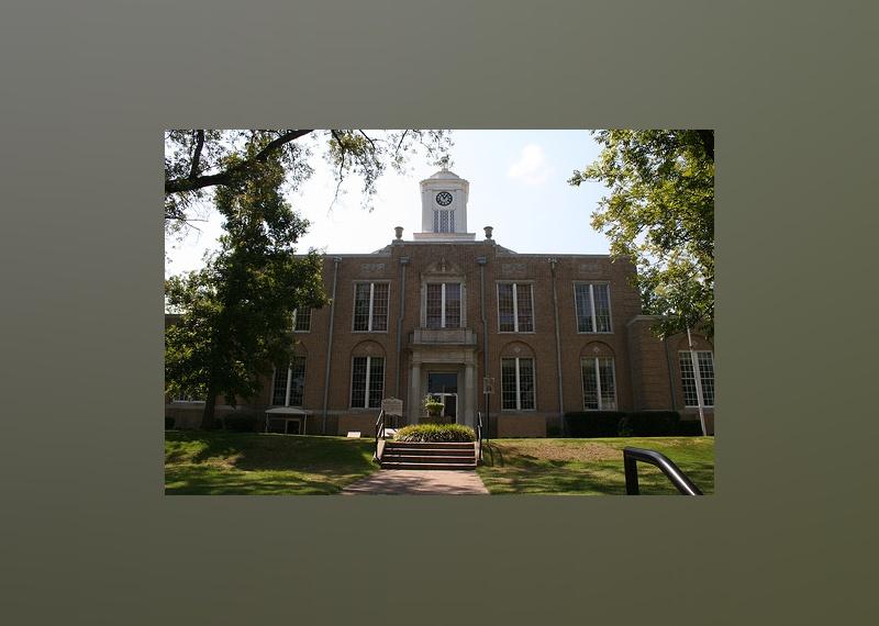
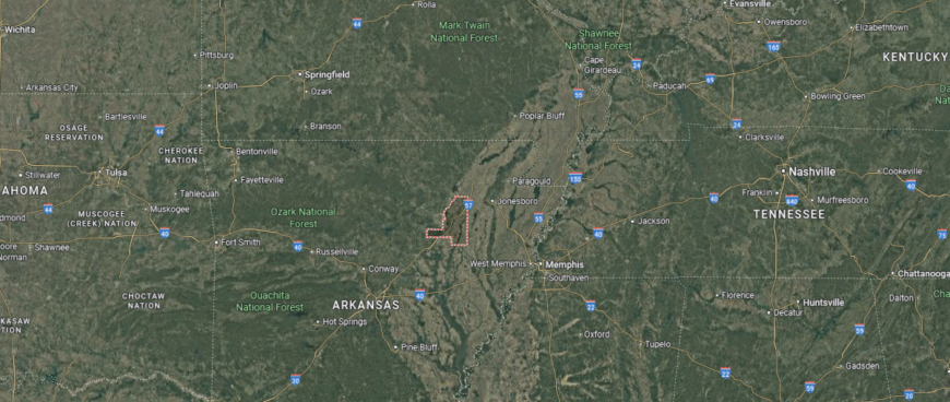
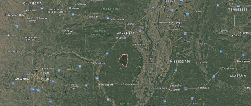
#37. Lafayette County (tie)
– Life expectancy: 73.4 years
— 0.9 years lower than the state average
About
Lafayette County reflects a deep-rooted agricultural identity blended with a quiet resilience shaped by its rural communities and scenic landscape. The county’s character is marked by strong local traditions, steady civic life, and ties to natural resources that have long supported its residents. With historic town squares, fields, forests, and community institutions at its core, Lafayette offers a grounded, enduring sense of place.
Residents engage in seasonal festivals, school-centered gatherings, and recreational life that connects them closely with the land and each other. This region supports a thoughtful, measured pace of living—defined by generational ties, pride in heritage, and a focus on local well-being. Lafayette County stands as a modest but meaningful example of lasting rural strength and shared values.
Where is Lafayette County?
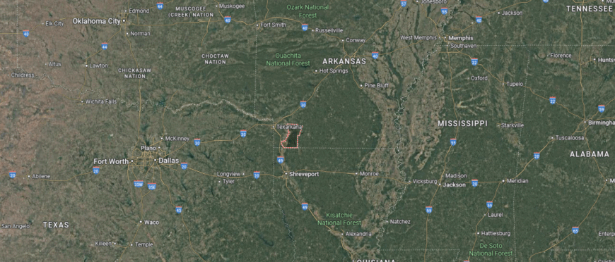
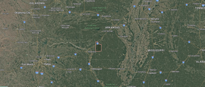
Lafayette County is located in the southwestern corner of Arkansas, bordering the state of Louisiana to the south and nestled between Miller County to the west and Columbia County to the east. It lies about 55 miles northeast of Shreveport, Louisiana, and approximately 140 miles southwest of Little Rock. The county spans roughly 35 miles from north to south and 30 miles from east to west.
Lewisville, the county seat, is situated near the center of the county and is approximately 20 miles east of the Red River. Nearby towns include Stamps, about 7 miles to the northeast, and Bradley, close to the Louisiana border in the south. Lafayette County is characterized by its rural landscapes, timberlands, and proximity to lakes and riverways such as Lake Erling and the Bodcau Creek.
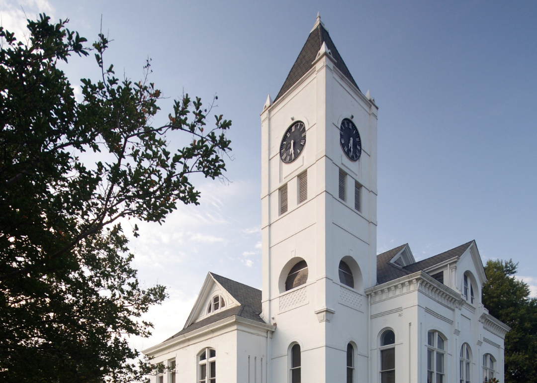
#36. Sevier County
– Life expectancy: 73.3 years
— 1.0 years lower than the state average
About
Sevier County blends scenic landscapes with a deep cultural heritage rooted in agriculture, craftsmanship, and close community ties. Surrounded by rolling hills, rivers, and woodlands, the county’s identity reflects a balance of natural beauty and working land. Its small towns and local institutions foster a strong sense of belonging, where family-run farms, schools, and churches serve as cornerstones of daily life.
Community events, fairs, and seasonal traditions bring residents together in celebration of local history and shared values. The area supports a quiet, purposeful lifestyle centered around resilience, connection, and appreciation for its surroundings. Sevier County represents the enduring spirit of rural life shaped by generations of commitment to place and people.
Where is Sevier County?
Sevier County is located in southwestern Arkansas, positioned near the foothills of the Ouachita Mountains and bordering Oklahoma to the west. It lies about 50 miles north of Texarkana and 125 miles southwest of Little Rock. The county spans approximately 40 miles from north to south and 35 miles from east to west.
De Queen, the county seat and largest city, sits near the center of the county and serves as a local hub for commerce and transportation. The nearby town of Horatio is located roughly 9 miles south of De Queen, while Lockesburg is about 10 miles to the east. Sevier County is known for its poultry and livestock production, forested landscapes, and access to outdoor recreation areas such as De Queen Lake, Gillham Lake, and the Cossatot River.
#35. Lincoln County
– Life expectancy: 73.2 years
— 1.1 years lower than the state average
Would you like to save this?
About
Lincoln County is defined by its expansive rural character, historical depth, and a steady connection to agriculture and natural resources. Rolling farmland, open skies, and quiet towns shape a landscape where tradition and practicality guide community life. Rooted in self-reliance and local pride, the county reflects a heritage of hard work and strong civic ties.
Residents participate in local fairs, school events, and seasonal routines that reinforce a shared way of life grounded in place and purpose. With a focus on family, farming, and community, Lincoln County offers a durable and meaningful rhythm of living shaped by generations of continuity and care.
Where is Lincoln County?
Lincoln County is located in southeastern Arkansas, situated within the Arkansas Delta region and bordered by the Arkansas River to the northwest. It lies approximately 45 miles southeast of Little Rock and about 60 miles north of the Louisiana border. The county extends around 30 miles from north to south and 25 miles east to west.
Star City, the county seat, is positioned near the center of the county and serves as the primary local government and commercial hub. Gould, another key town, is located roughly 15 miles southeast of Star City along U.S. Highway 65. Lincoln County is characterized by flat agricultural plains, dense timberlands, and a strong presence of farming communities and correctional institutions.
#34. Howard County (tie)
– Life expectancy: 73.1 years
— 1.2 years lower than the state average
About
Howard County carries a legacy shaped by agriculture, forestry, and close-knit rural traditions that continue to influence daily life. Set against a backdrop of wooded areas, fields, and quiet town centers, the county balances natural resource stewardship with a strong sense of local identity. Community roots run deep, supported by longstanding institutions, family farms, and local gatherings that foster connection and continuity.
Seasonal events, school sports, and civic traditions bring residents together in ways that emphasize shared responsibility and pride in place. Howard County reflects a grounded lifestyle where history, land, and community values intersect, offering a durable and steady sense of belonging.
Where is Howard County?
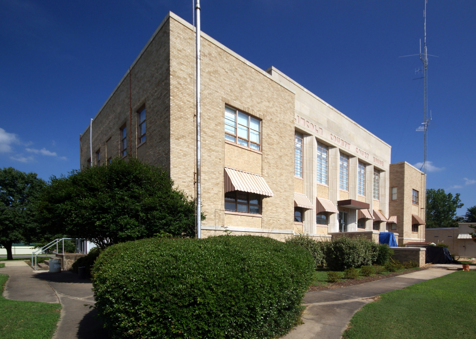
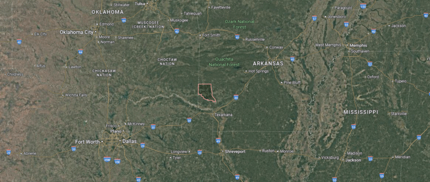
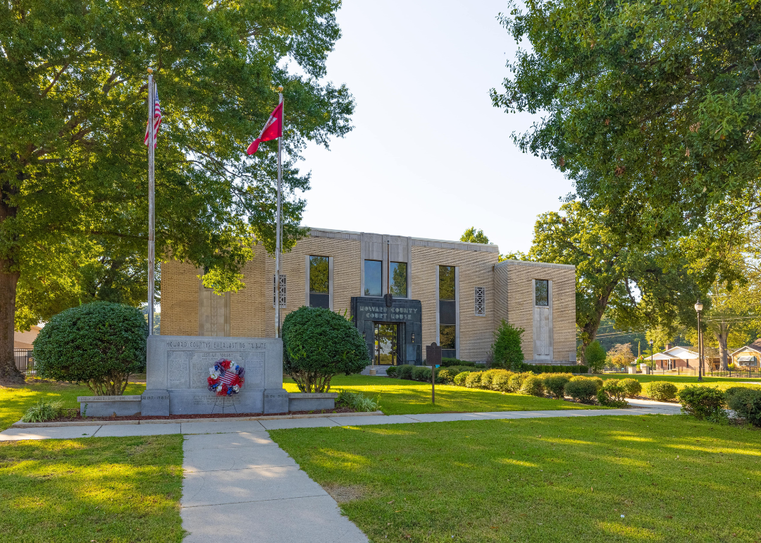
Howard County is located in southwest Arkansas, nestled between the Ouachita Mountains to the north and the West Gulf Coastal Plain to the south. It is approximately 45 miles north of Texarkana and about 115 miles southwest of Little Rock. The county spans roughly 35 miles from north to south and 30 miles from east to west.
Nashville, the county seat, sits near the center of the county and serves as its main center for commerce, healthcare, and education. Nearby towns include Dierks, located about 15 miles north, and Mineral Springs, roughly 7 miles to the south. Howard County is known for its timber and poultry industries, scenic waterways such as the Saline River and Dierks Lake, and its mix of rolling hills and pine forests.
#33. Nevada County (tie)
– Life expectancy: 73.1 years
— 1.2 years lower than the state average
You may also like: These 10 car insurers have the highest market share in Arkansas
About
Nevada County is steeped in heritage and defined by its connection to timberlands, farming, and generations of rural self-sufficiency. Its gently rolling terrain, pine forests, and small towns create a landscape where tradition and practicality guide daily life. Local institutions—from schools to courthouses—serve as anchors for a community rooted in resilience and shared history.
Residents uphold a rhythm marked by seasonal events, civic pride, and neighborly ties that span decades. With a lifestyle shaped by the land and longstanding values, Nevada County offers a stable, enduring sense of identity grounded in both legacy and local commitment.
Where is Nevada County?
Nevada County is located in southwestern Arkansas, within the Gulf Coastal Plain region and bordered by Ouachita County to the northeast and Hempstead County to the west. It lies about 90 miles southwest of Little Rock and approximately 35 miles northeast of Texarkana. The county stretches roughly 30 miles from north to south and 25 miles east to west.
Prescott, the county seat and largest town, is situated along Interstate 30 near the center of the county. Nearby towns include Bluff City to the east and Rosston to the south. Nevada County is known for its historical Civil War sites, pine timberlands, and agricultural activity, with access to regional rail and highway routes that support local commerce.
#32. Woodruff County (tie)
– Life expectancy: 73.0 years
— 1.3 years lower than the state average

About
Woodruff County embodies a quiet, agrarian way of life shaped by its rich delta soil, river systems, and deep farming heritage. Spanning flatlands and rural communities, the county’s identity is closely tied to agriculture, particularly row crops, which continue to support both the economy and daily rhythms of life. Small towns and tight-knit neighborhoods foster a culture of cooperation, tradition, and pride in place.
Community events, church gatherings, and seasonal harvests mark the passing of time and reinforce generational bonds. With a focus on land, labor, and lasting values, Woodruff County stands as a reflection of rural perseverance and a way of life rooted in connection to both the land and one another.
Where is Woodruff County?
Woodruff County is located in eastern Arkansas, in the heart of the Arkansas Delta, bordered by the White River to the west and Cache River to the east. It lies approximately 75 miles northeast of Little Rock and about 55 miles west of Memphis, Tennessee. The county spans about 25 miles from north to south and 30 miles from east to west.
Augusta, the county seat, sits along the banks of the White River and serves as the primary center for county government and local services. Nearby towns include McCrory, roughly 10 miles northeast of Augusta, and Cotton Plant, located about 15 miles southeast. Woodruff County is characterized by flat, fertile farmland, rich river bottomlands, and a strong agricultural presence, particularly in rice, soybeans, and cotton production.
#31. Hot Spring County (tie)
– Life expectancy: 73.0 years
— 1.3 years lower than the state average
About
Hot Spring County reflects a blend of forested uplands, working farmland, and longstanding traditions shaped by both natural resources and industrial roots. Nestled in central Arkansas, the county is anchored by communities like Malvern—once dubbed the “Brick Capital of the World”—and surrounded by woodlands, rivers, and fertile land that support cattle farming, timber, and crop production. Small towns and rural neighborhoods foster a sense of shared purpose, built on civic pride and connection to place.
Churches, school events, and annual fairs shape the cultural rhythm of the county, bringing people together around heritage and local identity. With a lifestyle centered on self-reliance, history, and community ties, Hot Spring County stands as a reflection of Arkansas’s enduring rural spirit—where land, labor, and legacy continue to define everyday life.
Where is Hot Spring County?
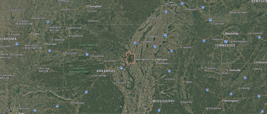
Hot Spring County is located in central Arkansas, positioned just southwest of the Ouachita Mountains and bordered by Saline and Garland counties to the north. It lies approximately 45 miles southwest of Little Rock and about 20 miles southeast of Hot Springs National Park. The county covers an area roughly 35 miles from north to south and 30 miles east to west.
Malvern, the county seat, is located along the I-30 corridor and serves as a regional hub for manufacturing and education. Nearby towns include Bismarck to the west and Donaldson to the south. Hot Spring County is known for its mix of forested terrain, industrial development, and recreational access to waterways such as Lake Catherine and the Ouachita River.
#30. Garland County (tie)
– Life expectancy: 73.0 years
— 1.3 years lower than the state average
About
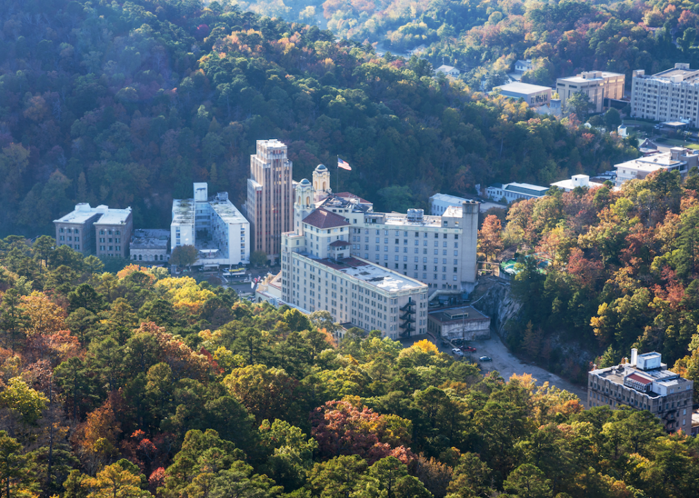
Garland County blends natural springs, wooded hills, and historic legacy into a vibrant landscape shaped by both tourism and local tradition. Anchored by Hot Springs—a city famed for its thermal waters and historic bathhouses—the county thrives at the intersection of natural beauty and cultural heritage. Forested terrain, clear lakes, and winding roads connect rural communities with a central hub known for wellness, recreation, and civic pride.
Local life revolves around events, festivals, and traditions rooted in the county’s long history as a health and resort destination. From mountain towns to lakeside neighborhoods, residents share a rhythm of community that honors both land and legacy. Garland County reflects a dynamic yet grounded lifestyle—where natural resources, heritage, and connection continue to shape daily experience.
Where is Garland County?
Garland County is located in west-central Arkansas, nestled within the Ouachita Mountains and home to portions of the Ouachita National Forest. It is situated about 55 miles southwest of Little Rock and shares its southern border with Hot Spring County. The county spans approximately 30 miles from north to south and 35 miles east to west.
Hot Springs, the county seat, is centrally located and serves as a major tourist destination, known for its historic bathhouses and Hot Springs National Park. Nearby communities include Lake Hamilton to the south and Fountain Lake to the northeast. Garland County is recognized for its natural hot springs, mountainous terrain, and recreational opportunities around Lake Hamilton and Lake Ouachita.
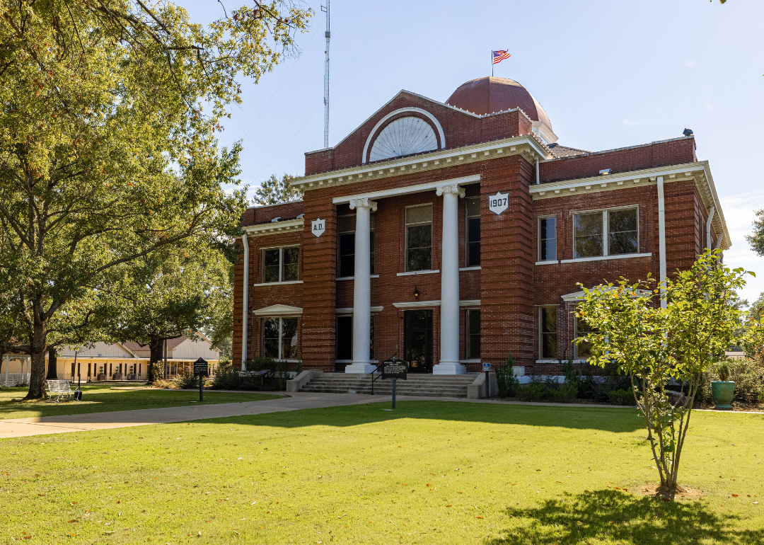
#29. Franklin County (tie)
– Life expectancy: 72.8 years
— 1.5 years lower than the state average
About
Franklin County offers a blend of forested ridges, river valleys, and rich farmland divided by the Arkansas River, creating a landscape that supports both outdoor recreation and agricultural livelihood. With two county seats—Ozark and Charleston—its civic life reflects a history of adaptation and strong local governance. From vineyard-covered hills in Altus to the rolling fields of the southern plains, the county’s identity is rooted in tradition, resilience, and connection to the land.
Seasonal festivals, school events, and faith-based gatherings tie together communities that value heritage and shared purpose. Residents carry forward a lifestyle centered on farming, family, and place—shaped by generations of labor and pride. Franklin County stands as a reflection of rural Arkansas character, where natural beauty and enduring values remain closely intertwined.
Where is Franklin County?
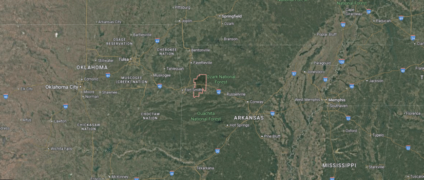
Would you like to save this?
Franklin County is located in west-central Arkansas, stretching across both sides of the Arkansas River and bordered by the Ozark National Forest to the north. It lies approximately 40 miles east of Fort Smith and about 110 miles northwest of Little Rock. The county spans around 35 miles from north to south and 30 miles from east to west.
The county has two seats: Ozark, located on the north side of the Arkansas River, and Charleston, situated to the south. Nearby communities include Altus, known for its vineyards, and Branch, located about 10 miles southeast of Charleston. Franklin County is characterized by its river valley farmlands, forested hills, and position along scenic Highway 64 and Interstate 40, providing access to outdoor recreation and small-town heritage.
#28. Fulton County (tie)
– Life expectancy: 72.8 years
— 1.5 years lower than the state average
You may also like: Counties with the worst commutes in Arkansas
About
Fulton County rests in the northern Ozark foothills near the Missouri border, shaped by wooded ridges, spring-fed rivers, and a landscape better suited to livestock and timber than large-scale farming. Centered around the town of Salem, the county’s rural character reflects a long-standing tradition of self-reliance, where tight-knit communities support one another through shared history and daily labor. The region’s natural beauty, including sites like Mammoth Spring, adds to its identity as both a working and recreational landscape.
Local life revolves around church gatherings, school events, seasonal fairs, and small-town festivals that reinforce generational bonds and civic pride. Residents maintain a lifestyle rooted in land, heritage, and connection—grounded by a culture that values endurance, simplicity, and mutual support. Fulton County reflects the quiet strength of Arkansas’s northern highlands, where tradition and place remain deeply intertwined.
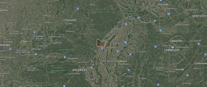
Where is Fulton County?
Fulton County is tucked into the rolling highlands of north-central Arkansas, it shares its northern border with Missouri and lies deep within the scenic Ozark Mountains. The county is anchored by Salem, a small yet central community that functions as its seat of government and local services. Surrounding towns such as Mammoth Spring, with its namesake spring and river access, and Viola, a quiet town to the west, give the area a distinctly rural character.
Fulton County is defined by its forested ridges, clear-flowing rivers like the Spring River and South Fork, and its appeal to outdoor enthusiasts. Located about 130 miles north of Little Rock and 90 miles southeast of Springfield, Missouri, the county remains relatively remote, favoring open landscapes over urban density. Agriculture, tourism, and a love of the outdoors shape life in this corner of the state.
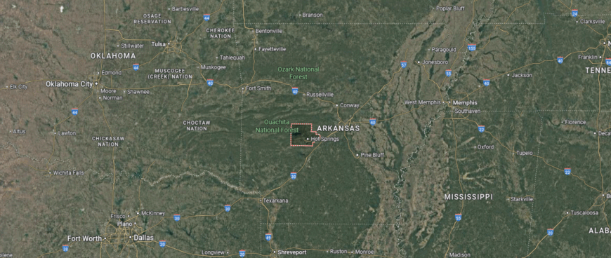
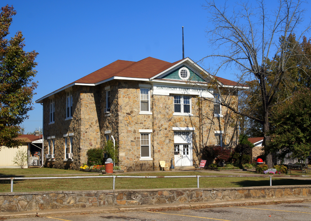
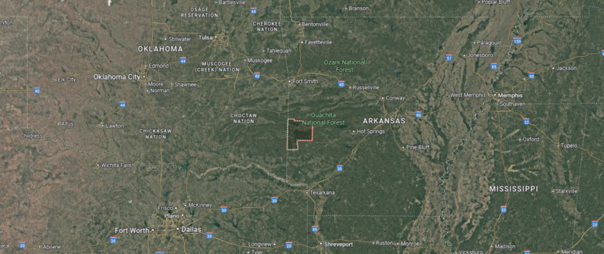
#27. Montgomery County (tie)
– Life expectancy: 72.7 years
— 1.6 years lower than the state average
About
Montgomery County is defined by forested ridges, clear-running streams, and a rugged terrain that anchors its identity in the heart of the Ouachita Mountains. With a legacy shaped by timber, quartz mining, and quiet perseverance, the county offers a way of life rooted in natural rhythms and strong community ties. Its small towns and rural byways reflect a culture of independence, shaped by generations who worked the land and learned from the hills.
Life moves with intention here—through school events, church gatherings, and seasons marked by the lake and the woods. Residents take pride in their connection to place, whether guiding visitors through crystal dig sites or fishing the calm coves of Lake Ouachita. Montgomery County remains a testament to Arkansas’s mountain heritage: steady, self-reliant, and closely connected to both land and neighbor.
Where is Montgomery County?
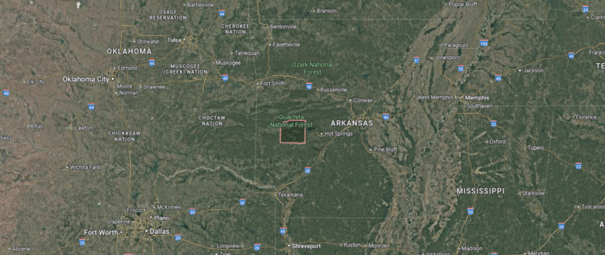
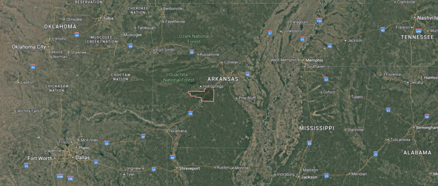
Montgomery County is located in west-central Arkansas, nestled within the Ouachita Mountains and surrounded by national forest lands. It lies approximately 90 miles west of Little Rock and about 35 miles northwest of Hot Springs. The county spans roughly 45 miles from north to south and 35 miles from east to west.
Mount Ida, the county seat, sits near the southern edge of Lake Ouachita and is about 25 miles west of Hot Springs. The town of Norman lies approximately 10 miles west of Mount Ida, while Oden is located around 15 miles to the northwest. Montgomery County is known for its crystal quartz deposits, mountainous terrain, and recreational access to rivers, lakes, and hiking trails throughout the Ouachita National Forest.
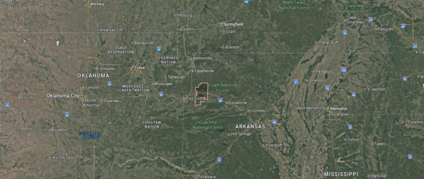
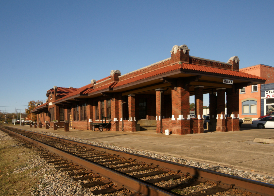
#26. Polk County (tie)
– Life expectancy: 72.7 years
— 1.6 years lower than the state average
About
Polk County reflects a dynamic blend of natural landscapes, civic energy, and community values. Defined by its rivers, lakes, and rolling countryside, the region balances agricultural heritage with economic development and growing urban centers. Local traditions and institutions reinforce a strong sense of place, anchored in both history and progress.
Residents experience a lifestyle shaped by outdoor recreation, cultural festivals, and hometown pride. From farmers’ markets and hiking trails to historic main streets and civic events, daily life honors both legacy and innovation. The area promotes connection—between people, environment, and shared purpose—fostering a spirit of resilience and neighborly support.
Where is Polk County?
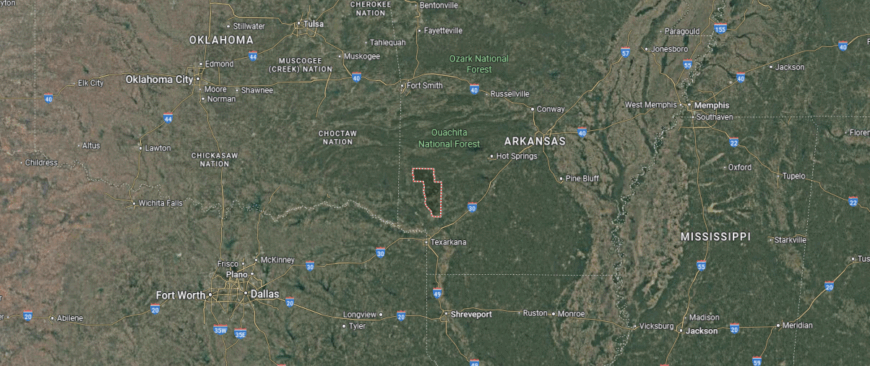
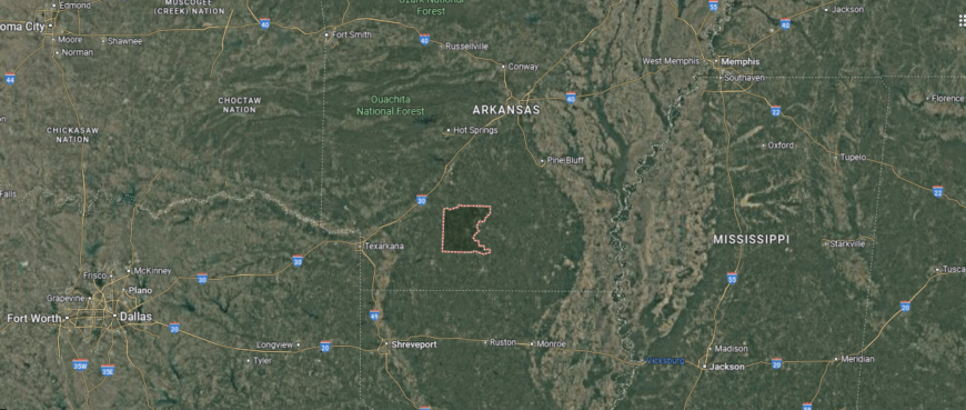
Polk County, Arkansas lies along the state’s western edge, sharing its border with Oklahoma and encompassing a large stretch of the Ouachita Mountains. The county seat, Mena, is centrally located and serves as a hub for outdoor tourism, especially for visitors traveling the Talimena Scenic Drive or exploring the vast Ouachita National Forest. Smaller communities like Wickes and Grannis sit farther south, surrounded by wooded hills and rural farmland.
Positioned about 120 miles west of Little Rock and 75 miles south of Fort Smith, Polk County offers a remote, mountainous landscape rich in recreational opportunities. Its forested terrain, elevation changes, and clear waterways make it a prime location for hiking, camping, and scenic exploration year-round.
#25. St. Francis County (tie)
– Life expectancy: 72.5 years
— 1.8 years lower than the state average
About
St. Francis County is shaped by its deep agricultural roots, historical significance, and connection to the land. Situated along the eastern Arkansas Delta, the region is defined by fertile soil, quiet towns, and a strong sense of community passed down through generations. Civic life is anchored in tradition, local institutions, and a shared respect for hard work and perseverance.
Residents enjoy the rhythms of rural life—seasonal harvests, community events, and time spent in nature. From its historic courthouse to the trails of Crowley’s Ridge, the area offers a connection to both past and place. St. Francis County stands as a testament to resilience, grounded living, and the enduring values of rural America.
Where is St. Francis County?
St. Francis County, Arkansas is situated in the eastern part of the state, within the flat, fertile expanses of the Mississippi Alluvial Plain. The county seat, Forrest City, lies along Interstate 40 and serves as a midpoint between Little Rock—about 90 miles to the west—and Memphis, Tennessee, roughly 45 miles to the east. Other nearby towns include Madison, located along the St. Francis River, and Hughes, farther to the south.
The county is named for the St. Francis River, which forms part of its eastern boundary and supports agriculture throughout the region. Known for its row-crop farming and delta landscapes, St. Francis County is also home to portions of Village Creek State Park, offering a natural contrast to its otherwise cultivated terrain.
#24. Clay County (tie)
– Life expectancy: 72.5 years
— 1.8 years lower than the state average
About
Clay County carries a legacy of rural heritage, natural beauty, and small-town resilience. Nestled in northeastern Arkansas, the region is shaped by agricultural landscapes, river systems, and tightly woven communities that reflect generations of local pride. Its identity is rooted in the rhythms of farming, shared traditions, and a commitment to place.
Life here moves with purpose—anchored by family-run businesses, school events, and ties to the land. Residents enjoy quiet towns, local fairs, and outdoor spaces that encourage connection and reflection. Clay County represents a steady, enduring way of life shaped by history, community strength, and a deep respect for the land.
Where is Clay County?
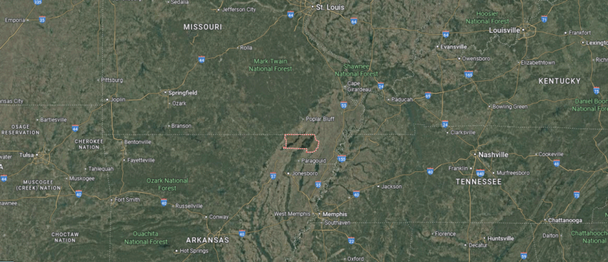
Clay County, Arkansas is located in the northeastern corner of the state, bordered by Missouri to the north and shaped by the flatlands of the Mississippi Alluvial Plain. The county is unique in that it has two county seats—Corning, in the western district, and Piggott, in the east—each serving different administrative functions. Other small communities such as Rector and Datto are scattered throughout the largely rural landscape.
Positioned about 180 miles northeast of Little Rock and 25 miles south of Poplar Bluff, Missouri, Clay County is defined by its agriculture, with rice, soybeans, and cotton covering much of the land. The Black River and its tributaries wind through the region, supporting both irrigation and recreation, while the area’s cultural history includes ties to author Ernest Hemingway, who spent time writing in Piggott.
#23. Columbia County (tie)
– Life expectancy: 72.3 years
— 2.0 years lower than the state average
You may also like: Best amusement parks in Arkansas
About
Columbia County reflects a blend of historical depth, agricultural tradition, and quiet progress. Located in southern Arkansas, the region is defined by pine forests, fertile land, and close-knit towns where heritage and daily life go hand in hand. Its civic and cultural foundations are supported by strong institutions, educational pride, and longstanding local values.
Residents experience a way of life marked by seasonal events, outdoor spaces, and a deep sense of belonging. From regional fairs and courthouse squares to forest trails and farmsteads, the area fosters a connection to both place and people. Columbia County stands as a grounded community where tradition, nature, and rural strength shape everyday living.
Where is Columbia County?
Columbia County, Arkansas is located in the southern part of the state, near the Louisiana border, and forms part of the Gulf Coastal Plain. The county seat, Magnolia, sits near the center of the county and serves as a regional hub for education, healthcare, and industry—home to Southern Arkansas University and an active petroleum and timber economy. Other communities such as McNeil, Taylor, and Emerson lie within short driving distance, surrounded by forests and farmland.
Situated about 130 miles south of Little Rock and 65 miles east of Texarkana, Columbia County combines rural charm with industrial heritage. Its pine-covered landscape and proximity to Logoly State Park make it a quiet destination for outdoor activities, while its economic base reflects a blend of agriculture, energy, and education.
#22. Logan County (tie)
– Life expectancy: 72.3 years
— 2.0 years lower than the state average
About
Logan County offers a landscape shaped by mountain ridges, rich farmland, and a legacy of hard work and local pride. Nestled in western Arkansas, the area spans scenic valleys, forested hills, and communities rooted in tradition. Its identity is strengthened by generational ties, historic town centers, and a culture of self-reliance and cooperation.
Residents find rhythm in the seasons—through festivals, farming, and time spent along trails and lakes. From courthouse squares to community gatherings, the region reflects a quiet strength and enduring sense of place. Logan County embodies a balance of natural beauty, heritage, and the resilient spirit of rural life.
Where is Logan County?
Logan County, Arkansas is located in the west-central part of the state, bridging the Arkansas River Valley and the western edge of the Ouachita Mountains. The county is home to two seats—Booneville in the south and Paris in the north—each serving distinct regions of the county. Smaller communities like Magazine and Blue Mountain are nestled in valleys and hills, with Mount Magazine, Arkansas’s highest peak, rising along the southern border.
Roughly 75 miles northwest of Little Rock and about 35 miles east of Fort Smith, Logan County combines mountainous terrain with fertile farmland and scenic waterways. Its economy blends agriculture, forestry, and tourism, while outdoor destinations such as Mount Magazine State Park attract visitors for hiking, hang gliding, and panoramic views.
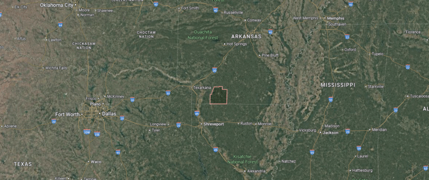
#21. Little River County (tie)
– Life expectancy: 72.1 years
— 2.2 years lower than the state average
About
Little River County is defined by its rivers, timberlands, and a legacy of Southern Arkansas resilience. Situated along the state’s western border, the county is shaped by the Little and Red Rivers, offering a landscape where agriculture, forestry, and community life intersect. Historic towns and local traditions reflect a deep connection to land, family, and steady living.
Residents engage with the outdoors, local schools, and events that bring neighbors together across generations. Whether along a quiet backroad or gathered at a county fair, life here centers on simplicity, pride, and shared experience. Little River County represents a close-knit, natural way of life rooted in history and sustained by community.
Where is Little River County?
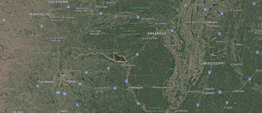
Little River County, Arkansas is located in the far southwestern corner of the state, bordered by Texas to the west and Oklahoma to the northwest. The county seat, Ashdown, lies just north of the Little River and serves as the central point for local government, education, and commerce. Other communities, including Foreman and Winthrop, are surrounded by pine forests, farmland, and waterways that define the rural landscape.
Positioned about 20 miles north of Texarkana and 150 miles southwest of Little Rock, Little River County sits at a strategic three-state junction. The area is known for its timber industry, agricultural production, and outdoor access to Millwood Lake and the Pond Creek National Wildlife Refuge, which draw both locals and visitors for fishing, birding, and scenic recreation.
#20. Lawrence County (tie)
– Life expectancy: 72.1 years
— 2.2 years lower than the state average
About
Lawrence County carries a deep agricultural legacy, historic roots, and a quiet sense of place in northeastern Arkansas. Defined by open fields, river lowlands, and small towns with strong local ties, the region reflects a heritage built on farming, railroads, and community resilience. Its courthouses, churches, and town squares stand as markers of generations past and present.
Residents live in rhythm with the land—through planting seasons, hometown festivals, and moments shared among neighbors. From the banks of the Black River to the heart of Walnut Ridge, life here is steady, grounded, and shaped by enduring connections. Lawrence County represents the enduring spirit of rural Arkansas—rooted, resilient, and rich in local tradition.
Where is Lawrence County?
Lawrence County, Arkansas is located in the northeastern part of the state, within the fertile lowlands of the Mississippi Alluvial Plain and along the Black River. The county seat, Walnut Ridge, sits near the center and serves as the primary hub for education, transportation, and local government. Other towns such as Hoxie, Imboden, and Black Rock are spread across the landscape, many of them shaped by railroads and agriculture.
Approximately 115 miles northeast of Little Rock and about 30 miles northwest of Jonesboro, Lawrence County is known for its row-crop farming, rich delta soil, and historic railroad roots. The area includes parts of the Cache River and Black River corridors, offering wetland ecosystems and recreational opportunities for hunters, anglers, and wildlife observers.
#19. Miller County
– Life expectancy: 72.0 years
— 2.3 years lower than the state average
About
Miller County sits at the southwest corner of Arkansas, where borders, rivers, and histories meet. As the only Arkansas county that lies entirely south of the Red River, it holds a unique place in the state’s geography and past. With deep roots in trade, transportation, and agriculture, the region blends urban presence in Texarkana with rural landscapes and close-knit communities.
Residents value both connection and independence—gathering for community events while maintaining strong family traditions and ties to the land. Life here flows between city pace and countryside calm, grounded in shared history and pride of place. Miller County reflects a distinctive blend of borderland identity, local heritage, and Southern character.
Where is Miller County?
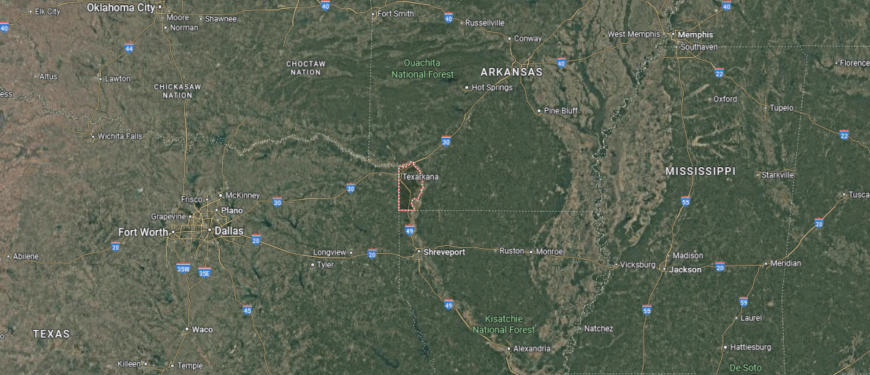
Miller County, Arkansas is located at the southwestern tip of the state, forming part of the tri-state region where Arkansas meets Texas and Louisiana. The county seat, Texarkana, straddles the Arkansas–Texas border and serves as a major commercial and transportation hub for the region. Other communities in the county include Fouke, known for its rural setting and folklore, and Garland, located to the southeast near the Red River.
Situated approximately 140 miles southwest of Little Rock and directly connected to I-30, Miller County is a gateway to both Arkansas and Texas. It is known for its transportation corridors, timber and agriculture industries, and access to nearby recreational areas such as Millwood Lake and Sulphur River Wildlife Management Area, which support hunting, fishing, and boating in a heavily wooded setting.
#18. Ashley County (tie)
– Life expectancy: 71.9 years
— 2.4 years lower than the state average
You may also like: Counties with the most tornadoes in Arkansas
About
Ashley County rests in the southeastern corner of Arkansas, shaped by timberlands, farmland, and generations of local tradition. Bordered by the Bayou Bartholomew and the Ouachita River, its identity is closely tied to natural resources, mill towns, and a longstanding rural way of life. Towns like Crossett and Hamburg reflect a legacy of industry, resilience, and community pride.
Residents take part in a steady rhythm of everyday life—marked by school events, forest trails, and gatherings that bring neighbors together. With deep ties to the land and each other, the county fosters a strong sense of belonging and self-reliance. Ashley County represents a rooted, working landscape where tradition, nature, and community continue to shape its story.
Where is Ashley County?
Ashley County, Arkansas is located in the southeastern corner of the state, bordered by Louisiana to the south and shaped by the flat terrain of the Mississippi Alluvial Plain and the West Gulf Coastal Plain. The county seat, Hamburg, lies near the geographic center and functions as a civic and historical anchor, while Crossett, the largest city, sits in the western part of the county and serves as a major center for industry, particularly in timber and paper manufacturing.
Roughly 110 miles southeast of Little Rock and about 95 miles north of Monroe, Louisiana, Ashley County blends rural agricultural land with vast pine forests and riverbottom ecosystems. Its economy is tied to forestry, agriculture, and manufacturing, while access to Felsenthal National Wildlife Refuge offers opportunities for fishing, birdwatching, and boating in preserved bayous and backwaters.
#17. Cross County (tie)
– Life expectancy: 71.9 years
— 2.4 years lower than the state average
About
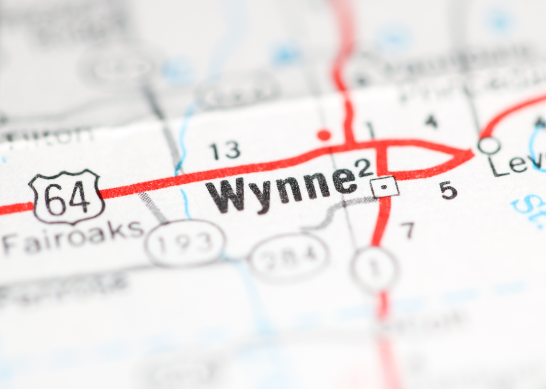
Cross County lies in eastern Arkansas, where delta farmland meets the rise of Crowley’s Ridge, shaping a region of both agricultural depth and natural contrast. The area’s history is rooted in cotton, railroads, and the growth of small towns built on family, faith, and perseverance. Wynne, the county seat, reflects this blend of tradition and quiet progress.
Residents live with a strong connection to land and community—gathering at local events, supporting schools, and honoring shared values. From fertile fields to wooded highlands, the landscape supports a lifestyle grounded in rhythm, resilience, and purpose. Cross County embodies the enduring spirit of rural Arkansas, where history and home are deeply intertwined.
Where is Cross County?
Cross County, Arkansas is located in the eastern part of the state, within the Arkansas Delta region, and is uniquely defined by the Crowley’s Ridge formation that runs north to south through its center. The county seat, Wynne, sits atop this ridge and serves as the economic and civic center, offering a mix of agriculture, education, and small-town life. Other communities, including Parkin and Cherry Valley, are surrounded by flat croplands and forested lowlands shaped by the nearby St. Francis River.
Situated about 90 miles northeast of Little Rock and 45 miles west of Memphis, Tennessee, Cross County is part of a region historically rooted in cotton and rice farming. The area offers access to outdoor recreation at Village Creek State Park, where wooded trails and lakes contrast with the flat delta terrain found throughout much of the surrounding region.
#16. Jackson County
– Life expectancy: 71.8 years
— 2.5 years lower than the state average
About
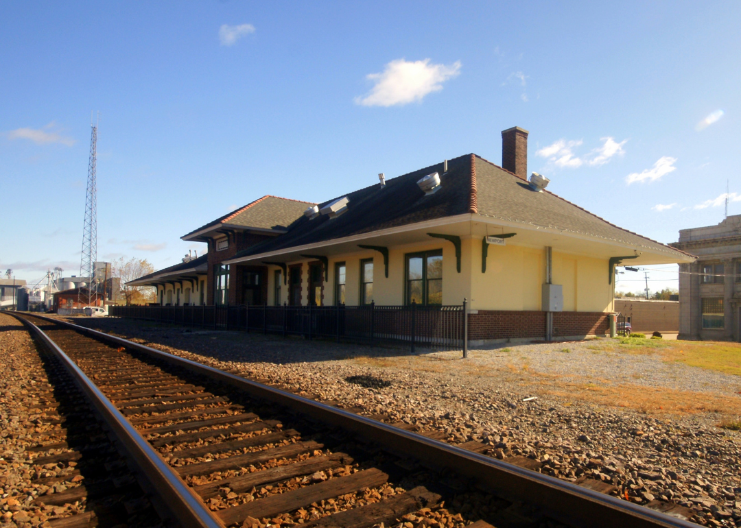
Jackson County rests in the heart of northeastern Arkansas, where fertile farmland, river routes, and local tradition shape everyday life. Anchored by the White River and the historic town of Newport, the county reflects a legacy built on agriculture, commerce, and civic pride. Its history lives on through preserved landmarks, generational farms, and institutions that serve as community anchors.
Residents enjoy a pace tied to both land and legacy—whether through seasonal fairs, river recreation, or close-knit town gatherings. Life here is defined by resilience, connection, and a deep sense of place. Jackson County stands as a steady, rooted community where history, hard work, and shared values continue to shape its future.
Where is Jackson County?
Jackson County, Arkansas is situated in the northeastern region of the state, within the rich agricultural zone of the Mississippi Alluvial Plain. The county seat, Newport, lies near the center along the White River and serves as the county’s hub for education, healthcare, and regional commerce. Other towns such as Tuckerman, Swifton, and Amagon are scattered across the flat, fertile landscape that supports large-scale row crop farming.
Located about 90 miles northeast of Little Rock and 45 miles west of Jonesboro, Jackson County is defined by its ties to the White River, which has historically supported transportation, industry, and floodplain agriculture. The area is known for its rice and soybean fields, its role in Arkansas’s rail and river commerce history, and its proximity to hunting and fishing grounds along river corridors and wetlands.
#15. Ouachita County (tie)
– Life expectancy: 71.5 years
— 2.8 years lower than the state average
About
Ouachita County sits in south-central Arkansas, shaped by the winding Ouachita River, dense pine forests, and a legacy of trade and timber. Centered around the historic town of Camden, the county reflects a deep connection to its past—from Civil War history and steamboat commerce to generations of local industry and craftsmanship. Its landscape and institutions speak to both natural beauty and civic strength.
Residents value tradition, self-reliance, and community ties—gathering at festivals, supporting hometown businesses, and sharing pride in local schools and stories. From courthouse squares to forested trails, life in Ouachita County moves with purpose and reflection. It remains a region grounded in history, shaped by nature, and united by a lasting sense of place.
Where is Ouachita County?
Ouachita County, Arkansas is located in the south-central region of the state, where the Gulf Coastal Plain meets pine-covered hills and river bottomlands. The county seat, Camden, is situated along the Ouachita River and serves as a cultural and economic center, historically known for its role in steamboat trade and later as a hub for defense manufacturing. Other communities such as Bearden, Stephens, and Chidester are surrounded by dense forests and rural landscapes shaped by timber and agriculture.
Roughly 100 miles south of Little Rock and 85 miles northeast of Texarkana, Ouachita County is defined by its natural resources and river access. The Ouachita River runs through the county, supporting both industry and outdoor recreation, while the surrounding woodlands are central to the county’s timber economy and hunting traditions. The area blends history, nature, and industry in a quiet but resource-rich setting.
#14. Desha County (tie)
– Life expectancy: 71.5 years
— 2.8 years lower than the state average
About
Desha County lies along the Mississippi River in southeastern Arkansas, shaped by rich delta soil, river heritage, and a deep-rooted agricultural tradition. With towns like Dumas, McGehee, and Arkansas City, the region reflects a history tied to cotton, steamboats, and the evolving story of rural Southern life. Its flatlands and waterways have long supported farming communities built on resilience and hard work.
Residents find meaning in shared history, seasonal rhythms, and strong local ties—gathering for festivals, school events, and civic life that honors both past and present. Life here flows with purpose, shaped by the land and a commitment to community. Desha County represents a steadfast, enduring spirit grounded in legacy, livelihood, and the culture of the Arkansas Delta.
Where is Desha County?
Desha County, Arkansas is located in the southeastern corner of the state, bordered by the Mississippi River to the east and shaped by the flat, fertile lands of the Arkansas Delta. The county seat, Arkansas City, sits along the river in the southeastern section, while Dumas, the largest city, lies farther west and serves as a key center for agriculture and commerce. Other towns like McGehee, Watson, and Tillar are spread across the region, surrounded by vast fields of cotton, soybeans, and rice.
Approximately 95 miles southeast of Little Rock and 40 miles north of Lake Village, Desha County is defined by its strong ties to river transportation, floodplain farming, and rural heritage. The Mississippi, Arkansas, and White Rivers all influence the region’s landscape and economy, while nearby Delta Heritage Trail State Park offers recreational access to bottomland forests, wetlands, and historic rail corridors.
#13. Scott County (tie)
– Life expectancy: 71.5 years
— 2.8 years lower than the state average
You may also like: Where to see the eclipse in Arkansas
About
Scott County sits in the rugged beauty of western Arkansas, where the Ouachita Mountains, timberlands, and creeks form a backdrop for deep-rooted rural life. Centered around the town of Waldron, the county reflects a legacy shaped by forestry, agriculture, and close community ties. Its landscape supports a rhythm of life grounded in self-reliance, tradition, and a deep connection to the land.
Residents embrace the balance between work and nature—engaging in outdoor recreation, local gatherings, and longstanding hometown customs. From forest trails to family farms, daily life is marked by quiet strength and neighborly bonds. Scott County represents the enduring character of Arkansas’s mountain region—resilient, natural, and community-centered.
Where is Scott County?
Scott County, Arkansas is located in the western part of the state, deep within the Ouachita Mountains and bordered by Oklahoma to the west. The county seat, Waldron, sits near the center and functions as the primary hub for government, education, and commerce in this largely rural, mountainous region. Other communities such as Mansfield, Honk Hill, and Boles are scattered along forested ridges and winding river valleys.
Roughly 115 miles west of Little Rock and 50 miles south of Fort Smith, Scott County is defined by its rugged landscape, timber industry, and outdoor access to national forest lands. The county is home to portions of the Ouachita National Forest and the Fourche La Fave River, making it a destination for hiking, hunting, and scenic drives through undeveloped terrain. Its economy is rooted in forestry, cattle ranching, and natural resource management.
#12. Bradley County
– Life expectancy: 71.3 years
— 3.0 years lower than the state average
About
Bradley County lies in southern Arkansas, known for its pine forests, fertile farmland, and the long-standing tradition of tomato farming. With Warren as its county seat, the region reflects a legacy built on timber, agriculture, and strong civic pride. Community identity is deeply rooted in the land, local institutions, and events like the annual Pink Tomato Festival—a celebration of both heritage and harvest.
Residents enjoy a way of life tied to rural values—working the land, supporting local schools, and gathering for seasonal traditions. Whether in small-town squares or along forested backroads, life here moves with purpose and connection. Bradley County represents the steady heart of rural Arkansas, shaped by labor, land, and community spirit.
Where is Bradley County?
Bradley County, Arkansas is located in the southeastern part of the state, within the West Gulf Coastal Plain and known for its deep pine forests and strong agricultural roots. The county seat, Warren, lies near the center and serves as the primary hub for commerce, education, and local government. Other communities such as Hermitage and Banks are surrounded by timberland, farmland, and low-lying streams.
Positioned about 90 miles south of Little Rock and 50 miles northeast of El Dorado, Bradley County is historically tied to the timber and tomato industries, with Warren famously hosting the annual Pink Tomato Festival. The region is defined by its pine-dominated landscapes, small-town traditions, and steady economic connection to forestry, agriculture, and food processing.
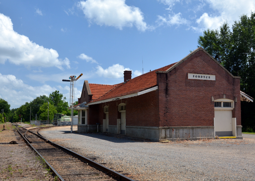
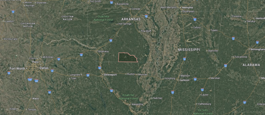
#11. Dallas County
– Life expectancy: 71.2 years
— 3.1 years lower than the state average
About
Dallas County is nestled in south-central Arkansas, where pine forests, small towns, and a deep sense of tradition define the region’s character. Anchored by the county seat of Fordyce, the area reflects a legacy built on timber, railroads, and a strong connection to the land. Its quiet roads, historic courthouses, and family-run businesses speak to a lifestyle rooted in resilience and community.
Residents value simplicity, stewardship, and shared history—gathering for local festivals, high school games, and community traditions that span generations. From forest trails to front porches, life moves at a steady, meaningful pace. Dallas County represents the enduring spirit of rural Arkansas, where heritage and neighborly ties remain at the center of daily life.
Where is Dallas County?
Dallas County, Arkansas is located in the south-central region of the state, within the timber-rich Gulf Coastal Plain. The county seat, Fordyce, lies near the center and serves as the focal point for local government, schools, and small-scale commerce. Other communities like Sparkman, Willisville, and Carthage are dispersed across a rural landscape dominated by pine forests and farmland.
Situated approximately 75 miles south of Little Rock and 60 miles northeast of El Dorado, Dallas County is known for its timber production and deep-rooted ties to southern Arkansas history. The area’s economy centers on forestry, agriculture, and wood products, while recreational sites such as Moro Bay State Park lie within reach for those seeking quiet riverside retreats and outdoor experiences.
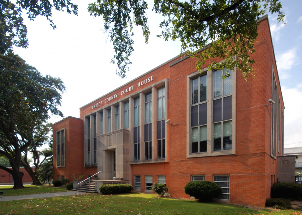
#10. Chicot County (tie)
– Life expectancy: 71.0 years
— 3.3 years lower than the state average
About
Chicot County rests in the southeastern corner of Arkansas, where the Mississippi River and Lake Chicot shape both its geography and identity. Known for its deep Delta roots, the region is defined by rich farmland, historic river towns like Lake Village, and a legacy of agriculture, trade, and resilience. Its past is visible in antebellum homes, levees, and landmarks that tell the story of Southern heritage and transformation.
Residents live in close rhythm with the land and water—fishing, farming, and gathering for local traditions that tie generations together. Life unfolds along quiet lakeshores and rural roads, grounded in connection and community. Chicot County reflects the enduring character of the Delta—rich in history, shaped by the river, and sustained by those who call it home.
Where is Chicot County?
Chicot County, Arkansas is located in the southeastern corner of the state, bordered by the Mississippi River to the east and Louisiana to the south. The county seat, Lake Village, sits along the shores of Lake Chicot, the largest natural oxbow lake in North America, and serves as the primary center for local government, tourism, and commerce. Other nearby towns include Dermott to the northwest and Eudora near the Louisiana border, all surrounded by flat delta farmland and riverbottom wetlands.
Roughly 125 miles southeast of Little Rock and about 50 miles south of Greenville, Mississippi, Chicot County is known for its rich alluvial soil, strong cotton-growing heritage, and deep connections to river trade history. The landscape is dominated by agriculture, backwater lakes, and levee systems, while Lake Chicot State Park offers fishing, boating, and birdwatching along the meandering remnants of the Mississippi River’s ancient path.
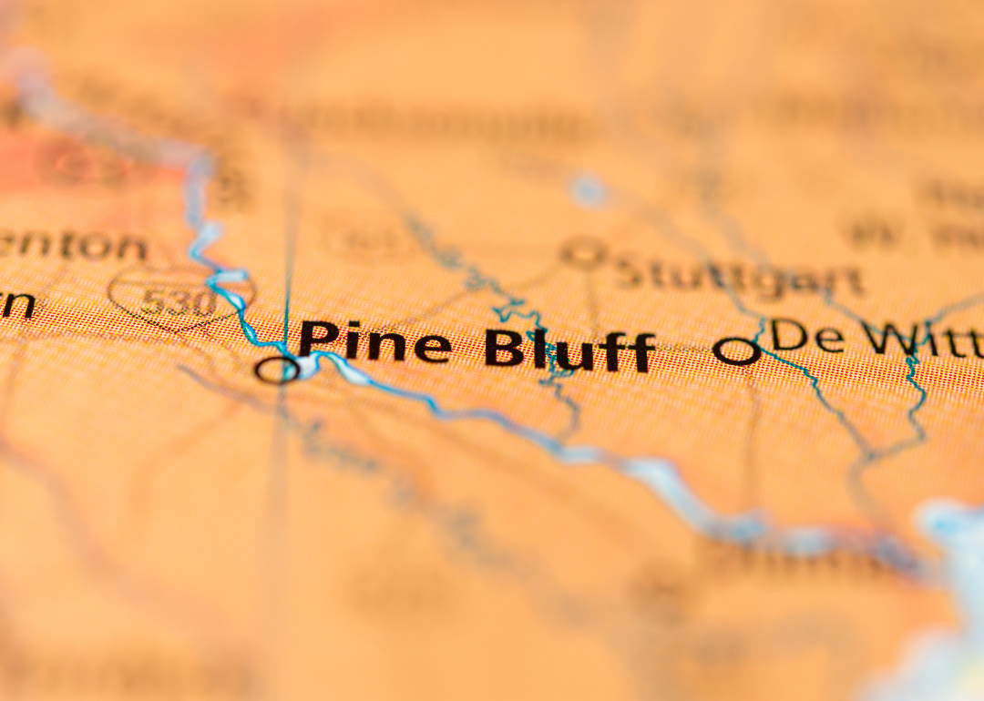
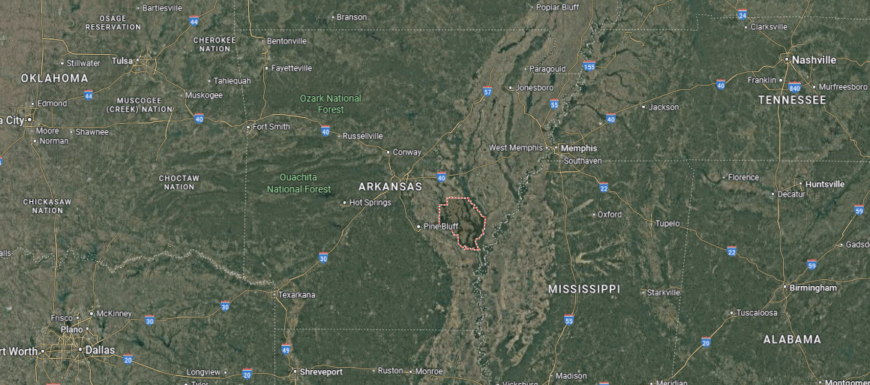
#9. Jefferson County (tie)
– Life expectancy: 71.0 years
— 3.3 years lower than the state average
About
Jefferson County lies in the heart of southeastern Arkansas, where riverfront industry, civic institutions, and cultural legacy intersect. Anchored by the city of Pine Bluff, the county blends urban energy with rural tradition—shaped by the Arkansas River, rail history, and a strong commitment to education and public service. Its identity is rooted in resilience, shaped by a past of transformation and a community that continues to adapt and endure.
Residents take part in a wide range of civic and cultural life—supporting local schools, gathering at festivals, and engaging in efforts to preserve history while shaping the future. From farmland to city blocks, life here is tied to shared experience and pride of place. Jefferson County represents a powerful blend of heritage, determination, and community spirit at the core of the Arkansas Delta.
Where is Jefferson County?
Jefferson County, Arkansas is located in the southeastern portion of the state, where the Mississippi Alluvial Plain meets the Arkansas River. The county seat, Pine Bluff, is a regional hub situated along the river and serves as the economic, educational, and cultural center of the county. Other communities include White Hall, Redfield, and Altheimer, each contributing to a mix of suburban, rural, and agricultural settings.
Approximately 45 miles southeast of Little Rock, Jefferson County is known for its historical ties to river commerce, its strong agricultural base, and its role in the development of southeastern Arkansas. The University of Arkansas at Pine Bluff (UAPB) anchors the county’s educational landscape, while the Delta Rivers Nature Center and local bayous reflect the area’s natural connection to river ecosystems, wetlands, and outdoor recreation.
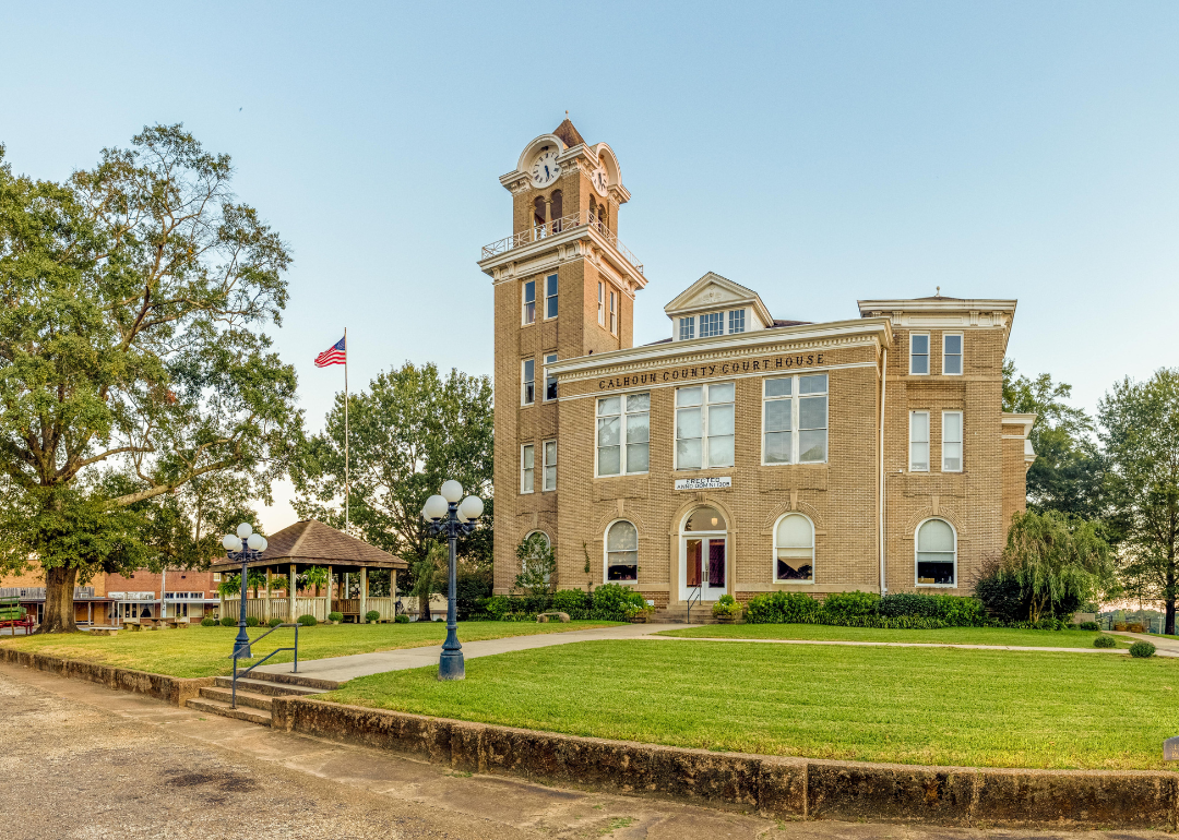
#8. Calhoun County (tie)
– Life expectancy: 70.8 years
— 3.5 years lower than the state average
You may also like: Airports using biometric facial recognition in Arkansas

About
Calhoun County rests in the quiet woodlands of southern Arkansas, where pine forests, winding backroads, and strong community ties define the rhythm of life. As one of the state’s least populated counties, it reflects a rural landscape shaped by timber, hunting traditions, and generational stewardship of the land. The town of Hampton serves as the county seat, anchoring a region where self-reliance and neighborly support remain central values.
Residents live in close connection with nature and each other—gathering for local events, working the land, and preserving a slower, more intentional way of life. From dense forests to family farms, daily life honors both tradition and the land itself. Calhoun County represents the enduring strength of rural Arkansas—quiet, rooted, and deeply committed to community.
Where is Calhoun County?
Calhoun County, Arkansas is located in the south-central region of the state, nestled within the pine forests and gently rolling terrain of the West Gulf Coastal Plain. The county seat, Hampton, lies near the center and serves as the focal point for local government, schools, and community life. Other small towns like Thornton, Harrell, and Tinsman are surrounded by dense timberlands, reflective of the county’s longstanding ties to the forestry industry.
Situated about 85 miles south of Little Rock and 30 miles northwest of El Dorado, Calhoun County is among the least populated in Arkansas, offering a quiet, rural landscape. Its economy is rooted in timber harvesting and wood processing, while rivers and bayous such as Smackover Creek provide recreational opportunities and support the area’s natural ecosystems.
#7. Union County (tie)
– Life expectancy: 70.8 years
— 3.5 years lower than the state average
About
Union County lies in southern Arkansas, where pine forests, petroleum history, and civic pride converge to shape a distinctive regional identity. Centered around El Dorado, the county reflects a legacy of boomtown energy—from early 20th-century oil discoveries to a strong tradition of commerce, culture, and innovation. The area balances industrial heritage with a growing focus on community arts, education, and revitalization.
Residents take pride in a lifestyle that honors both progress and place—supporting local festivals, preserving historic districts, and engaging in efforts to strengthen civic life. From tree-lined streets to rural backroads, life here is rich in tradition and purpose. Union County stands as a dynamic part of Arkansas’s story, where economic legacy and community spirit continue to shape the path forward.
Where is Union County?
Union County, Arkansas is located in the southern part of the state, bordering Louisiana and forming part of the Gulf Coastal Plain. The county seat and largest city, El Dorado, is a regional center for business, culture, and education, historically shaped by the oil boom of the 1920s. Other communities such as Smackover, Norphlet, and Calion are connected by timberlands, oil fields, and agricultural tracts.
Roughly 120 miles south of Little Rock and 75 miles northeast of Shreveport, Louisiana, Union County has long been known for its petroleum and chemical industries, alongside a strong forestry sector. The area is also home to arts and music festivals, historic downtown El Dorado, and access to outdoor recreation at Felsenthal National Wildlife Refuge, where rivers, sloughs, and bottomland hardwoods support fishing, hunting, and wildlife observation.
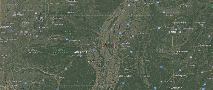
#6. Crittenden County
– Life expectancy: 70.4 years
— 3.9 years lower than the state average
About
Crittenden County sits along the eastern edge of Arkansas, where the Mississippi River and the Memphis metropolitan area shape both its economy and identity. With West Memphis as its largest city, the county blends Delta traditions with the energy of a regional crossroads—rooted in agriculture, transportation, and a history of resilience. Its location has long made it a vital link between rural Arkansas and urban opportunity.
Residents experience a blend of small-town life and metropolitan access—supporting local schools, gathering at civic events, and maintaining strong community ties. From riverfront views to farmland and neighborhoods, life here is defined by connection, adaptability, and pride in place. Crittenden County reflects a unique intersection of heritage, mobility, and enduring Delta character.
Where is Crittenden County?
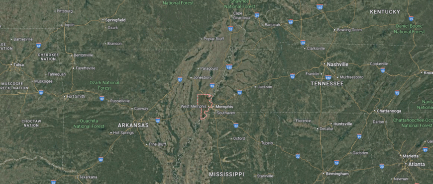
Crittenden County, Arkansas is located in the eastern part of the state, directly across the Mississippi River from Memphis, Tennessee. The county seat, Marion, sits just west of the river and shares the region’s economic and cultural ties with the Memphis metropolitan area. West Memphis, the largest city in the county, serves as a major transportation and logistics hub, while smaller communities like Earle, Crawfordsville, and Turrell are surrounded by fertile delta farmland.
Situated about 135 miles east of Little Rock and connected by Interstates 40 and 55, Crittenden County is a key gateway between Arkansas and the southeastern U.S. The area is shaped by the Mississippi River floodplain, and its economy has long relied on agriculture, river commerce, and trucking, with recent growth in warehousing and distribution. The county also offers access to riverfront parks, wetlands, and migratory bird habitats along the Mississippi Flyway.
#5. Arkansas County
– Life expectancy: 70.2 years
— 4.1 years lower than the state average
About
Arkansas County holds a special place in state history as the oldest county and home to Arkansas Post—the site of the first European settlement in the state. Nestled in the heart of the Grand Prairie and Delta regions, it is defined by fertile farmland, expansive wetlands, and a rich heritage tied to agriculture, hunting, and early frontier life. Towns like Stuttgart and DeWitt serve as anchors for both cultural tradition and economic activity.
Residents live in rhythm with the land—participating in duck hunting seasons, farming cycles, and longstanding community traditions. From historic battlegrounds to rice fields stretching to the horizon, life here is steeped in legacy and shaped by the natural environment. Arkansas County represents the deep roots of the state itself—where history, nature, and rural strength converge.
Where is Arkansas County?
Arkansas County, Arkansas is located in the southeastern part of the state, positioned within the heart of the Arkansas Delta and bordered by the White and Arkansas Rivers. Unique among counties, it has two county seats: Stuttgart in the northern district and DeWitt in the southern district. Stuttgart is known for its role in rice production and duck hunting, while DeWitt anchors the county’s southern agricultural and civic activity. Smaller communities such as Almyra, Gillett, and Humphrey are surrounded by flat, fertile farmland and wetland preserves.
Approximately 60 miles southeast of Little Rock, Arkansas County is recognized as the first county created in the Arkansas Territory, with a history tied to early French settlement and river trade. Today, it remains a major center for rice and soybean agriculture, wildlife conservation, and waterfowl tourism, with protected areas like Bayou Meto and parts of the White River National Wildlife Refuge offering rich ecological and recreational value.
#4. Lee County (tie)
– Life expectancy: 69.3 years
— 5.0 years lower than the state average
About
Lee County rests in the heart of the Arkansas Delta, where fertile farmland, historic towns, and a legacy of resilience define its identity. Anchored by the county seat of Marianna, the region has long been shaped by agriculture, civil rights history, and the strength of rural communities. Its flat landscapes and tree-lined backroads reflect generations of labor, stewardship, and deep ties to the land.
Residents find connection through local schools, churches, and shared traditions—from courthouse gatherings to harvest seasons. Life moves with a steady rhythm, grounded in family, place, and purpose. Lee County represents the enduring spirit of the Delta—rich in history, rooted in the land, and carried forward by the pride and perseverance of its people.
Where is Lee County?
Lee County, Arkansas is located in the eastern part of the state, within the rich agricultural expanse of the Mississippi Alluvial Plain and bordered by the St. Francis River to the east. The county seat, Marianna, lies near the center and serves as the main hub for local government, education, and commerce. Smaller towns such as Aubrey, LaGrange, and Haynes are scattered across the flat delta landscape, where row-crop farming remains central to daily life.
Roughly 90 miles east of Little Rock and about 60 miles southwest of Memphis, Tennessee, Lee County is defined by its historical ties to cotton agriculture, river trade, and rural heritage. The area includes access to Bear Creek Lake and portions of the St. Francis National Forest, offering quiet natural settings for fishing, hiking, and wildlife viewing in one of Arkansas’s most serene and least populated regions.
#3. Monroe County (tie)
– Life expectancy: 69.3 years
— 5.0 years lower than the state average
You may also like: Cities with the most expensive homes in Arkansas
About
Monroe County lies at the confluence of the White and Cache Rivers in eastern Arkansas, where wetlands, farmland, and history meet. With towns like Clarendon and Brinkley at its core, the county reflects a rich Delta heritage shaped by agriculture, waterways, and the enduring strength of small communities. Its landscape includes both fertile fields and ecologically significant bottomlands, offering a connection to both industry and nature.
Residents live with deep ties to the land and one another—gathering at local churches, celebrating seasonal traditions, and honoring a way of life built on resilience. From fishing along the riverbanks to walking historic downtowns, daily life moves at a meaningful, steady pace. Monroe County represents a quiet yet vital part of the Arkansas Delta, where heritage, natural beauty, and community spirit remain deeply rooted.
Where is Monroe County?
Monroe County, Arkansas is located in the east-central part of the state, where the Arkansas and White Rivers converge to shape a landscape of wetlands, fertile plains, and rich delta farmland. The county seat, Clarendon, sits along the White River and serves as the historic and civic center, while Brinkley, the largest city, lies in the northern section near the junction of Interstates 40 and 49. Other small towns like Holly Grove, Roe, and Fargo are surrounded by fields of rice, soybeans, and cotton.
Approximately 75 miles east of Little Rock and 85 miles west of Memphis, Monroe County is rooted in agriculture and known for its location within the Mississippi Flyway, a major route for migratory birds. It offers access to parts of the Cache River and White River National Wildlife Refuges, drawing hunters, birdwatchers, and nature enthusiasts to its quiet backwaters and bottomland forests.
#2. Poinsett County (tie)
– Life expectancy: 69.3 years
— 5.0 years lower than the state average
About
Poinsett County sits in northeast Arkansas, where the flatlands of the Delta meet the gentle rise of Crowley’s Ridge. Defined by its agricultural legacy, timberlands, and small-town life, the region blends natural contrasts with a strong sense of community. Towns like Harrisburg, Marked Tree, and Trumann reflect generations of farming tradition, civic pride, and connection to both land and history.
Residents live in rhythm with the seasons—planting, harvesting, and gathering for local events that tie neighbors together. From fertile fields to shaded ridgelines, life here is grounded in purpose, shaped by resilience, and enriched by shared experience. Poinsett County represents the enduring character of rural Arkansas—rooted in tradition, supported by nature, and carried forward by strong community ties.
Where is Poinsett County?
Poinsett County, Arkansas is located in the northeastern part of the state, within the Arkansas Delta and bordered to the east by the St. Francis River. The county seat, Harrisburg, sits near the western edge of Crowley’s Ridge and serves as the center of government and community life. Other key towns include Trumann, located just off Interstate 555 near Jonesboro, and Marked Tree, situated near the confluence of the St. Francis and Little Rivers.
Positioned about 85 miles northeast of Little Rock and 20 miles south of Jonesboro, Poinsett County is shaped by its blend of ridge and delta landscapes. Agriculture dominates the economy, with rice, soybeans, and cotton covering much of the flatland, while areas along Crowley’s Ridge offer upland forests and small creeks. The county also includes parts of the St. Francis Sunken Lands Wildlife Management Area, known for its wetlands, fishing, and waterfowl habitat.
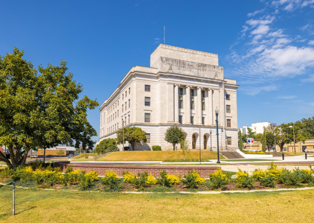
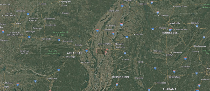
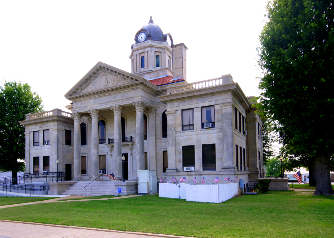
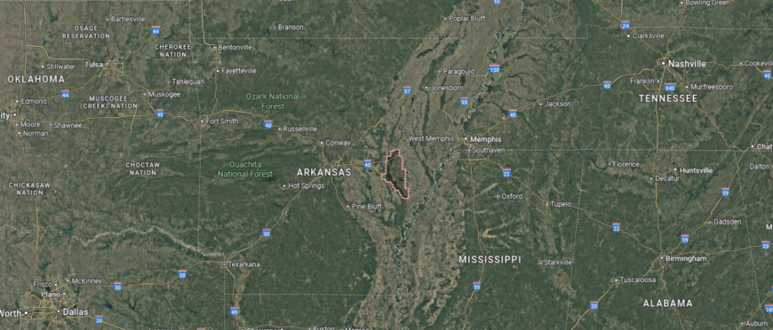
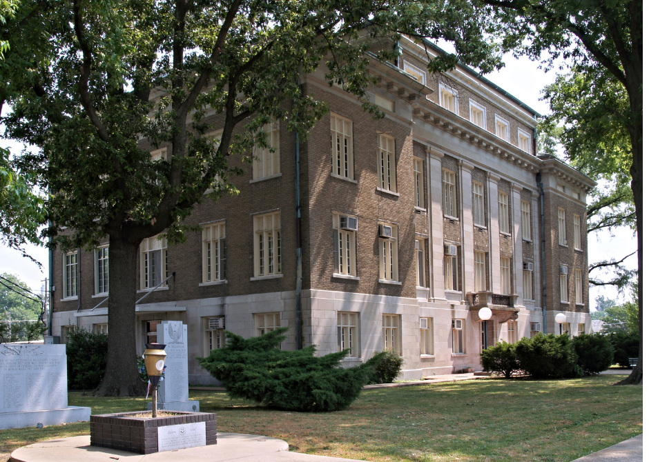
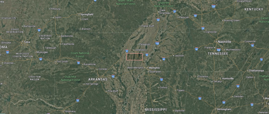
#1. Mississippi County
– Life expectancy: 68.3 years
— 6.0 years lower than the state average
About
Mississippi County lies along Arkansas’s northeastern border, where the Mississippi River and Delta farmlands have long shaped its economy, culture, and identity. Known for its strong industrial base and rich agricultural roots, the county blends the history of river commerce with modern manufacturing. Towns like Blytheville and Osceola reflect a legacy of hard work, resilience, and regional pride.
Residents experience a way of life grounded in tradition and progress—supporting local schools, participating in civic life, and maintaining deep ties to both land and community. From cotton fields to factory floors, the region honors its past while looking toward the future. Mississippi County represents a powerful intersection of heritage, industry, and the enduring strength of Arkansas’s Delta heartland.
Where is Mississippi County?
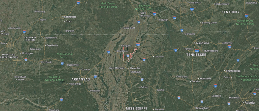
Mississippi County, Arkansas is located in the northeastern corner of the state, bordered by the Mississippi River to the east and Missouri to the north. The county has two seats: Blytheville, a regional industrial and commercial center in the north, and Osceola, a historic river town to the south. Other communities such as Manila, Leachville, and Luxora are surrounded by expansive, flat farmland that defines the region’s economy and identity.
Roughly 60 miles north of Memphis and 150 miles northeast of Little Rock, Mississippi County is a major hub for steel manufacturing, agriculture, and river transport. It lies within the Mississippi Alluvial Plain, one of the most fertile agricultural zones in the U.S., and is a top producer of soybeans, cotton, and corn. With its network of levees, grain terminals, and industrial facilities, the county blends deep delta roots with modern infrastructure and economic growth.