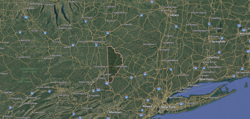
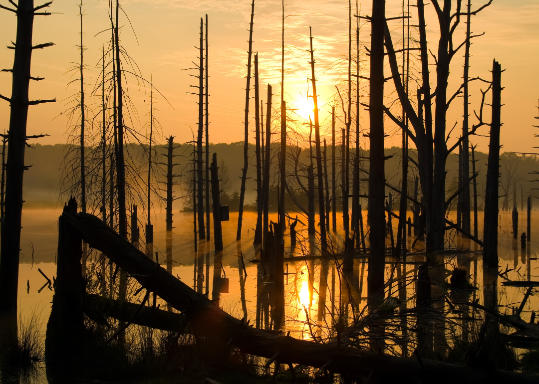
Counties with the shortest life expectancy in Pennsylvania
Life expectancy can be affected by a variety of factors. About 25% of your lifespan is determined by genetics, according to the National Library of Medicine. Health and wellness habits—like following a balanced, nutrient-rich diet; not smoking; drinking minimal alcohol; maintaining a healthy weight; and staying physically active—can add more than a decade to your life, research from the National Institutes of Health shows. While these factors are significant, another important element that you might not have considered is your environment and community.
While life expectancy generally increases annually in the United States—jumping from about 70.8 years old to 77.5 between 1970 and 2022, according to the Centers for Disease Control and Prevention—this particular metric can vary from state to state or even county to county. In some parts of the country, the average lifespan is getting shorter based on a variety of risk factors on top of health, including socioeconomic factors like poverty, unemployment, income, and education.
According to a 2020 study from researchers at Penn State, West Virginia, and Michigan State Universities, communities with a higher population density, more fast food restaurants, and a high number of extraction industry-based jobs tend to have shorter life expectancies.
To find out how life expectancy varies within Pennsylvania, Stacker used 2024 County Health Rankings & Roadmaps from the University of Wisconsin Population Health Institute to identify the counties with the shortest life expectancy. Life expectancy measures the average number of years from birth a person can expect to live and is calculated based on the number of deaths in a given time period and the average number of people at risk of dying during that period. Counties with unreliable or insufficient data were excluded from the analysis. Mortality data came from the National Vital Statistics System.
Read on to see if your county is on the list.
You may also like: Counties with the worst droughts in Pennsylvania
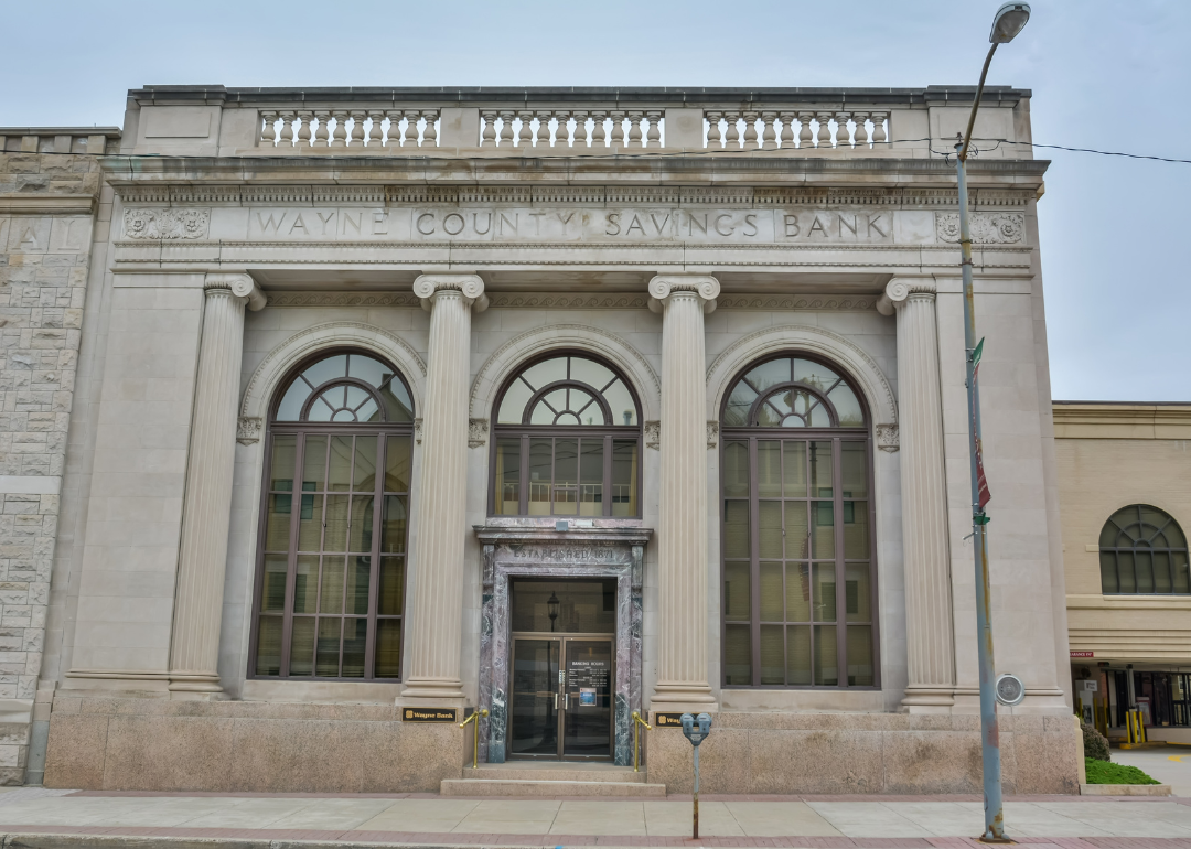
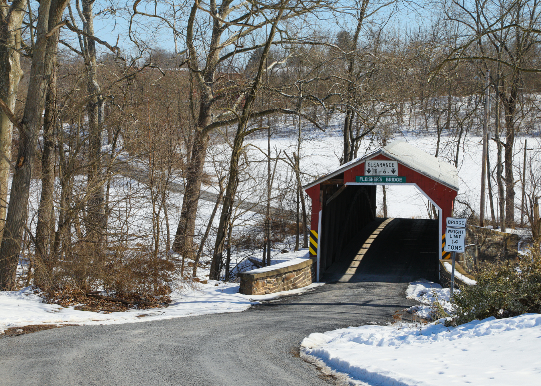
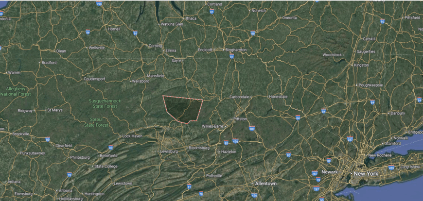
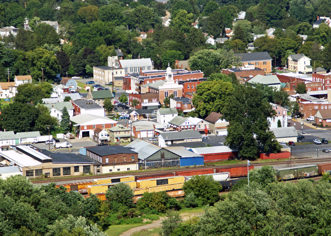
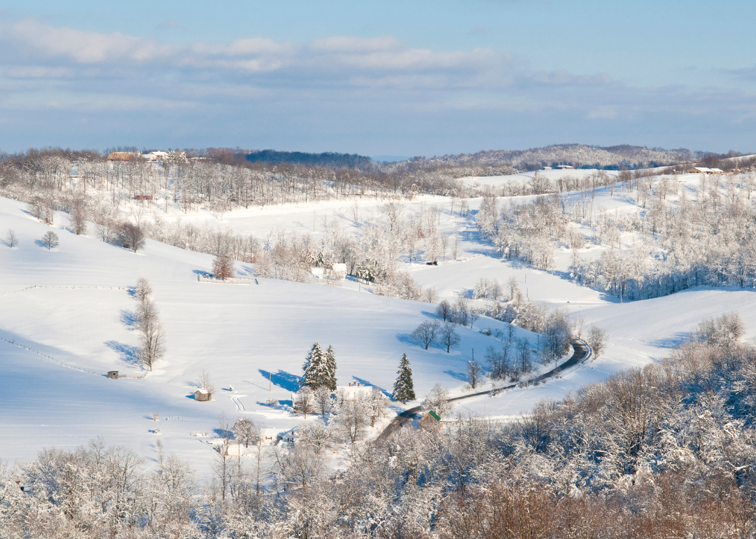
#34. Wayne County
– Life expectancy: 76.8 years
— 0.5 years lower than the state average
In order to come up with the very specific design ideas, we create most designs with the assistance of state-of-the-art AI interior design software. Also, assume links that take you off the site are affiliate links such as links to Amazon. this means we may earn a commission if you buy something.
About
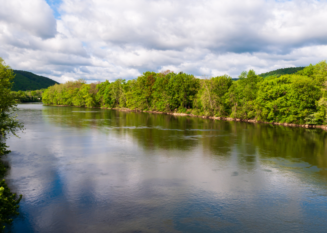
Wayne County, Pennsylvania developed as a center of rail and canal history, with Honesdale marking the place where America’s first steam locomotive ran. That legacy of innovation sits alongside a landscape of forests, lakes, and mountains that continues to define life in the county. Historic architecture and cultural traditions connect the present to a long past of settlement and industry.
Tourism now plays a major role, with the Poconos drawing visitors for recreation, while agriculture and small enterprises provide steady local support. Seasonal festivals, arts, and outdoor activities sustain both culture and economy. Wayne County stands out as a place where historic firsts and natural beauty combine to shape its identity.
Where is Wayne County?
Wayne County is situated in the northeastern corner of Pennsylvania, touching the New York state line with the Delaware River marking much of its border. It lies about 35 miles northeast of Scranton and roughly 100 miles northwest of New York City. The landscape is defined by forested hills, winding rivers, and parts of the Pocono Mountains.
Honesdale is the county seat, located near the confluence of the Lackawaxen and Dyberry Rivers. Surrounding towns such as Hawley, Waymart, and Lake Ariel provide additional centers of community and recreation. With its mix of scenic waterways and highway access, Wayne County links rural Pennsylvania to larger metropolitan areas.
#33. Perry County
– Life expectancy: 76.7 years
— 0.6 years lower than the state average
About
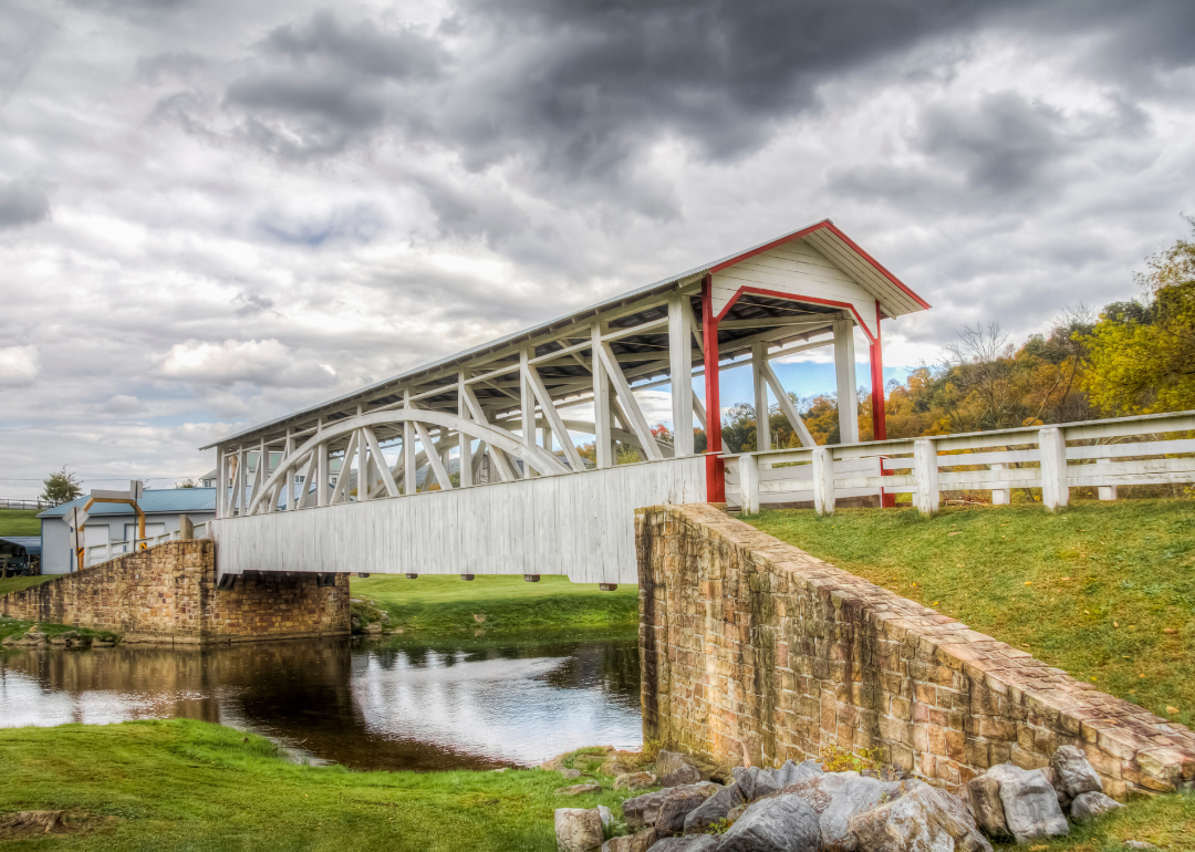
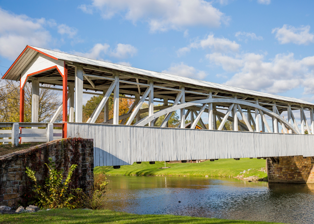
Perry County, Pennsylvania lies just north of the state capital, Harrisburg, with the Susquehanna River forming part of its border and the Appalachian ridges shaping much of its landscape. Small towns and villages are scattered across valleys and hills, with New Bloomfield serving as the county seat and a historic center of government and community life. Covered bridges, scenic byways, and preserved architecture reflect the county’s deep rural character.
Agriculture plays a steady role in the economy, with dairy farms, livestock, and crop production supporting local markets. Many residents also commute to nearby urban centers for work, linking the county’s rural identity to regional industries. Perry County blends agricultural heritage, historic charm, and its position at the edge of Pennsylvania’s mountain country.
Where is Perry County?

Perry County is located in south-central Pennsylvania, bordered by Juniata County to the northwest and Cumberland County to the south. The Susquehanna River forms its eastern boundary, separating it from Dauphin County. The terrain is largely mountainous, with parts of the Appalachian ridges running through and valleys devoted to farming.
New Bloomfield serves as the county seat and is positioned near the center of the county. Other communities such as Newport, Marysville, and Duncannon add to the county’s small-town network. With access to U.S. Routes 11/15 and proximity to Harrisburg, Perry County balances rural character with regional connections.
#32. Erie County
– Life expectancy: 76.6 years
— 0.7 years lower than the state average
About
Erie County, Pennsylvania stretches along the southern shore of Lake Erie, giving it a distinctive Great Lakes identity. Erie, the county seat, developed as a historic port city and remains a hub of culture, education, and industry for the region. Presque Isle State Park, with its beaches and trails, anchors the county’s reputation for recreation and natural beauty.
The economy is diverse, with manufacturing, healthcare, higher education, and tourism all playing major roles. The lake supports shipping and trade, while seasonal visitors boost local businesses and service industries. Erie County reflects a balance of industrial strength, natural resources, and cultural life shaped by its lakeside setting.
Where is Erie County?
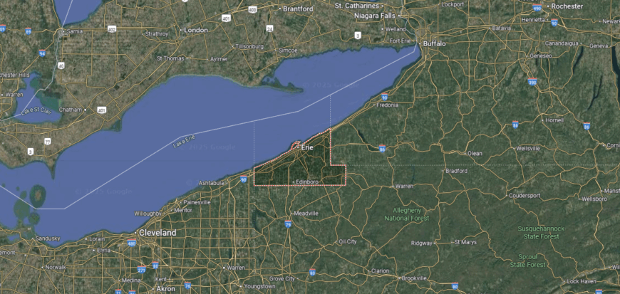
Erie County is located in the northwestern corner of Pennsylvania, bordered by Crawford County to the south and Ashtabula County, Ohio, to the west. Its northern edge lies along Lake Erie, giving the county the state’s only direct access to the Great Lakes. The terrain features a mix of lake plains, rolling farmland, and wooded hills.
Erie serves as the county seat and is the largest city, positioned on the southern shore of Lake Erie. Smaller communities such as Corry, North East, and Edinboro contribute to the county’s economic and cultural landscape. With Interstate 90 and the Port of Erie, the area serves as a key hub for trade, travel, and industry in the region.
#31. Bedford County (tie)
– Life expectancy: 76.5 years
— 0.8 years lower than the state average
About
Bedford County, Pennsylvania lies in the Allegheny Mountains, where ridges, valleys, and forests create a landscape tied closely to outdoor life. Bedford, the county seat, is known for its historic district, colonial heritage, and role as a crossroads in early American travel. Covered bridges, stone buildings, and preserved battlefields reflect a strong connection to history.
The economy combines agriculture, tourism, and small manufacturing, with farms, orchards, and artisan producers shaping its rural base. Visitors are drawn to the county’s resorts, state parks, and historic landmarks, making tourism a vital contributor. Bedford County blends mountain scenery, historic depth, and a resilient rural economy into a lasting identity.
Where is Bedford County?

Bedford County is situated in south-central Pennsylvania, bordered by Blair County to the north and Fulton County to the east. It lies along the state’s southern border with Maryland, placing it within the Allegheny Mountain region. The county’s geography is defined by forested ridges, fertile valleys, and sections of the Appalachian Mountains.
Bedford serves as the county seat and is positioned near the center of the county along major highway routes. Other communities such as Everett, Saxton, and Schellsburg add to the county’s small-town framework. With the Pennsylvania Turnpike and U.S. Route 30 passing through, Bedford County serves as a transportation link between eastern and western Pennsylvania.
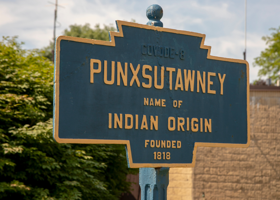
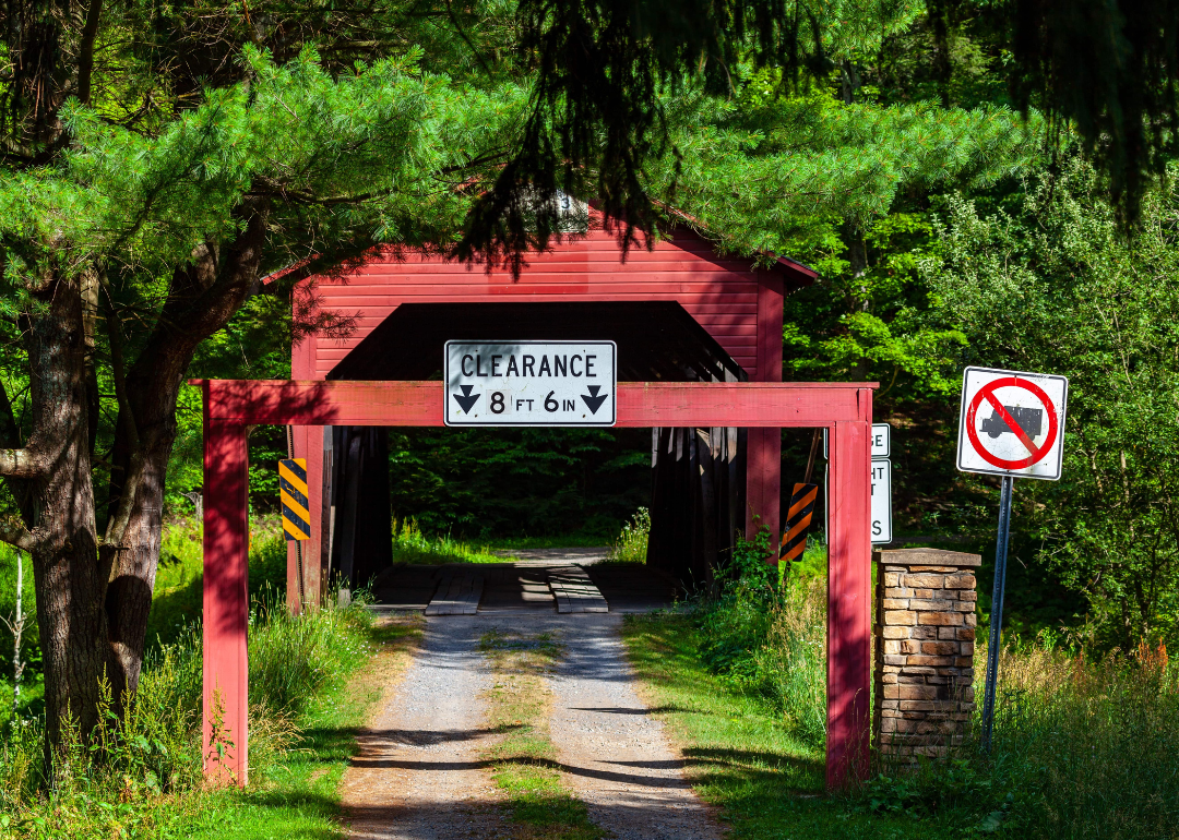
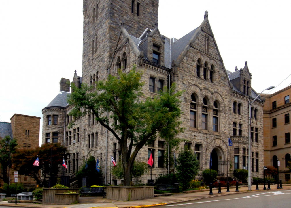
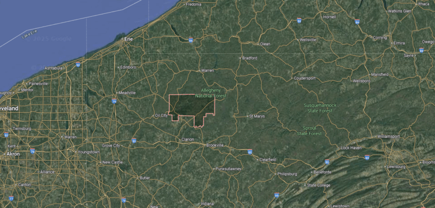
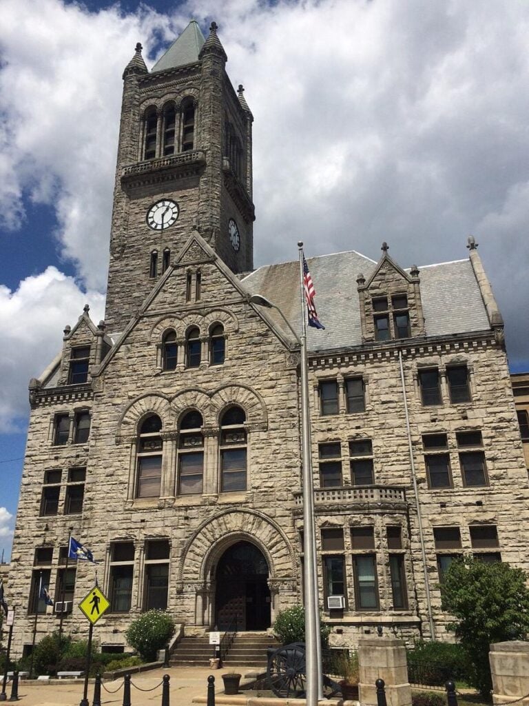
#30. Jefferson County (tie)
– Life expectancy: 76.5 years
— 0.8 years lower than the state average
You may also like: Counties with the highest rates of strokes in Pennsylvania
About
Jefferson County, Pennsylvania sits in the northwestern part of the state, where woodlands and farmland stretch across a rolling landscape. Brookville, the county seat, carries historic charm with 19th-century architecture and landmarks tied to early settlement and industry. The county is also known for its natural attractions, including Clear Creek State Park and access to the Allegheny National Forest.
Forestry and agriculture provide the economic base, with timber, dairy, and crop farming shaping local livelihoods. Manufacturing and small businesses add diversity, while outdoor recreation and tourism contribute to regional growth. Jefferson County reflects a blend of natural resources, historic character, and steady economic resilience.
Where is Jefferson County?
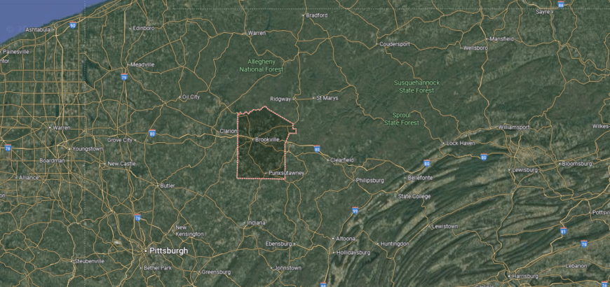
Jefferson County is located in western Pennsylvania, bordered by Elk County to the north and Indiana County to the south. It lies about 80 miles northeast of Pittsburgh and roughly 150 miles northwest of Harrisburg. The county’s landscape is made up of forested hills, river valleys, and farmland, with the Allegheny Plateau covering much of the area.
Brookville serves as the county seat and is positioned near the center of the county along Interstate 80. Other communities such as Punxsutawney, Reynoldsville, and Brockway contribute to its mix of small towns and rural life. With major highways and access to nearby state parks, Jefferson County combines natural resources with regional connectivity.
#29. Lycoming County (tie)
– Life expectancy: 76.5 years
— 0.8 years lower than the state average
About
Lycoming County, Pennsylvania is the largest county in the state by land area, stretching across the Appalachian Plateau with mountains, forests, and river valleys shaping its terrain. Williamsport, the county seat, is widely known as the birthplace of Little League Baseball, giving it international recognition and cultural pride. Historic districts, trails, and waterways highlight a blend of tradition and outdoor appeal.
The economy has roots in lumbering but today reflects a mix of healthcare, education, manufacturing, and natural gas development from the Marcellus Shale. Agriculture continues in the valleys, while tourism linked to sports and outdoor recreation adds vitality. Lycoming County combines historic influence, economic diversity, and a landscape that strongly defines its character.
Where is Lycoming County?

🔥 Would you like to save this?
Lycoming County is located in north-central Pennsylvania, bordered by Tioga County to the north and Union County to the south. It is the largest county in the state by land area, with a landscape defined by the Appalachian Mountains, dense forests, and winding river valleys. The West Branch of the Susquehanna River runs through the region, shaping both its geography and settlements.
Williamsport serves as the county seat and is the largest city, known as the home of Little League Baseball. Other communities such as Jersey Shore, Montoursville, and Muncy add to the county’s network of towns. With U.S. Route 15 and Interstate 180 providing access, Lycoming County connects rural Pennsylvania to larger state and interstate routes.
#28. Warren County
– Life expectancy: 76.4 years
— 0.9 years lower than the state average
About
Warren County, Pennsylvania developed its early reputation through the oil industry, which transformed the town of Warren into a prosperous center during the 19th century. That legacy is still visible in its historic downtown, with preserved buildings that reflect an era of growth and innovation. Beyond its history, the county is defined by the Allegheny River and the expanse of the Allegheny National Forest.
Forestry and wood products remain important, but recreation and tourism have become equally vital as visitors explore trails, waterways, and campgrounds. Manufacturing and small enterprises provide stability, linking the county’s natural resources to modern needs. Warren County represents a place where industrial heritage and outdoor landscapes continue to shape its identity.
Where is Warren County?

Warren County is located in northwestern Pennsylvania, bordered by Erie County to the west and McKean County to the east. Its northern boundary meets the state of New York, while the Allegheny River flows southward through the county. The terrain is dominated by forested hills and valleys, much of it within the Allegheny National Forest.
Warren serves as the county seat and is positioned along the Allegheny River. Other communities such as Youngsville, Sheffield, and Sugar Grove contribute to the county’s rural character. With U.S. Route 6 and scenic byways, Warren County combines natural beauty with access to nearby regions.
#27. Lackawanna County
– Life expectancy: 76.3 years
— 1.0 years lower than the state average
About
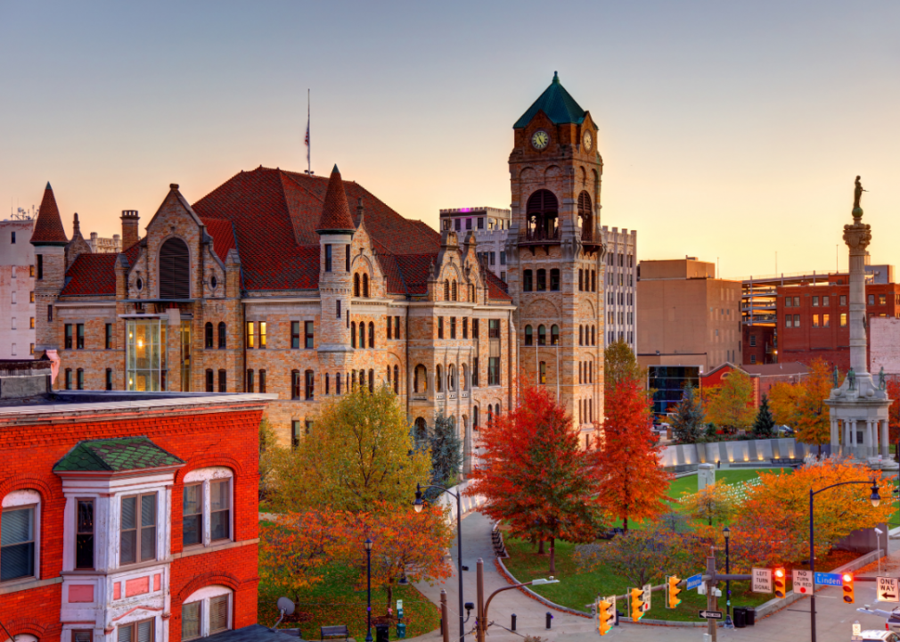
Lackawanna County, Pennsylvania is rooted in the heart of the state’s anthracite coal region, where Scranton rose as a center of railroads, mining, and early industry. Historic architecture, museums, and cultural venues reflect that industrial legacy while highlighting the city’s role in shaping modern labor movements. The surrounding landscape of valleys and hills provides both natural beauty and a reminder of the county’s rugged past.
Today, the economy has shifted from coal to a diverse base of healthcare, education, manufacturing, and services. Universities, hospitals, and cultural institutions give the county regional influence, while tourism tied to history and the Poconos adds vitality. Lackawanna County blends industrial heritage, academic presence, and economic renewal into a strong modern identity.
Where is Lackawanna County?
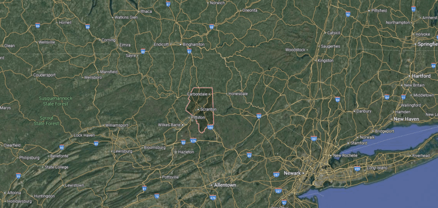
Lackawanna County is located in northeastern Pennsylvania, bordered by Susquehanna County to the north and Luzerne County to the south. It lies within the Pocono Plateau and Wyoming Valley regions, with a landscape of forested hills, valleys, and sections of the Appalachian Mountains. The Lackawanna River runs through the county, adding to its geographic identity.
Scranton serves as the county seat and is the largest city, anchoring the county’s cultural and economic life. Other communities such as Carbondale, Dickson City, and Moosic strengthen the county’s urban and suburban network. With Interstates 81, 84, and 380 intersecting the region, Lackawanna County is a major transportation hub in northeastern Pennsylvania.
#26. Fulton County (tie)
– Life expectancy: 76.2 years
— 1.1 years lower than the state average
About
Fulton County, Pennsylvania lies in the south-central part of the state, where the Appalachian ridges and valleys shape a quiet, rural setting. McConnellsburg, the county seat, anchors local life with historic buildings and ties to early American settlement along frontier routes. The county’s small size and mountain landscape have preserved a sense of seclusion and tradition.
Agriculture and forestry provide much of the economic base, with farms and timber operations supporting local markets. Small businesses and services sustain daily needs, while tourism linked to outdoor recreation and history offers additional opportunities. Fulton County reflects a balance of natural resources, rural heritage, and steady resilience.
Where is Fulton County?
Fulton County is situated in south-central Pennsylvania, bordered by Bedford County to the west and Franklin County to the east. It lies along the Maryland state line, placing it at the edge of the Allegheny Mountain region. The county’s terrain includes forested ridges, narrow valleys, and sections of state forest land.
McConnellsburg serves as the county seat and is located near the center of the county along U.S. Route 522. Smaller communities such as Needmore, Harrisonville, and Knobsville add to its rural character. With the Pennsylvania Turnpike running just north of the county, Fulton maintains access to regional travel routes while preserving a quiet, mountain setting.
#25. Clearfield County (tie)
– Life expectancy: 76.2 years
— 1.1 years lower than the state average
You may also like: Counties receiving the most SBA loans in Pennsylvania

About
Clearfield County, Pennsylvania spans a large section of the Allegheny Plateau, where forests, rivers, and rugged hills define its geography. Clearfield, the county seat, along with DuBois, serve as regional hubs, each carrying historic roots tied to coal mining, timber, and early industry. Landmarks, small towns, and preserved architecture highlight a long connection to Pennsylvania’s resource-driven past.
Coal mining and lumber once dominated the economy, but today the county relies on manufacturing, healthcare, retail, and service industries. Agriculture continues in its valleys, while outdoor recreation and tourism in the forests and parks bring added vitality. Clearfield County represents both the endurance of natural resources and the adaptability of a region shaped by change.
Where is Clearfield County?
Clearfield County is located in central Pennsylvania, bordered by Elk County to the north and Cambria County to the south. It is one of the largest counties in the state by land area, with a landscape shaped by the Allegheny Plateau, forested hills, and river valleys. The West Branch of the Susquehanna River flows through the county, influencing its geography and settlement patterns.
Clearfield serves as the county seat and is positioned near the center of the region. Other communities such as DuBois, Curwensville, and Philipsburg add to the county’s mix of towns and small cities. With Interstate 80 crossing east to west, Clearfield County is an important transportation corridor in central Pennsylvania.
#24. Washington County (tie)
– Life expectancy: 76.1 years
— 1.2 years lower than the state average
About
Washington County, Pennsylvania holds a unique place in American history as the site of the Whiskey Rebellion, linking its rolling hills and farmlands to the early struggles of a new nation. The county seat, Washington, reflects that heritage through museums, preserved architecture, and institutions like Washington & Jefferson College. Covered bridges and historic towns further add to its character, blending tradition with modern life.
Energy production plays a significant role in the economy, with natural gas from the Marcellus Shale joining agriculture and manufacturing as key contributors. Healthcare, education, and service industries provide balance, ensuring stability across the region. Washington County combines historic depth, economic diversity, and a strong rural-urban mix that defines its lasting identity.
Where is Washington County?

Washington County is located in southwestern Pennsylvania, bordered by Greene County to the south and Allegheny County to the north. It lies along the state’s border with West Virginia, about 30 miles southwest of Pittsburgh. The terrain includes rolling hills, river valleys, and farmland that form part of the Appalachian Plateau.
Washington serves as the county seat and is positioned near the center of the county. Other communities such as Canonsburg, Monongahela, and Charleroi contribute to its suburban and industrial mix. With Interstates 70 and 79 intersecting the region, Washington County serves as a key transportation and economic hub in southwestern Pennsylvania.
#23. Sullivan County (tie)
– Life expectancy: 76.1 years
— 1.2 years lower than the state average
About
Sullivan County, Pennsylvania is one of the state’s most rural areas, known for its forested plateaus, waterfalls, and quiet mountain valleys. Laporte, the small county seat, reflects a slower pace of life surrounded by state parks and natural landmarks that draw visitors seeking solitude and outdoor beauty. The county’s history is tied more to the land than to large-scale industry, giving it a distinct character within the state.
The economy leans on forestry, agriculture, and tourism, with seasonal visitors supporting local businesses through camping, hiking, and fishing. Cottage industries and small enterprises sustain the year-round population, while conservation remains an important focus. Sullivan County stands out as a place where natural resources and recreation shape both identity and livelihood.
Where is Sullivan County?
🔥 Would you like to save this?
Sullivan County is located in north-central Pennsylvania, bordered by Bradford County to the north and Columbia County to the south. It is one of the state’s least populous counties, known for its forested mountains, valleys, and numerous streams. The county is part of the Endless Mountains region, with large portions protected as state forest and game lands.
Laporte serves as the county seat and is a small community near the geographic center. Other towns and villages, including Dushore, Eagles Mere, and Forksville, add to its rural character. With scenic byways and state parks such as Worlds End, Sullivan County is a destination for outdoor recreation and natural beauty.
#22. Somerset County (tie)
– Life expectancy: 76.1 years
— 1.2 years lower than the state average
About
Somerset County, Pennsylvania rests in the Laurel Highlands, where mountains, rivers, and valleys define both its scenery and its way of life. The county seat, Somerset, reflects a long history of farming communities, frontier routes, and small-town traditions tied closely to the land. The area is also marked by historic sites such as the Flight 93 National Memorial, adding national significance to its local heritage.
The economy is grounded in agriculture, particularly dairy and livestock, while energy production—including coal and wind power—has long been part of its profile. Tourism tied to state parks, ski resorts, and outdoor recreation further strengthens the region. Somerset County blends natural beauty, historic depth, and diverse resources into a resilient identity.
Where is Somerset County?
Somerset County is located in southwestern Pennsylvania, bordered by Cambria County to the north and Fayette County to the west. It lies along the Maryland state line, with the Allegheny Mountains crossing much of the region. The terrain is marked by forested ridges, fertile valleys, and some of the state’s highest elevations, including Mount Davis, Pennsylvania’s tallest peak.
Somerset serves as the county seat and is positioned near the center of the county. Other communities such as Meyersdale, Berlin, and Windber contribute to its mix of small towns and rural settlements. With the Pennsylvania Turnpike (Interstate 76) and U.S. Route 219 running through, Somerset County is a key transportation corridor across the Appalachian region.
#21. Indiana County (tie)
– Life expectancy: 76.1 years
— 1.2 years lower than the state average
About
Indiana County, Pennsylvania gained recognition through its role in coal mining, which shaped both its economy and its communities throughout the 19th and 20th centuries. The county also carries cultural distinction as the birthplace of actor Jimmy Stewart, whose legacy is celebrated in Indiana, the county seat. Rolling farmland and wooded hills add a natural backdrop that ties the region to both work and recreation.
Today, Indiana University of Pennsylvania stands as a major influence, bringing education, research, and cultural life that extend beyond the county’s borders. Agriculture remains important, with dairy and crops contributing to the local base, while energy and small industries continue to diversify opportunities. Indiana County blends historic industry, cultural pride, and academic presence into a distinctive identity.
Where is Indiana County?

Indiana County is located in western Pennsylvania, bordered by Jefferson County to the north and Westmoreland County to the south. It lies about 60 miles northeast of Pittsburgh, with a landscape of forested hills, fertile valleys, and rolling farmland. The county is part of the Allegheny Plateau, shaped by numerous rivers and streams.
Indiana serves as the county seat and is home to Indiana University of Pennsylvania, making it both an educational and cultural hub. Other communities such as Blairsville, Clymer, and Homer City contribute to the county’s small-town framework. With U.S. Routes 22 and 119 providing major access, Indiana County maintains strong ties to nearby urban centers.
#20. Mifflin County
– Life expectancy: 76.0 years
— 1.3 years lower than the state average
You may also like: Counties with the most prewar homes in Pennsylvania
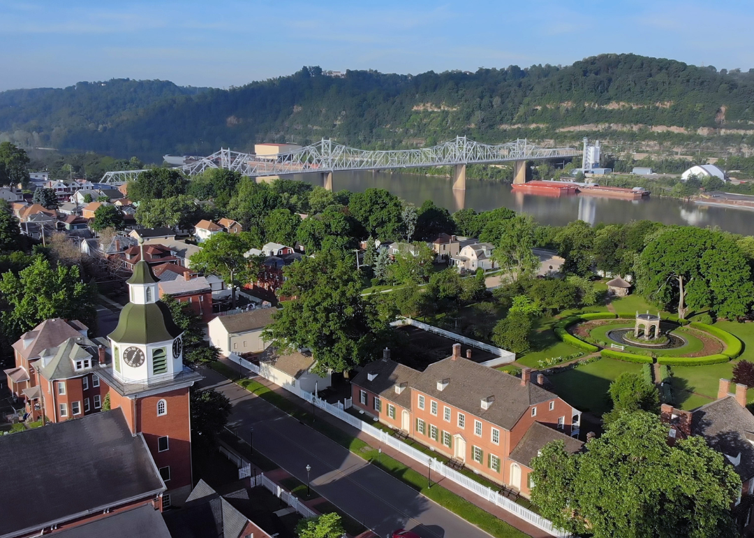
About
Mifflin County, Pennsylvania developed as a hub of early industry, with ironworks and mills along the Juniata River shaping its growth in the 18th and 19th centuries. Lewistown, the county seat, still carries that legacy in its historic districts, while the surrounding valleys reflect strong ties to farming and rural traditions. The presence of an Old Order Amish community also adds a distinctive cultural dimension to the area.
Today, the economy balances manufacturing, agriculture, and services, with small industries and local businesses supporting residents across the county. Outdoor recreation along the Juniata River and in the nearby mountains provides opportunities that connect people to the land. Mifflin County stands out for its mix of industrial heritage, agricultural strength, and cultural diversity.
Where is Mifflin County?
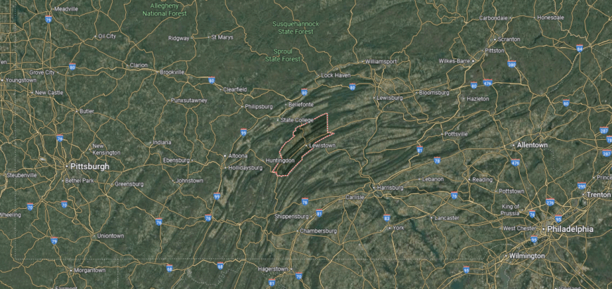
Mifflin County is located in central Pennsylvania, bordered by Huntingdon County to the west and Juniata County to the east. It lies about 65 miles northwest of Harrisburg and sits within the Juniata River valley, surrounded by ridges of the Appalachian Mountains. The county’s landscape combines fertile bottomlands along the river with steep forested slopes.
Lewistown serves as the county seat and is the largest community, positioned along the Juniata River. Smaller towns such as Burnham, Belleville, and Reedsville add to the county’s mix of industrial, agricultural, and rural life. With U.S. Route 322 and state highways crossing the area, Mifflin County connects central Pennsylvania to both State College and the Susquehanna Valley.
#19. Beaver County (tie)
– Life expectancy: 75.9 years
— 1.4 years lower than the state average
About
Beaver County, Pennsylvania sits at the confluence of the Ohio River and the Beaver River, a location that shaped its identity as a center of trade and industry. The county’s steel and manufacturing legacy still echoes in its towns, where mills once drove both local growth and national supply. Beaver, the county seat, reflects a blend of historic architecture, riverfront setting, and civic tradition.
In recent decades, the economy has shifted toward healthcare, education, retail, and small-scale manufacturing, balancing the region beyond its industrial roots. Proximity to Pittsburgh gives residents access to metropolitan opportunities while preserving a smaller community feel. Beaver County carries forward a story of adaptation—rooted in rivers, industry, and resilience.
Where is Beaver County?
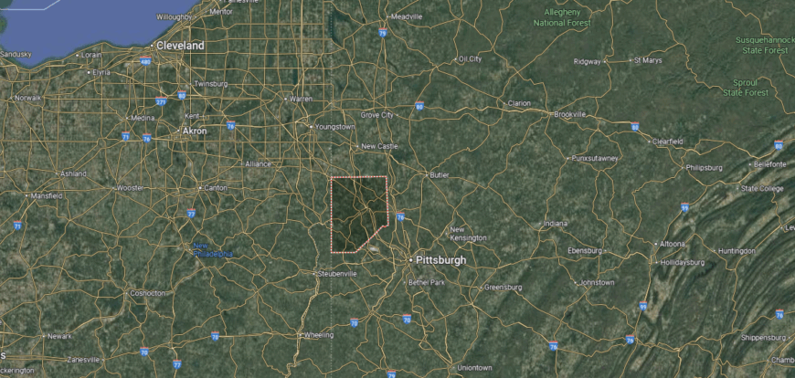
Beaver County sits in western Pennsylvania along the Ohio state line, with the Ohio River cutting across its center. It is positioned about 30 miles northwest of Pittsburgh, placing it within the greater metropolitan region. The county’s setting blends river valleys, wooded hills, and areas of industrial development.
Beaver, the county seat, is located on the north bank of the Ohio River. Other notable towns include Aliquippa, Ambridge, and Rochester, each tied historically to steelmaking and manufacturing. With Interstate 376 and the Pennsylvania Turnpike nearby, Beaver County is well connected to Pittsburgh and surrounding states.
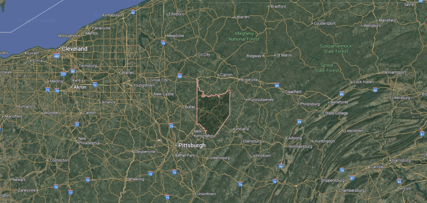
#18. Clarion County (tie)
– Life expectancy: 75.9 years
— 1.4 years lower than the state average
🔥 Would you like to save this?
About
Clarion County, Pennsylvania is best known for its wooded hills and the Clarion River, which winds through the region and provides both beauty and recreation. The county seat, Clarion, is home to PennWest Clarion (formerly Clarion University), giving the area an academic presence that shapes culture and community life. Annual events like the Autumn Leaf Festival draw visitors and highlight the county’s tradition of celebrating its natural setting.
Farming and forestry form an important part of the economy, with dairy, livestock, and timber production sustaining local livelihoods. Education, healthcare, and small industries add balance, creating stability alongside the rural base. Clarion County blends river landscapes, academic influence, and agricultural traditions into a distinctive identity.
Where is Clarion County?
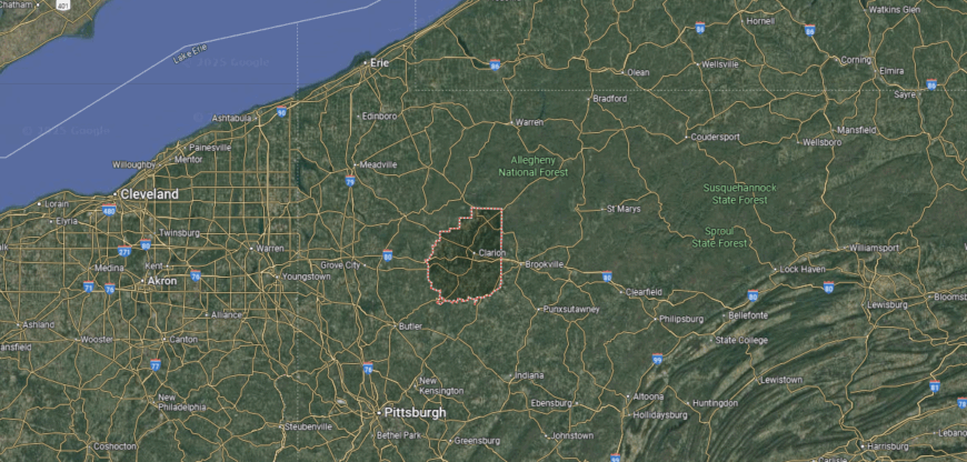
Clarion County lies in northwestern Pennsylvania, nestled between Forest County to the north and Armstrong County to the south. It is about 70 miles northeast of Pittsburgh and roughly 50 miles southeast of Erie. The Clarion River winds through the county, shaping both its geography and recreational identity.
Clarion serves as the county seat and is home to Clarion University, giving the town a strong educational presence. Surrounding communities such as Knox, New Bethlehem, and Rimersburg contribute to the county’s small-town framework. With Interstate 80 running east–west, Clarion County connects rural Pennsylvania to major travel and commerce routes.
#17. Crawford County
– Life expectancy: 75.8 years
— 1.5 years lower than the state average
About
Crawford County, Pennsylvania developed as a center of innovation, gaining national recognition when Meadville became home to the country’s first successful zipper manufacturer. Historic towns and preserved architecture reflect its industrial past, while Conneaut Lake and Pymatuning State Park showcase its natural appeal. The county’s mix of waterways, rolling farmland, and small communities gives it both character and variety.
The economy draws from manufacturing, education, and healthcare, with Allegheny College in Meadville adding cultural and academic depth. Agriculture remains steady in the rural areas, while tourism tied to lakes and outdoor recreation continues to grow. Crawford County represents a balance of historic ingenuity, educational influence, and strong ties to natural resources.
Where is Crawford County?

Crawford County is positioned in northwestern Pennsylvania, bordered by Erie County to the north and Mercer County to the south. It lies along the Ohio state line to the west and stretches eastward toward the Allegheny River watershed. The county’s landscape features rolling farmland, forested hills, and numerous lakes, including Conneaut Lake, the largest natural lake in the state.
Meadville serves as the county seat and is a historic community known for its role in Pennsylvania’s early industry. Titusville, another key town, is famous as the birthplace of the oil industry. Smaller communities such as Saegertown and Linesville add to the county’s rural and small-town character, while Interstate 79 and U.S. Route 6 keep it connected to the wider region.
#16. McKean County
– Life expectancy: 75.7 years
— 1.6 years lower than the state average
About
McKean County, Pennsylvania is tucked into the northern Allegheny Plateau, where dense forests and rugged hills have long defined its character. Bradford, the county seat, gained prominence through the oil boom of the 19th century, a legacy still remembered in its museums and historic districts. The Allegheny National Forest covers much of the county, making outdoor recreation a major part of its appeal.
Forestry, oil, and natural gas continue to play a role in the economy, alongside manufacturing and small industries. Tourism connected to the forest, the Kinzua Sky Walk, and seasonal activities supports local communities as well. McKean County blends industrial heritage, natural landscapes, and economic resilience into a distinctive identity.
Where is McKean County?

McKean County is located in north-central Pennsylvania, bordered by New York State to the north and Elk County to the south. It lies within the rugged Allegheny Plateau, where forested mountains, deep valleys, and winding rivers dominate the landscape. Large portions of the county are covered by the Allegheny National Forest, making it one of the state’s most heavily wooded regions.
Smethport serves as the county seat, set in a valley surrounded by hills. Bradford is the largest city, historically tied to the oil industry and manufacturing. Smaller communities such as Kane, Port Allegany, and Eldred add to the county’s network of towns, while U.S. Route 219 and scenic byways provide connections through its mountainous terrain.
#15. Wyoming County
– Life expectancy: 75.6 years
— 1.7 years lower than the state average
You may also like: Highest-rated things to do in Pennsylvania, according to Tripadvisor
About
Wyoming County, Pennsylvania is defined by the Susquehanna River cutting through its valleys, giving the area both scenic beauty and historic significance. Tunkhannock, the county seat, reflects small-town character with a vibrant downtown, historic homes, and cultural institutions that highlight its role as the county’s heart. The surrounding Endless Mountains add to the sense of place, offering rolling hills and outdoor escapes.
The economy draws strength from natural gas development in the Marcellus Shale, while agriculture—especially dairy farming—remains vital. Tourism also contributes, with festivals, arts, and recreation in the river valleys and mountains attracting visitors. Wyoming County represents a blend of natural resources, rural tradition, and evolving industry.
Where is Wyoming County?
Wyoming County is situated in northeastern Pennsylvania, bordered by Susquehanna County to the north and Luzerne County to the south. The Susquehanna River winds through the county, creating fertile valleys surrounded by forested hills and ridges of the Endless Mountains. Its setting blends scenic natural beauty with small farming communities and rural landscapes.
Tunkhannock serves as the county seat, located along the river in the heart of the county. Other towns and villages such as Meshoppen, Nicholson, and Factoryville contribute to its small-town network. With U.S. Route 6 crossing the region, Wyoming County maintains strong links between the northern tier of Pennsylvania and larger urban centers.
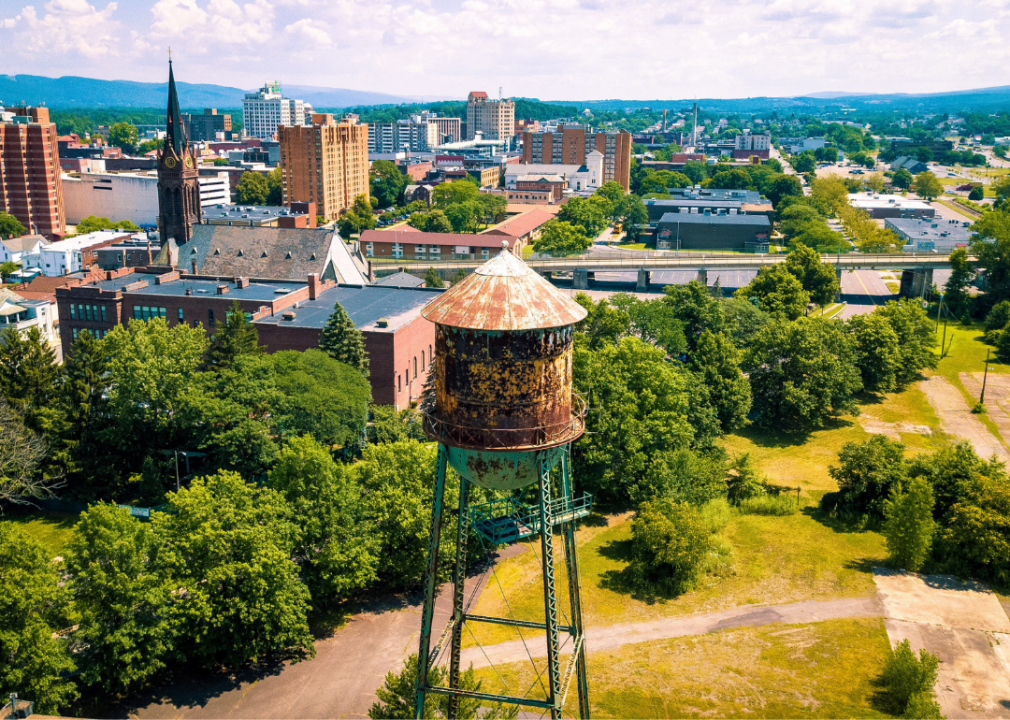
#14. Northumberland County
– Life expectancy: 75.5 years
— 1.8 years lower than the state average
About
Northumberland County, Pennsylvania rests at the meeting of the West and North branches of the Susquehanna River, a location that shaped its development as a crossroads of trade and settlement. Sunbury, the county seat, carries historic significance with its riverfront, old neighborhoods, and role as an early industrial town. The surrounding landscape of fertile valleys continues to tie the county closely to its agricultural roots.
Coal mining once dominated much of the economy, leaving a lasting mark on the region’s towns and heritage. Today, agriculture, healthcare, and manufacturing provide stability, while small businesses and cultural institutions add vitality. Northumberland County reflects a story of transition, where rivers, history, and resilience continue to shape its identity.
Where is Northumberland County?

Northumberland County is located in central Pennsylvania, bordered by Montour County to the north and Schuylkill County to the south. It lies at the confluence of the West Branch and North Branch of the Susquehanna River, which join near Sunbury to form the main stem of the river. The county’s terrain is a mix of river valleys, fertile farmland, and ridges that are part of the Appalachian Mountains.
Sunbury serves as the county seat, positioned at the meeting point of the two branches of the Susquehanna. Other significant communities include Shamokin, Mount Carmel, and Milton, each tied to the region’s coal and industrial history. With U.S. Routes 11, 15, and 61 running through, Northumberland County is a key connection point in central Pennsylvania.
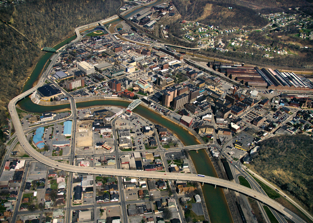
#13. Blair County
– Life expectancy: 75.4 years
— 1.9 years lower than the state average
About
Blair County, Pennsylvania grew out of the transportation age, with Altoona becoming a major hub for the Pennsylvania Railroad and a centerpiece of American rail history. The Horseshoe Curve, a National Historic Landmark, remains a symbol of that era and a key attraction for visitors. Beyond its industrial legacy, the county’s ridges and valleys offer a mix of small towns, farmland, and outdoor spaces.
Manufacturing and rail-related industries once drove the economy, but today Blair County relies on healthcare, education, retail, and small businesses for balance. Tourism tied to its rail heritage, along with cultural events and recreation, continues to support growth. Blair County blends industrial innovation, natural beauty, and modern resilience into a distinct regional identity.
Where is Blair County?
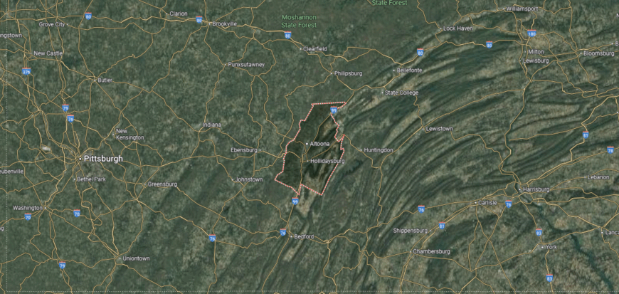
Blair County lies in central Pennsylvania, bordered by Centre County to the north and Bedford County to the south. It is set within the Ridge-and-Valley region of the Appalachians, where long mountain ridges and fertile valleys define the landscape. The Little Juniata River and Frankstown Branch of the Juniata River flow through the area, adding to its natural features.
Hollidaysburg serves as the county seat and is positioned near the geographic center. Altoona, the largest city, developed as a major railroad hub and remains central to the county’s economy and identity. Smaller towns such as Tyrone, Bellwood, and Martinsburg round out Blair County’s mix of urban, suburban, and rural communities.
#12. Armstrong County (tie)
– Life expectancy: 75.3 years
— 2.0 years lower than the state average
About
Armstrong County, Pennsylvania stretches along the Allegheny River, where steep valleys and wooded hills define much of its landscape. Kittanning, the county seat, carries historic roots tied to river trade and frontier settlement, with landmarks and preserved districts reflecting its past. The county’s rivers and trails also give it a strong reputation for outdoor recreation.
Coal mining and steel once shaped Armstrong’s economy, leaving a lasting imprint on its towns and industries. Today, manufacturing, healthcare, and small businesses provide stability, while agriculture and tourism add diversity. Armstrong County reflects a blend of historic industry, natural resources, and the steady adaptability of its communities.
Where is Armstrong County?
Armstrong County is located in western Pennsylvania, bordered by Clarion County to the north and Westmoreland County to the south. The Allegheny River flows through the county, shaping its valleys and providing both transportation routes and scenic views. Much of the terrain consists of rolling hills, forested areas, and farmland spread across the Appalachian Plateau.
Kittanning serves as the county seat, positioned on the east bank of the Allegheny River. Other towns such as Ford City, Leechburg, and Apollo add to the county’s industrial and small-town character. With U.S. Routes 422 and 28 crossing the region, Armstrong County maintains strong links to Pittsburgh and surrounding communities.
#11. Carbon County (tie)
– Life expectancy: 75.3 years
— 2.0 years lower than the state average
About
Carbon County, Pennsylvania takes its name from the coal that fueled its early rise, with towns like Jim Thorpe once serving as centers of mining and transportation. The county’s mountainous terrain and river valleys not only shaped its industrial past but also give it striking natural beauty today. Historic railroads, Victorian architecture, and preserved landmarks highlight its unique character.
While coal built its foundation, the modern economy leans on tourism, small businesses, and outdoor recreation in the Pocono Mountains. Whitewater rafting, hiking, and cultural festivals bring visitors year-round, adding vitality to the local base. Carbon County stands as a place where industrial history and natural landscapes come together to define its enduring identity.
Where is Carbon County?

Carbon County is situated in northeastern Pennsylvania, bordered by Luzerne County to the north and Lehigh County to the south. It lies within the Pocono Mountains and Blue Mountain range, giving it a rugged landscape of forested ridges, valleys, and rivers. The Lehigh River cuts through the county, shaping both its geography and its history of coal and rail development.
Jim Thorpe serves as the county seat, nestled in a valley along the Lehigh River and noted for its historic architecture. Other communities such as Palmerton, Lehighton, and Weatherly add to the county’s network of towns. With the Pennsylvania Turnpike and several scenic byways, Carbon County connects mountain landscapes with regional travel routes.
#10. Mercer County (tie)
– Life expectancy: 75.0 years
— 2.3 years lower than the state average
You may also like: Highest-rated breweries in Pennsylvania
About
Mercer County, Pennsylvania rests along the Ohio border, where rolling farmland and small towns blend with a legacy of industry and trade. Mercer, the county seat, reflects historic charm with its courthouse square, while Sharon and Hermitage have grown as larger commercial and cultural centers. The county’s setting ties it closely to both rural tradition and regional crossroads.
The economy is diverse, rooted in manufacturing, healthcare, and education, alongside agriculture that continues to shape the landscape. Retail and tourism also play a role, with outlets, local festivals, and nearby outdoor spaces adding vitality. Mercer County reflects a balance of industrial heritage, rural strength, and modern adaptability.
Where is Mercer County?
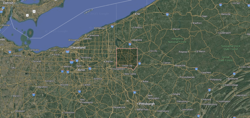
Mercer County is located in western Pennsylvania, bordered by Crawford County to the north and Lawrence County to the south. It lies along the Ohio state line, about 60 miles northwest of Pittsburgh and 80 miles southeast of Cleveland. The terrain is made up of rolling farmland, wooded hills, and river valleys tied to the Shenango River system.
Mercer serves as the county seat and is a small town positioned near the center of the county. Sharon and Hermitage are the largest communities, historically linked to steelmaking and now part of a diversified local economy. With Interstates 79 and 80 intersecting in the county, Mercer is a key transportation crossroads in the region.
#9. Venango County (tie)
– Life expectancy: 75.0 years
— 2.3 years lower than the state average
About
Venango County, Pennsylvania holds a special place in American history as the birthplace of the oil industry, with the first commercial well drilled at Titusville in 1859. Oil City and Franklin, its key towns, still carry the legacy of that boom era through museums, preserved architecture, and cultural landmarks. Forested hills and winding rivers add to the county’s identity, tying industry to a scenic setting.
Although oil shaped its beginnings, today the economy includes manufacturing, healthcare, retail, and tourism. Outdoor recreation along the Allegheny River, as well as festivals and heritage trails, supports both residents and visitors. Venango County blends historic innovation, natural resources, and steady community resilience into a lasting identity.
Where is Venango County?

Venango County is found in northwestern Pennsylvania, bordered by Crawford County to the west and Clarion County to the east. It lies about 90 miles north of Pittsburgh and sits within the Allegheny River valley. The landscape is a mix of forested hills, winding rivers, and fertile lowlands, with the Allegheny and Oil Creek shaping much of its geography.
Franklin serves as the county seat, positioned along the Allegheny River. Oil City, another major community, is historically significant as one of the birthplaces of the American oil industry. Smaller towns such as Polk and Sugarcreek add to the county’s rural and small-town fabric, while U.S. Routes 8 and 62 provide regional connections.
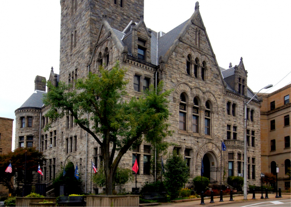
#8. Luzerne County (tie)
– Life expectancy: 75.0 years
— 2.3 years lower than the state average
About
Luzerne County, Pennsylvania sits in the heart of the Wyoming Valley, where the Susquehanna River winds through a landscape once dominated by anthracite coal mining. Wilkes-Barre, the county seat, grew rapidly during the coal era and today reflects both industrial heritage and modern renewal with its universities, cultural venues, and historic districts. Surrounding towns add depth with their own traditions, architecture, and community life.
The economy, once centered on coal, has diversified into healthcare, education, logistics, and small-scale manufacturing. Retail centers and service industries provide stability, while tourism tied to the Pocono Mountains and regional history continues to grow. Luzerne County stands as a place where historic roots, cultural vitality, and economic adaptation intersect.
Where is Luzerne County?
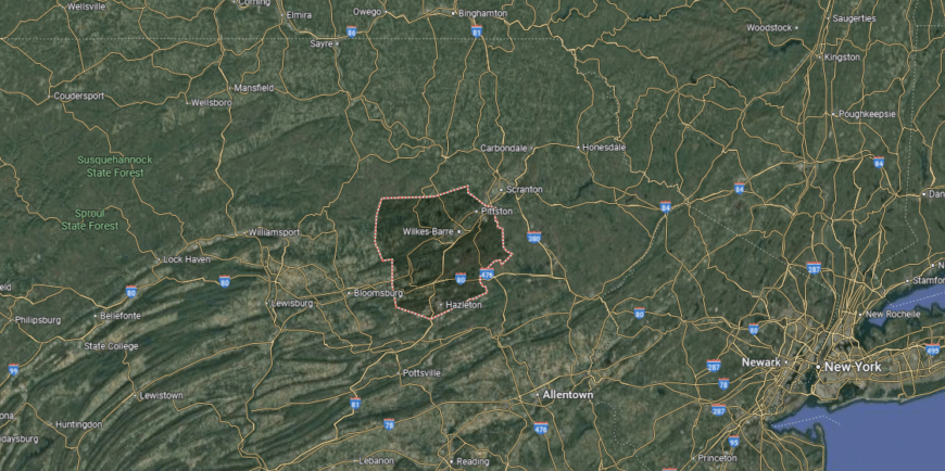
Luzerne County is located in northeastern Pennsylvania, bordered by Lackawanna County to the north and Schuylkill County to the south. It lies within the Wyoming Valley, framed by the Pocono Mountains to the east and the Appalachian ridges to the west. The Susquehanna River runs through the county, shaping its valleys and settlements.
Wilkes-Barre serves as the county seat and is one of the largest cities in the region. Hazleton, Pittston, and Nanticoke are other key communities, each contributing to the county’s industrial and cultural identity. With Interstates 80 and 81 crossing the area, Luzerne County is a major hub of transportation in northeastern Pennsylvania.
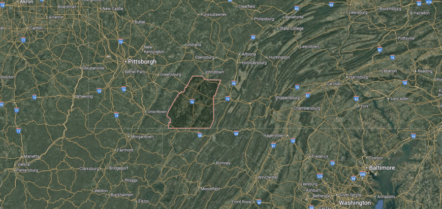
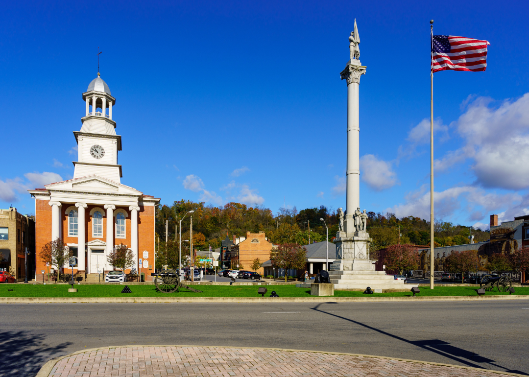
#7. Cambria County
– Life expectancy: 74.9 years
— 2.4 years lower than the state average
About
Cambria County, Pennsylvania rose during the height of the steel and coal industries, with Johnstown at its center becoming a symbol of both industrial might and resilience. The city’s history is marked by the Johnstown Floods, remembered through museums and memorials that honor stories of perseverance. Beyond industry, the county’s ridges, rivers, and valleys create a landscape tied to both work and recreation.
While steel once defined its economy, Cambria County today relies on healthcare, education, manufacturing, and service industries. Tourism connected to its industrial heritage, cultural festivals, and outdoor opportunities also supports growth. Cambria County reflects a balance of historic endurance, economic transition, and community spirit shaped by its mountain setting.
Where is Cambria County?

Cambria County is situated in west-central Pennsylvania, bordered by Clearfield County to the north and Somerset County to the south. It lies within the Allegheny Plateau, where steep hills, deep valleys, and forested ridges dominate the landscape. The county’s rivers and streams feed into both the Susquehanna and Ohio River watersheds, giving it a diverse terrain.
Ebensburg serves as the county seat and is positioned near the geographic center. Johnstown, the largest city, is known for its industrial heritage and the historic floods that shaped its history. Other communities such as Nanty Glo, Cresson, and Portage contribute to Cambria County’s mix of small towns and mountain settlements.
#6. Lawrence County
– Life expectancy: 74.7 years
— 2.6 years lower than the state average
About
Lawrence County, Pennsylvania is located in the western part of the state, where the Shenango River and rolling farmland frame both town and countryside. New Castle, the county seat, earned recognition as the “Fireworks Capital of America,” reflecting a unique industrial heritage that still sparks local pride. Historic neighborhoods, cultural institutions, and nearby Amish communities add depth to the county’s character.
The economy combines manufacturing, healthcare, and education with agriculture that remains central in its rural areas. Small businesses and retail centers support local growth, while tourism tied to festivals, outdoor recreation, and heritage sites contributes vitality. Lawrence County blends industrial tradition, cultural variety, and steady economic resilience into a lasting identity.
Where is Lawrence County?

Lawrence County is located in western Pennsylvania, bordered by Mercer County to the north and Beaver County to the south. It sits along the Ohio state line, about 50 miles northwest of Pittsburgh and 20 miles east of Youngstown, Ohio. The terrain includes river valleys, rolling farmland, and wooded hills typical of the Appalachian Plateau.
New Castle serves as the county seat and is the largest community, historically tied to manufacturing and industry. Other towns such as Ellwood City, Bessemer, and Wampum contribute to the county’s small-town and rural character. With Interstates 79 and 376 providing access, Lawrence County is well connected to Pittsburgh and northeastern Ohio.
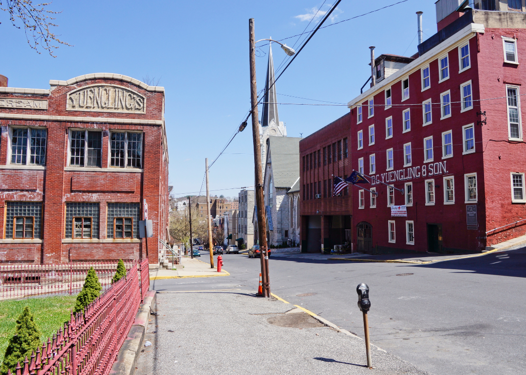
#5. Schuylkill County
– Life expectancy: 74.6 years
— 2.7 years lower than the state average
You may also like: Fastest-growing jobs in Pennsylvania
About
Schuylkill County, Pennsylvania grew out of the anthracite coal boom, with mining towns and railroads once driving its rapid expansion. Pottsville, the county seat, reflects that heritage in its historic downtown and landmarks like America’s oldest brewery, Yuengling, which remains a point of pride. The surrounding ridges and valleys of the Appalachian Mountains give the county a dramatic natural setting.
Coal shaped its early economy, but today Schuylkill relies on manufacturing, logistics, agriculture, and small businesses to sustain growth. Outdoor recreation, from trails and parks to hunting and fishing, also contributes to local life and tourism. Schuylkill County blends industrial history, natural landscapes, and economic adaptability into a distinct regional identity.
Where is Schuylkill County?

Schuylkill County is located in eastern Pennsylvania, bordered by Northumberland County to the north and Berks County to the south. It lies within the Appalachian Mountains, with ridges and valleys running through much of the county. The Schuylkill River begins in the area, flowing southeast toward Philadelphia.
Pottsville serves as the county seat and is historically known for its role in Pennsylvania’s anthracite coal region. Other communities such as Tamaqua, Shenandoah, and Mahanoy City reflect the county’s mining heritage and small-town character. With Interstate 81 and U.S. Route 209 passing through, Schuylkill County connects the coal region to larger markets and cities across the state.
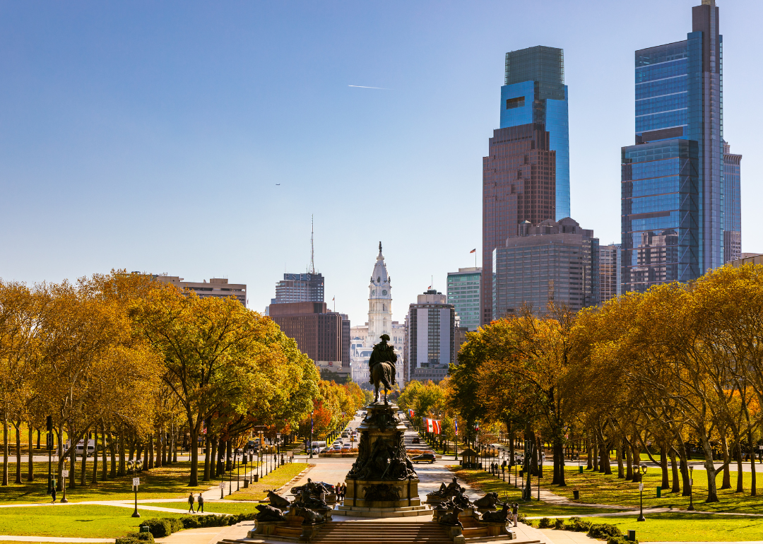
#4. Philadelphia County
– Life expectancy: 74.5 years
— 2.8 years lower than the state average
About
Philadelphia County, Pennsylvania sits along the Delaware and Schuylkill Rivers, a setting that has long shaped its growth as both a port and a crossroads of culture. The county is synonymous with the city of Philadelphia, where historic streets, vibrant neighborhoods, and a rich artistic scene define its everyday rhythm. Landmarks like the Liberty Bell, Independence Hall, and sprawling urban parks highlight the layers of heritage and community life.
Its economy is broad, fueled by education, healthcare, technology, finance, and tourism, with global institutions and local businesses working side by side. Universities and medical centers bring international recognition while sustaining thousands of jobs. Philadelphia County stands as a place where waterways, history, and modern energy converge to create one of America’s most dynamic urban identities.
Where is Philadelphia County?
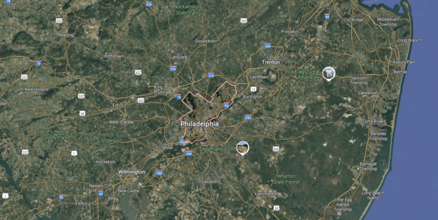
Philadelphia County is located in southeastern Pennsylvania along the Delaware River, directly bordering the state of New Jersey to the east. It is the most populous county in Pennsylvania and is unique in that it is completely consolidated with the City of Philadelphia. The geography includes riverfront lowlands, densely developed urban areas, and portions of Fairmount Park, one of the largest urban park systems in the nation.
Philadelphia serves as both the county seat and the state’s largest city, functioning as a major center for history, culture, and commerce. Surrounding neighborhoods such as Germantown, Kensington, and South Philadelphia each add distinct character to the county’s urban landscape. With Interstates 76, 95, and a major international airport, Philadelphia County is a central hub of transportation for the entire northeastern United States.
#3. Greene County
– Life expectancy: 74.4 years
— 2.9 years lower than the state average
About
Greene County, Pennsylvania sits in the state’s southwestern corner, defined by its rolling hills and location within the Appalachian Plateau. Waynesburg, the county seat, reflects the area’s historic roots, with connections to early American settlement and a tradition of courthouse-centered civic life. Covered bridges, rural landscapes, and ties to regional history give the county a distinctive character.
The economy has long been influenced by coal mining and natural gas, industries that shaped its communities and workforce. Agriculture, including livestock and crop production, remains an important part of the local base, while healthcare and small businesses add stability. Greene County represents a place where natural resources, history, and economic resilience continue to guide its identity.
Where is Greene County?
Greene County is located in the southwestern corner of Pennsylvania, sharing its southern border with West Virginia. It lies about 60 miles south of Pittsburgh and is part of the Appalachian Plateau region, where rolling hills and wooded ridges shape the landscape. The county is known historically for coal mining and its role in the early development of the state’s energy industry.
Waynesburg serves as the county seat and is positioned near the center of the county. Smaller communities such as Carmichaels, Jefferson, and Greensboro contribute to its rural network. With major routes like Interstate 79 providing access, the area connects to Pittsburgh while maintaining its agricultural and small-town setting.
#2. Forest County
– Life expectancy: 73.6 years
— 3.7 years lower than the state average
About
Forest County, Pennsylvania developed around its abundant timber, which gave the area both its name and its early economic lifeblood. Towns like Tionesta grew as centers of logging and river trade, leaving behind a heritage tied directly to the land. Today, much of the county remains covered in forest, creating a rare sense of quiet and open space.
Modern life here leans on a blend of natural gas, tourism, and small-scale businesses that sustain the local economy. The Allegheny River and surrounding forests provide opportunities for boating, hiking, and seasonal festivals that connect people to nature. Forest County endures as a place where history, industry, and wilderness are closely bound together.
Where is Forest County?
Forest County is located in northwestern Pennsylvania, bordered by Warren County to the north and Clarion County to the south. It is one of the least populated counties in the state, with vast stretches of the Allegheny National Forest covering much of its land. The terrain features wooded hills, river valleys, and streams, making it rich in natural resources and outdoor recreation.
Tionesta serves as the county seat, positioned along the Allegheny River. Marienville, another notable community, sits in the eastern part of the county and provides access to trails and forest lands. With its limited development and abundant public land, Forest County is a destination for hunting, fishing, and nature tourism.
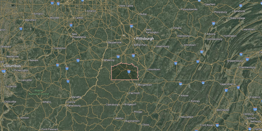
#1. Fayette County
– Life expectancy: 73.4 years
— 3.9 years lower than the state average
About
Fayette County, Pennsylvania lies in the Laurel Highlands, where mountain ridges, valleys, and rivers frame both its history and modern life. Uniontown, the county seat, grew as a hub for coal and steel, industries that once drove the region’s prosperity and left lasting cultural marks. The county also holds national significance as home to Fort Necessity, tying it to the earliest chapters of American history.
Today, the economy reflects a mix of healthcare, education, retail, and tourism, with natural gas adding another layer of importance. Outdoor attractions, from Ohiopyle State Park to Frank Lloyd Wright’s Fallingwater, draw visitors from across the country. Fayette County stands at the intersection of history, natural beauty, and economic transition, giving it a character that continues to evolve.
Where is Fayette County?

Fayette County is situated in southwestern Pennsylvania, bordered by Westmoreland County to the north and Greene County to the west. It lies along the state’s southern boundary with Maryland and West Virginia, set within the rugged terrain of the Allegheny Mountains. The county’s landscape includes forested ridges, river valleys, and sections of the Youghiogheny and Monongahela Rivers.
Uniontown serves as the county seat and is located near the center of the county. Other communities such as Connellsville, Brownsville, and Point Marion add to its industrial and small-town framework. With major highways like U.S. Route 40, known as the National Road, and Interstate 70 nearby, Fayette County connects Appalachian communities to larger metropolitan areas.
This story features data reporting by Karim Noorani, writing by Kiersten Hickman, and is part of a series utilizing data automation across 49 states.
By Stacker