🔥 Would you like to save this?

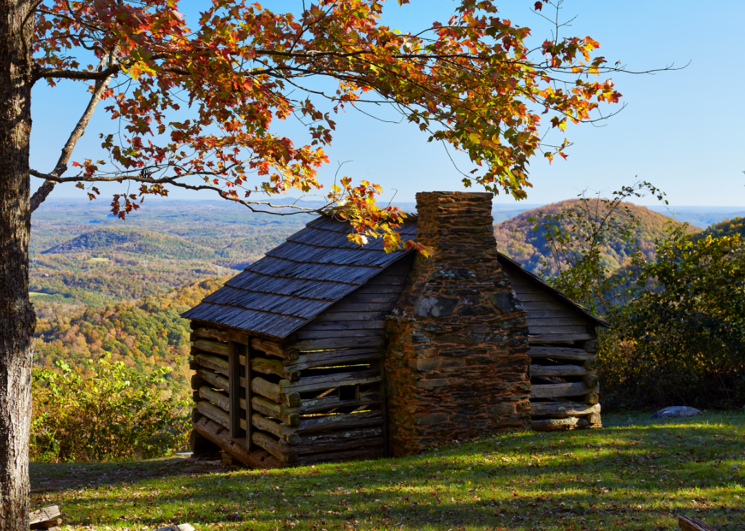
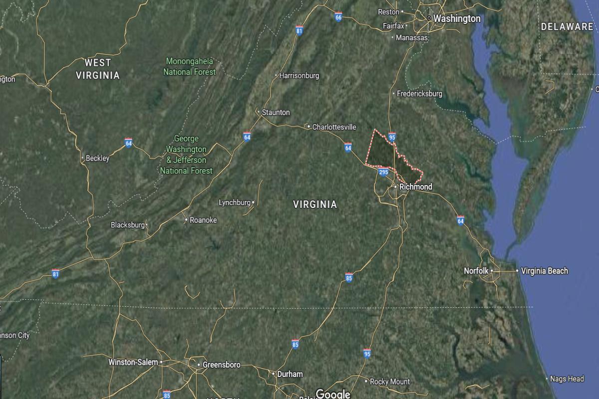
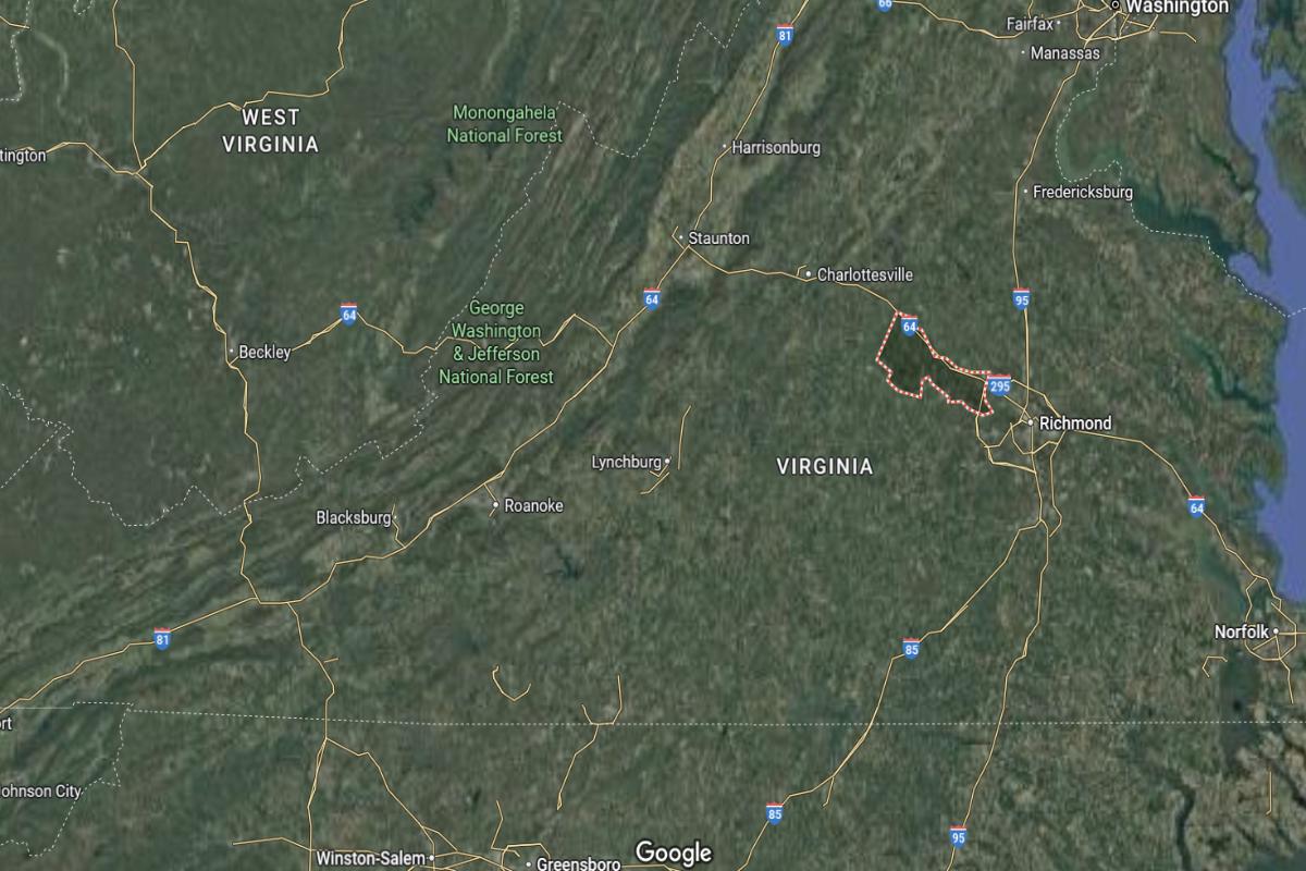
Best counties to live in Virginia
More counties in the United States experienced population growth in the last year, according to the latest Census data, even as pandemic-related moving trends begin to normalize.
Counties in the South continued to experience growth, particularly in Florida, where 96% of its 67 counties gained new residents. Polk County, Florida, a suburb of Orlando, added the most, with 26,000 people moving there in 2023.
In order to come up with the very specific design ideas, we create most designs with the assistance of state-of-the-art AI interior design software.
Meanwhile, counties in the Midwest and Northeast continued to lose population, but at slower rates than the year before. Some of the biggest losses were in counties home to large cities, including Cook County, Illinois (home of Chicago) and the boroughs of Brooklyn and Queens in New York.
Many counties are experiencing growth due to their job opportunities, education, or relatively affordable housing costs. Others are favored for their historic or well-designed downtowns or access to cultural opportunities.
Stacker compiled a list of the best counties to live in Virginia using rankings from Niche. Niche ranks counties by various factors including public schools, educational attainment, cost of living, and housing.
Keep reading to see if your county made the list.
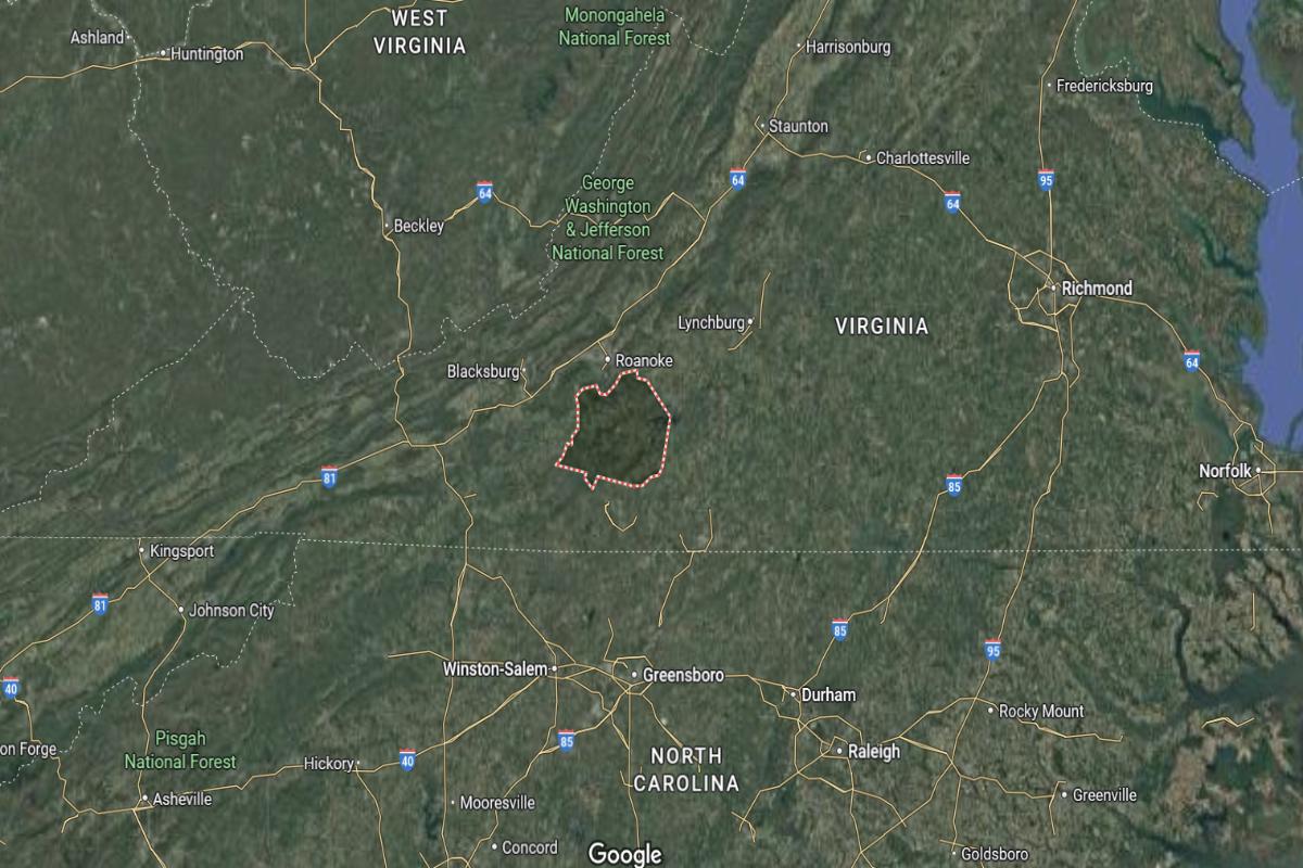
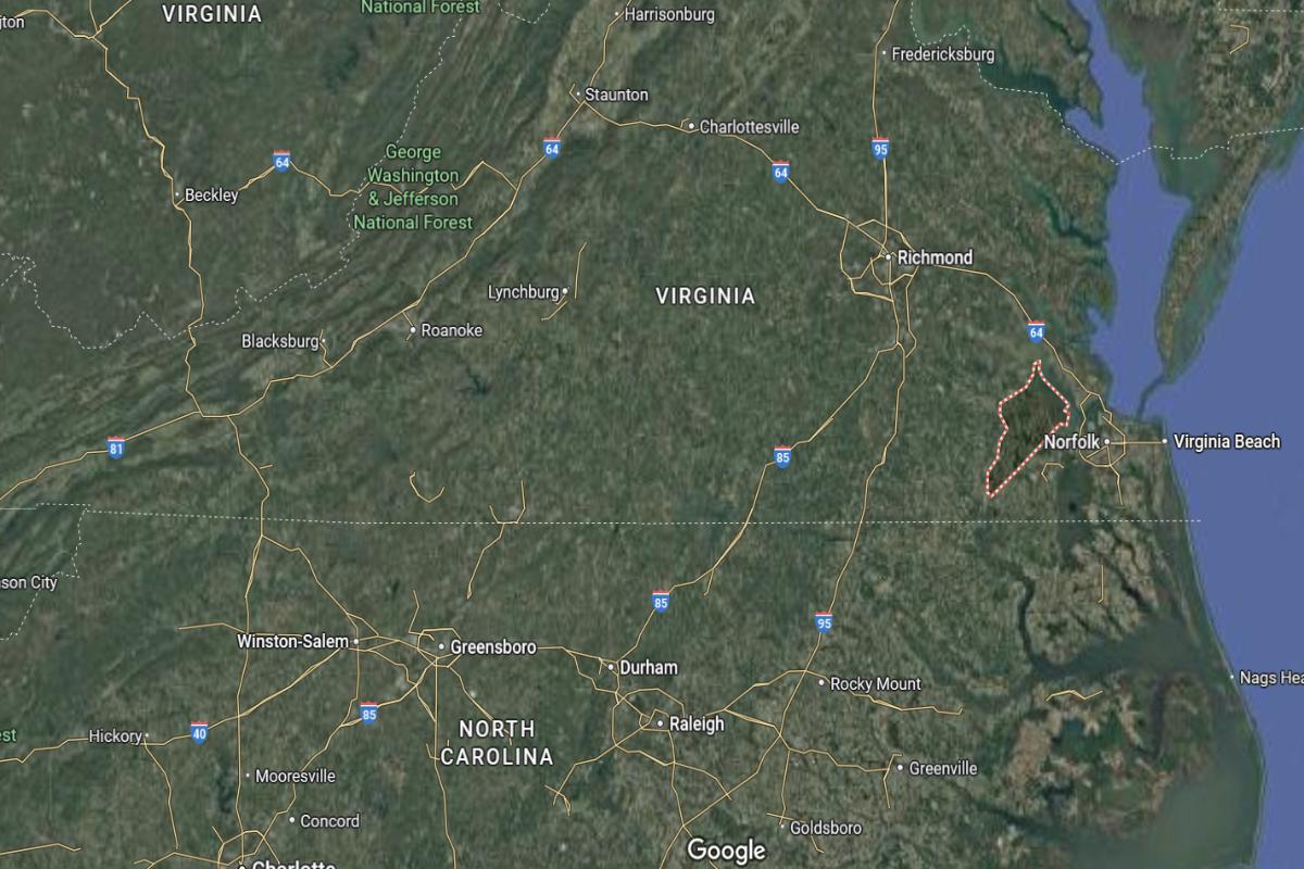
#30. Mecklenburg County, Virginia
– Overall Rank: 878
– Population: 30,367
– Median household income: $51,265
– Median home value: $157,800 (71% own)
– Median rent: $784 (29% rent)
– Top public schools: Bluestone Middle School (grade B+), Park View Middle School (grade B), South Hill Elementary School (grade B)
– Top private schools: First Christian School (grade unavailable), RIVERMONT SCHOOL – CHASE CITY (grade unavailable)
– Top places: South Hill (grade B+), Chase City (grade B), Clarksville (grade A minus)
About
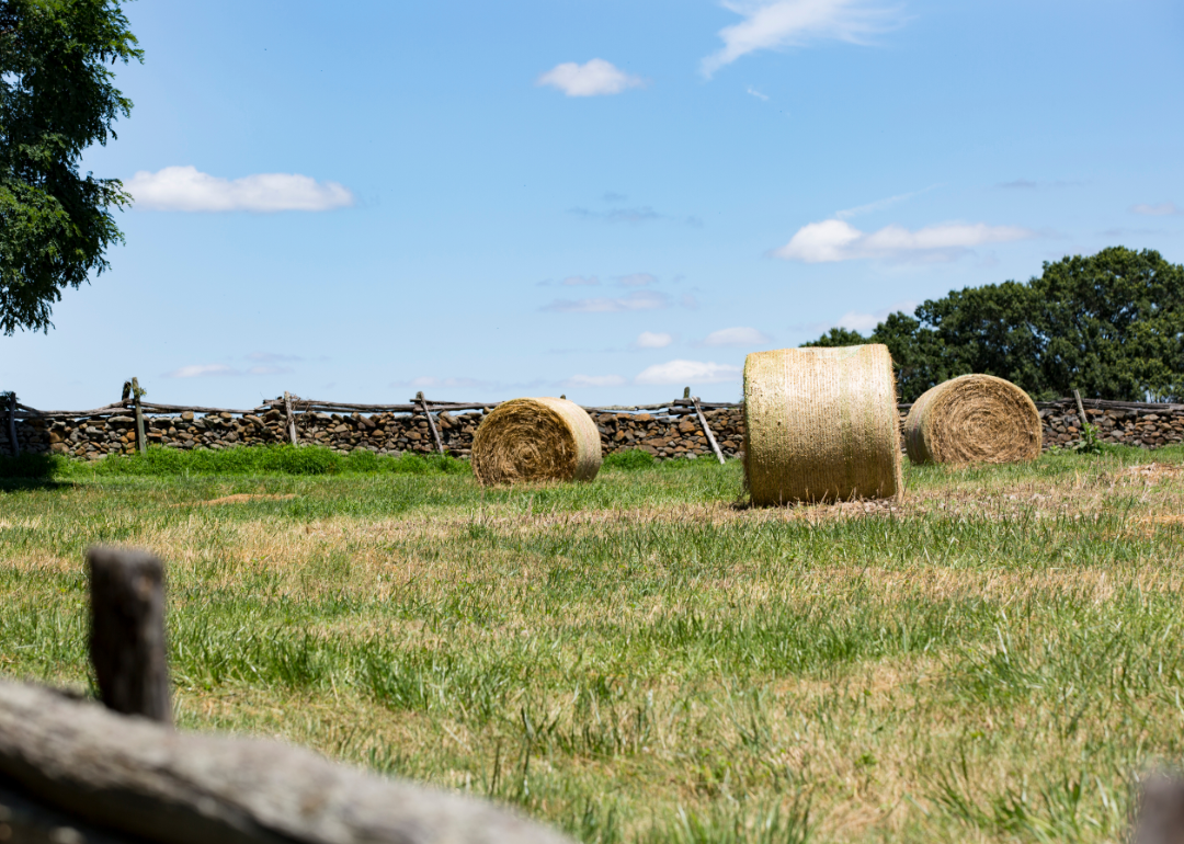
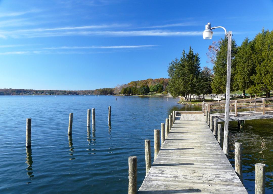
Mecklenburg County, Virginia is rooted in agriculture, manufacturing, and a growing tourism sector that draws from its natural and historical resources. The local economy is supported by farming, light industry, and outdoor recreation, with small towns providing a strong sense of community. Residents take pride in their heritage, with active participation in schools, events, and civic life.
Lakes, parks, and rural landscapes offer opportunities for boating, fishing, and nature exploration. Historical landmarks and festivals celebrate the county’s colonial and Civil War history, preserving its cultural legacy. With a balance of tradition, scenic charm, and economic stability, Mecklenburg County offers a peaceful and connected way of life.
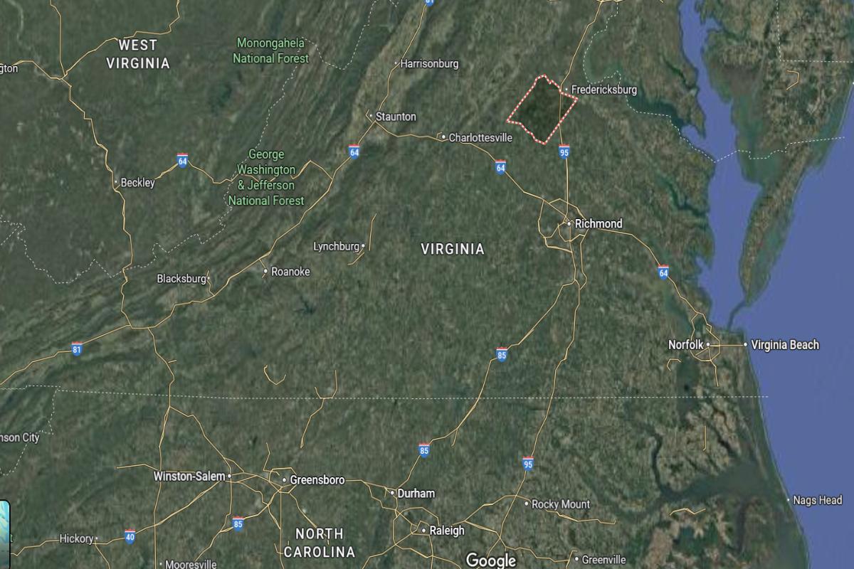
Where is Mecklenburg County?
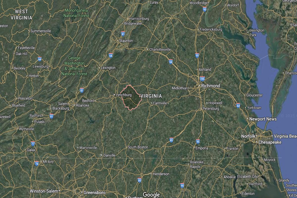
Mecklenburg County, Virginia, is located in the south-central part of the state, approximately 90 miles southwest of Richmond and about 80 miles northeast of Durham, North Carolina. The county seat, Boydton, lies near U.S. Highway 58 and is about 15 miles north of the North Carolina border. It is also around 65 miles west of Petersburg.
The county is roughly 100 miles southeast of Lynchburg and about 150 miles east of Roanoke. Mecklenburg County is approximately 160 miles south of Washington, D.C. Its location places it near the Kerr Lake region, offering access to both rural and recreational areas in southern Virginia.
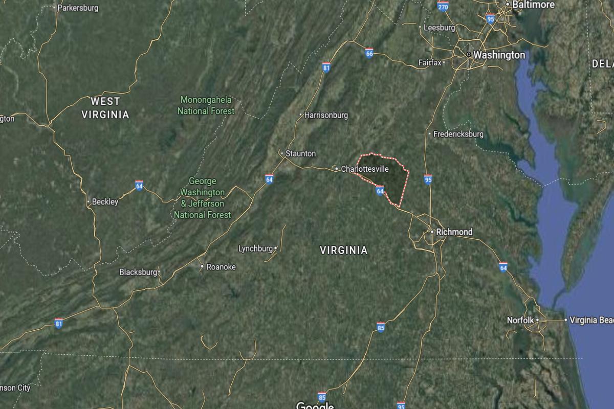
#29. Fluvanna County, Virginia
– Overall Rank: 820
– Population: 27,442
– Median household income: $90,766
– Median home value: $270,900 (88% own)
– Median rent: $1,363 (12% rent)
– Top public schools: Fluvanna Middle School (grade B), Fluvanna County High School (grade B), Central Elementary School (grade B minus)
– Top private schools: Fork Union Military Academy (grade A), Effort Christian School & Preschool (grade unavailable), Open Door Christian School (grade unavailable)
– Top places: Lake Monticello (grade A), Palmyra (grade C minus)
About
Fluvanna County, Virginia blends rural character with steady residential growth, supported by agriculture, small businesses, and local services. The community values education, volunteerism, and a strong sense of civic pride, reflected in its schools and local events. Residents enjoy a quiet, close-knit lifestyle with access to essential amenities.
Scenic countryside, forests, and rivers provide space for outdoor recreation and relaxation. Historic landmarks and preserved architecture highlight the county’s deep roots in early American history. With a focus on heritage, community, and natural beauty, Fluvanna County offers a balanced and welcoming environment.
Where is Fluvanna County?
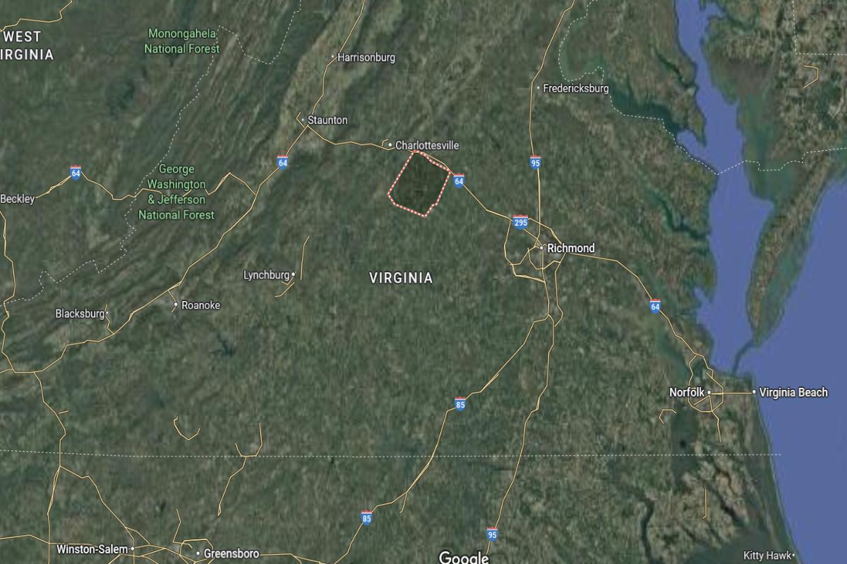
Fluvanna County, Virginia, is located in the central part of the state, approximately 25 miles southeast of Charlottesville and about 60 miles west of Richmond. The county seat, Palmyra, lies near U.S. Route 15 and is around 40 miles north of Farmville. It is also about 90 miles northwest of Norfolk.
The county is roughly 120 miles southwest of Washington, D.C., and about 100 miles northeast of Lynchburg. Fluvanna County is approximately 80 miles south of Fredericksburg. Its location places it within reach of major cities while maintaining a rural and historic character.
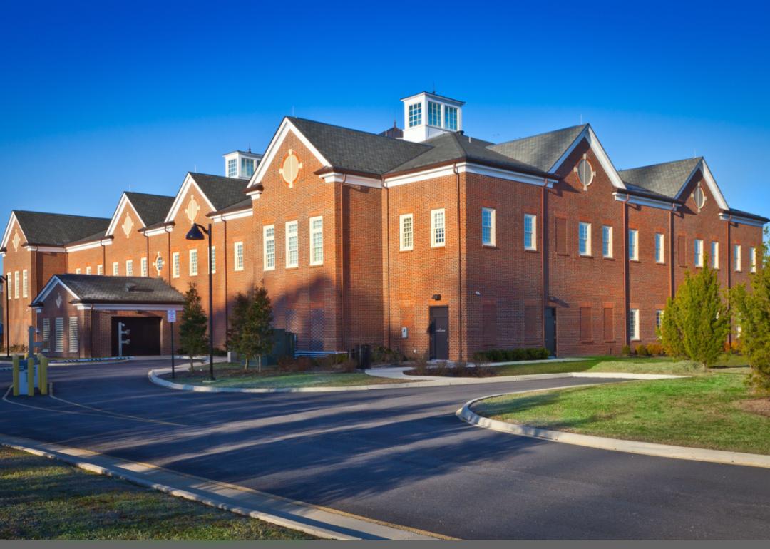
#28. Prince George County, Virginia
– Overall Rank: 809
– Population: 42,634
– Median household income: $80,318
– Median home value: $252,300 (71% own)
– Median rent: $1,519 (29% rent)
– Top public schools: L.L. Beazley Elementary School (grade A minus), South Elementary School (grade A minus), David A. Harrison Elementary School (grade B+)
– Top private schools: Fort Lee Child Development Center – Sisisky (grade unavailable)
– Top places: Prince George (grade B), Templeton (grade B)
About
Prince George County, Virginia has a strong foundation in agriculture, logistics, and military-related industries, contributing to a diverse and resilient economy. The community emphasizes education, public service, and a high quality of life supported by local schools and civic organizations. Residents enjoy a blend of rural charm and modern infrastructure that supports both families and businesses.
The county features woodlands, waterways, and parks that encourage outdoor activities like hiking, fishing, and camping. Historic sites and cultural programs preserve its colonial heritage and military significance. With a mix of tradition, economic stability, and natural beauty, Prince George County offers a grounded and connected way of life.
Where is Prince George County?
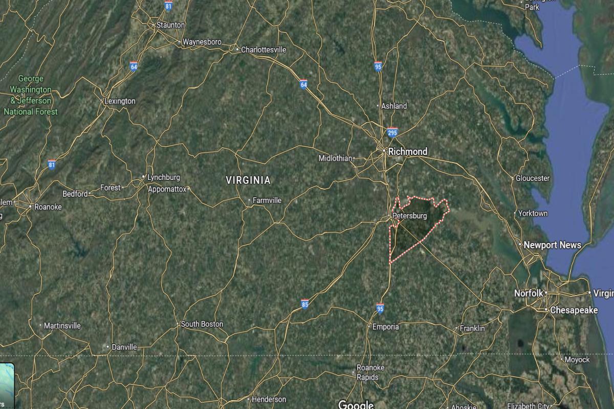
Prince George County, Virginia, is located in the southeastern part of the state, approximately 25 miles south of Richmond and about 10 miles east of Petersburg. The county seat, Prince George, lies near U.S. Route 460 and I-95, making it easily accessible. It is also about 70 miles northwest of Norfolk.
The county is roughly 130 miles southeast of Charlottesville and about 150 miles south of Washington, D.C. Prince George County is approximately 90 miles east of Lynchburg. Its location places it within the greater Richmond region with access to both urban and coastal areas.
– Overall Rank: 794
– Population: 16,253
– Median household income: $60,041
– Median home value: $178,000 (78% own)
– Median rent: $861 (22% rent)
– Top public schools: Appomattox County High School (grade B+), Appomattox Middle School (grade B), Appomattox Elementary School (grade B)
– Top private schools: Appomattox Christian Academy (grade A minus), Cornerstone Christian Academy (grade B)
– Top places: Appomattox (grade B)
About
Appomattox County, Virginia is known for its deep historical roots, agricultural economy, and close-knit community life. Farming, forestry, and local businesses support a stable rural economy, while residents maintain strong ties through schools, churches, and civic activities. The county embraces a peaceful lifestyle grounded in tradition and community pride.
Scenic landscapes, trails, and heritage sites offer opportunities for outdoor recreation and cultural exploration. Museums and landmarks commemorate the area’s pivotal role in American history, preserving its legacy for future generations. With a blend of natural beauty, historical depth, and rural values, Appomattox County offers a serene and meaningful way of life.
Where is Appomattox County?
🔥 Would you like to save this?
Appomattox County, Virginia, is located in the central-southern part of the state, approximately 25 miles east of Lynchburg and about 95 miles west of Richmond. The county seat, Appomattox, lies near U.S. Route 460 and is around 65 miles south of Charlottesville. It is also about 50 miles north of Danville.
The county is roughly 170 miles southwest of Washington, D.C., and about 100 miles northwest of Norfolk. Appomattox County is approximately 85 miles northeast of Martinsville. Its location places it in the foothills of the Piedmont region with strong historical significance and rural surroundings.
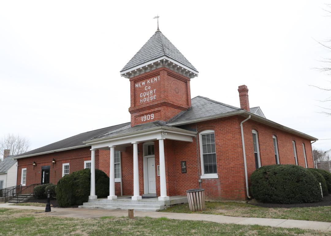
#26. New Kent County, Virginia
– Overall Rank: 778
– Population: 23,296
– Median household income: $113,120
– Median home value: $354,200 (92% own)
– Median rent: $1,391 (8% rent)
– Top public schools: George W. Watkins Elementary School (grade B), New Kent Elementary School (grade B), New Kent Middle School (grade B minus)
– Top private schools: Cumberland Academy (grade unavailable)
– Top places: New Kent (grade B minus)
About
New Kent County offers a blend of natural beauty, historical charm, and rural tranquility that attracts visitors and residents seeking a slower pace of life. The area features a mix of rolling countryside, established wineries, and recreational spaces that support outdoor activities like golfing, hiking, and fishing. A strong sense of community is reflected in local events, markets, and family-run businesses.
The county’s history is deeply rooted in colonial-era developments and Civil War landmarks, lending it cultural and architectural depth. Growth in recent years has been steady but controlled, preserving the region’s character while adding modern amenities. With an emphasis on quality of life, New Kent County balances progress with tradition.
Where is New Kent County?
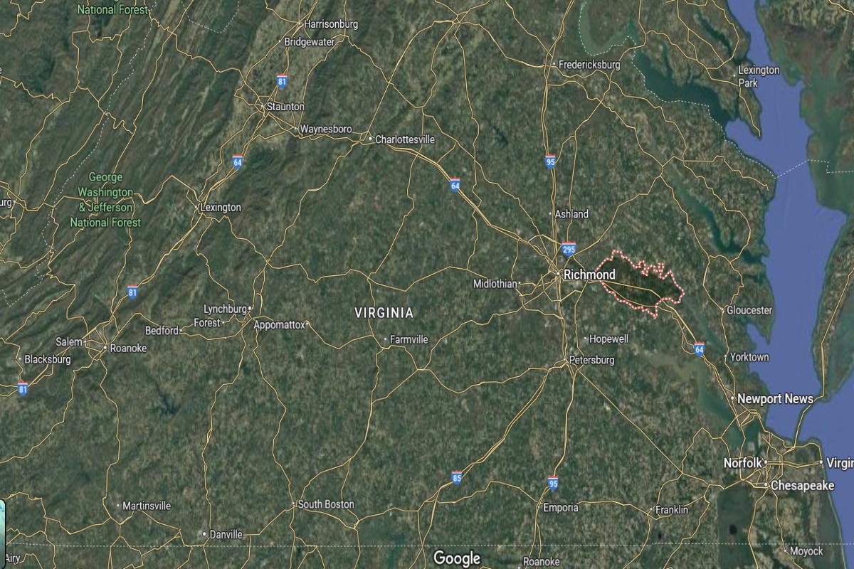
New Kent County, Virginia, is located in the eastern part of the state, approximately 30 miles east of Richmond and about 25 miles west of Williamsburg. The county seat, New Kent, lies along Interstate 64 and is around 60 miles northwest of Norfolk. It is also about 45 miles southeast of Fredericksburg.
The county is roughly 110 miles south of Washington, D.C., and about 80 miles northeast of Petersburg. New Kent County is approximately 130 miles east of Charlottesville. Its location provides a mix of rural landscapes with close access to urban and coastal regions.
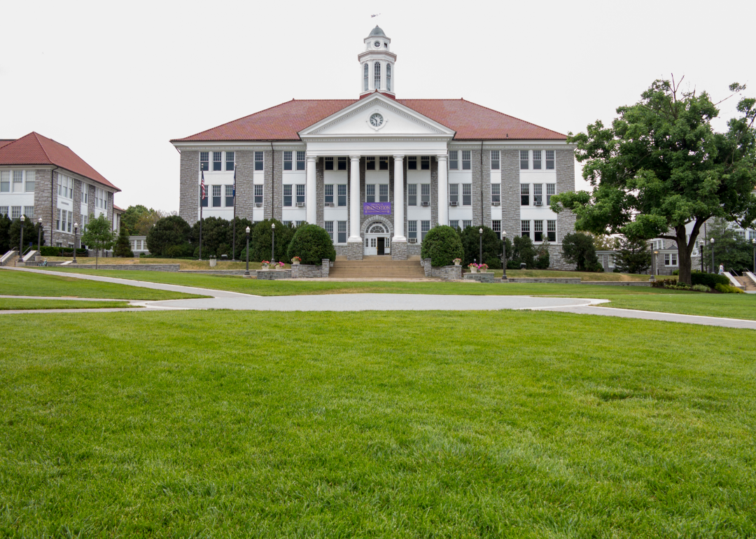
#25. Rockingham County, Virginia
– Overall Rank: 749
– Population: 83,905
– Median household income: $73,232
– Median home value: $266,900 (75% own)
– Median rent: $1,078 (25% rent)
– Top public schools: East Rockingham High School (grade A minus), Turner Ashby High School (grade A minus), Spotswood High School (grade A minus)
– Top private schools: Blue Ridge Christian School (grade A minus), Redeemer Classical School (grade unavailable), Cornerstone Christian School (grade unavailable)
– Top places: Bridgewater (grade A), Dayton (grade A), Massanutten (grade A minus)
About
Rockingham County is known for its blend of agricultural heritage, scenic landscapes, and small-town atmosphere. The region supports a strong farming economy, with poultry, livestock, and crop production playing central roles in its identity. Outdoor recreation thrives here with access to mountains, rivers, and trails that foster an active lifestyle.
The county also places value on education and community, reflected in local schools, civic events, and cultural traditions. Economic development has brought in light manufacturing and small businesses without sacrificing rural charm. Residents enjoy a balance of peaceful surroundings and practical amenities.
Where is Rockingham County?
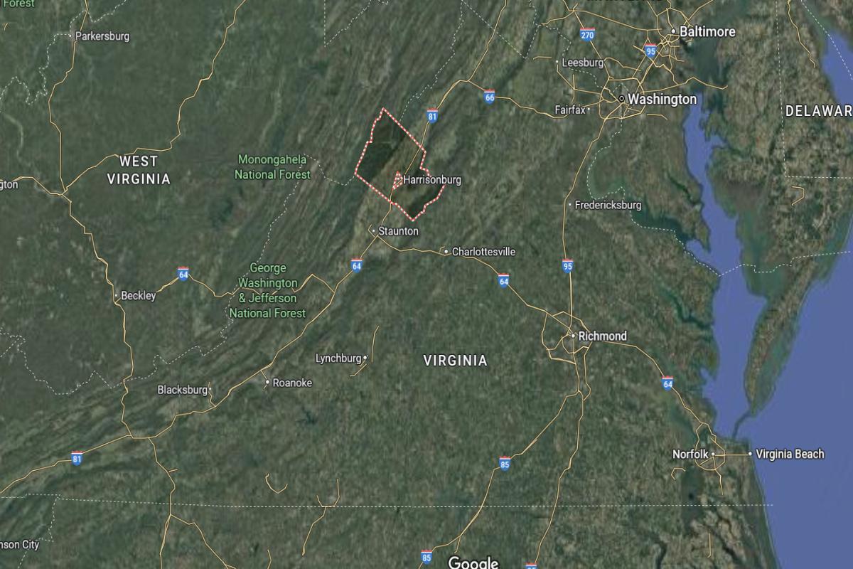
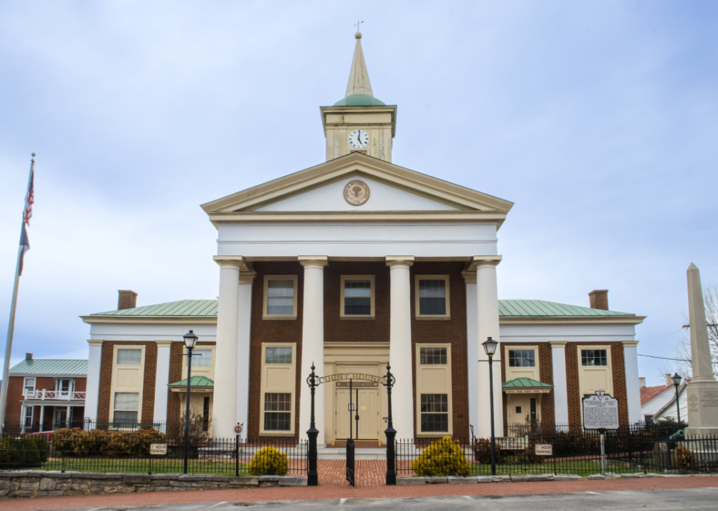
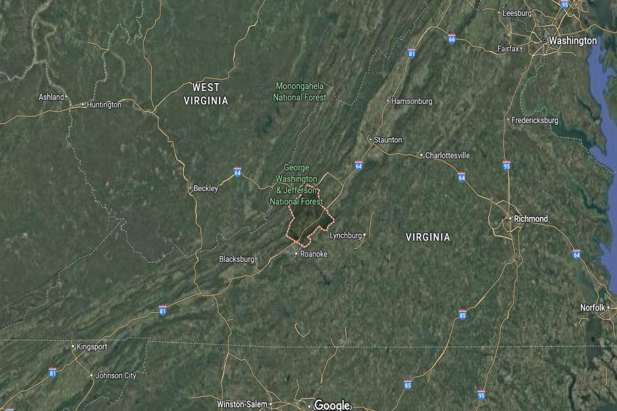
Rockingham County, Virginia, is located in the western part of the state, within the Shenandoah Valley, approximately 25 miles west of Charlottesville and about 60 miles north of Roanoke. The county seat, Harrisonburg, lies along Interstate 81 and is about 70 miles south of Winchester. It is also around 35 miles northeast of Staunton.
The county is roughly 130 miles west of Richmond and about 130 miles southwest of Washington, D.C. Rockingham County is approximately 90 miles north of Lexington. Its location places it in a mountainous and rural region with strong transportation links through the valley.
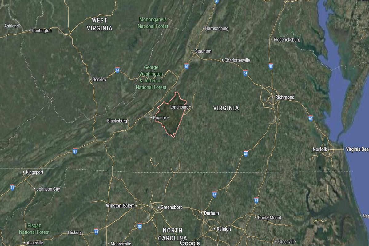
#24. Franklin County, Virginia
– Overall Rank: 709
– Population: 54,838
– Median household income: $66,275
– Median home value: $207,700 (80% own)
– Median rent: $809 (20% rent)
– Top public schools: Snow Creek Elementary School (grade A), Boones Mill Elementary School (grade A minus), Windy Gap Elementary School (grade A minus)
– Top private schools: Christian Heritage Academy (grade B minus), Lifes Academy (grade unavailable)
– Top places: Rocky Mount (grade B+), Boones Mill (grade B+), North Shore (grade B)
About
Franklin County blends rural charm with a rich cultural backdrop shaped by its agricultural and moonshining history. Rolling hills, lakes, and open spaces offer scenic beauty and support outdoor activities like boating, hiking, and fishing. The local economy remains rooted in farming, forestry, and small-scale industry.
The community emphasizes family life, tradition, and civic pride through events, fairs, and local gatherings. Economic initiatives have encouraged steady growth while maintaining the area’s relaxed character. Arts, music, and regional heritage also play a strong role in local identity.
Where is Franklin County?
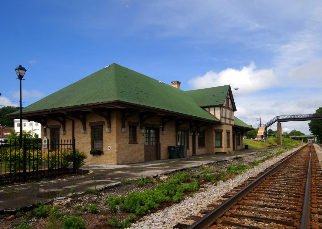
Franklin County, Virginia, is located in the southwestern part of the state, approximately 25 miles south of Roanoke and about 50 miles north of the North Carolina border. The county seat, Rocky Mount, lies near U.S. Route 220 and is about 80 miles west of Lynchburg. It is also around 60 miles northeast of Martinsville.
The county is roughly 170 miles west of Richmond and about 190 miles southwest of Charlottesville. Franklin County is approximately 230 miles southwest of Washington, D.C. Its location places it within the Blue Ridge foothills, offering a mix of rural landscape and access to regional centers.
#23. Louisa County, Virginia
– Overall Rank: 684
– Population: 38,106
– Median household income: $76,594
– Median home value: $266,700 (80% own)
– Median rent: $1,137 (20% rent)
– Top public schools: Louisa County High School (grade A minus), Moss-Nuckols Elementary School (grade A minus), Louisa County Middle School (grade A minus)
– Top private schools: Piedmont Christian School (grade unavailable), Grace Christian Academy (grade unavailable)
– Top places: Mineral (grade B), Louisa (grade B), Blue Ridge Shores (grade C+)
About
Louisa County is known for its peaceful countryside, agricultural roots, and a growing interest in rural living. Farms, forests, and lakes shape the landscape, offering residents and visitors ample opportunities for recreation and scenic enjoyment. The area maintains a strong connection to its past while adapting to modern needs.
Community life in Louisa centers around local schools, family events, and small-town values. Development is balanced with conservation, supporting both economic opportunity and environmental care. Local businesses, artisans, and historic sites contribute to a sense of identity and pride.
Where is Louisa County?
Louisa County, Virginia, is located in the central part of the state, approximately 35 miles east of Charlottesville and about 50 miles northwest of Richmond. The county seat, Louisa, lies near U.S. Route 33 and is around 70 miles southwest of Fredericksburg. It is also about 60 miles northeast of Lynchburg.
The county is roughly 120 miles south of Washington, D.C., and about 110 miles northwest of Norfolk. Louisa County is approximately 90 miles east of the Blue Ridge Mountains. Its central location provides convenient access to both the Piedmont region and major urban areas in Virginia.
🔥 Would you like to save this?
#22. Botetourt County, Virginia
– Overall Rank: 667
– Population: 33,734
– Median household income: $77,680
– Median home value: $264,200 (87% own)
– Median rent: $869 (13% rent)
– Top public schools: Read Mountain Middle School (grade A minus), Central Academy Middle School (grade A minus), Colonial Elementary School (grade A minus)
– Top private schools:
– Top places: Daleville (grade B+), Blue Ridge (grade B+), Cloverdale (grade B)
About
Botetourt County combines scenic landscapes with a strong sense of heritage and community pride. Its rolling hills, rivers, and forested areas support outdoor activities like hiking, kayaking, and camping. The economy includes a mix of agriculture, light industry, and small businesses that reflect both tradition and growth.
Residents value a quiet, connected lifestyle centered around schools, local events, and cultural preservation. Historic buildings and rural charm are carefully maintained even as modern development continues. The area fosters a balance between natural beauty and practical living.
Where is Botetourt County?
Botetourt County, Virginia, is located in the western part of the state, approximately 25 miles north of Roanoke and about 50 miles south of Lexington. The county seat, Fincastle, lies near U.S. Route 220 and is around 65 miles west of Lynchburg. It is also about 90 miles north of Martinsville.
The county is roughly 140 miles west of Richmond and about 180 miles southwest of Charlottesville. Botetourt County is approximately 200 miles southwest of Washington, D.C. Its location places it in the Appalachian foothills, offering a mix of mountainous terrain and rural communities.
#21. Washington County, Virginia
– Overall Rank: 645
– Population: 53,985
– Median household income: $59,116
– Median home value: $181,000 (75% own)
– Median rent: $796 (25% rent)
– Top public schools: Wallace Middle School (grade A minus), Watauga Elementary School (grade A minus), High Point Elementary School (grade B+)
– Top private schools: Cornerstone Christian Academy (grade B), Sullins Academy (grade unavailable), Victory Children’s Center (grade unavailable)
– Top places: Abingdon (grade A), Emory (grade A minus), Glade Spring (grade B+)
About
Washington County blends historic charm with a diverse landscape of farmland, rolling hills, and small communities. Its economy benefits from agriculture, manufacturing, and local enterprises that support steady, community-focused growth. Scenic byways and natural attractions offer opportunities for hiking, fishing, and exploration.
The county places importance on education, tradition, and cultural expression through festivals, music, and the arts. Residents enjoy a balance of rural living with access to essential services and modern conveniences. Civic pride and preservation of local heritage remain central to the area’s identity.
Where is Washington County?
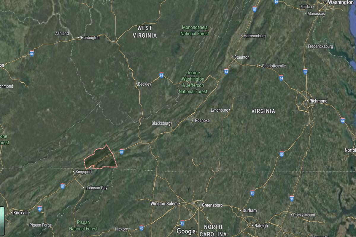
Washington County, Virginia, is located in the southwestern corner of the state, approximately 150 miles southwest of Roanoke and about 20 miles northeast of the Tennessee border near Bristol. The county seat, Abingdon, lies along Interstate 81 and is around 60 miles south of Richlands. It is also about 130 miles west of Wytheville.
The county is roughly 300 miles southwest of Richmond and about 320 miles southwest of Washington, D.C. Washington County is approximately 100 miles north of Asheville, North Carolina. Its location places it in the Appalachian Highlands, offering access to regional trade routes and mountain landscapes.
#20. Isle of Wight County, Virginia
– Overall Rank: 611
– Population: 38,898
– Median household income: $91,680
– Median home value: $327,600 (78% own)
– Median rent: $1,223 (22% rent)
– Top public schools: Windsor Elementary School (grade B+), Carrsville Elementary School (grade B+), Smithfield Middle School (grade B+)
– Top private schools: Isle of Wight Academy (grade B), Hampton Roads Classical (grade unavailable)
– Top places: Carrollton (grade B+), Smithfield (grade B), Benns Church (grade B minus)
About
Isle of Wight County features a mix of rural landscapes, historic architecture, and a strong agricultural presence. The area supports farming, forestry, and small-scale manufacturing while preserving its cultural and historical roots. Quiet communities, open spaces, and water access contribute to its laid-back atmosphere.
Local traditions and civic engagement play a central role in daily life, with festivals, markets, and community events bringing people together. Growth has been managed to maintain a balance between development and preservation. Residents value heritage, natural beauty, and a strong sense of place.
Where is Isle of Wight County?
Isle of Wight County, Virginia, is located in the southeastern part of the state, approximately 25 miles west of Norfolk and about 45 miles southeast of Petersburg. The county seat, Isle of Wight, lies near U.S. Route 258 and is around 20 miles south of Newport News. It is also about 70 miles southeast of Richmond.
The county is roughly 160 miles south of Washington, D.C., and about 90 miles east of Emporia. Isle of Wight County is approximately 30 miles northeast of Suffolk. Its location places it near the Hampton Roads region, combining rural character with proximity to urban coastal areas.
🔥 Would you like to save this?

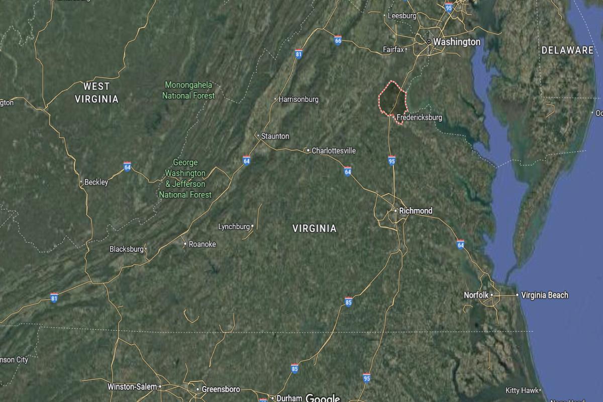
#19. King George County, Virginia
– Overall Rank: 545
– Population: 26,985
– Median household income: $103,264
– Median home value: $372,300 (75% own)
– Median rent: $1,385 (25% rent)
– Top public schools: King George Middle School (grade B+), King George High School (grade B+), Potomac Elementary School (grade B)
– Top private schools:
– Top places: Dahlgren (grade B+), King George (grade B), Fairview Beach (grade B)
About
King George County blends a rural setting with growing residential and economic development. Its landscape includes farms, forests, and waterways that support outdoor activities and scenic views. The local economy is supported by government facilities, agriculture, and small businesses.
Community life centers around schools, family activities, and a commitment to preserving natural and historic resources. Development is guided by a desire to maintain the county’s peaceful character while expanding opportunities. Residents value a lifestyle that balances progress with tradition.
Where is King George County?
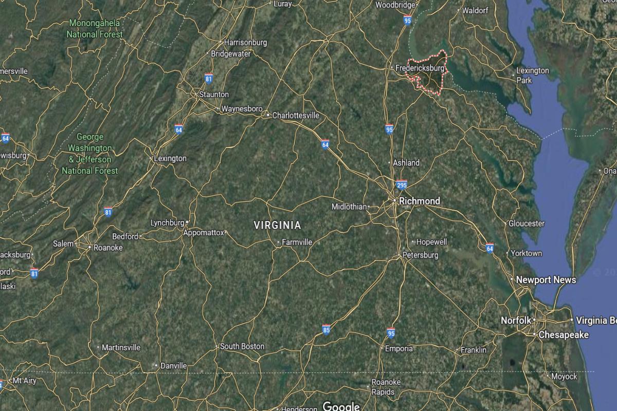
King George County, Virginia, is located in the northeastern part of the state, approximately 60 miles northeast of Richmond and about 20 miles east of Fredericksburg. The county seat, King George, lies near U.S. Route 301 and is around 15 miles south of the Maryland border across the Potomac River. It is also about 50 miles southwest of Washington, D.C.
The county is roughly 80 miles northwest of Norfolk and about 95 miles north of Williamsburg. King George County is approximately 130 miles northeast of Charlottesville. Its location places it within the Northern Neck region, providing a rural setting close to major metropolitan areas.
#18. Fauquier County, Virginia
– Overall Rank: 543
– Population: 73,290
– Median household income: $122,785
– Median home value: $501,200 (77% own)
– Median rent: $1,468 (23% rent)
– Top public schools: Kettle Run High School (grade B+), Greenville Elementary School (grade B+), C. Hunter Ritchie Elementary School (grade B)
– Top private schools: Wakefield School (grade A+), Highland School (grade A+), Fresta Valley Christian School (grade B minus)
– Top places: New Baltimore (grade A minus), Warrenton (grade B), Bealeton (grade B)
About
Fauquier County is characterized by its rolling countryside, equestrian culture, and deep agricultural roots. Vineyards, farms, and historic estates shape both the landscape and the local economy. The area attracts those seeking open space, scenic views, and a quieter pace of life.
Community values emphasize preservation, education, and civic pride through events, traditions, and conservation efforts. Growth is managed to protect natural beauty while allowing for thoughtful development. Residents appreciate a balance of rural charm with access to modern services.
Where is Fauquier County?
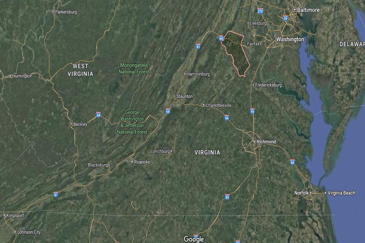
Fauquier County, Virginia, is located in the northern part of the state, approximately 45 miles west of Washington, D.C. and about 70 miles north of Charlottesville. The county seat, Warrenton, lies near U.S. Route 29 and is around 35 miles southeast of Winchester. It is also about 60 miles northwest of Fredericksburg.
The county is roughly 100 miles northeast of Harrisonburg and about 140 miles north of Lynchburg. Fauquier County is approximately 90 miles west of Annapolis, Maryland. Its location places it in the Piedmont region, offering a blend of rural countryside with access to Northern Virginia’s metropolitan areas.
#17. Bedford County, Virginia
– Overall Rank: 527
– Population: 79,761
– Median household income: $74,773
– Median home value: $263,900 (84% own)
– Median rent: $939 (16% rent)
– Top public schools: Forest Elementary School (grade A minus), Forest Middle School (grade B+), Boonsboro Elementary School (grade B+)
– Top private schools: Smith Mountain Lake Christian Academy (grade B), Blue Ridge Montessori School (grade unavailable), Mineral Springs Christian School (grade unavailable)
– Top places: Forest (grade A), Bedford (grade B minus), Big Island (grade C)
About
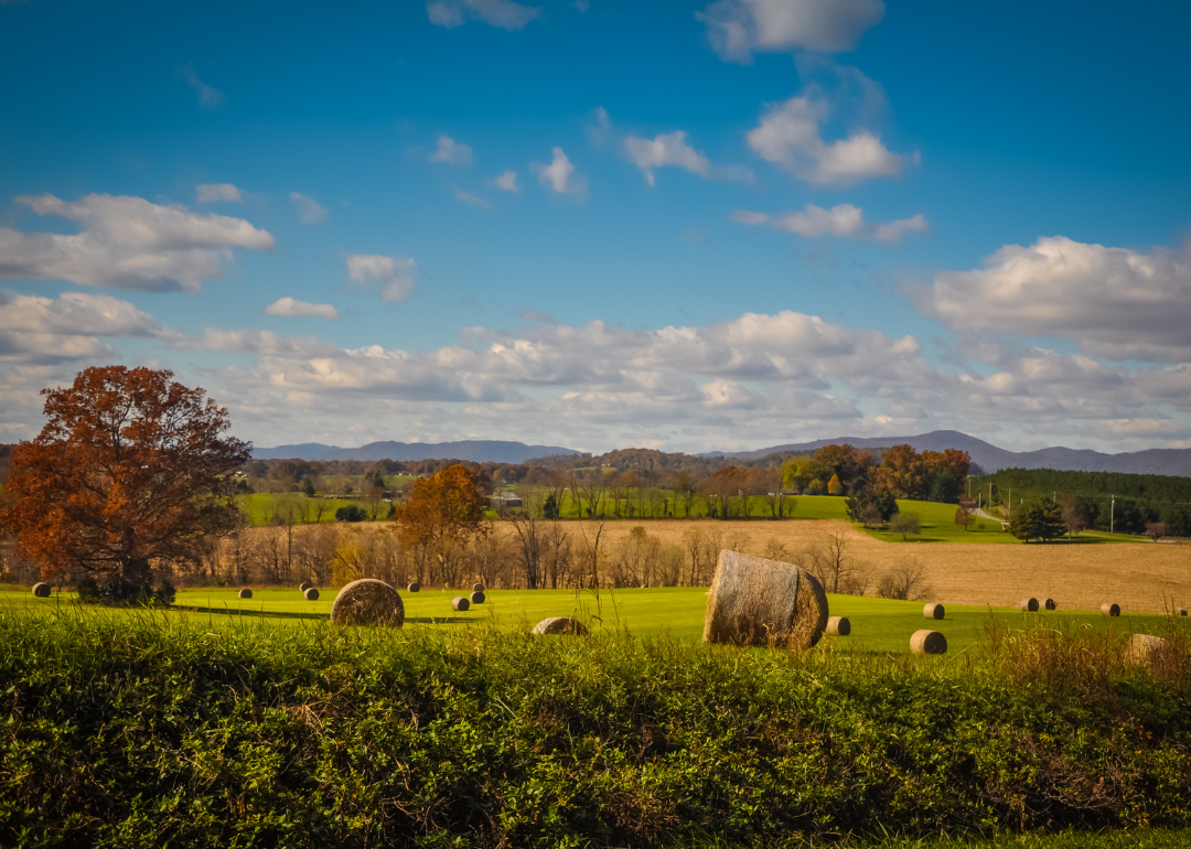
Bedford County offers a mix of scenic landscapes, historical significance, and a strong sense of community. The area features rolling hills, lakes, and farmland that support outdoor recreation and a rural lifestyle. Agriculture, tourism, and small businesses form the foundation of the local economy.
The county values education, heritage, and family life, reflected in its schools, events, and preservation efforts. Growth is approached with care to maintain the area’s character and natural resources. Residents enjoy a peaceful setting with access to both tradition and progress.
Where is Bedford County?
Bedford County, Virginia, is located in the central-southern part of the state, approximately 25 miles east of Roanoke and about 25 miles west of Lynchburg. The county seat, Bedford, lies along U.S. Route 460 and is around 65 miles north of Danville. It is also about 55 miles south of Lexington.
The county is roughly 110 miles west of Richmond and about 180 miles southwest of Washington, D.C. Bedford County is approximately 90 miles northwest of Martinsville. Its location places it at the foot of the Blue Ridge Mountains, offering a mix of rural and scenic landscapes.

#16. Campbell County, Virginia
– Overall Rank: 517
– Population: 55,518
– Median household income: $59,022
– Median home value: $183,100 (74% own)
– Median rent: $792 (26% rent)
– Top public schools: Leesville Road Elementary School (grade B+), Brookville High School (grade B+), Tomahawk Elementary School (grade B)
– Top private schools: Timberlake Christian Schools (grade A minus), The Branches Academy (grade unavailable), Desmond T. Doss Junior Academy (grade unavailable)
– Top places: Timberlake (grade A minus), Altavista (grade B), Rustburg (grade A minus)
About
Campbell County blends rural charm with a stable, diversified economy rooted in agriculture, manufacturing, and small business. Its landscape includes farmland, wooded areas, and quiet communities that offer a peaceful environment. Outdoor recreation and natural beauty are central to daily life for many residents.
The county places importance on education, local heritage, and community involvement through schools, civic groups, and cultural events. Growth is carefully managed to support economic opportunity while preserving rural character. Residents value strong community ties, a slower pace of life, and practical access to modern amenities.
Where is Campbell County?
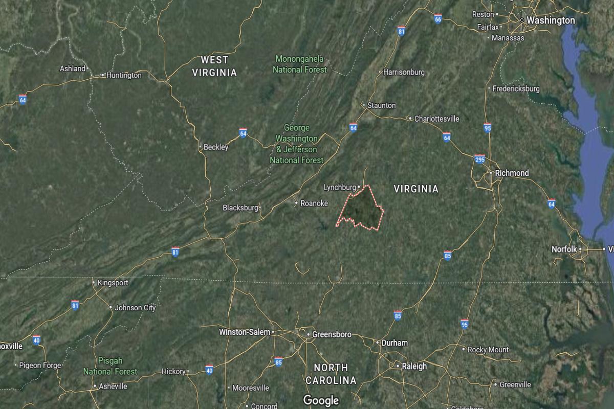
Campbell County, Virginia, is located in the central-southern part of the state, approximately 10 miles south of Lynchburg and about 60 miles north of Danville. The county seat, Rustburg, lies along U.S. Route 29 and is around 100 miles west of Richmond. It is also about 55 miles northeast of Martinsville.
The county is roughly 180 miles southwest of Washington, D.C., and about 90 miles northwest of South Boston. Campbell County is approximately 120 miles south of Charlottesville. Its location places it in the Piedmont region, with access to both rural areas and nearby urban centers.
#15. Spotsylvania County, Virginia
– Overall Rank: 458
– Population: 141,097
– Median household income: $105,068
– Median home value: $349,900 (79% own)
– Median rent: $1,677 (21% rent)
– Top public schools: Riverbend High School (grade A minus), Chancellor Elementary School (grade A minus), Courtland High School (grade A minus)
– Top private schools: Fredericksburg Academy (grade A+), St. Michael the Archangel High School (grade A), Fredericksburg Christian School (grade A minus)
– Top places: Spotsylvania Courthouse (grade B), Lake Wilderness (grade B+)
About
Spotsylvania County blends historical legacy with modern suburban and rural lifestyles. The area features battlefields, preserved landmarks, and a growing residential landscape supported by retail, healthcare, and light industry. Natural spaces, lakes, and parks offer recreational opportunities for families and outdoor enthusiasts.
Community life centers around schools, local events, and a focus on preserving heritage while embracing thoughtful development. Residents enjoy a mix of quiet neighborhoods, accessible services, and cultural richness. The county balances tradition with ongoing growth and connectivity.
Where is Spotsylvania County?
Spotsylvania County, Virginia, is located in the northeastern part of the state, approximately 55 miles south of Washington, D.C. and about 50 miles north of Richmond. The county seat, Spotsylvania Courthouse, lies near U.S. Route 1 and I-95, around 15 miles southwest of Fredericksburg. It is also about 70 miles northeast of Charlottesville.
The county is roughly 120 miles northwest of Norfolk and about 100 miles east of Harrisonburg. Spotsylvania County is approximately 160 miles north of Danville. Its location places it within the I-95 corridor, offering access to both rural landscapes and major metropolitan areas.
#14. Powhatan County, Virginia
– Overall Rank: 368
– Population: 30,503
– Median household income: $108,089
– Median home value: $356,500 (91% own)
– Median rent: $1,170 (9% rent)
– Top public schools: Powhatan Elementary School (grade A minus), Flat Rock Elementary School (grade B+), Pocahontas Elementary School (grade B+)
– Top private schools: The Blessed Sacrament Huguenot School (grade A)
– Top places: Powhatan (grade C+)
About
Powhatan County is known for its blend of rural beauty, historical significance, and a steadily growing community. The landscape features forests, farmland, and rivers that support outdoor recreation and a relaxed pace of life. Agriculture and small businesses form the backbone of the local economy.
Community values are reflected in strong schools, civic engagement, and efforts to preserve the area’s character. Development is approached with care, balancing modern needs with the county’s traditional charm. Residents appreciate the combination of peaceful surroundings and access to essential services.
Where is Powhatan County?
Powhatan County, Virginia, is located in the central part of the state, approximately 30 miles west of Richmond and about 60 miles south of Charlottesville. The county seat, Powhatan, lies along U.S. Route 60 and is around 70 miles northeast of Farmville. It is also about 95 miles northwest of Norfolk.
The county is roughly 120 miles south of Washington, D.C., and about 100 miles east of Lynchburg. Powhatan County is approximately 80 miles southeast of Staunton. Its location places it in the Piedmont region, offering a rural setting with close access to central Virginia’s urban centers.

#13. Hanover County, Virginia
– Overall Rank: 197
– Population: 110,513
– Median household income: $104,678
– Median home value: $347,900 (83% own)
– Median rent: $1,392 (17% rent)
– Top public schools: Pole Green Elementary School (grade A), Oak Knoll Middle School (grade A minus), Chickahominy Middle School (grade A minus)
– Top private schools: Atlee Christian Academy (grade unavailable), GRACE CHRISTIAN SCHOOL (grade unavailable), Liberty Christian School (grade unavailable)
– Top places: Ashland (grade A minus), Mechanicsville (grade A minus), Hanover (grade B+)
About
Hanover County combines a strong sense of history with a thriving mix of rural and suburban lifestyles. Its economy is supported by agriculture, manufacturing, and local enterprises that contribute to steady growth. Scenic landscapes, farms, and historic structures add to the county’s unique character.
The community emphasizes education, heritage preservation, and quality of life through events, schools, and public services. Development is carefully guided to maintain a balance between tradition and progress. Residents value open space, civic pride, and a welcoming atmosphere.
Where is Hanover County?
Hanover County, Virginia, is located in the central part of the state, approximately 20 miles north of Richmond and about 60 miles southeast of Charlottesville. The county seat, Hanover, is near U.S. Route 301 and I-95, around 45 miles south of Fredericksburg. It is also about 85 miles northwest of Norfolk.
The county is roughly 100 miles southwest of Washington, D.C., and about 90 miles northeast of Lynchburg. Hanover County is approximately 120 miles north of Danville. Its location provides access to major highways and a balance between rural landscapes and proximity to the Richmond metropolitan area.
#12. Goochland County, Virginia
– Overall Rank: 185
– Population: 24,906
– Median household income: $105,600
– Median home value: $433,600 (85% own)
– Median rent: $1,407 (15% rent)
– Top public schools: Goochland High School (grade A minus), Goochland Elementary School (grade A minus), Randolph Elementary School (grade A minus)
– Top private schools: Richmond Academy (grade A), Saint Gertrude High School (grade A), Benedictine College Preparatory (grade A)
– Top places: Goochland (grade B+)
About
Goochland County offers a rural landscape marked by rolling farmland, woodlands, and a growing residential presence. Agriculture remains a central part of the local identity, supported by small businesses and steady economic development. Outdoor recreation and scenic views contribute to a peaceful way of life.
Community values are reflected in strong schools, historic preservation, and thoughtful planning that protects the area’s charm. Growth is managed to enhance services while maintaining the county’s rural character. Residents enjoy a close-knit atmosphere with access to essential amenities and natural beauty.
Where is Goochland County?
Goochland County, Virginia, is located in the central part of the state, approximately 30 miles west of Richmond and about 50 miles southeast of Charlottesville. The county seat, Goochland, lies along U.S. Route 522 and is around 60 miles northeast of Farmville. It is also about 100 miles northwest of Norfolk.
The county is roughly 120 miles south of Washington, D.C., and about 90 miles east of Lynchburg. Goochland County is approximately 80 miles southeast of Staunton. Its location offers a rural setting with convenient access to central Virginia’s urban areas and transportation routes.
#11. Stafford County, Virginia
– Overall Rank: 132
– Population: 157,606
– Median household income: $128,036
– Median home value: $431,900 (80% own)
– Median rent: $1,828 (20% rent)
– Top public schools: Colonial Forge High School (grade A), Mountain View High School (grade A), Rodney E. Thompson Middle School (grade A minus)
– Top private schools: Grace Preparatory School (grade B+), Holy Cross Academy (grade unavailable), The Merit School (grade unavailable)
– Top places: Falmouth (grade A), Aquia Harbour (grade A minus), Southern Gateway (grade B+)
About
Stafford County blends historical depth with rapid residential and commercial development. The area features a mix of suburban neighborhoods, preserved landmarks, and natural spaces that support recreation and family life. A diverse economy includes government, technology, retail, and service industries.
Community priorities include strong education, infrastructure growth, and preserving cultural heritage. Development is guided to support both expanding populations and environmental stewardship. Residents value the balance of convenience, history, and a strong sense of community.
Where is Stafford County?
Stafford County, Virginia, is located in the northeastern part of the state, approximately 40 miles south of Washington, D.C. and about 60 miles north of Richmond. The county seat, Stafford, lies near I-95 and is around 10 miles northeast of Fredericksburg. It is also about 70 miles southeast of Winchester.
The county is roughly 110 miles northwest of Norfolk and about 90 miles east of Charlottesville. Stafford County is approximately 160 miles northeast of Lynchburg. Its location places it within the fast-growing I-95 corridor, offering access to both Northern Virginia and central parts of the state.

#10. Roanoke County, Virginia
– Overall Rank: 116
– Population: 96,653
– Median household income: $80,872
– Median home value: $245,800 (76% own)
– Median rent: $1,116 (24% rent)
– Top public schools: Hidden Valley High School (grade A), Cave Spring High School (grade A), Penn Forest Elementary School (grade A)
– Top private schools: North Cross School (grade A+), Faith Christian School (grade A minus), Roanoke Valley Christian Schools (grade B+)
– Top places: Cave Spring (grade A+), Hollins (grade B+), Vinton (grade B+)
About
Roanoke County features a blend of scenic beauty, suburban development, and a commitment to quality of life. Its economy includes healthcare, education, retail, and light manufacturing, offering both stability and opportunity. The surrounding mountains and green spaces provide ample outdoor recreation and natural appeal.
The community values education, cultural enrichment, and responsible growth through well-maintained schools, libraries, and civic initiatives. Development is planned to enhance accessibility while preserving the area’s natural character. Residents enjoy a balance of modern convenience and a connection to the outdoors.
Where is Roanoke County?
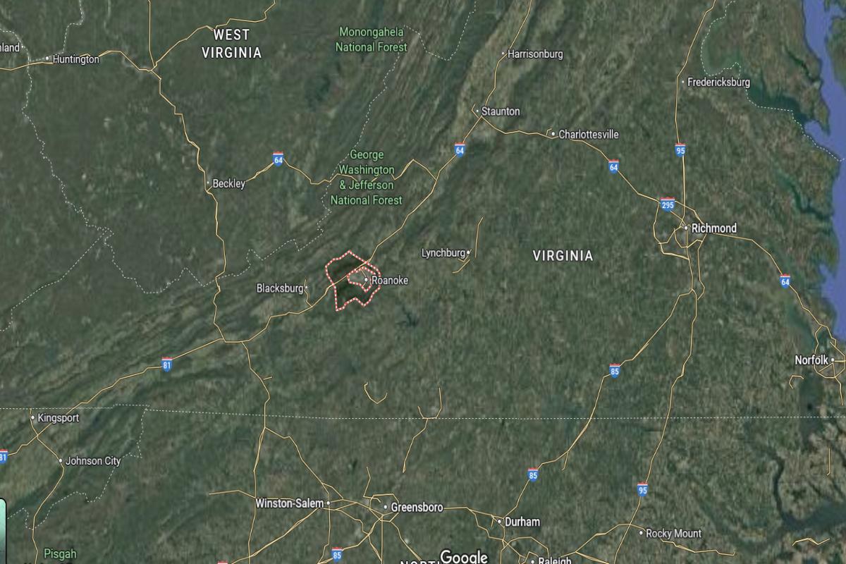
Roanoke County, Virginia, is located in the western part of the state, surrounding the independent city of Roanoke, which lies about 50 miles east of the West Virginia border. The county seat, Salem, is approximately 120 miles west of Lynchburg and about 90 miles north of the North Carolina border. It is also around 75 miles south of Covington.
The county is roughly 170 miles west of Richmond and about 240 miles southwest of Washington, D.C. Roanoke County is approximately 100 miles northwest of Danville. Its location places it in the Blue Ridge region, offering a mix of mountainous terrain and access to key transportation routes in southwest Virginia.
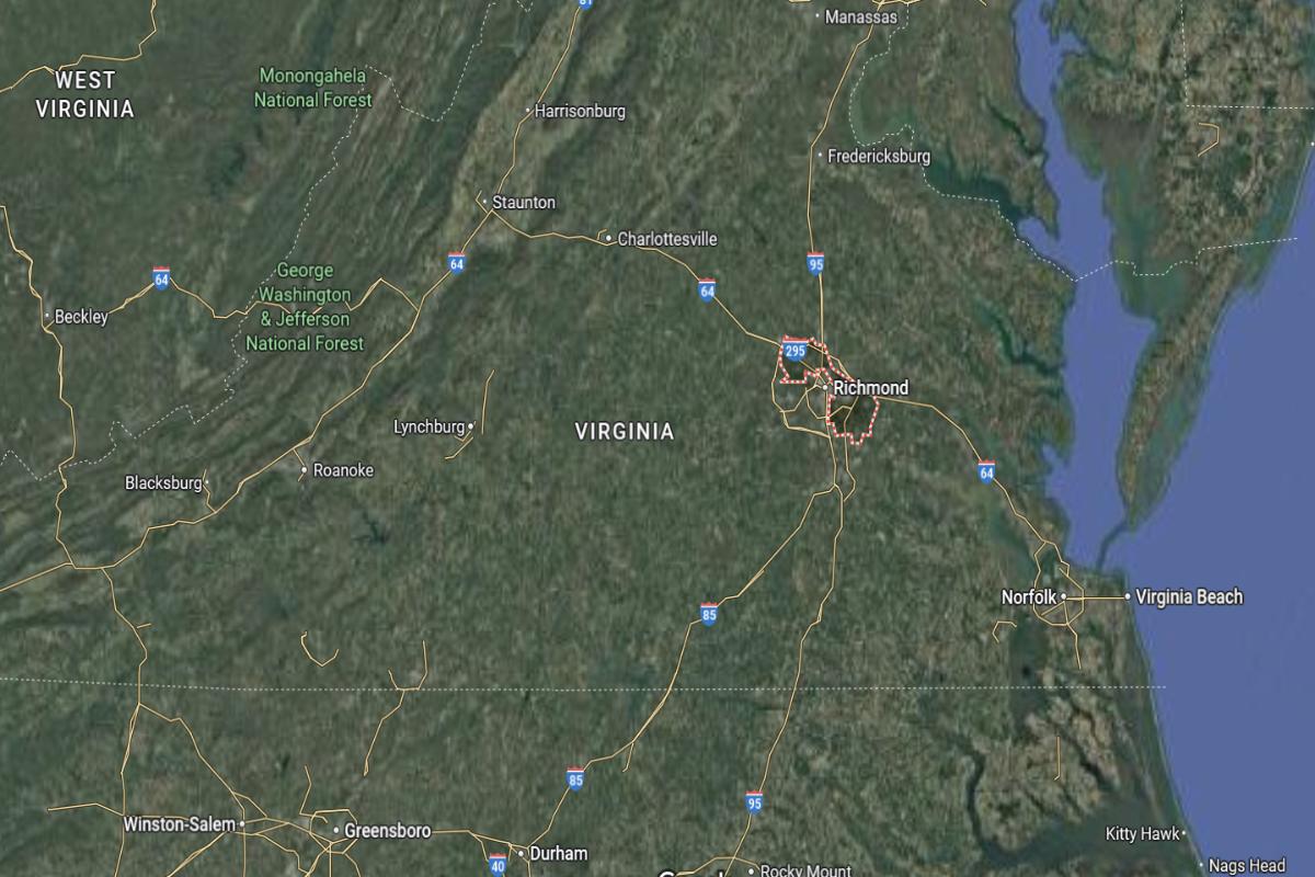
#9. Chesterfield County, Virginia
– Overall Rank: 100
– Population: 366,019
– Median household income: $95,757
– Median home value: $306,500 (77% own)
– Median rent: $1,460 (23% rent)
– Top public schools: Clover Hill High School (grade A), Cosby High School (grade A), Midlothian High School (grade A)
– Top private schools: Millwood School (grade A), Richmond Christian School (grade B+), Guardian Christian Academy (grade B)
– Top places: Bon Air (grade A+), Woodlake (grade A+), Brandermill (grade A)
About
Chesterfield County combines suburban growth with historical significance and a strong sense of community. Its economy thrives on a mix of retail, healthcare, education, and light industry, supporting a diverse and expanding population. Parks, rivers, and recreational amenities offer a high quality of life for residents.
Community priorities include excellent schools, public safety, and managed development that respects natural and historical resources. Cultural events, local traditions, and civic involvement reflect the area’s commitment to connection and progress. Residents enjoy a well-rounded lifestyle rooted in both heritage and innovation.
Where is Chesterfield County?
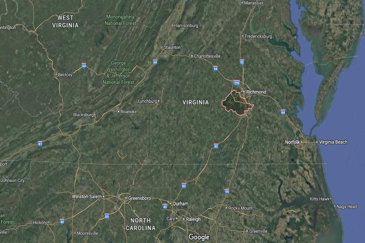
Chesterfield County, Virginia, is located in the central part of the state, approximately 15 miles south of Richmond and about 70 miles northwest of Norfolk. The county seat, Chesterfield Court House, lies near U.S. Route 1 and Route 288, around 40 miles southeast of Charlottesville. It is also about 50 miles north of Emporia.
The county is roughly 120 miles south of Washington, D.C., and about 90 miles east of Lynchburg. Chesterfield County is approximately 100 miles northeast of Danville. Its location places it within the Richmond metropolitan area, offering a mix of suburban and rural communities with strong regional access.
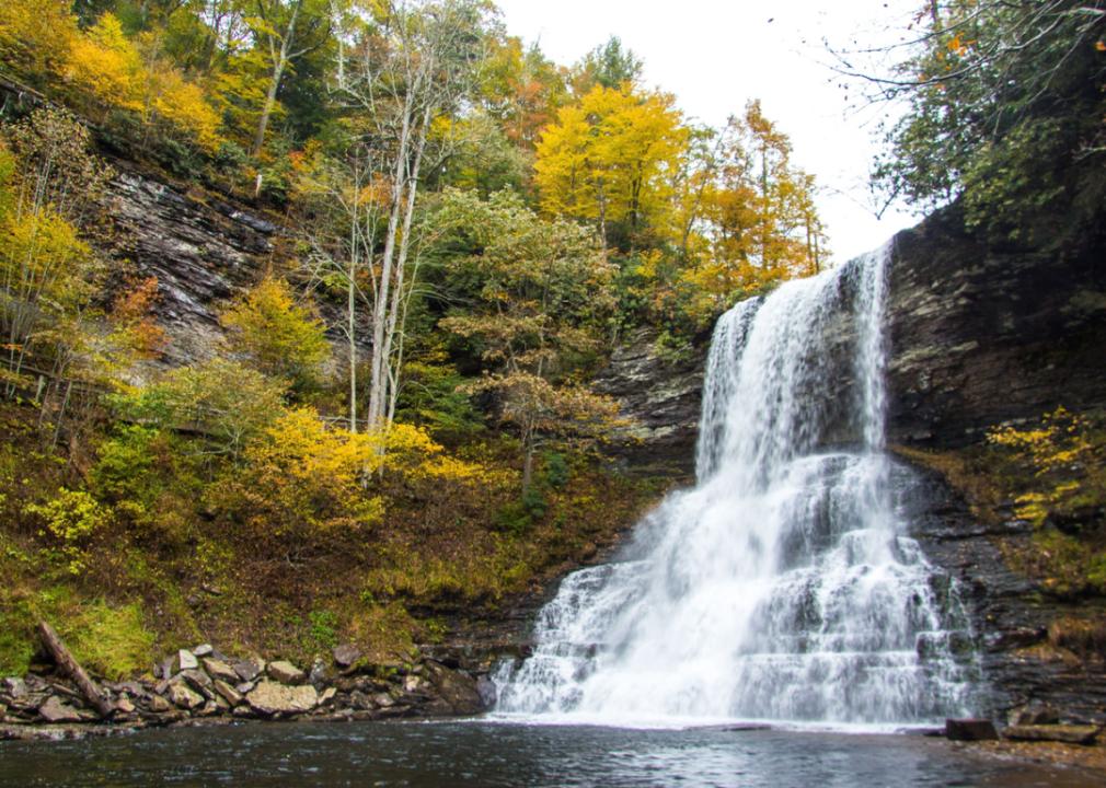
#8. Montgomery County, Virginia
– Overall Rank: 99
– Population: 99,373
– Median household income: $65,270
– Median home value: $269,300 (55% own)
– Median rent: $1,161 (45% rent)
– Top public schools: Blacksburg High School (grade A+), Gilbert Linkous Elementary School (grade A), Harding Avenue Elementary School (grade A)
– Top private schools: Dayspring Christian Academy (grade C+), St. John Neumann Academy (grade unavailable), Blacksburg New School (grade unavailable)
– Top places: Blacksburg (grade A+), Merrimac (grade A), Christiansburg (grade A minus)
About
Montgomery County offers a blend of academic influence, natural beauty, and small-town appeal. Its economy benefits from education, research, technology, and a mix of local businesses. Mountains, trails, and parks provide year-round opportunities for outdoor recreation and scenic enjoyment.
The community places strong emphasis on learning, innovation, and cultural expression through schools, events, and public programs. Development is guided by a commitment to sustainability and balanced growth. Residents value a vibrant, inclusive atmosphere with access to both tradition and progress.
Where is Montgomery County?
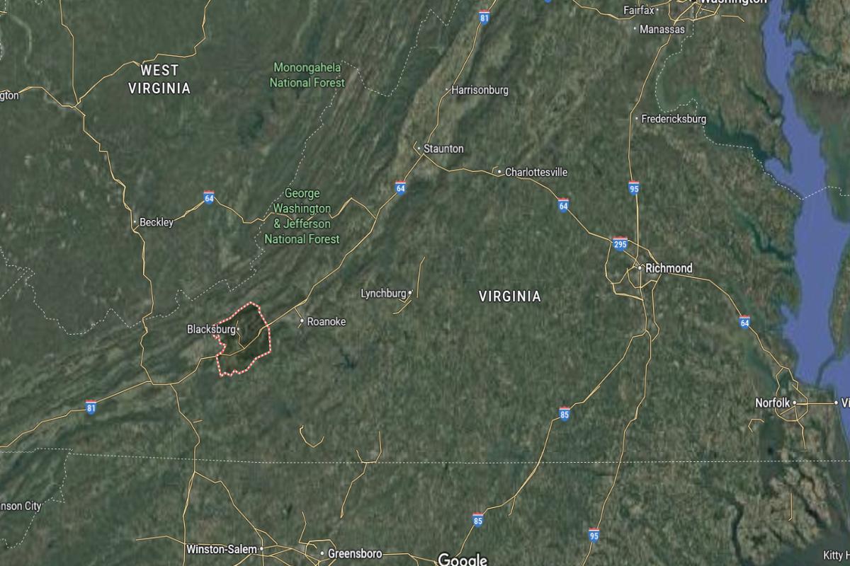
Montgomery County, Virginia, is located in the southwestern part of the state, approximately 40 miles southwest of Roanoke and about 30 miles northwest of Radford. The county seat, Christiansburg, lies along U.S. Route 460 and is about 20 miles southeast of Blacksburg. It is also around 60 miles north of the North Carolina border.
The county is roughly 190 miles west of Richmond and about 250 miles southwest of Washington, D.C. Montgomery County is approximately 120 miles northwest of Danville. Its location places it in the heart of the New River Valley, combining access to higher education and mountain landscapes.
#7. Henrico County, Virginia
– Overall Rank: 90
– Population: 333,120
– Median household income: $82,424
– Median home value: $309,700 (65% own)
– Median rent: $1,380 (35% rent)
– Top public schools: Deep Run High School (grade A+), Mills E. Godwin High School (grade A), Glen Allen High School (grade A)
– Top private schools: The Steward School (grade A+), Collegiate School (grade A+), Landmark Christian School (grade A)
– Top places: Innsbrook (grade A+), Short Pump (grade A+), Wyndham (grade A+)
About
Henrico County features a dynamic mix of urban convenience, suburban comfort, and historic charm. Its economy is diverse, with strengths in healthcare, education, retail, and government services supporting a steadily growing population. Parks, cultural venues, and green spaces enhance the overall quality of life.
The county prioritizes excellent schools, infrastructure, and community engagement through events and public services. Thoughtful planning supports balanced development while preserving historic districts and natural areas. Residents enjoy a well-connected, vibrant environment rooted in both heritage and modern living.
Where is Henrico County?
Henrico County, Virginia, is located in the central part of the state, surrounding the city of Richmond on the north and east sides. It is approximately 60 miles southeast of Charlottesville and about 85 miles northwest of Norfolk. The county is also around 50 miles south of Fredericksburg.
Henrico County is roughly 110 miles south of Washington, D.C., and about 95 miles northeast of Lynchburg. It is approximately 90 miles north of Emporia. Its location places it at the heart of Virginia’s urban corridor with strong access to highways and regional economic centers.
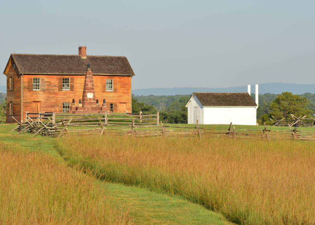
#6. Prince William County, Virginia
– Overall Rank: 75
– Population: 481,114
– Median household income: $123,193
– Median home value: $472,000 (74% own)
– Median rent: $1,907 (26% rent)
– Top public schools: Battlefield High School (grade A), Osbourn Park High School (grade A), Charles J. Colgan Senior High School (grade A)
– Top private schools: Saint John Paul the Great Catholic High School (grade A), Christ Chapel Academy (grade A), Heritage Christian School (grade A minus)
– Top places: Haymarket (grade A+), County Center (grade A+), Gainesville (grade A)
About
Prince William County blends suburban development, historic preservation, and natural beauty into a thriving, diverse community. The local economy is driven by government, education, healthcare, and a wide range of private-sector industries. Parks, trails, and cultural venues support active lifestyles and community enrichment.
Education, public safety, and inclusive growth are central priorities, reflected in schools, services, and infrastructure investments. The county balances rapid development with efforts to protect natural resources and historical landmarks. Residents enjoy a dynamic environment that supports families, business, and cultural connection.
Where is Prince William County?
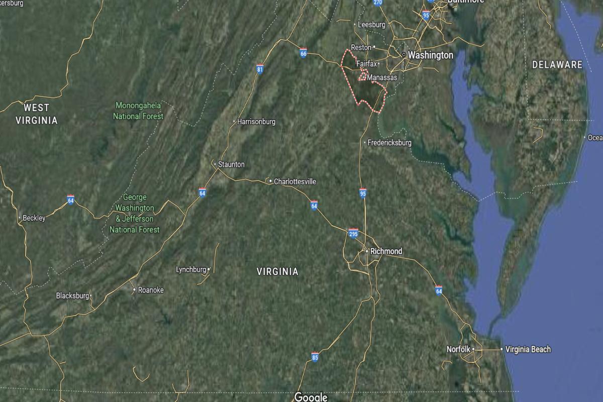
Prince William County, Virginia, is located in the northern part of the state, approximately 30 miles southwest of Washington, D.C. and about 60 miles north of Fredericksburg. The county seat, Manassas, lies near I-66 and is around 35 miles southeast of Winchester. It is also about 70 miles northeast of Front Royal.
The county is roughly 100 miles north of Charlottesville and about 150 miles northeast of Harrisonburg. Prince William County is approximately 170 miles north of Lynchburg. Its location places it within the Washington metropolitan area, combining suburban growth with access to major highways and federal employment centers.
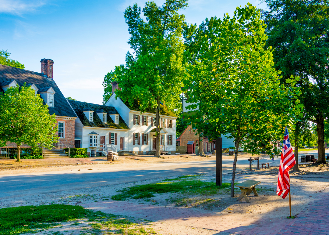
#5. James City County, Virginia
– Overall Rank: 59
– Population: 78,818
– Median household income: $100,711
– Median home value: $396,800 (78% own)
– Median rent: $1,435 (22% rent)
– Top public schools: Jamestown High School (grade A), Lafayette High School (grade A minus), Matoaka Elementary School (grade A minus)
– Top private schools: Williamsburg Christian Academy (grade A), Providence Classical School (grade A), Williamsburg Montessori School (grade unavailable)
About
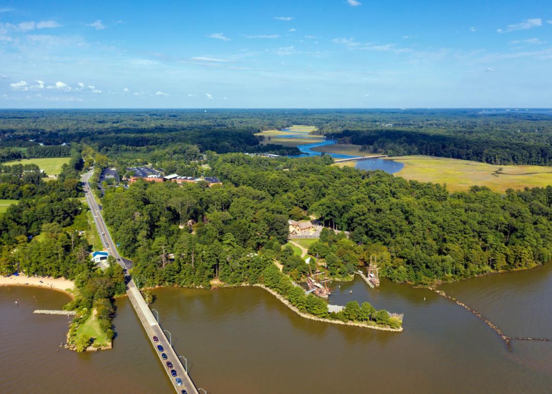
James City County blends historical significance with a carefully planned modern lifestyle. Its economy is supported by tourism, education, and service industries, alongside growing residential and commercial areas. Natural spaces, trails, and waterways contribute to a relaxed and active way of life.
The community emphasizes heritage preservation, quality education, and sustainable growth through thoughtful planning and civic involvement. Residents benefit from a strong sense of place, cultural opportunities, and access to essential services. The county offers a balanced environment where history and progress coexist.
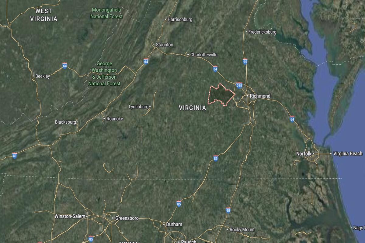
Where is James City County?
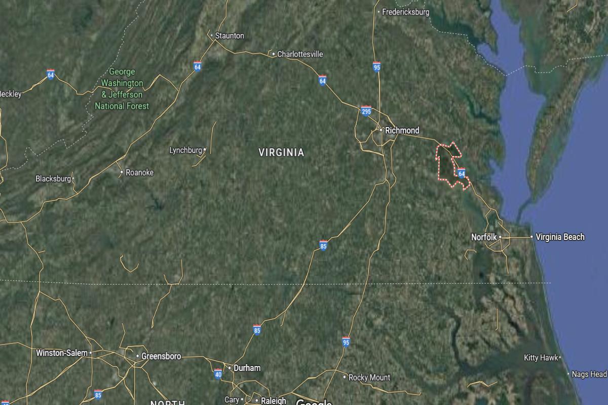
James City County, Virginia, is located in the southeastern part of the state, approximately 45 miles southeast of Richmond and about 30 miles northwest of Norfolk. The county seat is Williamsburg, which lies near Interstate 64 and is around 20 miles southeast of Newport News. It is also about 60 miles northeast of Suffolk.
The county is roughly 130 miles south of Washington, D.C., and about 80 miles east of Petersburg. James City County is approximately 90 miles southeast of Charlottesville. Its location places it in the Hampton Roads region, offering a blend of historical sites and coastal access.
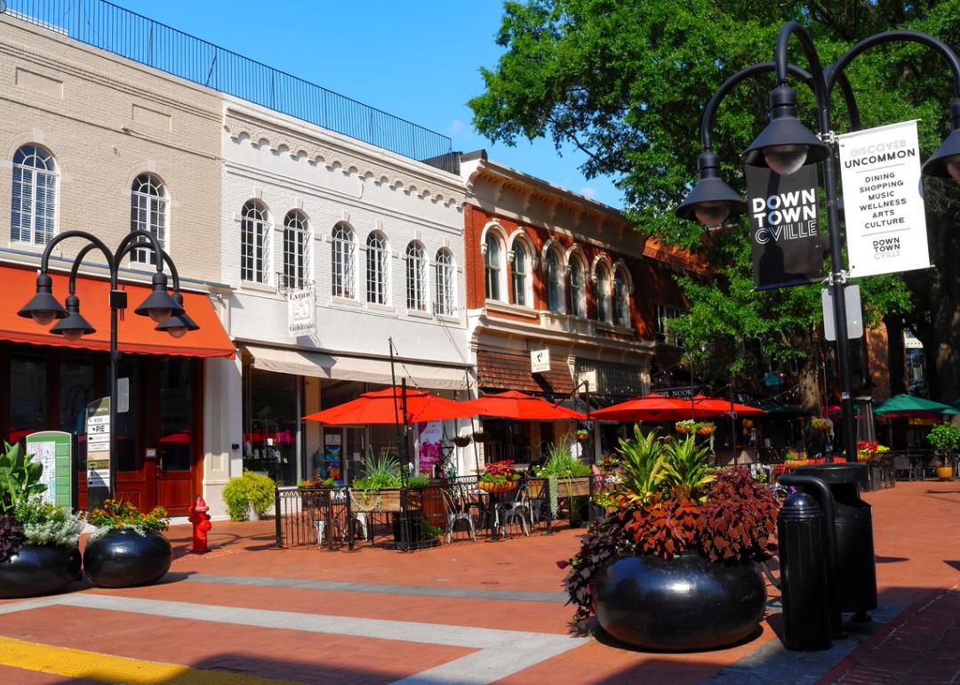
#4. Albemarle County, Virginia
– Overall Rank: 48
– Population: 112,513
– Median household income: $97,708
– Median home value: $450,200 (67% own)
– Median rent: $1,570 (33% rent)
– Top public schools: Albemarle High School (grade A), Virginia L. Murray Elementary School (grade A), Hollymead Elementary School (grade A)
– Top private schools: Tandem Friends School (grade A+), Miller School of Albemarle (grade A+), Regents School of Charlottesville (grade A minus)
– Top places: Piney Mountain (grade A+), Hollymead (grade A+), Crozet (grade A+)
About
Albemarle County features a mix of scenic landscapes, cultural richness, and a blend of rural and urban lifestyles. Its economy is supported by education, agriculture, technology, and tourism, creating a diverse and resilient community. Rolling hills, vineyards, and preserved natural areas offer residents a connection to the land.
The county places a strong emphasis on environmental stewardship, historic preservation, and inclusive development. Schools, public services, and community programs reflect a commitment to quality of life and civic engagement. Residents value the balance of natural beauty, innovation, and deep-rooted tradition.
Where is Albemarle County?
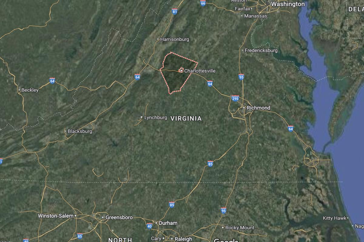
Albemarle County, Virginia, is located in the central part of the state, approximately 70 miles northwest of Richmond and about 35 miles south of Culpeper. The county seat, Charlottesville, lies near U.S. Route 29 and I-64, around 60 miles northeast of Lynchburg. It is also about 35 miles east of Staunton.
The county is roughly 115 miles southwest of Washington, D.C., and about 100 miles northwest of Norfolk. Albemarle County is approximately 90 miles north of Danville. Its location places it in the foothills of the Blue Ridge Mountains, offering scenic landscapes and access to cultural and educational centers.
#3. Fairfax County, Virginia
– Overall Rank: 19
– Population: 1,145,354
– Median household income: $145,165
– Median home value: $666,900 (69% own)
– Median rent: $2,159 (31% rent)
– Top public schools: Thomas Jefferson High School for Science & Technology (grade A+), Oakton High School (grade A+), McLean High School (grade A+)
– Top private schools: BASIS Independent McLean (grade A+), The Madeira School (grade A+), The Potomac School (grade A+)
– Top places: Franklin Farm (grade A+), Vienna (grade A+), Oakton (grade A+)
About
Fairfax County is a dynamic and densely populated area known for its economic strength, cultural diversity, and modern infrastructure. The economy is driven by government, technology, defense, and global business, making it one of the most prosperous regions in the state. Parks, libraries, and arts venues enhance daily life for residents across urban and suburban communities.
The county prioritizes excellence in education, public services, and sustainable development. Community engagement is strong, with events, multicultural programs, and initiatives that foster inclusion and innovation. Residents benefit from a high quality of life balanced with access to career opportunities and civic resources.
Where is Fairfax County?
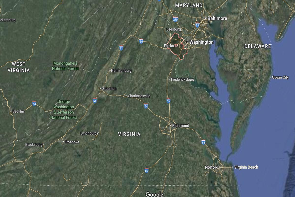
Fairfax County, Virginia, is located in the northern part of the state, approximately 15 miles southwest of Washington, D.C. and about 55 miles north of Fredericksburg. The county includes several major suburbs and lies near I-66 and I-95, offering direct access to the nation’s capital. It is also around 40 miles southeast of Leesburg.
The county is roughly 95 miles northeast of Charlottesville and about 75 miles east of Winchester. Fairfax County is approximately 160 miles north of Richmond. Its location places it in the heart of Northern Virginia’s urban corridor, serving as a key economic and governmental center.
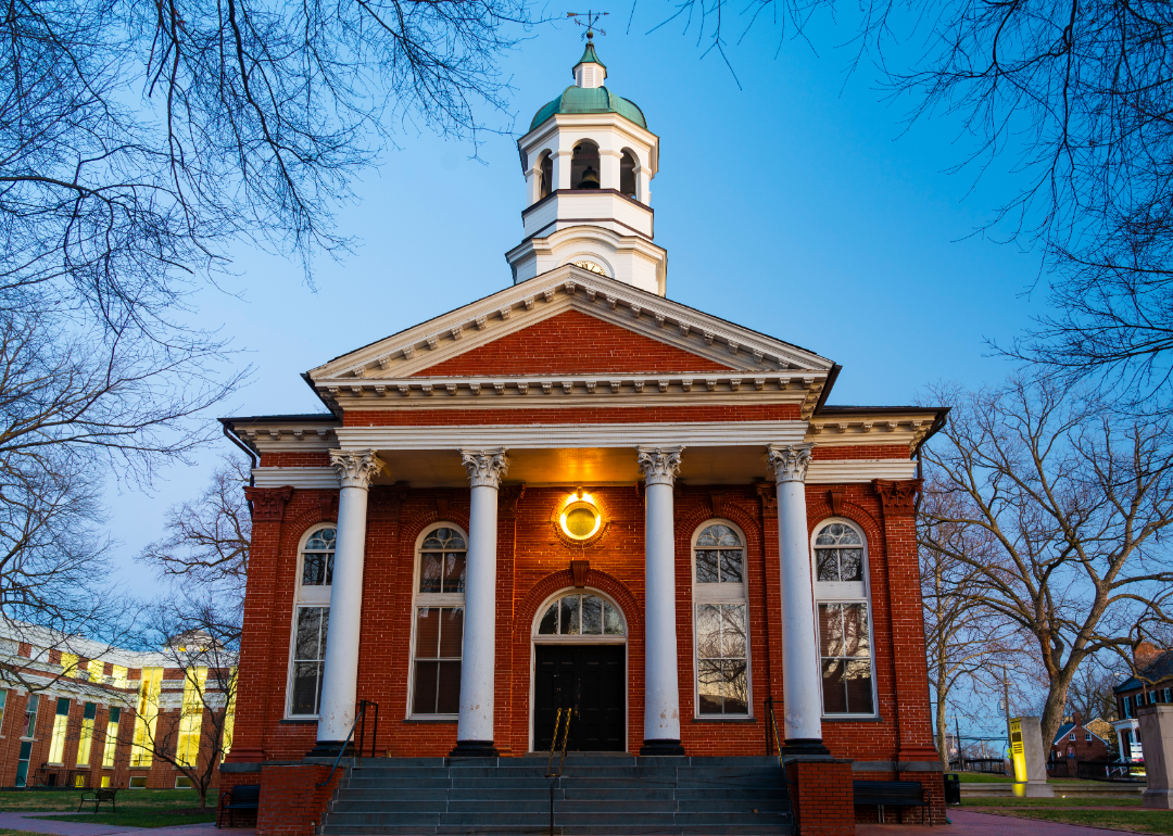
#2. Loudoun County, Virginia
– Overall Rank: 10
– Population: 420,773
– Median household income: $170,463
– Median home value: $657,000 (77% own)
– Median rent: $2,195 (23% rent)
– Top public schools: Independence High School (grade A+), Rock Ridge High School (grade A+), Riverside High School (grade A+)
– Top private schools: Fairfax Christian School (grade A+), Foxcroft School (grade A+), Loudoun School for Advanced Studies (grade A+)
– Top places: Stone Ridge (grade A+), Broadlands (grade A+), Loudoun Valley Estates (grade A+)
About
Loudoun County is known for its rapid growth, technological innovation, and blend of suburban and rural character. Its economy thrives on data centers, government contracting, and a strong presence of wineries and agriculture. The landscape features rolling countryside, planned communities, and preserved open space.
Community priorities include top-tier education, sustainable development, and high-quality public services. Cultural events, historic sites, and scenic trails contribute to a vibrant and balanced lifestyle. Residents enjoy both economic opportunity and access to natural beauty.
Where is Loudoun County?
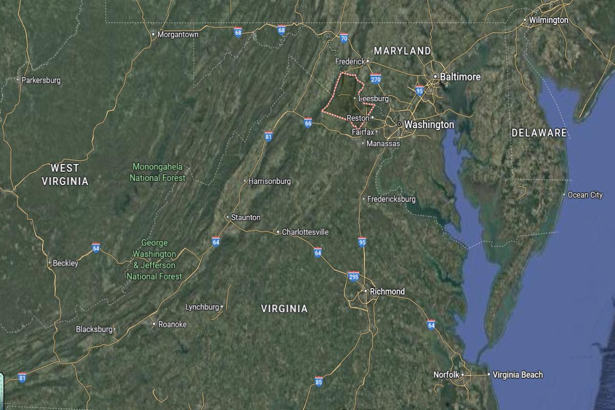
Loudoun County, Virginia, is located in the northern part of the state, approximately 35 miles northwest of Washington, D.C. and about 15 miles north of Manassas. The county seat, Leesburg, lies near U.S. Route 15 and Route 7, around 25 miles southeast of Winchester. It is also about 50 miles northeast of Front Royal.
The county is roughly 100 miles north of Charlottesville and about 170 miles north of Richmond. Loudoun County is approximately 60 miles west of Baltimore, Maryland. Its location places it in the Washington metropolitan area, blending suburban growth with access to rural landscapes and transportation corridors.
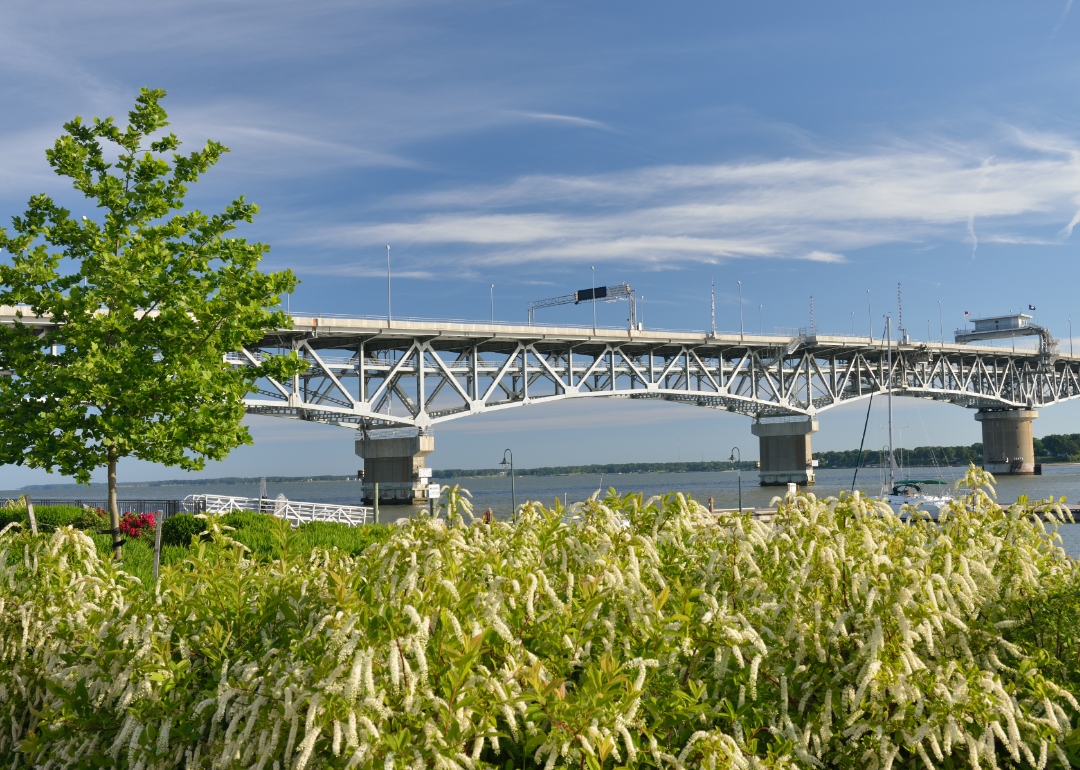
#1. York County, Virginia
– Overall Rank: 6
– Population: 70,238
– Median household income: $105,154
– Median home value: $387,200 (72% own)
– Median rent: $1,701 (28% rent)
– Top public schools: Tabb High School (grade A+), Grafton High School (grade A), Dare Elementary School (grade A)
– Top private schools: Summit Christian Academy (grade B+), Little Log Cabin CC & Learning Center (grade unavailable), COVENANT CHRISTIAN SCHOOL (grade unavailable)
– Top places: Yorktown (grade A)
About
York County offers a balanced mix of historical heritage, suburban comfort, and natural beauty. Its economy benefits from military presence, tourism, and a growing base of local businesses. Waterways, parks, and preserved sites support outdoor activities and cultural exploration.
The community values strong schools, civic engagement, and careful planning to maintain quality of life. Growth is managed with attention to preserving character and enhancing services. Residents enjoy a peaceful, family-friendly environment rooted in tradition and progress.
Where is York County?
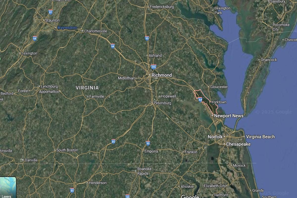
York County, Virginia, is located in the southeastern part of the state, approximately 35 miles northwest of Norfolk and about 45 miles southeast of Richmond. The county seat, Yorktown, lies along the York River near U.S. Route 17 and is around 20 miles northeast of Newport News. It is also about 25 miles southeast of Williamsburg.
The county is roughly 130 miles south of Washington, D.C., and about 90 miles east of Petersburg. York County is approximately 85 miles southeast of Charlottesville. Its location places it within the Hampton Roads region, offering proximity to historical sites and coastal access.
This story features data reporting and writing by Elena Cox and is part of a series utilizing data automation across 50 states.
By Stacker