Would you like to save this?

Best counties to live in South Dakota
More counties in the United States experienced population growth in the last year, according to the latest Census data, even as pandemic-related moving trends begin to normalize.
Counties in the South continued to experience growth, particularly in Florida, where 96% of its 67 counties gained new residents. Polk County, Florida, a suburb of Orlando, added the most, with 26,000 people moving there in 2023.
Meanwhile, counties in the Midwest and Northeast continued to lose population, but at slower rates than the year before. Some of the biggest losses were in counties home to large cities, including Cook County, Illinois (home of Chicago) and the boroughs of Brooklyn and Queens in New York.
Many counties are experiencing growth due to their job opportunities, education, or relatively affordable housing costs. Others are favored for their historic or well-designed downtowns or access to cultural opportunities.
Stacker compiled a list of the best counties to live in South Dakota using rankings from Niche. Niche ranks counties by various factors including public schools, educational attainment, cost of living, and housing.
Keep reading to see if your county made the list.
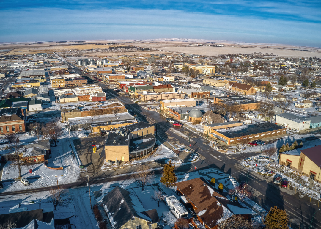
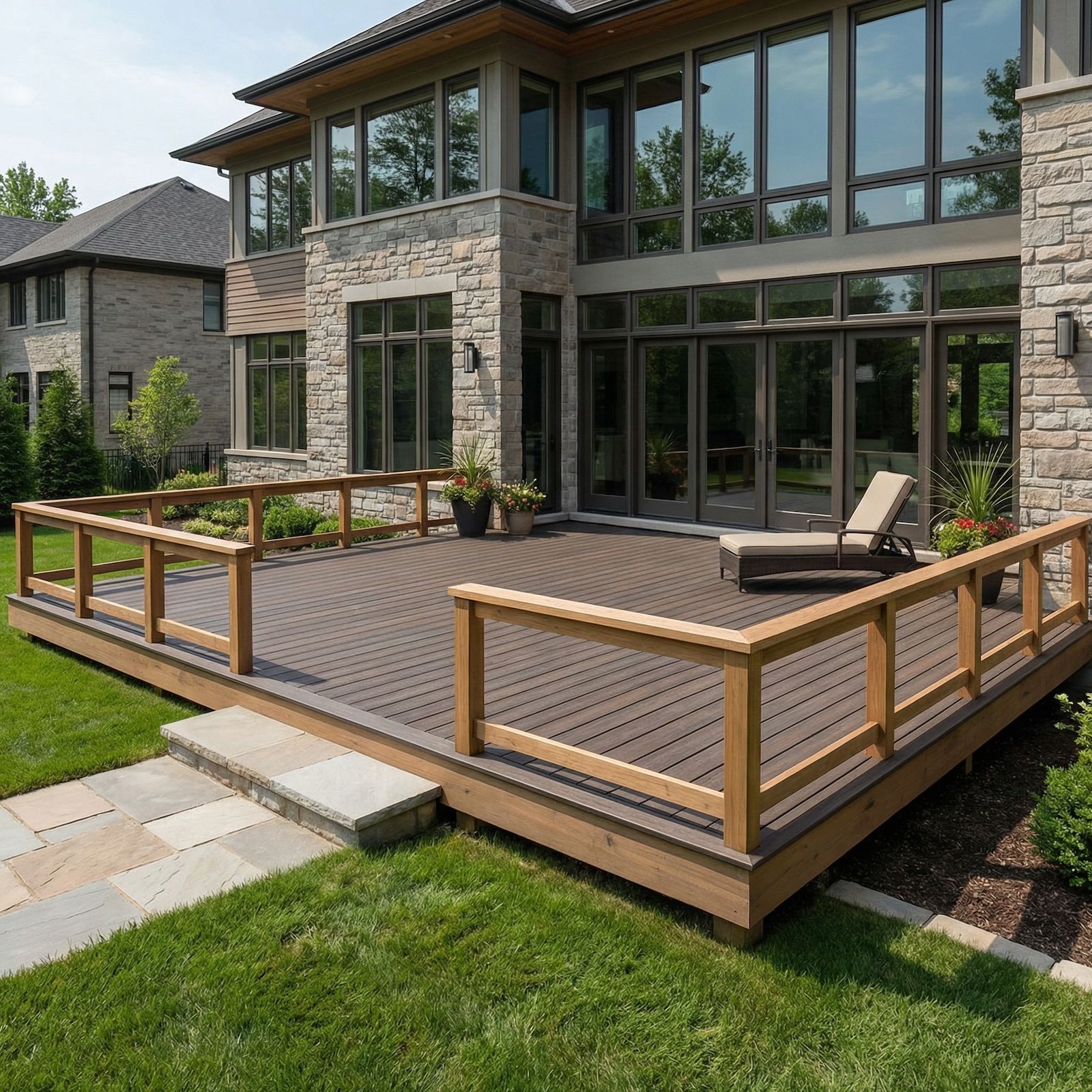
#30. Tripp County, South Dakota
– Overall Rank: Not ranked
– Population: 5,607
– Median household income: $56,758
– Median home value: $128,100 (71% own)
– Median rent: $800 (29% rent)
– Top public schools: Winner High School (grade B), Winner Elementary School (grade B minus), Winner Middle School (grade B minus)
– Top private schools:
– Top places: Winner (grade B minus), Colome (grade B minus), Lamro Township (grade B minus)
About
Tripp County’s economy is primarily rooted in agriculture, including cattle ranching, crop production, and related agribusiness services. Local efforts focus on sustaining rural livelihoods through community support, infrastructure improvements, and resource management. The area values independence, hard work, and traditions tied to the land.
Community life centers around seasonal events, fairs, and local institutions that bring residents together and preserve cultural heritage. Outdoor recreation such as hunting, fishing, and camping plays a significant role in the lifestyle and tourism appeal. Public services, schools, and a strong sense of community contribute to a steady and close-knit environment.
Where is Tripp County?
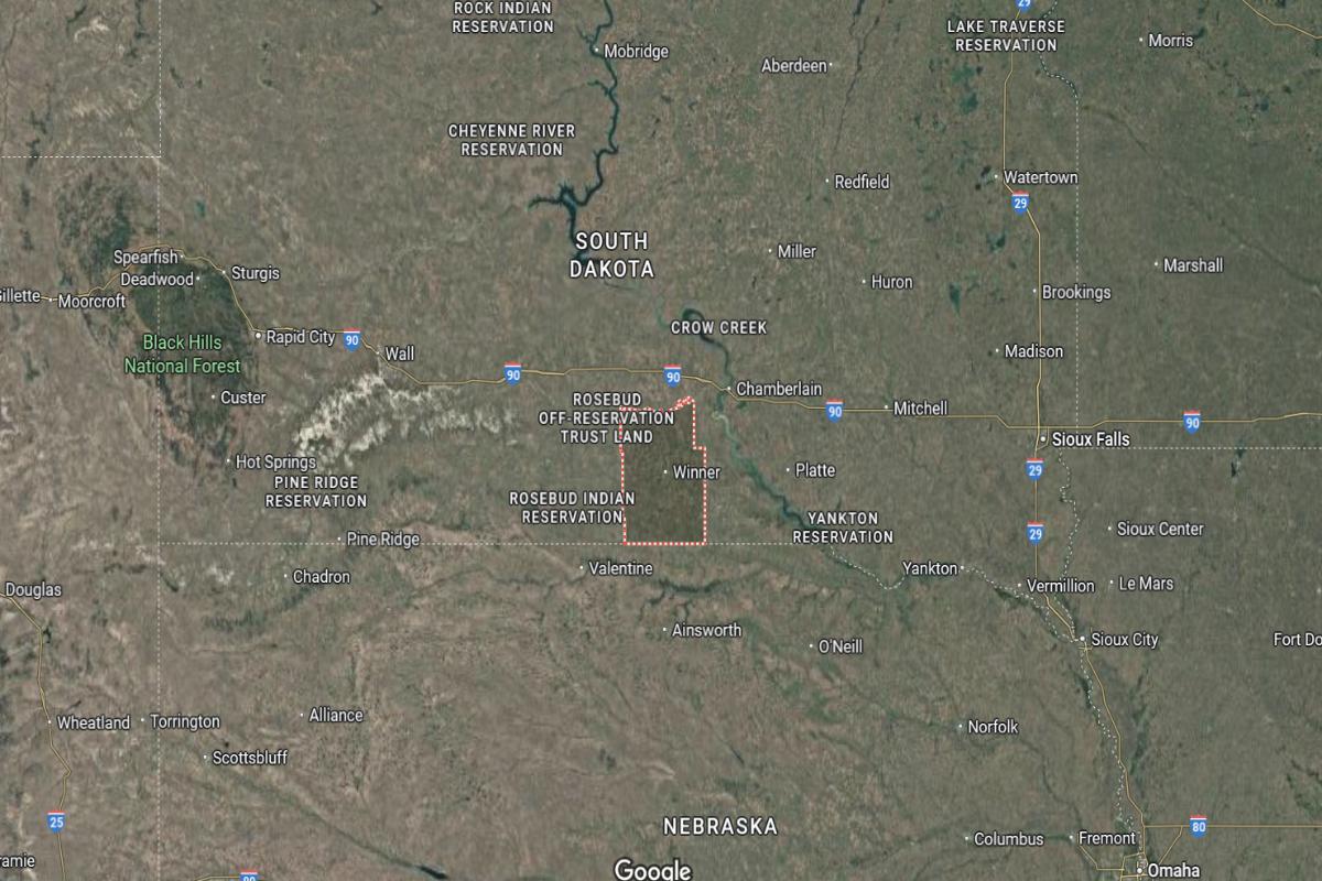
Tripp County is located in south-central South Dakota, near the Nebraska border. The county seat, Winner, is about 140 miles southwest of Pierre. It lies approximately 65 miles north of Valentine, Nebraska.
The county is around 160 miles west of Mitchell and about 100 miles southeast of Rapid City. Winner is situated roughly 70 miles east of Mission. U.S. Highway 18 and U.S. Highway 183 run through the area, connecting it to surrounding regions.
#29. Bon Homme County, South Dakota
– Overall Rank: Not ranked
– Population: 7,018
– Median household income: $57,554
– Median home value: $112,700 (76% own)
– Median rent: $702 (24% rent)
– Top public schools: Tyndall Elementary School (grade B+), Bon Homme Middle School (grade B), Avon Elementary School (grade B minus)
– Top private schools:
– Top places: Scotland (grade B+), Springfield (grade B+), Tyndall (grade B)
About
Bon Homme County maintains a rural economy supported by agriculture, small manufacturing, and local service industries. Farming, particularly livestock and crop production, plays a central role in sustaining the region’s economic base. Community development emphasizes resilience, tradition, and stewardship of natural resources.
Residents enjoy a quiet pace of life enriched by historical landmarks, local festivals, and close community ties. Outdoor recreation opportunities like hunting, fishing, and boating contribute to both lifestyle and tourism. Strong schools, public services, and civic pride foster a supportive and family-oriented environment.
Where is Bon Homme County?
Bon Homme County is located in southeastern South Dakota along the Missouri River. The county seat, Tyndall, is about 85 miles southwest of Sioux Falls. It lies approximately 25 miles west of Yankton.
The county is around 60 miles north of Norfolk, Nebraska, and about 100 miles east of Winner. Tyndall is situated roughly 45 miles south of Mitchell. U.S. Highway 50 and State Highway 37 provide access through the region.
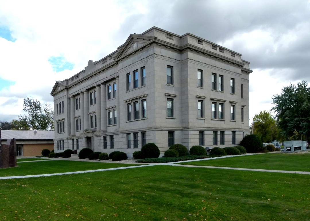
#28. Codington County, South Dakota
– Overall Rank: Not ranked
– Population: 28,402
– Median household income: $65,747
– Median home value: $206,600 (67% own)
– Median rent: $863 (33% rent)
– Top public schools: Lincoln Elementary School (grade A minus), Mellette Elementary School (grade B+), Watertown Junior High School (grade B+)
– Top private schools: Great Plains Lutheran High School (grade B), Immaculate Conception School (grade unavailable), St. Martin’s Lutheran School (grade unavailable)
– Top places: Watertown (grade B+), Kranzburg Township (grade B), Elmira Township (grade B)
About
Codington County has a diverse and growing economy supported by manufacturing, agriculture, retail, and service industries. Economic development is fueled by infrastructure investment, skilled workforce programs, and strong business-community partnerships. The region emphasizes sustainable growth while preserving its local character.
Cultural life includes community festivals, arts programs, and public events that foster civic pride and engagement. Residents enjoy parks, sports facilities, and outdoor recreation that promote an active lifestyle. Quality education, accessible healthcare, and dedicated public services contribute to a high standard of living.
Where is Codington County?
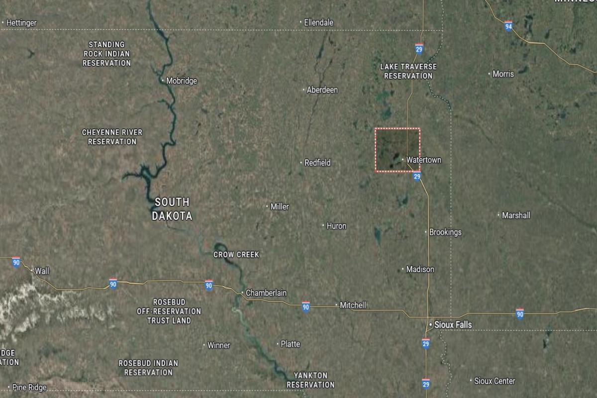
Codington County is located in northeastern South Dakota, within the Glacial Lakes region. The county seat, Watertown, is about 105 miles north of Sioux Falls. It lies approximately 70 miles south of the North Dakota border.
The county is around 65 miles northeast of Huron and about 85 miles west of Marshall, Minnesota. Watertown is situated roughly 40 miles east of Redfield. Interstate 29 and U.S. Highway 212 run through the area, offering key transportation routes.
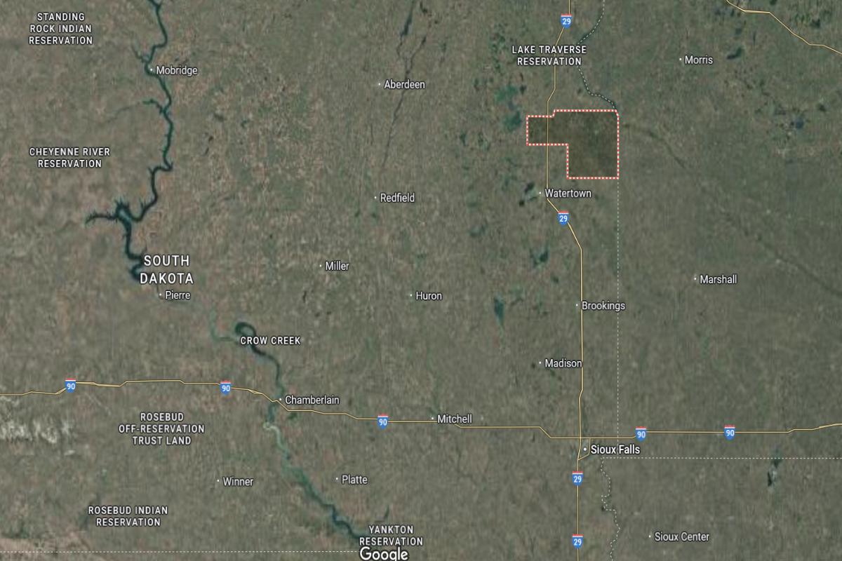
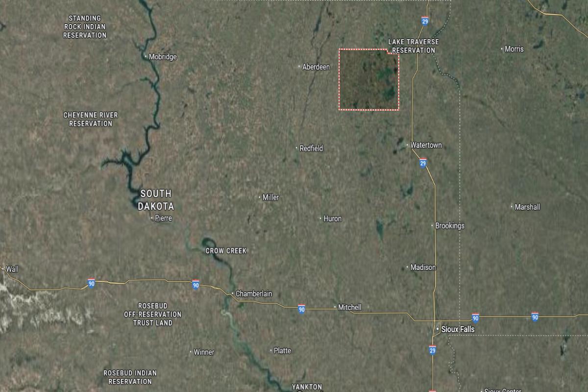
#27. Roberts County, South Dakota
– Overall Rank: Not ranked
– Population: 10,242
– Median household income: $59,022
– Median home value: $127,800 (68% own)
– Median rent: $596 (32% rent)
– Top public schools: Sisseton High School (grade B minus), Summit High School (grade B minus), Westside Elementary School (grade B minus)
– Top private schools:
– Top places: Lawrence Township (grade B), Sisseton (grade B), Rosholt (grade B)
About
Roberts County’s economy is grounded in agriculture, with farming and livestock production serving as key economic drivers. The area also benefits from small business development, local services, and tourism tied to its natural landscapes. Community initiatives focus on sustainability, economic diversification, and preserving rural traditions.
Cultural identity is shaped by local heritage, festivals, and tribal influences that enrich community life. Residents enjoy outdoor activities such as fishing, hunting, and hiking, supported by the county’s scenic environment. Strong schools, healthcare access, and civic involvement contribute to a connected and supportive way of life.
Where is Roberts County?
Would you like to save this?
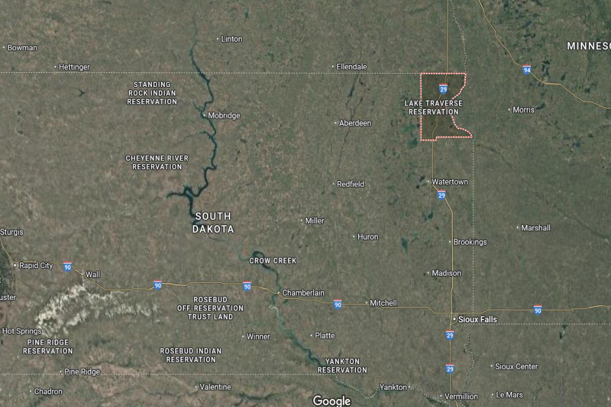
Roberts County is located in the northeastern corner of South Dakota, bordering both Minnesota and North Dakota. The county seat, Sisseton, is about 70 miles northeast of Watertown. It lies approximately 115 miles north of Brookings.
The county is around 25 miles west of Wahpeton, North Dakota, and about 60 miles southeast of Aberdeen. Sisseton is situated roughly 10 miles south of the North Dakota border. Interstate 29 and U.S. Highway 81 run through the area, connecting it to nearby states and regions.
#26. Hamlin County, South Dakota
– Overall Rank: Not ranked
– Population: 6,196
– Median household income: $76,995
– Median home value: $181,800 (81% own)
– Median rent: $717 (19% rent)
– Top public schools: Hamlin High School (grade B+), Hamlin Elementary School (grade B+), Estelline Elementary School (grade B minus)
– Top private schools:
– Top places: Brantford Township (grade A), Cleveland Township (grade A minus), Norden Township (grade B+)


About
Hamlin County has a stable economy primarily based on agriculture, with strong contributions from crop farming, livestock, and agribusiness services. Local economic activity is supported by small businesses, manufacturing, and infrastructure that connects rural communities. The region values sustainability, innovation in farming, and strong community ties.
Cultural life centers around local events, school activities, and traditions that bring residents together year-round. Outdoor recreation such as fishing, hunting, and snowmobiling is a key part of the lifestyle. Quality schools, public services, and civic pride contribute to a family-friendly and resilient community atmosphere.
Where is Hamlin County?
Hamlin County is located in eastern South Dakota, within the Glacial Lakes region. The county seat, Hayti, is about 90 miles north of Sioux Falls. It lies approximately 25 miles west of Watertown.
The county is around 55 miles east of Huron and about 75 miles south of the North Dakota border. Hayti is situated roughly 30 miles northeast of De Smet. U.S. Highway 81 and State Highway 28 provide access through the region.
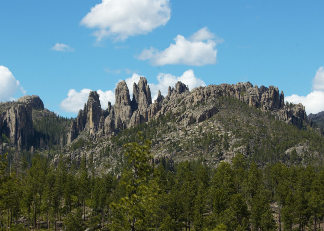
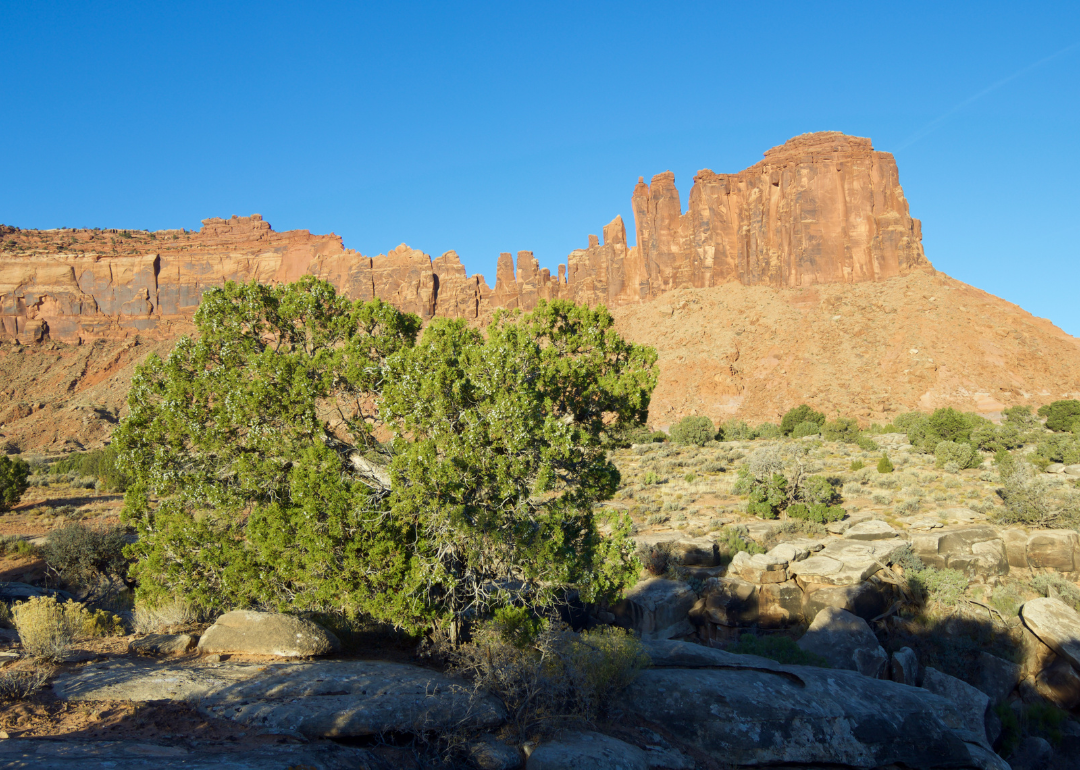
#25. Custer County, South Dakota
– Overall Rank: Not ranked
– Population: 8,515
– Median household income: $75,943
– Median home value: $294,700 (86% own)
– Median rent: $948 (14% rent)
– Top public schools: Custer High School (grade B), Custer Middle School (grade B), Custer Elementary School (grade C+)
– Top private schools:
– Top places: Custer (grade B+), Hermosa (grade B), Pringle (grade C)
About
Custer County’s economy is supported by tourism, forestry, small business, and agriculture, with natural attractions playing a major role in local income. Economic development emphasizes sustainability, resource management, and support for local entrepreneurs. The area blends historical preservation with efforts to maintain modern services and infrastructure.
Community life is enriched by arts events, cultural festivals, and outdoor recreation that reflect the region’s scenic and historical character. Residents and visitors alike enjoy hiking, biking, and wildlife viewing throughout the year. Strong civic involvement, quality education, and a welcoming atmosphere contribute to a vibrant and close-knit community.
Where is Custer County?
Custer County is located in the southwestern part of South Dakota, within the Black Hills region. The county seat, Custer, is about 40 miles southwest of Rapid City. It lies approximately 20 miles east of the Wyoming border.
The county is around 60 miles north of the Nebraska border and about 70 miles west of Hot Springs. Custer is situated roughly 30 miles south of Mount Rushmore. U.S. Highway 16 and State Highway 385 run through the area, providing scenic routes across the region.

#24. Turner County, South Dakota
– Overall Rank: Not ranked
– Population: 8,687
– Median household income: $72,312
– Median home value: $175,300 (79% own)
– Median rent: $691 (21% rent)
– Top public schools: Parker High School (grade B+), Parker Junior High School (grade B+), Centerville Elementary School (grade B)
– Top private schools:
– Top places: Parker Township (grade A minus), Swan Lake Township (grade B+), Centerville (grade B+)
About
Turner County has a strong agricultural economy focused on crop production, livestock, and agribusiness services that support rural livelihoods. Economic activity is bolstered by local manufacturing, small businesses, and infrastructure that connects its communities. The county values tradition, efficient resource use, and collaborative growth.
Cultural life is centered around fairs, community events, and historical preservation efforts that bring residents together. Outdoor recreation such as hunting, fishing, and local sports promotes a healthy and active lifestyle. Quality schools, public services, and strong civic participation foster a supportive and community-oriented environment.
Where is Turner County?
Turner County is located in southeastern South Dakota, west of Sioux Falls. The county seat, Parker, is about 30 miles southwest of Sioux Falls. It lies approximately 55 miles east of Mitchell.
The county is around 40 miles north of Yankton and about 45 miles west of the Iowa border. Parker is situated roughly 25 miles southeast of Bridgewater. U.S. Highway 81 and State Highway 19 run through the area, offering regional access.
#23. Kingsbury County, South Dakota
– Overall Rank: 1,334
– Population: 5,172
– Median household income: $65,964
– Median home value: $149,300 (80% own)
– Median rent: $681 (20% rent)
– Top public schools: Arlington Elementary School (grade A minus), Arlington Junior High School (grade A minus), Lake Preston Elementary School (grade A minus)
– Top private schools: Sunny Plains Christian School (grade unavailable)
– Top places: Lake Preston (grade B+), Oldham (grade B+), Arlington (grade B)
About
Kingsbury County’s economy is primarily based on agriculture, with grain farming and livestock production playing central roles. Local businesses and services support rural communities, while infrastructure investments aid in sustaining economic activity. The county emphasizes efficient land use, heritage preservation, and long-term rural resilience.
Community life revolves around agricultural fairs, school events, and historic landmarks that reflect deep local roots. Residents enjoy outdoor recreation such as hunting, fishing, and snowmobiling throughout the seasons. Strong education systems, public services, and community pride create a close-knit and supportive living environment.
Where is Kingsbury County?
Would you like to save this?
Kingsbury County is located in east-central South Dakota, in the prairie lake region. The county seat, De Smet, is about 90 miles northwest of Sioux Falls. It lies approximately 35 miles east of Huron.
The county is around 30 miles west of Brookings and about 60 miles south of Watertown. De Smet is situated roughly 75 miles north of Mitchell. U.S. Highway 14 and State Highway 25 run through the area, providing access across the region.
#22. McCook County, South Dakota
– Overall Rank: 1,299
– Population: 5,714
– Median household income: $74,873
– Median home value: $186,100 (82% own)
– Median rent: $778 (18% rent)
– Top public schools: Canistota Elementary School (grade A minus), Canistota Middle School (grade B+), Bridgewater-Emery Elementary School (grade B+)
– Top private schools: Salem St. Mary’s Elementary School (grade unavailable)
– Top places: Grant Township (grade A), Bridgewater Township (grade A), Canistota (grade B+)
About
McCook County has an economy grounded in agriculture, with a focus on corn, soybeans, and livestock operations. Local industry is supported by small businesses, agribusiness services, and transportation infrastructure that connects rural communities. Economic development efforts promote sustainability, innovation, and community collaboration.
Cultural life includes county fairs, school-centered events, and historical celebrations that strengthen local identity. Outdoor activities such as hunting, fishing, and camping are popular among residents and visitors. Strong schools, reliable public services, and a close-knit atmosphere contribute to a stable and welcoming community.
Where is McCook County?
McCook County is located in southeastern South Dakota, west of Sioux Falls. The county seat, Salem, is about 35 miles west of Sioux Falls. It lies approximately 45 miles east of Mitchell.
The county is around 65 miles north of Yankton and about 60 miles south of Brookings. Salem is situated roughly 25 miles northwest of Parker. Interstate 90 and State Highway 81 run through the area, offering convenient regional access.
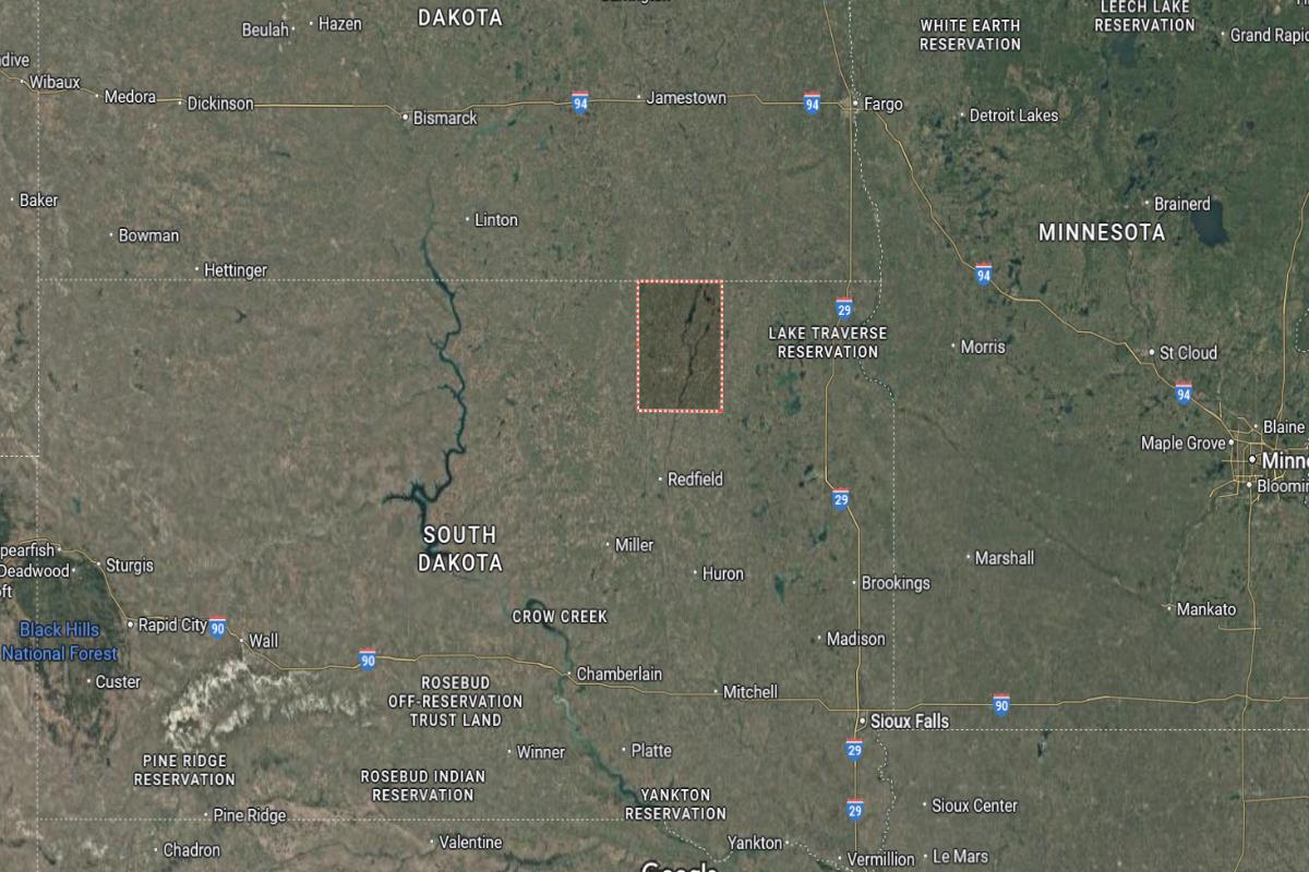
#21. Spink County, South Dakota
– Overall Rank: 1,277
– Population: 6,355
– Median household income: $65,795
– Median home value: $108,200 (74% own)
– Median rent: $651 (26% rent)
– Top public schools: Northwestern Middle School (grade B+), Northwestern Elementary School (grade B+), Doland Elementary School (grade B)
– Top private schools:
– Top places: Northville Township (grade A minus), Northville (grade A minus), Redfield Township (grade B)
About
Spink County’s economy is rooted in agriculture, with large-scale crop farming and livestock production serving as key economic drivers. The area also benefits from agri-services, light manufacturing, and small businesses that support rural livelihoods. Economic development focuses on infrastructure, workforce support, and preserving agricultural heritage.
Community life centers around local traditions, fairs, and school events that bring residents together throughout the year. Outdoor recreation such as hunting, fishing, and snowmobiling is a major part of daily life. Reliable public services, quality education, and strong community bonds contribute to a supportive and resilient environment.
Where is Spink County?
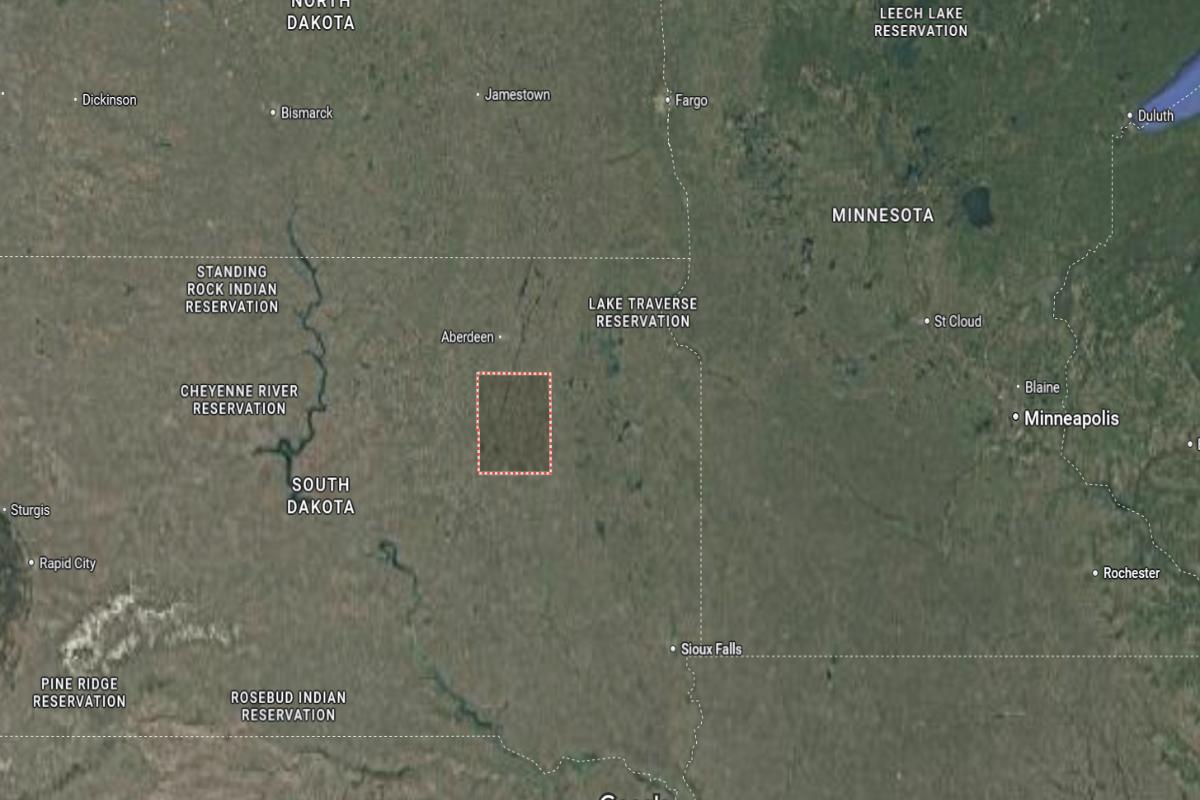
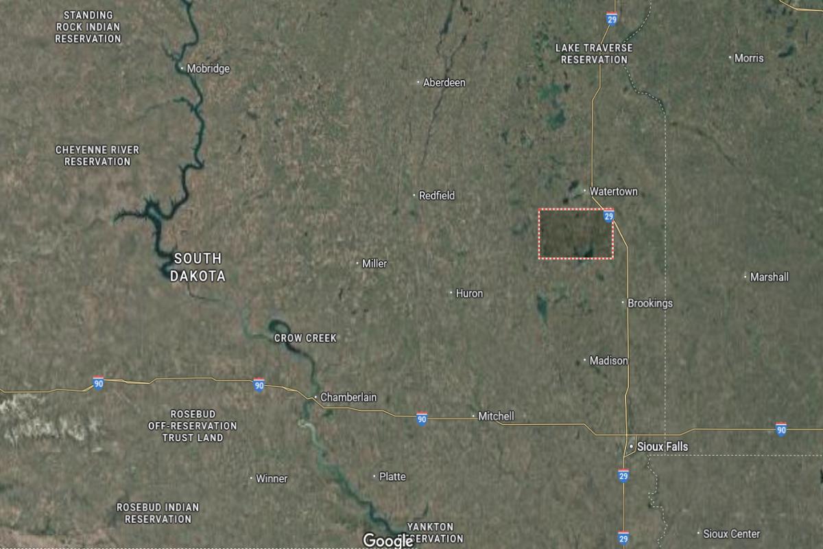
Spink County is located in northeastern South Dakota, in the James River Valley region. The county seat, Redfield, is about 45 miles southeast of Aberdeen. It lies approximately 105 miles northwest of Brookings.
The county is around 70 miles north of Huron and about 90 miles west of Watertown. Redfield is situated roughly 60 miles south of the North Dakota border. U.S. Highway 212 and State Highway 37 run through the area, providing access across the region.
#20. Grant County, South Dakota
– Overall Rank: 1,037
– Population: 7,533
– Median household income: $70,851
– Median home value: $168,500 (81% own)
– Median rent: $493 (19% rent)
– Top public schools: Big Stone City Middle School (grade A), Big Stone City Elementary School (grade A minus), Milbank Middle School (grade B)
– Top private schools: St. Lawrence School (grade unavailable)
– Top places: Milbank (grade A minus), Melrose Township (grade B+), Big Stone City (grade B)
About
Grant County has a stable economy built on agriculture, manufacturing, and renewable energy. Farming remains a cornerstone, supported by grain production, livestock, and agribusiness services. The county encourages growth through infrastructure investment, workforce training, and business-friendly policies.
Community life is enriched by local festivals, school events, and historical attractions that highlight regional pride. Residents enjoy outdoor activities such as fishing, hunting, and snowmobiling across scenic landscapes. Strong schools, public services, and civic engagement create a close-knit and welcoming community atmosphere.
Where is Grant County?
Would you like to save this?
Grant County is located in northeastern South Dakota, near the Minnesota border. The county seat, Milbank, is about 120 miles north of Sioux Falls. It lies approximately 30 miles west of the Minnesota state line.
The county is around 55 miles east of Watertown and about 65 miles southeast of Sisseton. Milbank is situated roughly 40 miles north of Clear Lake. U.S. Highway 12 and State Highway 15 run through the area, connecting it to nearby regions.
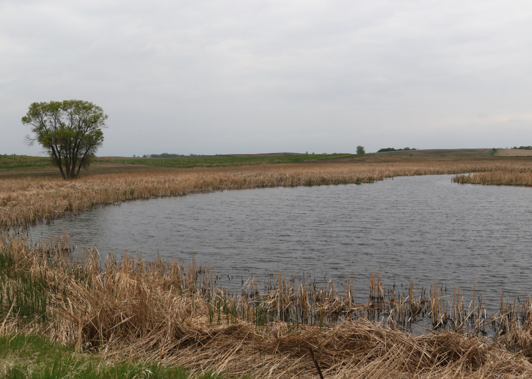
#19. Day County, South Dakota
– Overall Rank: 1,005
– Population: 5,485
– Median household income: $57,558
– Median home value: $134,800 (75% own)
– Median rent: $594 (25% rent)
– Top public schools: Webster Area Middle School (grade A minus), Webster Area Elementary School (grade B+), Waubay Elementary School (grade B minus)
– Top private schools:
– Top places: Webster Township (grade B+), Webster (grade B+), Roslyn (grade B)
About
Day County’s economy is largely driven by agriculture, with crop farming and livestock production forming the backbone of local industry. Small businesses and agri-services support the rural economy, while infrastructure improvements aid in regional connectivity. The county emphasizes economic stability, land stewardship, and community resilience.
Cultural life features local fairs, community events, and school activities that strengthen ties among residents. The area offers abundant outdoor recreation, including fishing, hunting, and lake activities that draw visitors and support tourism. Quality education, dependable public services, and strong civic participation contribute to a supportive and family-oriented environment.
Where is Day County?
Day County is located in northeastern South Dakota, within the Glacial Lakes region. The county seat, Webster, is about 45 miles west of Sisseton. It lies approximately 55 miles north of Watertown.
The county is around 35 miles south of the North Dakota border and about 85 miles northeast of Aberdeen. Webster is situated roughly 30 miles east of Redfield. U.S. Highway 12 and State Highway 25 run through the area, providing regional access.
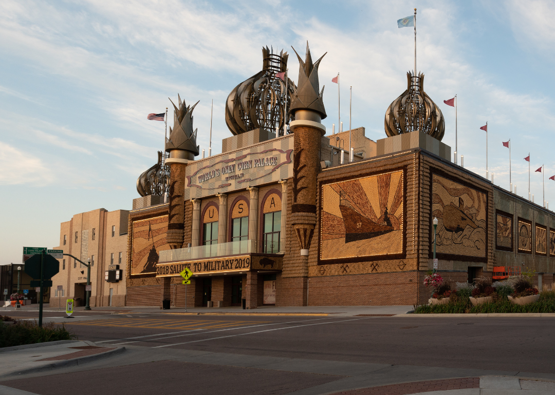
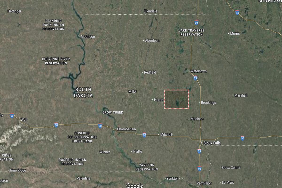
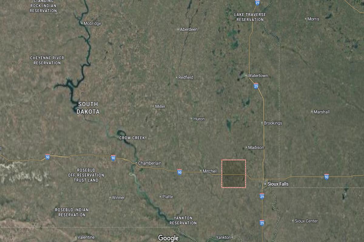
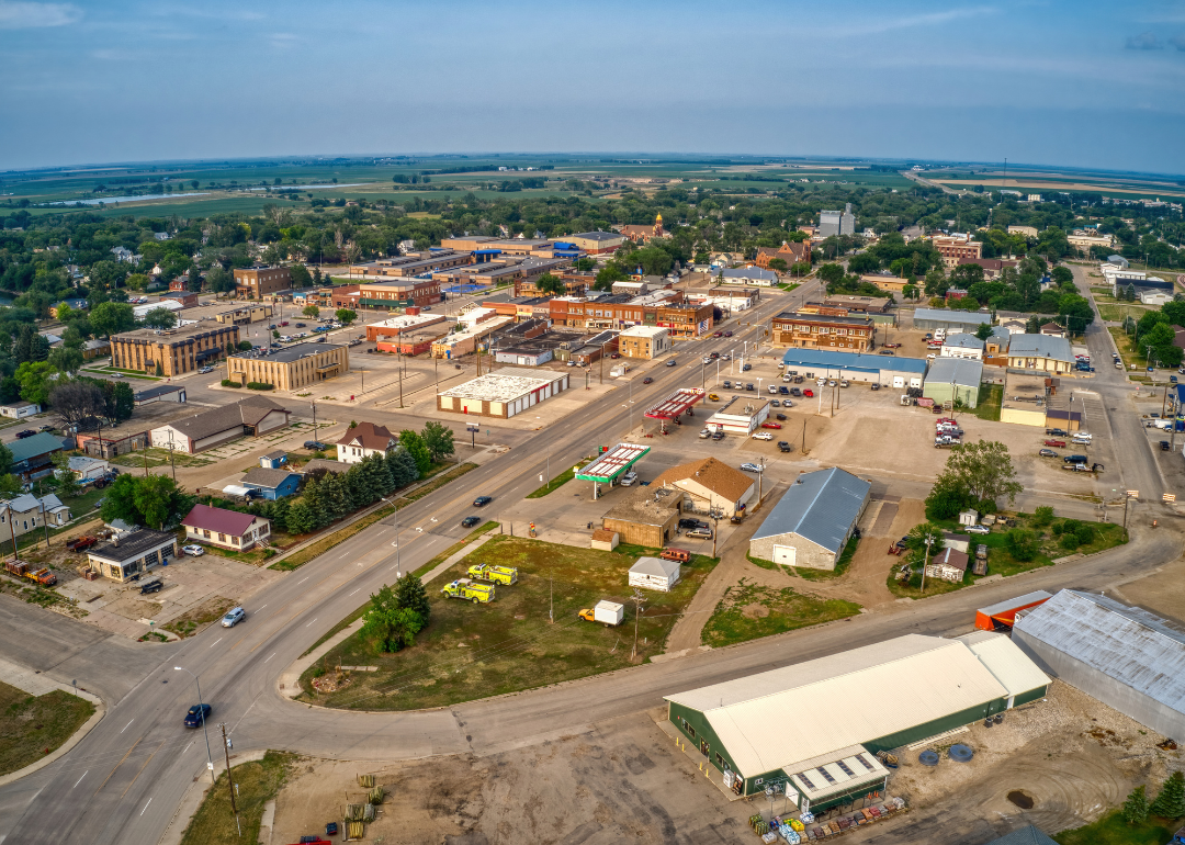
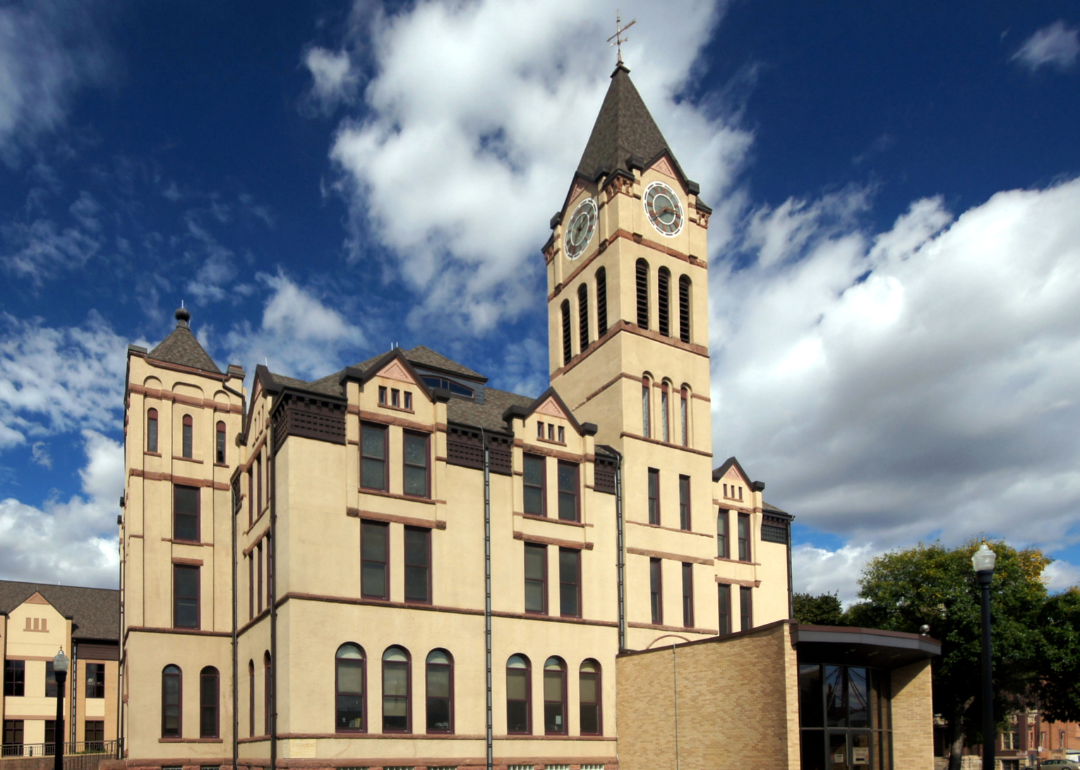
#18. Davison County, South Dakota
– Overall Rank: 918
– Population: 19,966
– Median household income: $55,606
– Median home value: $178,100 (63% own)
– Median rent: $772 (37% rent)
– Top public schools: Mitchell High School (grade A minus), Longfellow Elementary School (grade A minus), L.B. Williams Elementary School (grade A minus)
– Top private schools: Mitchell Christian School (grade B+), John Paul II Elementary School (grade unavailable), Abbott House (grade unavailable)
– Top places: Mitchell (grade B+), Prosper Township (grade B), Mount Vernon (grade B)
About
Davison County has a diverse economy supported by agriculture, manufacturing, healthcare, and retail sectors. Its central location and strong infrastructure promote business growth, job creation, and regional accessibility. Local efforts focus on workforce development, innovation, and sustaining long-term economic health.
Cultural life includes fairs, performing arts, museums, and community events that foster civic pride and engagement. Residents benefit from parks, recreational facilities, and educational programs that encourage active and connected lifestyles. Quality public services, strong schools, and a collaborative spirit contribute to a vibrant and welcoming community.
Where is Davison County?
Davison County is located in southeastern South Dakota, in the James River Valley. The county seat, Mitchell, is about 70 miles west of Sioux Falls. It lies approximately 55 miles south of Huron.
The county is around 90 miles east of Chamberlain and about 65 miles north of Yankton. Mitchell is situated roughly 35 miles west of Salem. Interstate 90 and U.S. Highway 37 run through the area, providing key transportation routes.
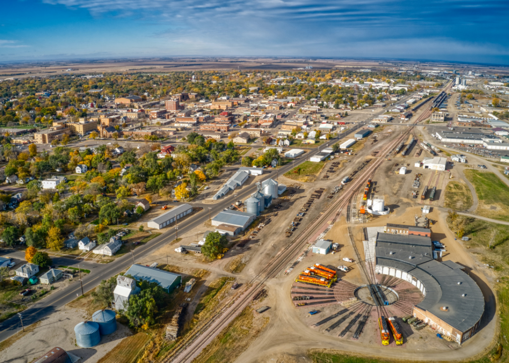
#17. Beadle County, South Dakota
– Overall Rank: 906
– Population: 19,089
– Median household income: $63,813
– Median home value: $152,100 (70% own)
– Median rent: $807 (30% rent)
– Top public schools: Wolsey Wessington High School (grade B), Hitchcock-Tulare Elementary School (grade B), Huron High School (grade B)
– Top private schools: James Valley Christian School (grade B), Holy Trinity Catholic Elementary School (grade unavailable)
– Top places: Huron (grade B+), Valley Township (grade A minus), Wolsey (grade B)
About
Beadle County features a balanced economy with strong roots in agriculture, supported by manufacturing, healthcare, and education. Economic development is driven by business-friendly initiatives, infrastructure investment, and workforce training. The region values innovation while maintaining its agricultural heritage and rural character.
Cultural life is enriched by fairs, arts events, and community gatherings that reflect local pride and diversity. Residents enjoy parks, trails, and recreational facilities that promote wellness and connection. Quality schools, civic engagement, and dependable public services contribute to a resilient and family-oriented environment.
Where is Beadle County?
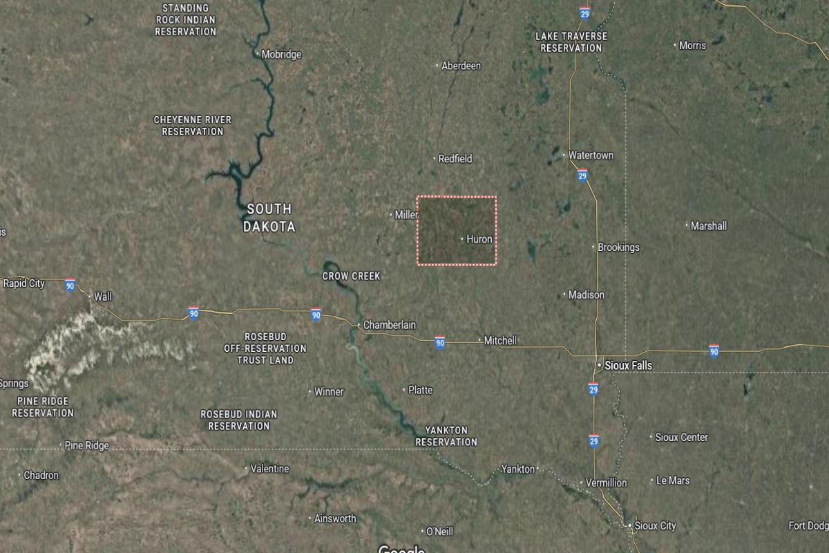
Beadle County is located in east-central South Dakota, within the James River Valley. The county seat, Huron, is about 65 miles northwest of Mitchell. It lies approximately 55 miles west of Brookings.
The county is around 60 miles south of Redfield and about 80 miles northeast of Chamberlain. Huron is situated roughly 70 miles north of Salem. U.S. Highway 14 and State Highway 37 provide main transportation routes through the area.
#16. Lawrence County, South Dakota
– Overall Rank: 738
– Population: 26,047
– Median household income: $62,977
– Median home value: $267,900 (66% own)
– Median rent: $888 (34% rent)
– Top public schools: Creekside Elementary School (grade B+), Spearfish High School (grade B), Whitewood Elementary School (grade B)
– Top private schools: Black Hills Christian Academy (grade unavailable), Black Hills Classical Christian Academy (grade unavailable), Chrildren First (grade unavailable)
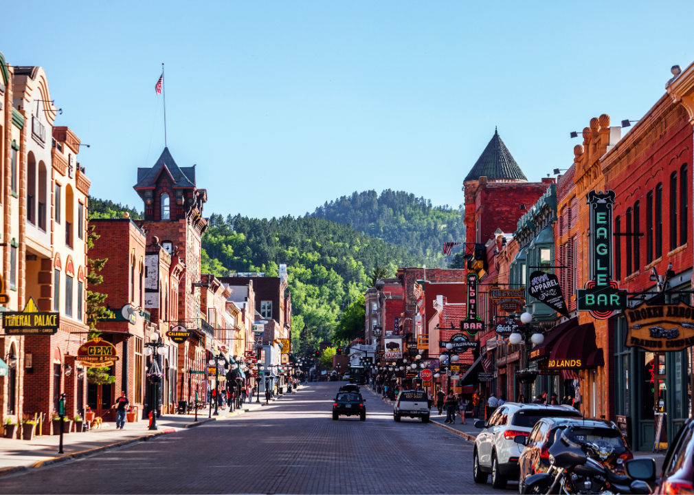
– Top places: Spearfish (grade A minus), Deadwood (grade B), Lead (grade B minus)
About
Lawrence County has a diverse economy supported by tourism, mining, small business, and outdoor recreation industries. Historic preservation, natural beauty, and a strong service sector drive regional growth and attract visitors year-round. Local leadership emphasizes sustainable development and community-based planning.
Cultural life thrives through festivals, performing arts, historical sites, and events that celebrate the area’s rich heritage. Residents and tourists enjoy hiking, skiing, and exploring public lands that define the region’s outdoor lifestyle. Strong schools, healthcare access, and active civic participation contribute to a dynamic and close-knit community.
Where is Lawrence County?
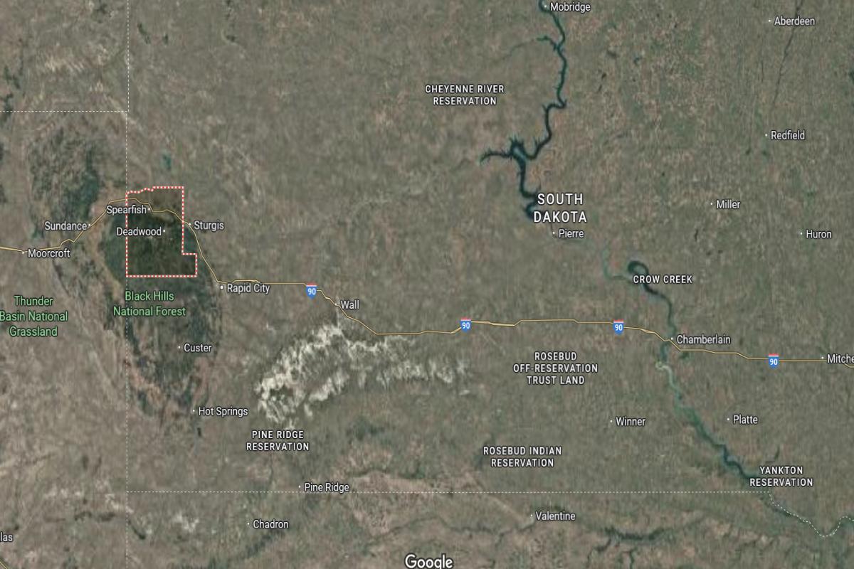
Lawrence County is located in western South Dakota, in the northern Black Hills region. The county seat, Deadwood, is about 45 miles northwest of Rapid City. It lies approximately 50 miles south of the Montana border.
The county is around 30 miles west of Sturgis and about 60 miles northeast of Newcastle, Wyoming. Deadwood is situated roughly 25 miles north of Custer. U.S. Highway 85 and State Highway 14A run through the area, offering scenic access across the region.
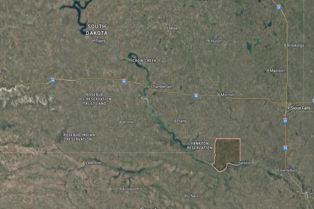
#15. Yankton County, South Dakota
– Overall Rank: 699
– Population: 23,311
– Median household income: $68,847
– Median home value: $190,400 (70% own)
– Median rent: $765 (30% rent)
– Top public schools: Yankton Middle School – 02 (grade B), Lincoln Elementary School (grade B), Beadle Elementary School (grade B)
– Top private schools: Sacred Heart School (grade unavailable), Sacred Heart Middle School – (grade unavailable), Missouri Valley Christian Academy (grade unavailable)
– Top places: Yankton (grade A minus), Gayville (grade B minus), Mission Hill (grade C+)
About
Yankton County has a diverse and stable economy built on manufacturing, healthcare, education, and agriculture. Economic development is supported by strong infrastructure, workforce readiness, and collaboration between public and private sectors. The county encourages growth while preserving its historical and cultural identity.
Community life is vibrant with arts festivals, historic sites, and outdoor recreation that reflect local pride and tradition. Residents enjoy parks, riverfront trails, and year-round activities that foster wellness and connection. High-quality schools, public services, and civic engagement contribute to a welcoming and well-rounded community atmosphere.
Where is Yankton County?
Yankton County is located in southeastern South Dakota, along the Missouri River and near the Nebraska border. The county seat, Yankton, is about 65 miles southwest of Sioux Falls. It lies approximately 85 miles southeast of Mitchell.
The county is around 30 miles west of Vermillion and about 40 miles northeast of Norfolk, Nebraska. Yankton is situated roughly 25 miles east of Tyndall. U.S. Highway 81 and State Highway 50 provide direct access through the area.
#14. Moody County, South Dakota
– Overall Rank: 690
– Population: 6,346
– Median household income: $71,469
– Median home value: $194,000 (70% own)
– Median rent: $644 (30% rent)
– Top public schools: Colman-Egan Junior High School (grade B), Flandreau High School (grade B), Colman Elementary School (grade B minus)
– Top private schools:
– Top places: Flandreau Township (grade B+), Grovena Township (grade B+), Flandreau (grade B+)
About
Moody County’s economy is primarily driven by agriculture, with a focus on crop production and livestock operations. Supporting industries such as agribusiness, manufacturing, and small local enterprises contribute to economic stability. Community initiatives promote rural development, workforce support, and infrastructure improvement.
Cultural life includes county fairs, local festivals, and school events that bring residents together and celebrate community spirit. Outdoor recreation such as hunting, fishing, and hiking plays a significant role in daily life. Quality education, public services, and strong civic engagement create a supportive and closely connected living environment.
Where is Moody County?
Moody County is located in eastern South Dakota, near the Minnesota border. The county seat, Flandreau, is about 45 miles north of Sioux Falls. It lies approximately 30 miles southeast of Brookings.
The county is around 20 miles west of Pipestone, Minnesota, and about 35 miles south of Madison. Flandreau is situated roughly 60 miles east of Mitchell. Interstate 29 and State Highway 32 provide access through the area.
#13. Hutchinson County, South Dakota
– Overall Rank: 681
– Population: 7,401
– Median household income: $69,139
– Median home value: $143,800 (77% own)
– Median rent: $660 (23% rent)
– Top public schools: Parkston High School (grade A minus), Parkston Elementary School (grade A minus), Freeman High School (grade B+)
– Top private schools: Freeman Academy (grade A minus)
– Top places: Parkston (grade A minus), Freeman (grade A minus), Wittenberg Township (grade A minus)
About
Hutchinson County’s economy is rooted in agriculture, with corn, soybeans, and livestock forming the backbone of local industry. Small manufacturing operations and service-based businesses contribute to economic diversification. The county focuses on preserving rural traditions while supporting infrastructure and workforce development.
Community life is centered around local festivals, school events, and historical celebrations that strengthen neighborhood bonds. Residents enjoy outdoor recreation, including hunting, fishing, and community sports. Strong schools, public services, and civic pride contribute to a dependable and family-friendly environment.
Where is Hutchinson County?
Hutchinson County is located in southeastern South Dakota, west of the Sioux Falls area. The county seat, Olivet, is about 65 miles southwest of Sioux Falls. It lies approximately 45 miles southeast of Mitchell.
The county is around 30 miles north of Yankton and about 35 miles west of Vermillion. Olivet is situated roughly 25 miles south of Parkston. U.S. Highway 18 and State Highway 37 provide access through the region.
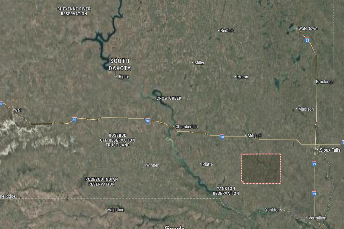
#12. Charles Mix County, South Dakota
– Overall Rank: 613
– Population: 9,302
– Median household income: $60,729
– Median home value: $163,200 (74% own)
– Median rent: $713 (26% rent)
– Top public schools: Platte-Geddes Elementary School (grade A), Platte-Geddes High School (grade A minus), Wagner High School (grade A minus)
– Top private schools:
– Top places: Platte (grade B+), Plain Center Township (grade B), Geddes (grade B)
About
Charles Mix County has a diverse economy supported by agriculture, tribal enterprises, small businesses, and tourism. Farming and ranching remain central, while local development efforts promote economic inclusion and infrastructure improvements. The county values community collaboration and the preservation of cultural and natural resources.
Cultural life is shaped by a blend of traditions, community events, and heritage celebrations that highlight the area’s diversity. Residents enjoy outdoor activities such as fishing, boating, and hunting, which contribute to both lifestyle and tourism. Strong schools, public services, and civic involvement create a supportive and connected environment.
Where is Charles Mix County?
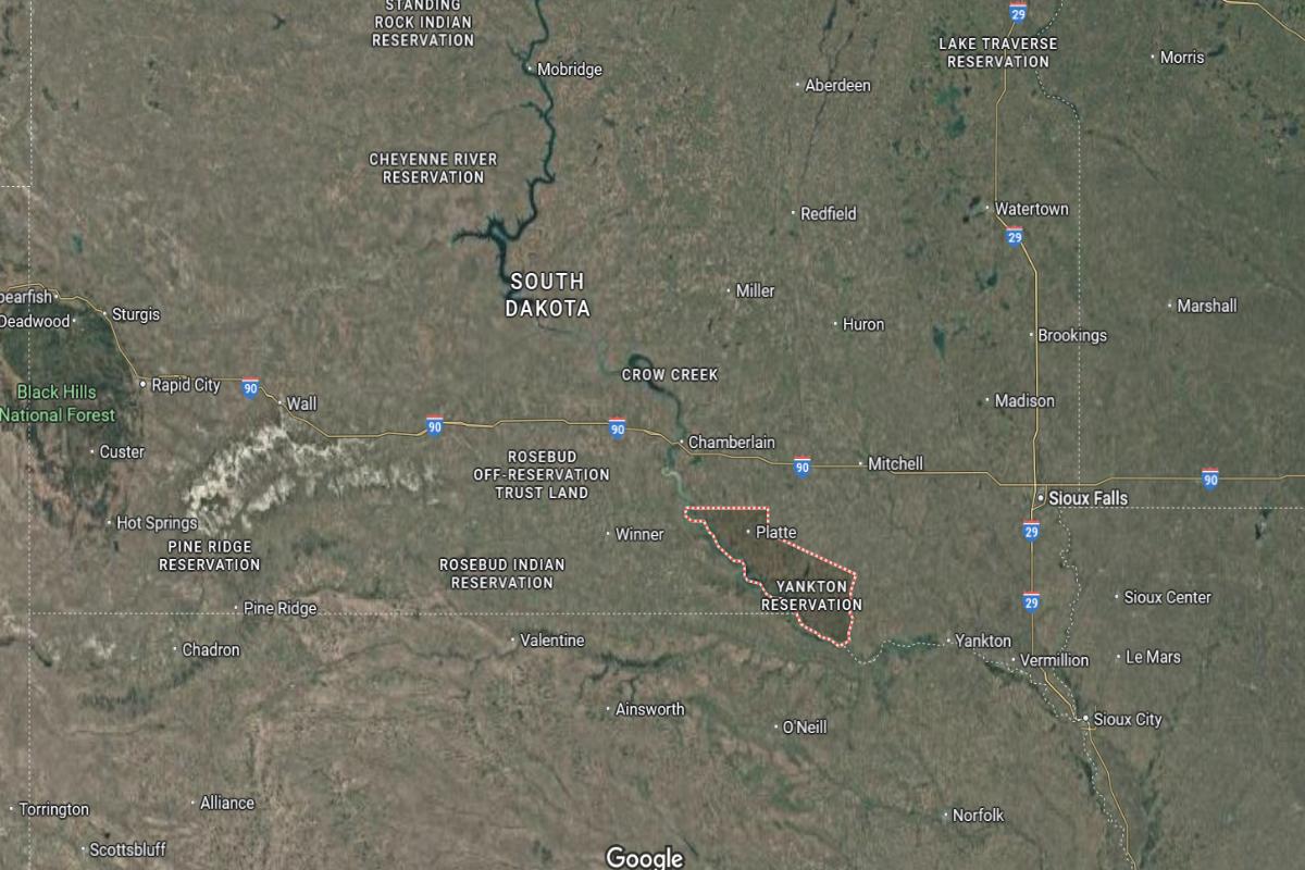
Charles Mix County is located in south-central South Dakota, along the Missouri River and near the Nebraska border. The county seat, Lake Andes, is about 85 miles southwest of Mitchell. It lies approximately 40 miles west of Yankton.
The county is around 75 miles south of Chamberlain and about 60 miles north of Norfolk, Nebraska. Lake Andes is situated roughly 30 miles east of Wagner. U.S. Highway 281 and State Highway 50 run through the area, providing regional access.
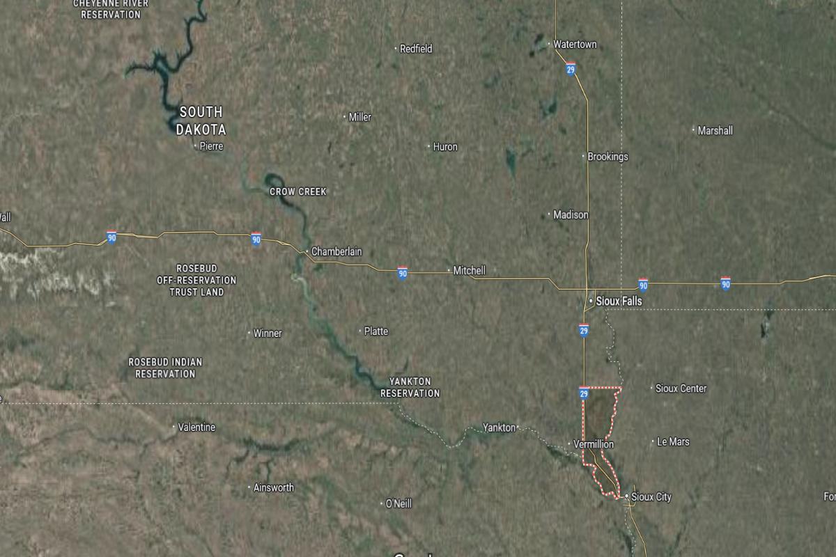
#11. Clay County, South Dakota
– Overall Rank: 590
– Population: 14,953
– Median household income: $55,963
– Median home value: $209,300 (51% own)
– Median rent: $758 (49% rent)
– Top public schools: Vermillion Middle School (grade B+), Vermillion High School (grade B minus), Jolley Elementary School (grade B minus)
– Top private schools: St. Agnes Elementary School (grade unavailable)
– Top places: Vermillion (grade A minus), Meckling Township (grade A minus), Norway Township (grade B+)
About
Clay County’s economy is driven by education, healthcare, agriculture, and small business development. A strong academic presence supports innovation, workforce training, and community engagement. Local efforts focus on sustainable growth, infrastructure investment, and maintaining a high quality of life.
Cultural life includes arts festivals, historical landmarks, and events that reflect a rich and diverse heritage. Residents enjoy parks, trails, and recreational programs that promote wellness and outdoor activity. Quality schools, public services, and civic pride foster a vibrant and inclusive community atmosphere.
Where is Clay County?
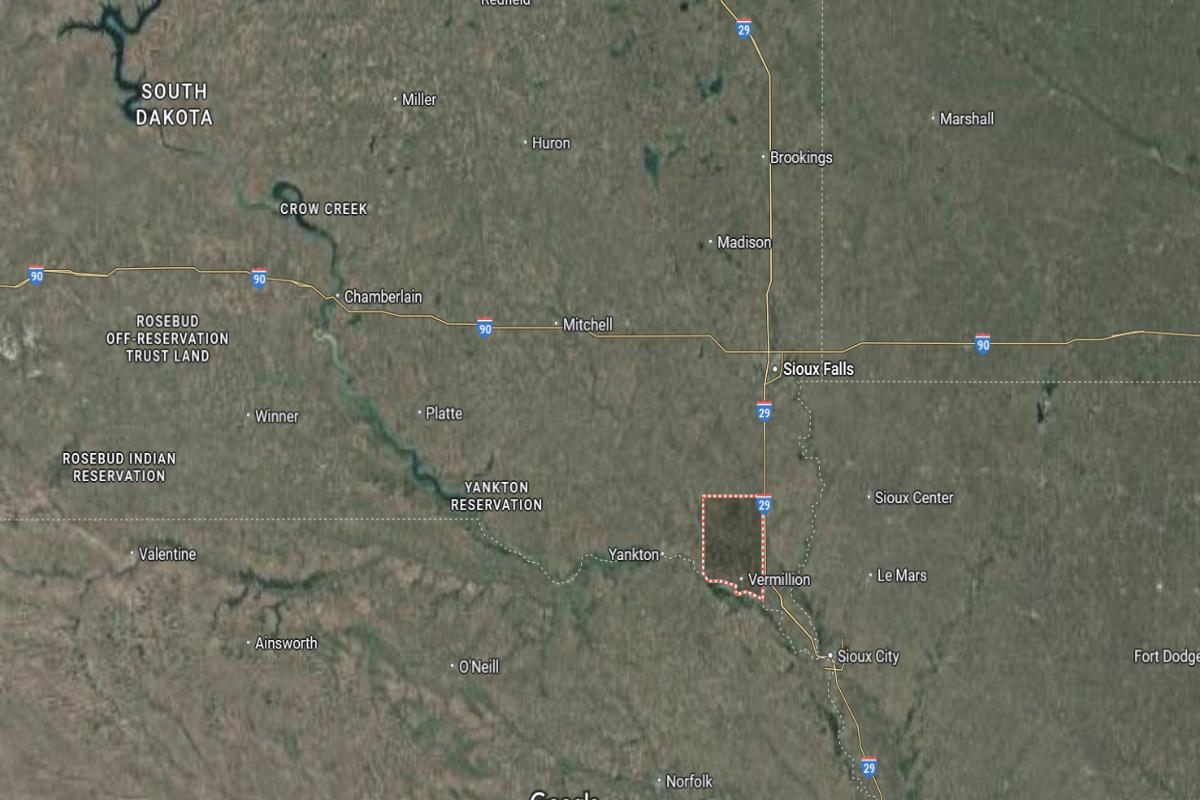
Clay County is located in southeastern South Dakota, along the Missouri River and bordering Nebraska. The county seat, Vermillion, is about 60 miles southwest of Sioux Falls. It lies approximately 30 miles southeast of Yankton.
The county is around 20 miles northeast of Hartington, Nebraska, and about 50 miles west of Sioux City, Iowa. Vermillion is situated roughly 35 miles south of Parker. U.S. Highway 50 and State Highway 19 provide main transportation routes through the county.
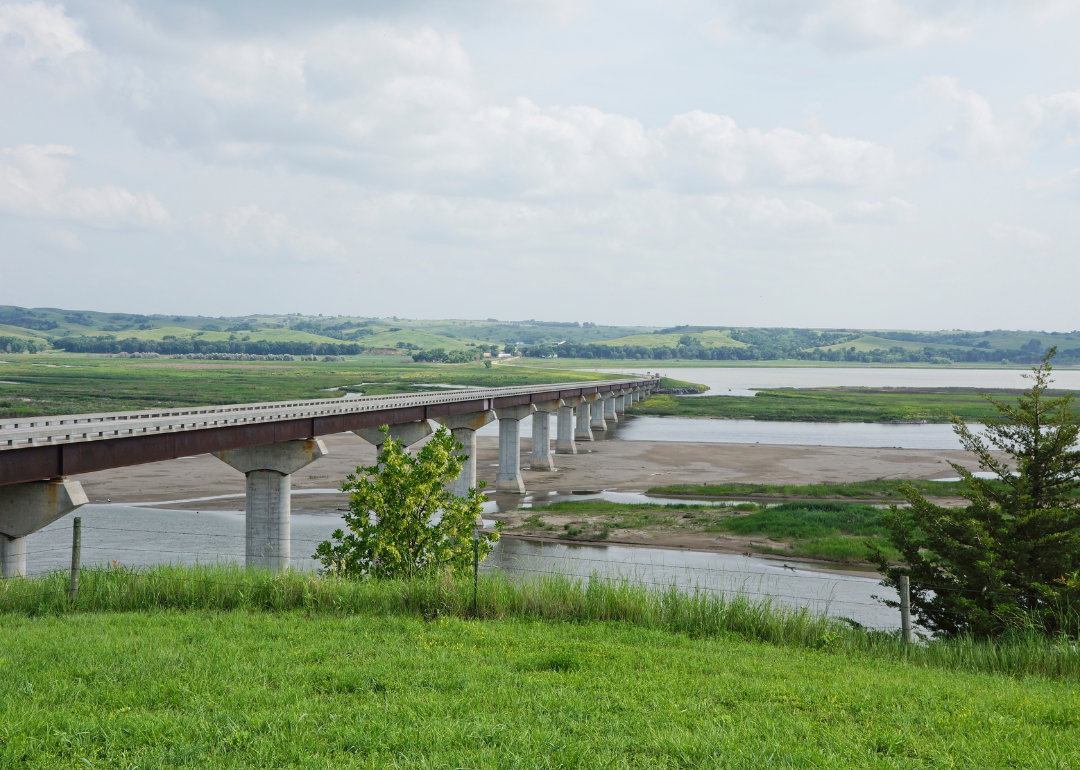
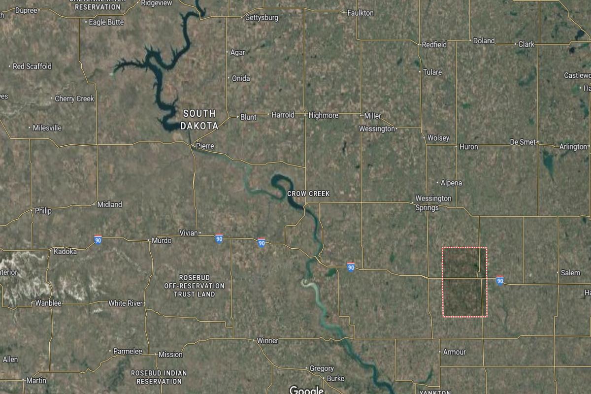
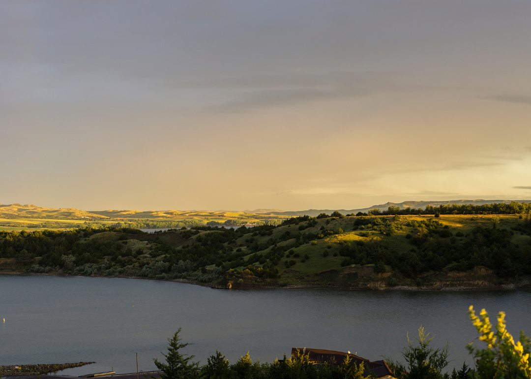
#10. Brule County, South Dakota
– Overall Rank: 582
– Population: 5,247
– Median household income: $64,821
– Median home value: $187,900 (65% own)
– Median rent: $755 (35% rent)
– Top public schools: Kimball Elementary School (grade B+), Chamberlain High School (grade B), Kimball Junior High School (grade B)
– Top private schools: St. Joseph Elementary School (grade unavailable)
– Top places: Chamberlain (grade A minus), Kimball (grade B+), Pukwana (grade B)
About
Brule County has a strong agricultural economy centered on crop production, livestock, and agri-business services. Local industries are supported by transportation access, small businesses, and community-driven development efforts. The county focuses on preserving its rural character while promoting steady economic growth.
Cultural and recreational life includes fairs, heritage events, and outdoor activities that bring residents together and attract visitors. Hunting, fishing, and water-based recreation are popular across the county’s scenic landscapes. Quality education, reliable public services, and community engagement contribute to a welcoming and resilient environment.
Where is Brule County?
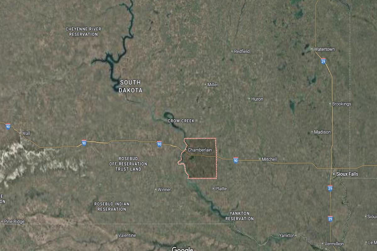
Brule County is located in south-central South Dakota, along the eastern bank of the Missouri River. The county seat, Chamberlain, is about 70 miles west of Mitchell. It lies approximately 140 miles west of Sioux Falls.
The county is around 60 miles south of Huron and about 85 miles east of Winner. Chamberlain is situated roughly 40 miles northwest of Lake Andes. Interstate 90 and State Highway 50 provide direct access through the area.
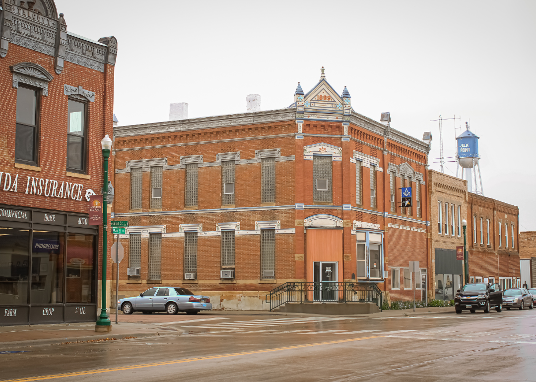
#9. Union County, South Dakota
– Overall Rank: 531
– Population: 16,700
– Median household income: $82,036
– Median home value: $254,900 (70% own)
– Median rent: $1,008 (30% rent)
– Top public schools: Dakota Valley Elementary School (grade A), Dakota Valley High School (grade B+), Dakota Valley Junior High School (grade B+)
– Top private schools:
– Top places: Dakota Dunes (grade A), North Sioux City (grade B+), Big Sioux Township (grade A)
About
Union County features a diverse economy supported by agriculture, manufacturing, logistics, and small business growth. Its location near major transportation routes enhances trade and economic activity, while community planning encourages balanced development. The county promotes innovation, workforce readiness, and sustainable practices.
Cultural life is enriched by local festivals, heritage celebrations, and strong community traditions. Residents enjoy access to parks, trails, and outdoor recreation that support an active lifestyle. Quality schools, public services, and civic pride contribute to a connected and thriving community environment.
Where is Union County?
Union County is located in the southeastern corner of South Dakota, where it borders both Iowa and Nebraska. The county seat, Elk Point, is about 60 miles south of Sioux Falls. It lies approximately 15 miles northwest of Sioux City, Iowa.
The county is around 35 miles southeast of Vermillion and about 40 miles east of Yankton. Elk Point is situated roughly 10 miles west of the Big Sioux River. Interstate 29 and U.S. Highway 50 provide major transportation routes through the area.
#8. Walworth County, South Dakota
– Overall Rank: 528
– Population: 5,317
– Median household income: $57,697
– Median home value: $115,900 (73% own)
– Median rent: $832 (27% rent)
– Top public schools: Mobridge High School (grade A minus), Mobridge Middle School (grade A minus), Selby Elementary School (grade B+)
– Top private schools:
– Top places: Mobridge (grade A), Java (grade B), Selby (grade B)
About
Walworth County’s economy is rooted in agriculture, with crop farming, livestock production, and agribusiness playing central roles. Additional support comes from small businesses, local services, and tourism related to outdoor recreation. The county emphasizes steady growth, resource management, and rural community support.
Cultural life includes local fairs, school events, and community gatherings that reflect the area’s traditions and pride. Residents and visitors enjoy activities such as fishing, hunting, and boating across the region’s natural landscapes. Strong public services, education, and civic engagement contribute to a stable and connected community environment.
Where is Walworth County?
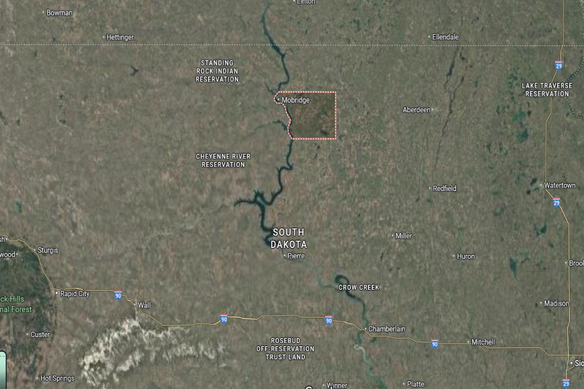
Walworth County is located in north-central South Dakota, along the Missouri River. The county seat, Selby, is about 75 miles north of Pierre. It lies approximately 95 miles west of Aberdeen.
The county is around 50 miles south of the North Dakota border and about 20 miles east of Mobridge. Selby is situated roughly 120 miles northwest of Huron. U.S. Highway 83 and State Highway 20 run through the area, offering regional connectivity.
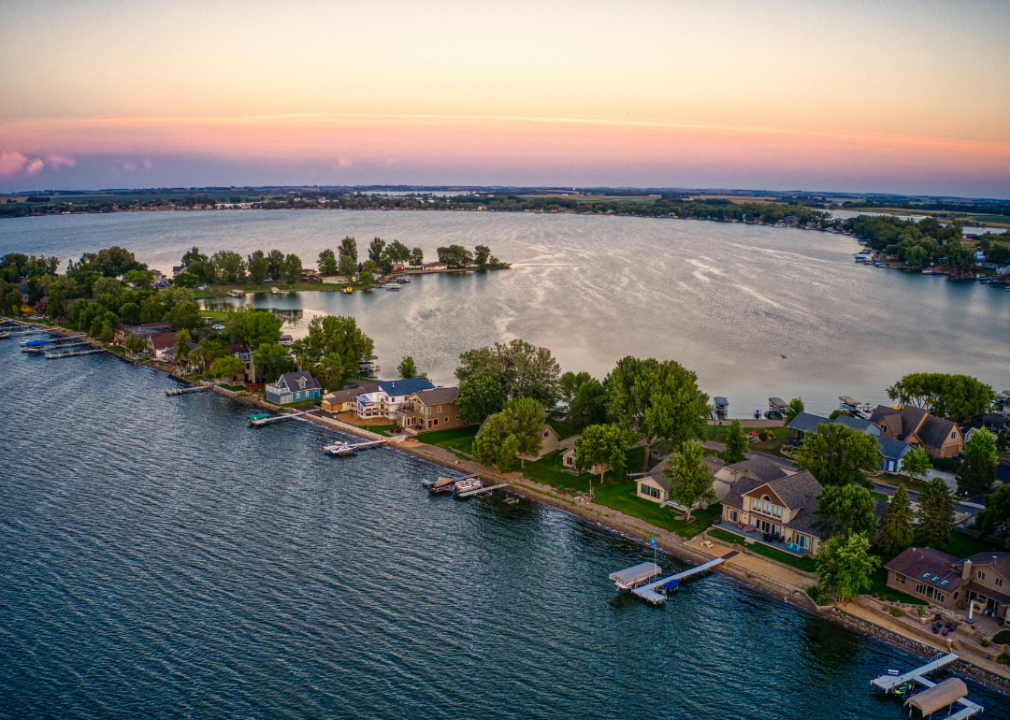
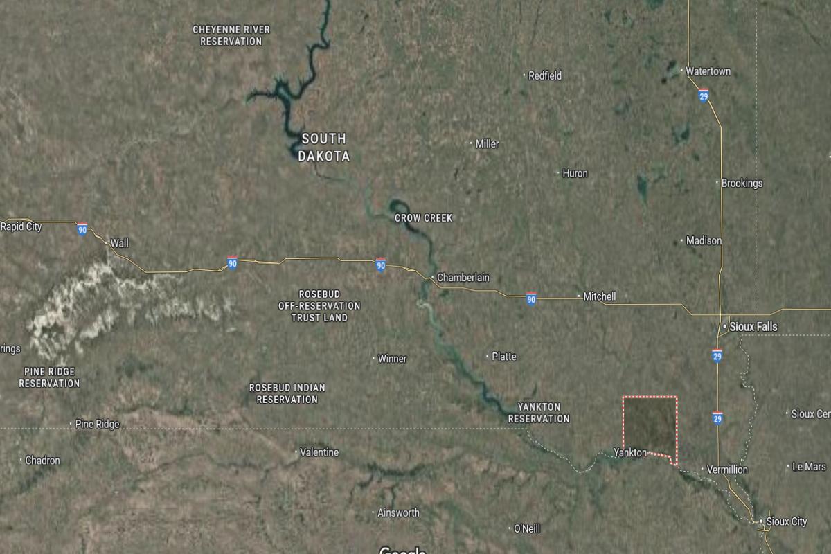
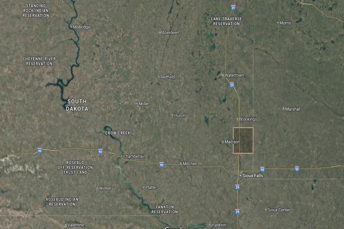
#7. Lake County, South Dakota
– Overall Rank: 516
– Population: 11,207
– Median household income: $74,884
– Median home value: $196,600 (73% own)
– Median rent: $819 (27% rent)
– Top public schools: Oldham-Ramona Elementary School (grade A), Rutland Junior High School (grade B+), Madison Elementary School (grade B+)
– Top private schools: St. Thomas School (grade unavailable), Madison Christian School (grade unavailable)
– Top places: Madison (grade A minus), Summit Township (grade A), Ramona (grade A minus)
About
Lake County has a balanced economy supported by agriculture, manufacturing, education, and technology. Local development efforts focus on infrastructure, workforce training, and promoting entrepreneurship. The area values innovation while maintaining its rural heritage and strong community ties.
Cultural life is active with festivals, arts programs, and historical events that foster local pride and engagement. Residents enjoy lakes, parks, and recreational activities that support a healthy and active lifestyle. Quality schools, reliable public services, and strong civic participation contribute to a welcoming and well-rounded community environment.
Where is Lake County?
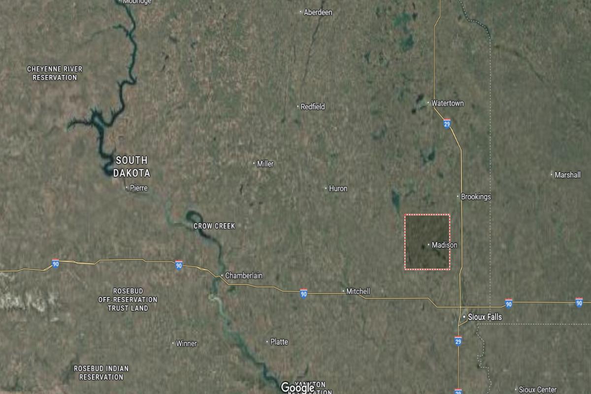
Lake County is located in eastern South Dakota, within the prairie lake region. The county seat, Madison, is about 50 miles northwest of Sioux Falls. It lies approximately 35 miles south of Brookings.
The county is around 40 miles east of Mitchell and about 60 miles west of the Minnesota border. Madison is situated roughly 30 miles north of Salem. U.S. Highway 81 and State Highway 34 provide main routes through the area.
#6. Pennington County, South Dakota
– Overall Rank: 467
– Population: 110,386
– Median household income: $67,823
– Median home value: $247,800 (69% own)
– Median rent: $996 (31% rent)
– Top public schools: Southwest Middle School (grade B+), Stevens High School (grade B+), Hill City Middle School (grade B+)
– Top private schools: Rapid City Catholic School System (grade A minus), Rapid City Christian School (grade B), St. Elizabeth Seton School (grade unavailable)
– Top places: Rapid City (grade B+), Box Elder (grade B), Colonial Pine Hills (grade B)
About
Pennington County has a dynamic and diverse economy supported by tourism, healthcare, government services, retail, and defense industries. Strategic infrastructure and workforce development initiatives contribute to ongoing regional growth and business investment. The county balances economic advancement with natural resource preservation and community well-being.
Cultural and recreational life is vibrant, with museums, festivals, historic landmarks, and abundant outdoor attractions drawing both residents and visitors. Hiking, biking, and wildlife exploration are popular throughout the area’s scenic landscapes. Strong schools, public safety, and active civic engagement foster a resilient and inclusive community environment.
Where is Pennington County?
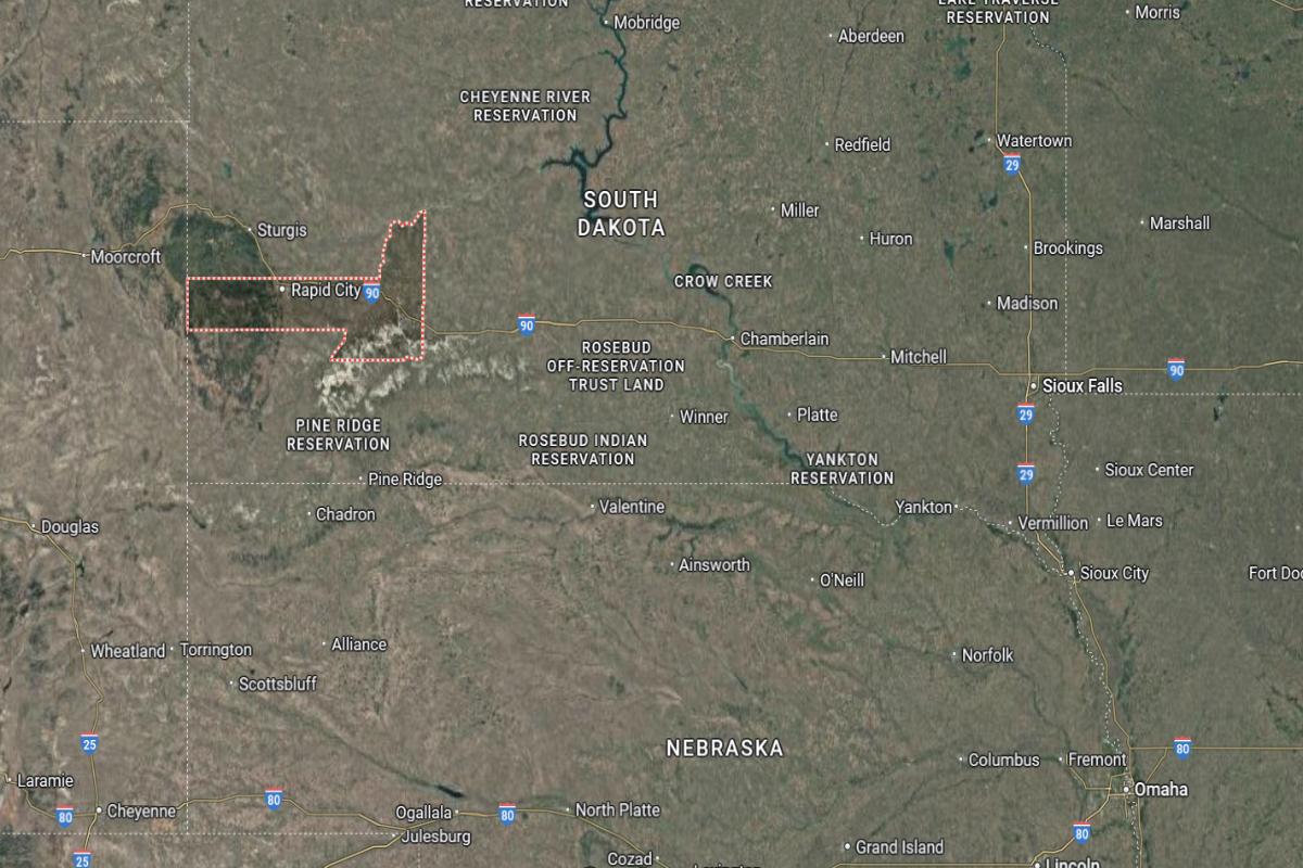
Pennington County is located in western South Dakota, in the heart of the Black Hills region. The county seat, Rapid City, is about 55 miles east of the Wyoming border. It lies approximately 110 miles west of Pierre.
The county is around 35 miles northeast of Custer and about 60 miles northwest of Hot Springs. Rapid City is situated roughly 25 miles south of Sturgis. Interstate 90 and U.S. Highway 16 run through the area, providing major transportation access.
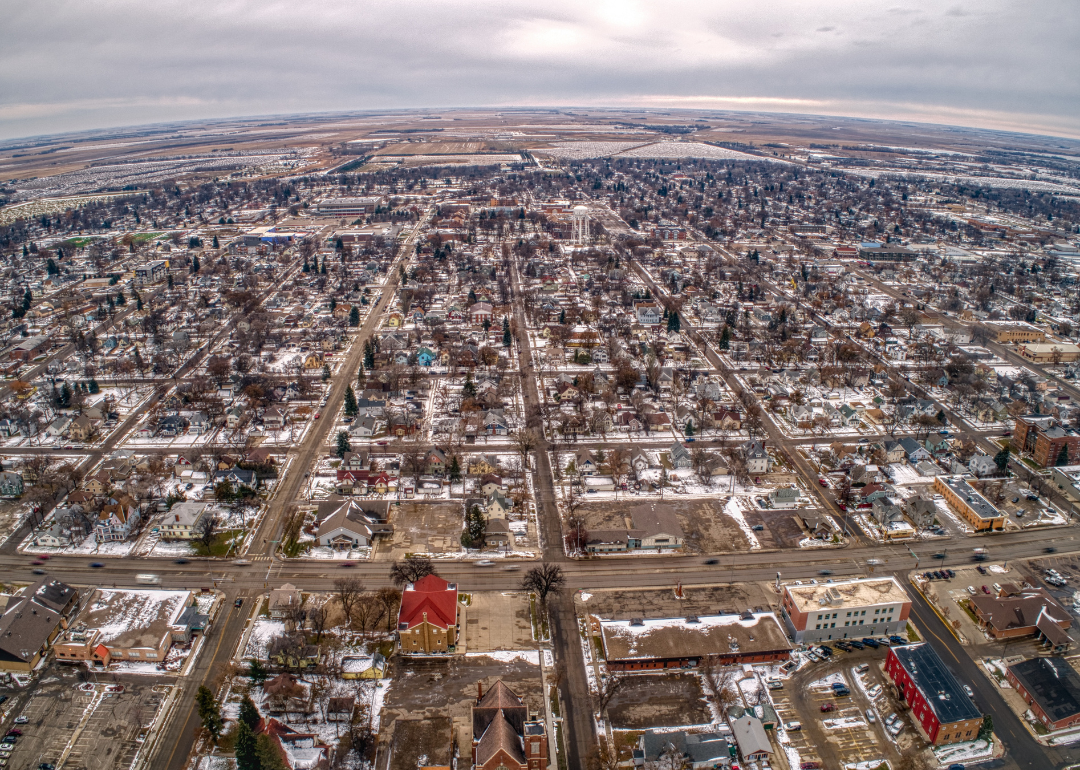
#5. Brookings County, South Dakota
– Overall Rank: 401
– Population: 34,631
– Median household income: $64,438
– Median home value: $227,800 (58% own)
– Median rent: $870 (42% rent)
– Top public schools: Sioux Valley High School (grade A minus), Brookings High School (grade B+), Medary Elementary School (grade B)
– Top private schools: Volga Christian School (grade unavailable), Early Learning Center of Brookings managed by Bright Horizons (grade unavailable)
– Top places: Brookings (grade A), Medary Township (grade B+), Bruce (grade B+)
About
Brookings County has a thriving economy driven by education, research, manufacturing, agriculture, and technology. Local growth is supported by a strong university presence, innovation initiatives, and robust infrastructure. The county fosters a collaborative environment that encourages entrepreneurship and long-term development.
Cultural life is enriched by arts events, community festivals, and historical attractions that reflect a vibrant and inclusive spirit. Residents enjoy access to parks, trails, and recreational programs that promote wellness and connection. High-quality schools, healthcare, and civic involvement contribute to a dynamic and welcoming community.
Where is Brookings County?
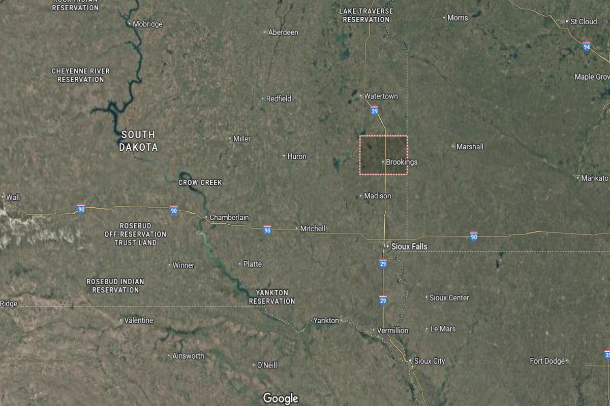
Brookings County is located in eastern South Dakota, near the Minnesota border. The county seat, Brookings, is about 55 miles north of Sioux Falls. It lies approximately 40 miles south of Watertown.
The county is around 30 miles west of Marshall, Minnesota, and about 45 miles east of Madison. Brookings is situated roughly 60 miles southeast of Huron. Interstate 29 and U.S. Highway 14 provide key transportation routes through the area.
#4. Brown County, South Dakota
– Overall Rank: 343
– Population: 38,278
– Median household income: $70,379
– Median home value: $200,400 (66% own)
– Median rent: $748 (34% rent)
– Top public schools: Warner Middle School (grade A), Warner Elementary School (grade A), Frederick Junior High School (grade A)
– Top private schools: Aberdeen Christian School – Elementary Campus (grade B), Roncalli Middle/Senior High School (grade B minus), Roncalli Elementary School (grade unavailable)
– Top places: Aberdeen (grade B+), Groton (grade A minus), Ordway Township (grade B+)
About
Brown County features a diverse economy supported by agriculture, manufacturing, healthcare, education, and retail. Economic growth is driven by strong infrastructure, regional connectivity, and workforce development programs. The county promotes innovation and sustainable practices while maintaining its agricultural roots.
Cultural life includes community festivals, arts events, and historical landmarks that showcase local heritage and pride. Residents enjoy outdoor recreation such as hunting, fishing, and park activities throughout the year. Quality schools, public services, and civic engagement contribute to a vibrant and supportive community environment.
Where is Brown County?
Brown County is located in northeastern South Dakota, near the North Dakota border. The county seat, Aberdeen, is about 125 miles northeast of Pierre. It lies approximately 45 miles west of Sisseton.
The county is around 10 miles south of the North Dakota state line and about 70 miles north of Redfield. Aberdeen is situated roughly 100 miles northwest of Watertown. U.S. Highway 281 and U.S. Highway 12 run through the area, providing regional access.
#3. Lincoln County, South Dakota
– Overall Rank: 296
– Population: 65,801
– Median household income: $92,317
– Median home value: $292,200 (73% own)
– Median rent: $1,206 (27% rent)
– Top public schools: Endeavor Elementary – 07 (grade A), Harrisburg North Middle School – 08 (grade A minus), Tea Area Venture Elementary – 06 (grade A minus)
– Top private schools: Sioux Falls Christian Schools (grade B), Sioux Falls Lutheran School (grade B), Central Baptist Preschool & Kindergarten (grade unavailable)
– Top places: Tea (grade A minus), Harrisburg (grade B+), Canton (grade B)
About
Lincoln County has one of the fastest-growing economies in the region, supported by construction, healthcare, retail, and professional services. Strong infrastructure, strategic planning, and a skilled workforce contribute to sustained development and residential growth. The county fosters business innovation while maintaining a high quality of life.
Community life is vibrant with local festivals, arts programs, and recreational opportunities that reflect both tradition and progress. Residents enjoy parks, trails, and public spaces designed for family and community engagement. Excellent schools, reliable services, and active civic participation create a dynamic and welcoming environment.
Where is Lincoln County?
Lincoln County is located in southeastern South Dakota, bordering Iowa to the east. The county seat, Canton, is about 20 miles southeast of Sioux Falls. It lies approximately 15 miles north of the Iowa city of Sioux City.
The county is around 60 miles northeast of Yankton and about 40 miles south of Brookings. Canton is situated roughly 25 miles east of Parker. Interstate 29 and State Highway 18 provide key transportation routes through the area.
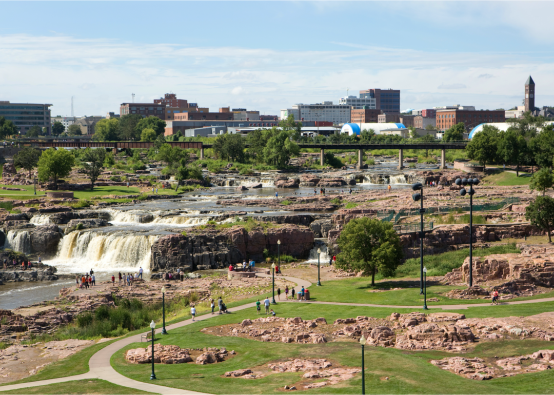
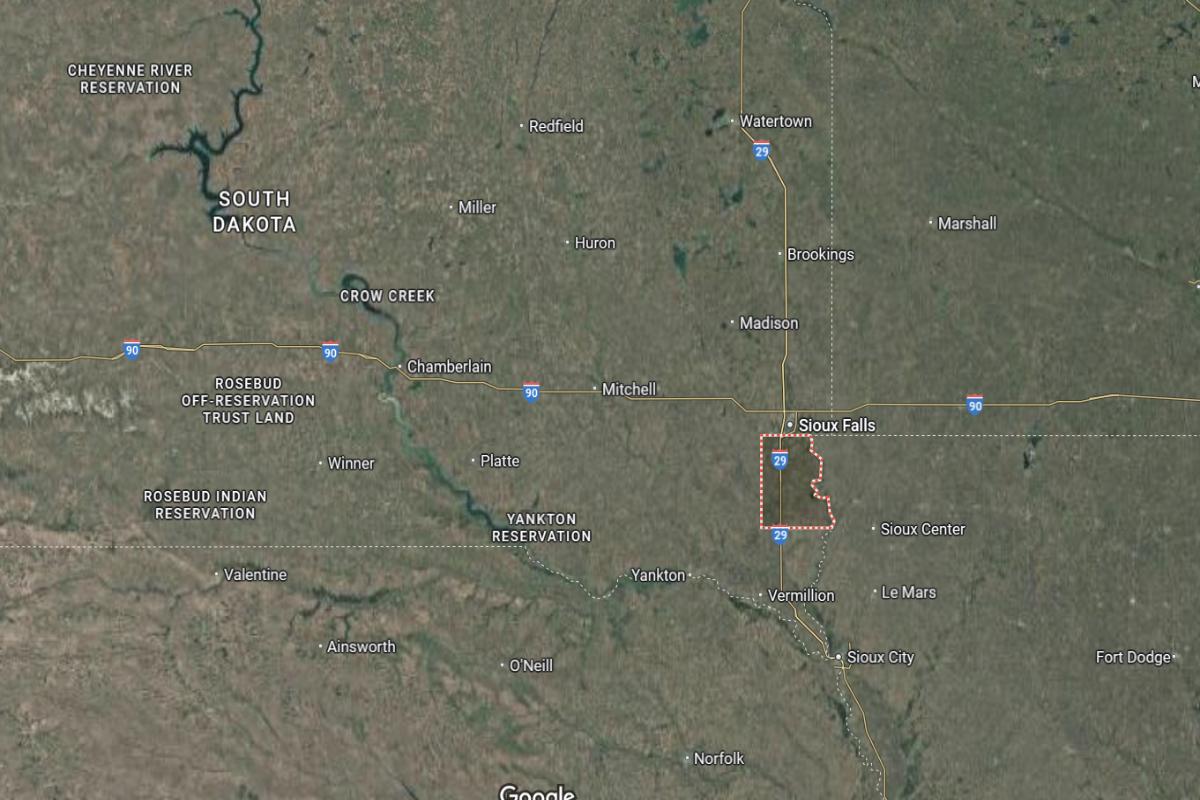
#2. Minnehaha County, South Dakota
– Overall Rank: 218
– Population: 197,742
– Median household income: $73,110
– Median home value: $246,200 (63% own)
– Median rent: $927 (37% rent)
– Top public schools: Valley Springs Elementary School (grade A), Brandon Valley Middle School (grade A), Fred Assam Elementary School (grade A)
– Top private schools: O’Gorman High School (grade A minus), Saint Mary Catholic Schools (grade B), Holy Spirit Elementary (grade unavailable)
– Top places: Brandon (grade A), Sioux Falls (grade A), Dell Rapids (grade B+)
About
Minnehaha County boasts a strong and diverse economy anchored by healthcare, finance, manufacturing, retail, and technology sectors. Economic growth is driven by infrastructure investment, workforce development, and a pro-business environment. The county supports innovation and sustainability while accommodating steady population growth.
Cultural life thrives with museums, performing arts, festivals, and community events that showcase local talent and heritage. Residents enjoy a wide range of parks, trails, and recreational programs that support active and connected living. Quality education, public services, and civic involvement contribute to a progressive and inclusive community atmosphere.
Where is Minnehaha County?
Minnehaha County is located in southeastern South Dakota, along the border with Iowa and Minnesota. The county seat, Sioux Falls, is about 65 miles southeast of Mitchell. It lies approximately 50 miles south of Brookings.
The county is around 20 miles west of the Minnesota state line and about 25 miles north of Canton. Sioux Falls is situated roughly 90 miles north of Sioux City, Iowa. Interstate 29 and Interstate 90 intersect in the county, providing major regional access.
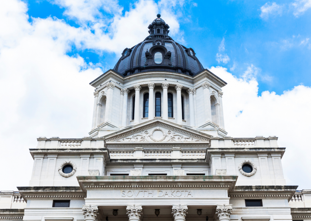
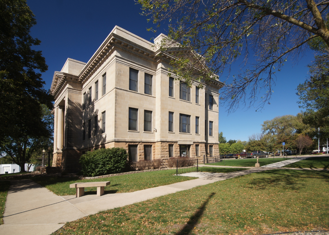
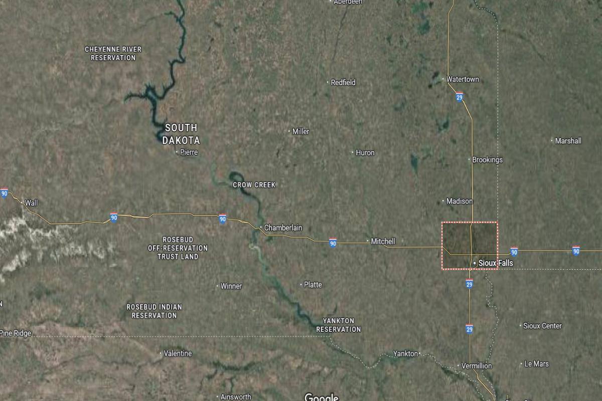
#1. Hughes County, South Dakota
– Overall Rank: 211
– Population: 17,812
– Median household income: $83,750
– Median home value: $216,500 (73% own)
– Median rent: $920 (27% rent)
– Top public schools: Blunt Elementary School (grade A), T.F. Riggs High School (grade B+), Buchanan Elementary School (grade B+)
– Top private schools: St. Joseph Elementary School (grade unavailable)
– Top places: Pierre (grade A minus), Blunt (grade B)
About
Hughes County has a stable economy supported by government services, healthcare, retail, and small business development. The area benefits from steady employment, strong infrastructure, and regional connectivity that foster long-term growth. Economic development efforts focus on sustainability, innovation, and workforce readiness.
Cultural life includes community events, arts programs, and historical attractions that reflect local pride and tradition. Residents enjoy outdoor recreation such as boating, hiking, and fishing, supported by scenic natural surroundings. High-quality schools, public services, and civic engagement contribute to a connected and well-rounded community environment.
Where is Hughes County?
Hughes County is located in central South Dakota, along the eastern bank of the Missouri River. The county seat, Pierre, is also the state capital and lies about 110 miles northwest of Mitchell. It is approximately 145 miles northeast of Rapid City.
The county is around 85 miles south of Mobridge and about 90 miles west of Huron. Pierre is situated roughly 60 miles north of Chamberlain. U.S. Highway 83 and U.S. Highway 14 run through the area, offering key transportation routes.
This story features data reporting and writing by Elena Cox and is part of a series utilizing data automation across 50 states.
By Stacker